This is a draft, and will only be validated during the trip itself.
But what I’ve done is tried to point to what to watch for and when, and how “important”, and when a photo is really worth the effort.
What is The Canadian?
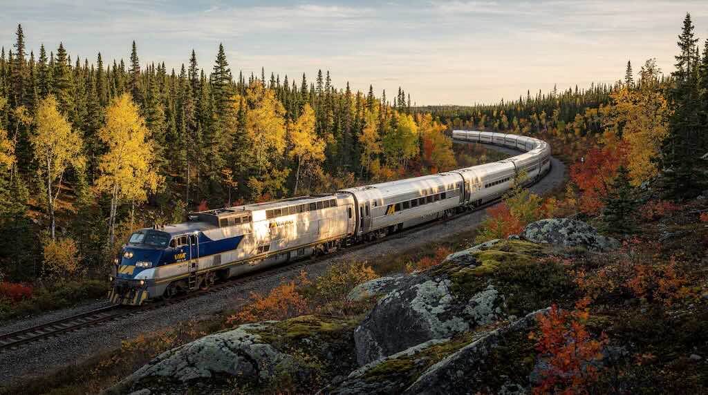
The Canadian is a transcontinental passenger train operated by Via Rail.
It is Canada’s flagship long-distance passenger train, running between Vancouver and Toronto over a distance of 4,466 km (2,775 miles).
The westbound service (Toronto → Vancouver) is Train No. 1, while the eastbound service (Vancouver → Toronto), which I took, is Train No. 2.
When operating on the normal schedule, the Canadian operates twice per week, departing Toronto on Wednesdays and Sundays and Vancouver on Mondays and Fridays. I travelled on the Monday 28 September 2026, through to Friday 2 October 2026.
Originally it was a 3-day, 3-night trip, but 12-hour delays became almost standard. On-time performance had fallen from 84% in 2009 to just 8% in 2017. Continuing delays reached nearly 2 days in length by mid-May, 2018. To address this issue, the schedule was lengthened again, effective July 26, 2018, to four days and four nights in each direction due to continuing congestion problems on the host railway. This change has almost entirely resolved the issue.
The fundamental problem was railway capacity, not the VIA train itself.
The Canadian does not have its own railway between Toronto and Vancouver. For most of the journey it operates over tracks owned and controlled by CN. By 2017–18, particularly in Western Canada, those tracks were carrying substantially more freight. VIA itself specifically attributed the deterioration to the “significant growth of freight rail traffic”.
This matters because much of the transcontinental route is not two completely independent tracks. There are long stretches where dispatchers have to coordinate trains through available tracks, sidings, junctions and passing points. CN controls the dispatching. A very long freight train can therefore constrain where the Canadian can be fitted into the traffic flow. VIA acknowledged that its trains sometimes had to pull into sidings to allow other trains to pass.
By early 2018 VIA reported that freight congestion and station delays had deteriorated performance so badly in Western Canada that 73% of Toronto evening departures for Vancouver were being postponed until the following day. In May the accumulated delays became so great that VIA actually cancelled two complete departures simply to reset the operation and get trains, crews and maintenance back into the correct sequence.
What Happened before The Canadian?
The Canadian itself did not exist before 1955, however Canadian Pacific had already been carrying passengers across Canada for nearly 70 years, but under other train names and with older rolling stock.
Before The Canadian there was The Dominion
The immediate predecessor was Canadian Pacific’s The Dominion. It began as a summer Toronto–Vancouver service in 1931, and from 23 June 1933 became CP’s principal transcontinental train, replacing the earlier Imperial Limited. It ran from both Montreal and Toronto, the sections coming together for the journey west.
By the early 1950s, however, The Dominion was beginning to look old-fashioned. Its rolling stock was a mixture of pre-war heavyweight cars and newer lightweight cars, so cars of different ages and designs were assembled into the train.
The passenger cars were the traditional riveted-steel, developed in the early decades of the 20th century. They had relatively small windows, conventional roofs and no panoramic dome.
By the late 1940s and early 1950s, North American passenger trains were changing dramatically. American railways were introducing lightweight, air-conditioned streamliners, including spectacular dome cars. CP management inspected the General Motors/Pullman-Standard demonstration “Train of Tomorrow” in 1949 and became convinced that its transcontinental service needed modernisation.
It’s also true that cars and airlines were beginning to take passengers away from the railway, so another reason for a facelift. In June 1953 new stainless-steel cars were ordered. And rather than just modernise The Dominion, they created a new prestige service.
On 24 April 1955, The Canadian was born.
Montreal–Vancouver fell from approximately 85 hours to 71 hours, enough to reduce the journey from four nights to three.
However, Canadian Pacific completed its transcontinental railway back in 1885, and through passenger services followed in 1886. So when The Canadian appeared in 1955, CP had already been operating transcontinental passenger trains for nearly 70 years.
One particularly interesting twist is that The Dominion did not disappear when The Canadian appeared. CP continued operating it alongside the new flagship, and some of the new cars were used to upgrade it as well. The Dominion finally disappeared in 1966.
Passenger Rolling Stock - Sleepers, Coaches, Dining Cars, Dome Cars, etc.
The stainless-steel cars behind the locomotives are not replicas or modern cars made to look historic. Many are essentially the cars built for the introduction of The Canadian in 1955.
As mentioned, Canadian Pacific ordered an entirely new fleet from the Budd Company of Philadelphia in 1953. In total, 173 stainless-steel cars were delivered in 1954–55. This included baggage/dormitory cars, coaches, Skyline dome cars, dining cars, Manor and Château sleeping cars, and the Park dome-observation cars.
They were built using Budd’s stainless-steel construction methods, which is an important reason why they have survived. Their corrugated stainless-steel exterior provided a remarkably corrosion-resistant structural body.
The new train entered service on 24 April 1955, operated by Canadian Pacific. It was then one of the most modern passenger trains in North America, air-conditioned, diesel-hauled, with dining cars and glass observation domes.
When VIA took over CP’s passenger services in 1978, it acquired these cars. VIA subsequently rebuilt and modernised them extensively, but retained the stainless-steel bodies. VIA itself describes them as the last all-new train of the Art Moderne-influenced Streamliner era.
A railway car is one complete vehicle. Its stainless-steel body, underframe, two trucks (bogies), usually four axles/eight wheels in total, braking and electrical equipment, couplers, and whatever interior was designed for its function.
All the cars are 29.5 m long, and 3.06 m wide. Sleepers are 4.13 m high, and dining cars and domes vary. Weight is between 60.8 t and 66.3 t, before passengers, supplies, baggage.
A 20-car peak-season Canadian is an exceptionally long passenger train, i.e. well over 500 m overall.
The Locomotives
Canadian Pacific’s earlier transcontinental trains, including The Dominion, had for decades been steam-hauled. By the later steam era CP was using some extremely powerful locomotives, particularly in the mountains, where the combination of long trains and steep gradients demanded enormous tractive effort.
But CP was already dieselising its passenger services in the early 1950s. Diesels were already appearing before The Canadian was launched, so it was decided to also ordered new General Motors Diesel FP9 locomotives, supplementing FP7s already in the fleet. These became the characteristic locomotives of the new train.
Each FP9A produced 1,750 hp, but several units were coupled together and controlled from the leading cab. Thus, for example, three 1,750-hp units gave approximately 5,250 hp.
They were diesel-electric, which is slightly different from what the name might suggest. The diesel engine does not mechanically drive the wheels through a gearbox as in a car. The diesel turns a generator, and the generator produces electricity, which runs electric traction motors turn the locomotive’s wheels.
However, contemporary accounts record The Canadian occasionally being steam-hauled as late as 1959.
Today’s locomotives are the F40PH-2, built in the late 1980s, also by General Motors Electro-Motive Division. Each has 3,000 hp (2.2 MW) from a turbocharged 16-cylinder EMD 645E3C diesel engine. It weighs 117,936 kg (almost 118 tonnes), and has four axles and four electric traction motors. Continuous tractive effort is 44,000 lb, or about 196 kN. Maximum speed is approximately 145–153 km/h.
Again, The Canadian can use more than one locomotive. Two F40s provide 6,000 hp; three provide 9,000 hp. Long, heavy versions of The Canadian have historically used three.
These locomotives also supply Head End Power (HEP), i.e. electricity for lighting, heating, air conditioning, kitchens, pumps and other equipment. Originally the F40’s main 3,000-hp engine also had to produce this electricity. That meant the big V16 had to continue running rapidly even when the train was standing in a station.
During VIA’s 2007–12 rebuilding programme, the locomotives received a separate diesel generator for the passenger cars. It supplies 500 kW of electrical power. Consequently the main engine can idle when the train is stationary and, when necessary, devote its full 3,000 hp to traction.
The Canadian offers three main classes of service, namely Economy, Sleeper Plus, and, since 2014, Prestige. Trains are equipped with one or more dining cars and at least one Skyline (dome) car per class, a Panorama car (west of Edmonton), and a Park car. All classes have access to their own Skyline car, and Sleeper Plus and Prestige passengers also have access to the Panorama car. Prestige passengers have semi-exclusive access to the Park car, a licensed lounge at the back of the train. Onboard talks and activities are scheduled during the summer months. If a singer or musical group is travelling with the train, separate performances will be available to each class of service.
I am travelling Sleeper Plus, and with Prestige passengers, have pre-boarded at a separate area of the train from Economy class passengers. Sleeper Plus has a choice of upper/lower berths, a roomette for one, or a cabin for two that features chairs or facing sofa seats during the day and beds at night. Sleeper Plus has one washroom per car, while Sleeper Plus roomettes and cabins for two include private washroom facilities, and access to a shared shower in each car.
Sleeper Plus includes a three-course meals in a dining car, including non-alcoholic drinks during meals and coffee/tea/snacks at all hours. Meals include breakfast, lunch, and dinner. Breakfast is open seating, with an additional continental breakfast available in the Skyline car. Lunch and dinner are served in two or three seatings, usually chosen the previous evening.
https://happytowander.com/via-rail-canadian-train/
https://www.seat61.com/train-from-toronto-to-vancouver.htm
The route, per Wikipedia (validated for 2026)
The Canadian‘s eastbound journey begins at Vancouver’s Pacific Central Station. It uses the BNSF Railway‘s tracks through suburban communities until it reaches the New Westminster Bridge, where trains cross the Fraser River.
The Canadian then uses Canadian National (CN) tracks through the eastern Fraser Valley. Trains then switch between CN and CPKC tracks for 249 kilometres (155 mi) from Mission to Kamloops through the use of directional running through the Fraser and Thompson River canyons. Eastbound trains use the CPKC lines, and westbound trains use the CN tracks.
The CN route passes through Painted Canyon, and features CN’s 240-metre (800 ft) steel-arched bridge over the Fraser River and the CPKC mainline at Cisco. The tracks in Painted Canyon are only approximately 61 metres (200 ft) above the Thompson River.
On their regular schedules, the amount of the Fraser and Thompson river canyons traversed in daylight varies by direction and season. On the 2026 eastbound schedule, the Canadian reaches part of the Fraser Canyon in late afternoon and early evening.
From Kamloops North station, the tracks run north and follow the North Thompson River. The icefields of the Albreda Glacier are visible from the route, which is protected by railway slide fences.
From Valemount station to Redpass Junction, eastbound and westbound trains routes again diverge. Eastbound trains use CN’s Albreda Subdivision through Mount Robson Provincial Park. Westbound trains use CN’s Robson Subdivision, which is lower in elevation.
The Canadian travels past Moose Lake and follows the Fraser to Yellowhead Lake. The train crosses the Continental Divide of the Americas at Yellowhead Pass, which at 3,718 ft (1,133 m) is one of the lowest crossing of the divide in North America. The pass also marks the boundaries between British Columbia and Alberta, the Pacific and Mountain time zones, the Pacific and Arctic watersheds, and Mount Robson Provincial Park and Jasper National Park.
The route passes the Victoria Cross Range above the Miette River and runs through tunnels to reach the Jasper train station, where trains take an extended servicing break. The station itself was declared a heritage railway station by the federal government in 1992.
From Jasper, the train runs along the Athabasca River and descends into the Athabasca Valley, where it has views of nearby mountains and passes Henry House.
The Yellowhead Highway (Highway 16) continues to parallel the route. The route follows the west shore of Jasper Lake, a common location for railway photography, and passes near local sand dunes.
The route continues northeast and leaves the Canadian Rockies as the terrain opens up into wide plains. The Canadian reverses at a wye to reach Edmonton station in the outskirts of the city, where a long servicing stop is scheduled.
The train continues southeast across the Canadian prairies for nearly 470 kilometres (290 mi), making stops in several rural communities before leaving Alberta for Saskatchewan.
The Canadian enters Saskatoon from the west and stops at Saskatoon station in the southwestern outskirts of the city.
The route rejoins the CN mainline and enters Manitoba, where it begins to follow the Trans-Canada Highway. It then continues east towards Winnipeg, where the tracks turn north along the Assiniboine River to enter the historic Winnipeg Union Station in the city centre. The station also serves as the terminus to the Winnipeg–Churchill train.
The Canadian enters Ontario and crosses the rugged Canadian Shield, where it has flag stops in many small communities that are primarily accessed by rail.
Between Winnipeg and Capreol, passengers may request to be dropped off or picked up at any location.
At Sudbury, the train stops at Sudbury Junction, and a separate station in the city serves the Sudbury–White River line.
The Canadian then turns south towards and reaches another section of CN–CPKC directional running from Wanup to Parry Sound. Eastbound trains use the CN Bala Subdivision, while westbound trains use the CPKC’s Parry Sound Subdivision, which traverses the Parry Sound CPR Trestle. Through Parry Sound, all trains make use of separate stations depending on the direction of travel.
From Bala, the train continues along CN trackage for approximately 40 km (25 mi) to Washago, its penultimate eastbound stop.
The train travelled through and stopped at Barrie and Orillia via the Newmarket Subdivision until the section was abandoned in the 1990s.
South of Bloomington, the route is shared with GO Transit‘s Richmond Hill line commuter services, which uses separate stations.
The Canadian reaches Toronto and follows Don River for its final 10 km before terminating at Toronto Union Station.
DAY 1 — MONDAY 28 SEPTEMBER
Afternoon — Vancouver 15:00 → Fraser Canyon ~19:00
BEST SEAT: RIGHT
Stay predominantly on the right from Mission onward. Move/look left for specifically marked sights.
15:00 — PACIFIC CENTRAL STATION → EAST VANCOUVER ★★
OBSERVE
This is a rather appropriate place to begin a transcontinental railway journey. Vancouver itself owes much of its explosive late-19th-century development to the transcontinental railway. The CPR chose Vancouver rather than Port Moody as its Pacific terminus, and its first scheduled passenger train reached Vancouver in 1887.
But there is an immediate historical curiosity: your eastbound Canadian does not leave Vancouver on Canadian Pacific track—or even CN track. It initially uses BNSF trackage. It is a reminder that today’s Canadian is not simply following one historic railway from coast to coast; it is operating through a modern network of running rights and shared infrastructure.
LOOK — BOTH
For the first few minutes don’t search for a monument. Look at the railway geography: yards, sidings, industry, warehouses and the way the passenger railway threads out through an already-developed city.
WHEN
Departure 15:00 is your zero point.
PHOTO — — OBSERVE.
Your photographs of the Vancouver suburbs won’t improve the historical record.
~15:20–15:45 — THE INDUSTRIAL FRASER / BURNABY–NEW WESTMINSTER ★★
OBSERVE
This is useful because it strips away the postcard image of British Columbia. The Fraser is not simply a scenic river: it is one of western Canada’s great transport and industrial corridors.
Watch for lumber, yards, warehouses and railway infrastructure. Timber from the enormous Fraser watershed could be brought downstream; railways could distribute products inland; ocean-going transport could connect the Lower Mainland internationally.
You’re effectively seeing why river + railway + port produced this urban geography.
LOOK — increasingly LEFT
Don’t stare at the distant mountains yet. Look closer: sidings, freight stock, industrial buildings and glimpses of the Fraser.
The river is beginning to become the organising feature of your journey.
RUNNING CHECKPOINT
When the broad Fraser becomes unmistakable and New Westminster becomes urban rather than suburban, prepare for the first genuine object.
PHOTO — — don’t bother unless the industrial landscape particularly appeals.
~15:45–16:00 — NEW WESTMINSTER RAIL BRIDGE ★★★★
A first real object
OBSERVE
This old steel bridge deserves attention.
Construction began in August 1902 and it opened on 23 July 1904. It was designed by Waddell & Hedrick. The steelwork is about 2,400 ft (730 m) long and includes a 330-ft swing span, necessary because the Fraser remained a navigable waterway. Some foundations went approximately 135 ft below high water.
And what you see today isn’t its complete original function.
The bridge originally had two levels: railway below and a roadway above for pedestrians, wagons and later motor traffic. The road function disappeared after the Pattullo Bridge opened in 1937. Contemporary photographs show crowds walking across the upper level at the 1904 opening.
The bridge fundamentally improved communications between New Westminster and the country south of the Fraser; before it, the river was a significant transport barrier.
More than 120 years later, your transcontinental passenger train is still crossing it.
That’s worth observing.
LOOK — BOTH, but LEFT particularly
As you approach, look ahead for the old steel through-truss structure.
Once actually on it, look LEFT/upstream and RIGHT/downstream rather than trying to photograph the bridge you’re standing inside.
Notice its relatively low level. That explains the swing span: engineers couldn’t simply put a high fixed bridge across a working navigable river.
RUNNING CHECKPOINT
Very easy: you cannot miss the Fraser River.
PHOTO — 📷 REAL PHOTO OP
Not because you’ll make the world’s finest photograph of the bridge—you can’t, because you’re on it.
Photograph through the truss along the river. That’s a genuine passenger’s-eye view of a piece of infrastructure still doing its original job after 122 years.
~16:00–16:25 — SOUTH/EAST BANK OF THE FRASER ★★★
OBSERVE
Now pay attention to the relationship between railway and river.
You are temporarily on the south side of the Fraser, moving east on CN infrastructure. The river is generally LEFT.
This broad, low-lying landscape is radically different from what is coming. The Fraser Valley here has accumulated deep alluvial sediments. Agriculture, settlement, road and rail all have room.
The point is to establish a visual baseline.
In about an hour the same river will be confined between mountains and the railway engineers will have almost nowhere to put their tracks.
LOOK — LEFT
Fraser River, floodplain, dykes, industrial land and—where the view opens—the mountains closing in ahead.
PHOTO — ○ GOOD
Take one photograph if the valley and mountains line up nicely. Otherwise just watch.
~16:25–16:35 — APPROACH TO MATSQUI / MISSION ★★★★
OBSERVE
Now something operationally important is about to happen.
Your train is approaching the southern end of the Fraser/Thompson directional-running zone.
CN and CPKC each inherited a transcontinental railway through extremely difficult canyon terrain. Instead of treating those two mostly single-track railways simply as competitors, the companies now use them in effect as a paired railway: normally one route for eastbound traffic and the other for westbound traffic.
The arrangement greatly increases capacity through the constrained canyon. The Mission crossing is where your eastbound train makes the crucial transition from the CN side to the CPKC route.
This explains something that would otherwise be invisible:
you are travelling on VIA, having left Vancouver over BNSF and CN infrastructure, and are about to join the old Canadian Pacific route.
~16:30 — MISSION RAILWAY BRIDGE ★★★★★
FIRST AFTERNOON MUST-NOT-MISS
OBSERVE
This is much more important than its rather workaday appearance suggests.
The first railway bridge here opened in 1891. It was then the only Fraser crossing below Siska in the canyon. The present bridge dates principally from 1909 and is approximately 533 m long, carried on concrete piers, with a swing span for navigation.
From 1927 until 1973, it did something wonderfully improbable: cars and trains shared it. Road vehicles crossed alternately in one direction, controlled by traffic signals, but trains had priority. A proper highway bridge finally relieved it in 1973.
In 1955, a pier weakened during the Fraser freshet and a bridge span collapsed. Vehicle and passenger traffic had to be carried across by tug-powered scows for 16 months.
But for us its greatest significance is operational.
This is effectively the gateway to the directional-running railway.
You cross the Fraser northward, arrive at Mission, and then turn east onto CPKC’s Cascade Subdivision. The CPKC milepost data put Mission Junction at mile 87.0 and North Bend at mile 0.0.
From here onwards, the historic railway underneath you really matters.
LOOK — BOTH
Look down the length of the old steel bridge.
During the crossing look at the Fraser itself.
Then watch carefully as the train curves into Mission. You are changing river bank and railway system simultaneously.
RUNNING CHECKPOINT
Mission Harbour scheduled 16:35.
So regardless of accumulated delay:
Mission bridge → Mission Harbour = essentially your 16:35 checkpoint.
From here onward, reset your sightseeing clock to the actual Mission departure, not 16:35.
PHOTO — 📷 REAL PHOTO OP
Yes. Old steel bridge + broad Fraser + train-window viewpoint.
MISSION HARBOUR — scheduled 16:35 ★★★
OBSERVE
Mission itself grew around railway and river.
Its name derives from the nearby St Mary’s Mission, established by the Oblates in 1868. The railway settlement that became Mission City developed after the railway arrived; its original commercial core was squeezed between the CPR and the river. Following the major 1894 Fraser flood, commercial activity moved onto higher ground.
That explains what you see: the railway occupies the narrow low corridor along the Fraser while much of the town rises behind it.
LOOK — LEFT
Town and hillside.
RIGHT
Fraser River.
And from this point until Cisco, remember a wonderfully simple rule:
CPKC eastbound = generally north/west bank → FRASER ON YOUR RIGHT.
PHOTO — — observe.
Mission + ~10–15 min — HATZIC / LOWER FRASER ★★
OBSERVE
Watch the river and valley rather than looking for a named monument.
The railway is still travelling through a broad floodplain. The mountains ahead are now increasingly obvious, but there is still space for farms, wetlands, roads and settlements.
This is the last part of the journey where the Fraser looks like a broad lowland river.
LOOK — RIGHT
Fraser and floodplain.
LOOK AHEAD
The walls through which the river has to escape the interior of British Columbia are beginning to converge.
PHOTO — ○ GOOD
Especially if evening light is developing over the river.
Mission + ~18–20 min — HARRISON MILLS / HARRISON RIVER ★★★
OBSERVE
This small place is a lovely example of a settlement that makes sense once you understand the railway.
Harrison Mills sits near the conjunction of the Harrison and Fraser Rivers. Lumber was the economic foundation, but completion of the railway made the location viable as a mill community. By the early 20th century it had mill workers, railway workers and their families; because the settlement occupied flood-prone land, buildings were connected by raised boardwalks.
The surviving Kilby General Store opened in 1906 and is now a historic site.
So don’t look for a grand town. Look at the geography and ask:
Why would anyone build a community here?
River + timber + railway is the answer.
LOOK — RIGHT
Wetlands / Harrison River / Fraser landscape.
There is also a railway bridge across the Harrison River immediately around Harrison Mills—the CPKC timetable places Harrison Mills at mile 68.1 and the drawbridge at 68.2.
PHOTO — ○ GOOD
Landscape rather than architecture.
AGASSIZ — scheduled 17:03 ★★
RUNNING CHECKPOINT
This one is gold for our purposes.
Whatever the actual clock says:
AGASSIZ = reset point 17:03
VIA gives only 14 minutes from Agassiz to Katz.
OBSERVE
You’re now approaching the geological bottleneck.
The broad Fraser Valley is coming to an end. Mountains that have been scenery are about to become constraints.
That distinction matters enormously to railway history.
Until now the railway could choose broadly where to go.
Very shortly, the river has already chosen the route—and the engineers have to negotiate for whatever ledges remain.
LOOK — BOTH / FORWARD
Ignore Agassiz itself unless something catches your eye.
Watch the valley geometry.
PHOTO — ○ GOOD, particularly forward-looking mountain/valley shots.
KATZ — scheduled 17:17 ★★★
OBSERVE
Katz is more valuable as a navigation point than a destination.
The CPKC timetable places Katz at mile 44.9, Yale at 29.0, Spuzzum at 15.5, and North Bend at 0.0.
That gives us an exceptionally useful physical countdown:
Katz → Yale = 15.9 railway miles
Yale → Spuzzum = 13.5 miles
Spuzzum → North Bend = 15.5 miles
Now you no longer need VIA’s clock.
If the train is two hours late, Katz still means the same thing geographically.
~17:20–17:35 — HOPE / ENTRANCE TO THE FRASER CANYON ★★★★
OBSERVE
This is the transition I’ve been preparing you for.
At Hope, the Fraser ceases to behave like the broad lower-river system you’ve been following and the railway enters the constrained Fraser Canyon corridor.
This was the great geographical obstacle between the Pacific coast and the interior.
And this landscape had already acquired enormous historical importance before the transcontinental railway arrived. The 1858 Fraser River gold rush drew thousands into this corridor. Yale, just ahead, became a crucial staging point for movement toward the interior.
The railway therefore did not “discover” a route through empty country. It overlaid Indigenous travel landscapes, fur-trade routes and the infrastructure created during the gold-rush era.
LOOK — RIGHT
The Fraser.
LOOK FORWARD
This is the important view: watch the valley close.
You should actually be able to perceive the moment when the broad agricultural Fraser Valley gives way to canyon.
PHOTO — 📷 REAL PHOTO OP
Yes—not necessarily because it’s the prettiest picture, but because a sequence of photographs from Mission → Agassiz → Hope will record a real geographical transformation.
~17:40–18:00 — YALE ★★★★★
SECOND AFTERNOON MUST-NOT-MISS
OBSERVE
Yale deserves much more than a passing name.
A Hudson’s Bay Company post was established here by Ovid Allard in 1847 and named Fort Yale after James Murray Yale.
Then came the 1858 Fraser Canyon gold rush.
Yale became a crucial gateway between the navigable lower Fraser and the increasingly difficult country northward. It subsequently became the southern terminus of the Cariboo Wagon Road, built from 1862–65 and extending roughly 400 miles toward the Cariboo goldfields.
The little settlement consequently occupied a position vastly more important than its present size suggests.
There is another history physically embedded here. Chinese people came into the region during the gold-rush period and later formed a major part of the labour force that built the CPR through British Columbia. Some remained in Yale as merchants and residents. The surviving On Lee property is officially recognised for its association with Yale’s Chinese community—and its location also records the racial segregation of the frontier town.
The railway you’re riding belongs to the next layer of that history.
So when you pass tiny modern Yale, don’t judge its importance by what you see.
You are passing a place whose significance was created by the same geographical problem you are about to experience: how to get from the lower Fraser into the interior.
LOOK — LEFT
Yale settlement is principally on your side of the river, between/around railway, highway and canyon wall.
Among the surviving historic fabric is St John the Divine, built in 1863, described by the province as the oldest Anglican church in British Columbia still standing on its original site.
Don’t count on identifying individual historic buildings from a moving train. The settlement itself is the object.
RIGHT
The Fraser—and increasingly severe canyon wall beyond.
RUNNING CHECKPOINT
CPKC milepost:
Yale = 29.0.
This is now much better than a clock.
PHOTO — ○ GOOD
Take a picture if the river/Yale/canyon composition works.
But OBSERVE first. Better photographs of Historic Yale exist; what cannot be replicated is watching its strategic geography reveal itself from the transcontinental railway.
~18:00–18:35 — YALE → SPUZZUM: THE RAILWAY BECOMES THE OBJECT ★★★★★
OBSERVE
Now stop thinking of the train merely as a platform from which you view scenery.
The railway itself is what you have come to see.
CP’s builders had to fit a railway between steep rock and the Fraser. Cuttings, tunnels, retaining works, bridges and repeated curvature aren’t incidental features—they are the engineering response to the canyon.
The original CPR construction through this region belongs to the great western phase of Canada’s first transcontinental railway. Chinese labour was fundamental to its construction in British Columbia; the provincial government’s historical work explicitly records Chinese workers’ role in building the railway and the communities that remained afterwards.
And across the river you will increasingly see the other railway—the line that ultimately became CN.
That gives you an extraordinary moving historical comparison:
two transcontinental railways, built by different companies at different times, independently solving the same canyon.
Today they cooperate through directional running.
LOOK — RIGHT, repeatedly
River below.
Then deliberately look across it.
Whenever you see railway track, tunnel portals, retaining walls or a freight train on the opposite bank, that is CN’s route.
Don’t regard a passing freight as an obstruction. It demonstrates the system.
LEFT
Look close to the train occasionally: blasted rock, cuts, slide protection and just how little horizontal space exists between track and mountain.
The Cascade Subdivision timetable lists repeated slide detectors through this section.
That’s not trivia. Look at the slopes and you’ll understand why.
PHOTO — 📷 REAL PHOTO OP
Absolutely.
The best photograph isn’t necessarily “beautiful canyon.”
Try to get:
Fraser + opposite CN railway + your own CPKC alignment implied in foreground.
That photograph explains the place.
~18:30 — SPUZZUM ★★★★
RUNNING CHECKPOINT
CPKC mile 15.5.
Now you are only 15.5 railway miles from North Bend.
OBSERVE
By Spuzzum the railway has become thoroughly committed to the canyon.
This is also where I want you to notice the protection systems rather than simply admire the rock. CPKC’s route data identify a remarkable sequence of slide-detector locations between Spuzzum and North Bend.
In other words, the landscape isn’t merely dramatic—it remains an active operational hazard more than a century after the railway was built.
The mountains haven’t stopped moving because engineers put rails through them.
LOOK — LEFT close / RIGHT distant
LEFT: rock face, protection infrastructure.
RIGHT: Fraser + CN.
PHOTO — — OBSERVE
Save the camera for what comes next.
~18:45–19:00 — DEEPER CANYON / LAST DIRECT SUNLIGHT ★★★★★
This could be one of the loveliest periods of the entire first day.
At Yale on 28 September the Sun sets at approximately 18:54; civil twilight continues until about 19:22.
But remember: astronomical sunset isn’t the same as canyon sunset.
The surrounding mountains can remove direct sunlight substantially earlier.
OBSERVE
Watch the light.
The river may remain illuminated while one canyon wall has already fallen into shadow; then the remaining high slopes lose the Sun.
This is one occasion where darkness actually contributes something. You’ve watched the Fraser progress from a broad working river beside metropolitan Vancouver to a constrained mountain river at the bottom of a railway canyon.
And the human history has changed with it:
port and industry → agriculture → railway settlements → gold-rush corridor → transcontinental engineering.
All in roughly four hours.
LOOK — RIGHT predominantly
Fraser and opposite CN alignment.
But don’t become religious about RIGHT. The canyon twists constantly; look through the dome because the high walls and disappearing light are part of the experience.
PHOTO — 📷 REAL PHOTO OP
Yes.
If conditions cooperate, this is precisely the sort of photograph for which yours may be more valuable to you than a technically superior web image:
a working railway disappearing into the Fraser Canyon at dusk, photographed from another working railway.
EVENING — North Bend → Cisco → Lytton → Thompson Canyon → Ashcroft
BEST SIDE: RIGHT from North Bend to Cisco. After Cisco: BOTH.
Light: North Bend is scheduled at 19:46, so most of this section is after sunset on 28 September. Cisco and Lytton remain important, but we should be realistic about what will be photographically possible. The VIA fixed points are North Bend 19:46, Ashcroft 22:32, Kamloops North 00:17.
| CHECKPOINT / WHERE AM I? | OBSERVE / WHAT AM I ACTUALLY SEEING? |
|---|---|
| NORTH BEND — 19:46 RIGHT: Boston BarLEFT: North Bend ★★★ | NORTH BEND & BOSTON BAR — TWO RAILWAY SETTLEMENTS North Bend is not simply a village that happens to have a railway. Canadian Pacific created it as a divisional point during construction of the transcontinental railway in the 1880s. Railway crews changed here and locomotives and trains could be serviced. Across the Fraser, Boston Bar subsequently became an important operating point on the competing railway that became CN. The result is unusually legible from the train: CP railway settlement on one side of the Fraser; CN railway settlement on the other. The physical separation mattered. Until 1940 there was no direct road connection between them; an aerial cable ferry capable of carrying a car then crossed the Fraser, and a road bridge did not replace it until 1985. North Bend also marks an operational railway boundary: mile 0.0 of CPKC’s Cascade Subdivision becomes mile 121.5 of the Thompson Subdivision. So although nothing dramatic happens aboard your train, railway geography changes here. LOOK:RIGHT across the Fraser for Boston Bar, CN track and railway land; LEFT for the CPKC infrastructure at North Bend. PHOTO: ○ Good record photograph, but OBSERVE is better. |
| RESET HEREWhatever your actual arrival time, forget 19:46. North Bend = 0 min. | This is our first really useful running checkpoint. From here the railway mileage is much more reliable for knowing what comes next than the published clock time. |
| North Bend + ~10–15 minRIGHT | THE TWO RAILWAYS BECOME ONE OPERATING SYSTEM Keep looking across the Fraser. The track you can see there is the other half of the directional-running system. The arrangement normally sends eastbound traffic over CPKC and westbound traffic over CNthrough this constrained corridor. That is much more interesting than merely saying that CN is “on the other side”. Two railways originally built by competing transcontinental companies now function operationally rather like the two tracks of a very widely separated double-track railway. Consequently, if you see a freight on the opposite alignment, its direction is significant: it should normally be travelling westward. LOOK: RIGHT for CN track, tunnel mouths, signals and approaching freight headlights. At dusk, the lights may actually make the railway alignment easier to follow than in daylight. PHOTO: 📷 REAL PHOTO OP if an opposing freight appears against the canyon wall. |
| KEEFERS — CPKC MP 110.8North Bend MP 121.5 Cisco next: MP 100.3 ⚠️ START PAYING ATTENTION | KEEFERS IS PRIMARILY A NAVIGATION POINT. From North Bend to Keefers is 10.7 railway miles. From Keefers to Cisco is another 10.5 miles. This gives us a beautifully simple practical rule that doesn’t care whether VIA is ten minutes or three hours late: once Keefers is passed, Cisco is the next major object. PHOTO: — Put the camera down for now. |
| KEEFERS PASSED RIGHT⚠️ CISCO ~10.5 rail miles ahead★★★★★ DON’T MISS | NOW LOOK FOR THE OTHER RAILWAY. Don’t simply wait for “some bridges”. Identify the CN railway across the Fraser first. You are about to watch the two historic transcontinental routes converge, cross the river and effectively exchange sides. |
| CISCO — CPKC MP 100.3RIGHT → FORWARD → BOTH★★★★★ | CISCO — TWO TRANSCONTINENTAL RAILWAYS CROSS EACH OTHER This is one of the great railway locations of the entire trip. Canadian Pacific reached this canyon first. Its original Cisco bridge was prefabricated in Britain and shipped to British Columbia in 1883; the present CPKC crossing is principally a 1910 steel truss bridge, roughly 160 m long. The later Canadian Northern—the ancestor of this part of CN—then had to put a second transcontinental railway through a canyon in which CP had already occupied much of the obvious alignment. Its solution was spectacular: the CN line crosses the Fraser on a much larger steel-arch bridge, about 247 m long and roughly 67 m above the river, and its alignment passes above the CPKC railway. Thus the extraordinary arrangement outside your window is not decorative bridge building. It is the physical residue of two competing transcontinental companies independently solving the same topographical problem. Today the irony is complete: the former rivals’ lines are coordinated through directional running. |
| CISCO — WHAT TO DO 1. RIGHT: find CN 2. Find large CN arch 3. Your train takes lower CPKC truss 4. Watch the alignments cross 5. After bridge: change your mental map | LOOK: The important thing is the relationship between the structures. First find CN across the river. Then find its large arch. Your train is approaching the lower CPKC truss. The CN alignment crosses the river nearby and passes above the CPKC alignment. Your own train then crosses the Fraser. You have physically changed river bank. PHOTO: 📷 REAL PHOTO OP, if there is sufficient light. Your photograph may be technically inferior to hundreds online, but very few ordinary photographs reproduce the experience of being on one railway while passing through the crossing with the other. If light is poor, don’t waste Cisco staring at a phone screen. OBSERVE wins. |
| CISCO → LYTTON Only ~5½ rail milesBOTH ⚠️ DON’T RELAX YET | THE RIVER STORY IS ABOUT TO CHANGE. Since Vancouver the Fraser has effectively organised the journey: industrial river, agricultural floodplain, then canyon. At Lytton another great river arrives—the Thompson. Your train will turn away from the Fraser and begin following the Thompson toward Kamloops. This is therefore not simply another town. It is the point at which the physical logic of your journey changes from Fraser Canyon to Thompson Canyon. |
| LYTTON — CPKC MP 94.9~5.4 miles after Cisco BOTH★★★★★ OBSERVE | LYTTON — A PLACE OLDER THAN THE RAILWAY STORY. The confluence lies within the traditional territory of the Nlaka’pamux, and the location’s importance long predates European transport systems. That is hardly surprising when you look at the geography: two major river corridors meet here. Later fur-trade, gold-rush, road and railway routes exploited corridors already known and used by Indigenous peoples. Then both rival transcontinental railways had to pass the same strategic point. Lytton therefore represents several transport histories occupying the same geography rather than a town created solely by the railway. |
| LYTTON — LOOK FOR THE SETTLEMENT | A SECOND, VERY RECENT HISTORY IS VISIBLE HERE. On 30 June 2021, after temperatures at Lytton had reached extraordinary levels during the western North American heat wave, wildfire swept through the village. More than 90% of the village was destroyed and two people died. Rebuilding has been prolonged. Railway operations were initially suspected as a possible ignition source because trains had recently passed through the area. The Transportation Safety Board investigated and found no evidence linking railway operations to the fire. That last point matters: it is easy for an interesting association to harden into “fact” when it isn’t supported by the investigation. LOOK: Don’t search for a picturesque historic town. Look at the scale of the settlement and, if light permits, the confluence itself. PHOTO: — OBSERVE rather than photograph fire damage. |
| LYTTON PASSED Fraser finished Now following THOMPSONBOTH | NOTICE THE LANDSCAPE CHANGE. You’re moving toward the much drier British Columbia interior. Increasing rain-shadow effects mean the dense vegetation associated with the coast and lower Fraser progressively gives way to more open slopes, grassland and eventually sagebrush country. Darkness will hide much of that tonight, but the transformation becomes unmistakable later. The railway remains the immediate object: bends, tunnels, signals, slide protection and the opposite railway show just how constrained the Thompson corridor remains. |
| THOMPSON CANYON BOTH | THE NIGHT RAILWAY CAN ACTUALLY BE BETTER THAN THE NIGHT LANDSCAPE. Watch signals appear around curves; locomotive headlights illuminate rock; long freight trains reveal the curvature of the opposite alignment. Instead of trying unsuccessfully to photograph a dark canyon, use the artificial light to understand how the railway occupies it. PHOTO: 📷 REAL PHOTO OP only if a freight train or illuminated railway composition presents itself. Otherwise don’t bother. |
| SPENCES BRIDGE — MP 72.8 Lytton MP 94.9 Ashcroft MP 47.3 ★★★ / CHECKPOINT | SPENCES BRIDGE — ROAD HISTORY MEETS RAILWAY HISTORY. This was an important crossing and stopping place in the Thompson corridor and became associated with the Cariboo Road, the great colonial wagon road constructed in the 1860s to connect the lower Fraser with the Cariboo goldfields. The railway later overlaid a transport geography already shaped by river, Indigenous routes, gold-rush movement and the wagon road. For us, however, its greatest practical value tonight is as a checkpoint: Lytton → Spences Bridge = 22.1 railway miles; Spences Bridge → Ashcroft = 25.5 miles. PHOTO: — Nothing you can photograph tonight is likely to add much. |
| SPENCES BRIDGE PASSEDAshcroft ~25½ rail miles | NOW THINK GEOLOGY. The valley walls around the Thompson are increasingly formed not simply from solid mountain rock but from enormous deposits associated with the Ice Ages. In parts of this region, tens of metres of glacial and glacial-lake sediment accumulated before the modern river cut down through them. That produces the conspicuous terraces and steep sediment slopes characteristic of the Ashcroft region. They are not merely scenery. They have presented a continuing engineering problem to both transcontinental railways. |
| APPROACHING ASHCROFTBOTH ★★★★ OBSERVE | AN ACTIVE LANDSCAPE, NOT A DEAD GLACIAL RELIC. Geological Survey of Canada work documents landslides affecting railway and other infrastructure along roughly a 10-km section south of Ashcroft since the 1880s. River erosion, groundwater, irrigation and human excavation interact with weak glacial sediments. Thus the railway remains vulnerable to processes that began with Ice Age deposition but continue today. If moonlight or artificial light lets you distinguish broad flat-topped terraces above the river, that’s what you’re seeing. PHOTO: — Far better photographed in daylight; understand it tonight. |
| BASQUE — MP 56.8 NEPA — MP 54.8 ⚠️ LOOK FOR TRACK CONNECTIONS★★★★ OBSERVE | THE DIRECTIONAL RAILWAY ENDS. This is visually almost nothing and intellectually excellent. From Mission you’ve been travelling through a coordinated system in which the historic CP and CN routes function as paired directional tracks. Around Basque/Nepa, connections allow the railways to separate operationally again. CPKC’s timetable identifies Nepa at MP 54.8 as the connection with CN’s Ashcroft Subdivision. LOOK: Points, connecting track, signals and the other railway converging/diverging. If you identify it, you’ve understood something most passengers won’t even know happened. PHOTO: — Absolutely not. |
| ASHCROFT — 22:32 RESET POINT ★★★★ | ASHCROFT — LOOK BACK MENTALLY TO VANCOUVER. At 15:00 you were in a damp Pacific port city beside a broad lower Fraser. By 22:32 you’re in the semi-arid interior, beside a river cut through great sediment terraces. Yet the train hasn’t conquered the landscape by climbing dramatically over a mountain pass. It has followed the rivers through it. That is perhaps the central geographical lesson of Day 1. The railway’s route is essentially a chain of solutions to river valleys: lower Fraser → Fraser Canyon → Thompson Canyon. LOOK: silhouettes of the high terraces and much more open valley. PHOTO: — OBSERVE. |
| ASHCROFT 22:32 → KAMLOOPS NORTH 00:17YOU MAY STOP WATCHING | There are worthwhile places ahead—Walhachin, Savona, Kamloops Lake and the Thompson—but on your timetable they occur in darkness. I don’t want to invent “must sees” merely because the train passes them. If you’re tired, this is the point to stop. VIA reaches Kamloops North at 00:17. Tomorrow morning matters much more. |
Day 2 - Tuesday 29 September
MORNING — Blue River → Valemount → Mount Robson country → Yellowhead Pass → Jasper
BEST SIDE: LEFT from Valemount toward Redpass/Mount Robson; thereafter BOTH.
This should be one of the periods for which you make a deliberate effort to be awake. VIA’s fixed checkpoints are Blue River 05:11, Valemount 07:01 and Jasper 11:00.
There is an important time-zone issue: VIA’s 11:00 Jasper time is Mountain Time. British Columbia is still on Pacific Time before the Alberta border. In elapsed journey time, Jasper’s 11:00 is 10:00 Pacific. Don’t accidentally think Valemount 07:01 → Jasper 11:00 is four hours; it is about three hours elapsed.
| CHECKPOINT / WHERE AM I? | OBSERVE / WHAT AM I ACTUALLY SEEING? |
|---|---|
| BLUE RIVER — 05:11 PT Both★★ Still dark / dawn approaching | BLUE RIVER — DON’T GET UP RIDICULOUSLY EARLY JUST FOR THE STATION.You’re already on CN’s Albreda Subdivision, which runs from Jasper through Valemount to Blue River. Railway mileage puts Blue River at MP 132.3 and Valemount at MP 74.5. The significance is positional: during the next two hours the train follows the North Thompson/Canoe River mountain corridor north toward Valemount. At the end of September much of the first part will be dark. PHOTO: — sleep is more valuable. |
| ~06:15–06:30 PTGET UP Both | FIRST LIGHT — NOW THE JOURNEY BECOMES WORTH WATCHING. You’re travelling through a long structural mountain corridor rather than “crossing the Rockies” in the Hollywood sense. Watch how railway, river and valley floor repeatedly occupy the same limited strip of relatively level ground. The mountains are not yet one named object; their importance is that they constrain the route. LOOK: river, mist if present, forested lower slopes and increasingly visible high ground. PHOTO: ○ GOOD, particularly with low cloud or mist. |
| CANOE RIVER — CN MP 82.6Valemount ~8 rail miles ahead ⚠️ Prepare | A USEFUL RAILWAY CHECKPOINT. The CN mileages are exceptionally useful here: Canoe River MP 82.6 → Valemount MP 74.5 = 8.1 miles. Once Canoe River is passed, breakfast can wait. Valemount marks the beginning of the most important morning sequence. |
| VALEMOUNT — 07:01 PT RESET POINT★★★★★ FROM HERE, STAY ALERT | VALEMOUNT EXISTS LARGELY BECAUSE OF THIS RAILWAY. The first homestead in the immediate area dates from 1906. Railway construction reached the area in 1914, when a station was established at Swift Creek. Logging, railway work, tie-making and trapping supported the developing settlement. In 1927 CN moved the station about a mile and renamed it Valemount—essentially “valley in the mountains.” The 1914 station survives as the Valemount Museum, although it was physically relocated from the trackside in the late 1980s. So don’t expect an ancient mountain community: its form and even its present name are products of the railway. PHOTO: — OBSERVE. |
| VALEMOUNT PASSED TAKE LEFT SIDE ⚠️ Important route change immediately ahead | THE TWO CN ROUTES SEPARATE. This is one of those excellent things that most passengers won’t know is happening. North of Valemount the railway has two different mountain alignments. Your eastbound train normally takes the Albreda Subdivision; the westbound route uses the Robson Subdivision. The Albreda mileage gives the sequence precisely: Valemount 74.5 → Von Zuben 73.3 → Charles 71.6 → Spicer 70.6 → Jackman 65.5 → Morey 57.3 → Foster 49.6 → Redpass 43.7. This isn’t yesterday’s CP/CN directional running; these are both CN routes. LOOK: points, diverging tracks and changes in alignment rather than scenery alone. |
| VALEMOUNT + first 15–25 minLEFT predominantly★★★★ | WHY ARE THERE TWO RAILWAYS HERE? The answer lies in Canada’s extraordinary early-20th-century railway boom. Canadian Pacific already had a transcontinental railway farther south. Two additional systems then attempted to cross Canada: the Grand Trunk Pacific (GTP)and Canadian Northern (CNoR). Both built through the Yellowhead region. The GTP completed its route through the pass in 1914; Canadian Northern followed in 1915. Financial problems, intensified by the First World War and the enormous costs of railway expansion, eventually brought both systems under government control and into Canadian National. The remarkable consequence is outside your window: CN inherited two competing transcontinental alignments through parts of this corridor. It eventually rationalised them, but significant parallel/divergent infrastructure survived and today provides operational flexibility. |
| JACKMAN — MP 65.5 ~9 rail miles after Valemount LEFT⚠️ MOUNTAIN WATCH | NOW STOP READING FOR A WHILE. You are entering the section where the mountains themselves deserve your attention. Jackman is principally useful to us as a railway-location warning. Mount Robson country is approaching. |
| MOREY — MP 57.3 FOSTER — MP 49.6 LEFT★★★★★ WATCH CONTINUOUSLY | THE ALBREDA ROUTE GAINS HEIGHT. This is why the eastbound and westbound experiences differ. Your Albreda alignment climbs through higher country before descending toward Redpass. CN’s own infrastructure list even identifies a detector at MP 55.2 specifically as being within an avalanche zone. That is a wonderfully concrete thing to observe: the magnificent scenery is simultaneously an operating hazard. LOOK: avalanche paths—open strips cutting through forest down steep slopes—plus protection/detection infrastructure where identifiable. PHOTO: ○ to 📷 depending on conditions. |
| MOUNT ROBSON COUNTRY LEFT★★★★★ ABSOLUTE MUST-NOT-MISS | MOUNT ROBSON — DON’T JUST LOOK FOR “THE BIGGEST MOUNTAIN”. At 3,954 m, Mount Robson is the highest peak in the Canadian Rockies. Its visual impact comes partly from the enormous local relief: it rises dramatically above the surrounding valleys rather than appearing as one member of a uniform high ridge. The mountain’s naming origin is uncertain; BC’s official geographical-name record says the name was already long established when formally adopted in 1912. Mountaineers repeatedly attempted it between 1906 and 1909. Railway construction made the region increasingly accessible; in 1911 A.O. Wheeler led an Alpine Club expedition into the Berg Lake area, and his campaigning helped bring about establishment of Mount Robson Provincial Park in 1913. That same summer W.W. Foster, A.H. McCarthy and Conrad Kain made the first successful ascent. In other words, railway penetration, early mountaineering and creation of the park are historically intertwined. |
| MOUNT ROBSON — WHAT TO LOOK FOR LEFT / high | Don’t look only sideways at valley level. Look high and well ahead whenever the alignment opens. Robson’s summit is frequently obscured by cloud, so distinguish three outcomes: full summit = exceptional; upper mountain intermittently appearing = still excellent; clouded summit = entirely normal. Don’t dismiss the mountain because the very top isn’t visible. Look for the huge mass rising above the valley and for snow/ice high on the mountain. PHOTO: ○ GOOD PHOTO / ★★★★★ EXPERIENCE. Take photographs, certainly, but technically superior Robson photographs are easy to find. Seeing whether the mountain chooses to reveal itself from the railway is the event. |
| REDPASS — MP 43.7 ★★★ CHECKPOINT | THE ROUTES COME TOGETHER AGAIN. Redpass is the junction with the Robson Subdivision. So the parallel history you’ve been travelling through since Valemount resolves here. It is a superb OBSERVE point because something historically significant occurs with little visual drama: the railway geography simplifies again. LOOK: junction tracks and signals. PHOTO: — absolutely unnecessary. |
| REDPASS → MOOSE LAKEBOTH, RIGHT particularly useful for lake ★★★★ | MOOSE LAKE — NOW WATCH THE WATER. The railway reaches one of the journey’s beautiful high mountain lakes. More importantly, you’re back beside the Fraser River system. The Fraser rises in this mountain country before beginning the immense journey that eventually takes it to the Pacific—the same river you followed out of Vancouver yesterday. You have effectively travelled around to its upper watershed. That gives Day 1 and Day 2 a satisfying geographical connection: yesterday the mature Fraser carried you into British Columbia’s interior; this morning you’re near its headwaters. LOOK: lake, steep mountain walls and railway squeezed between water and slope. PHOTO: 📷 REAL PHOTO OP when water, railway and mountain reflections cooperate. |
| MOOSE LAKE — MP 41.6 Grant Brook 31.9Fitzwilliam 25.2Yellowhead 17.6 | These are excellent countdown points. From Moose Lake you’re about 24 railway miles from Yellowhead. The terrain may look increasingly gentle for something supposedly called the Continental Divide. That apparent contradiction is exactly what you should observe. |
| APPROACH TO YELLOWHEAD PASS BOTH★★★★★ OBSERVE | THE MOST IMPORTANT THING TO NOTICE IS WHAT ISN’T THERE. There is no spectacular assault on a mountain wall, no succession of hairpins and no great summit station. Yellowhead is a remarkably low, broad passage through the Rockies. Parks Canada gives the pass elevation as 1,133 m and calls it one of the lowest-elevation passes across the Continental Divide in the Northern Rockies. This gentle geography explains why the corridor has repeatedly attracted transport routes. Indigenous peoples used it for millennia. Fur traders used it during the first half of the 19th century. Then both Grand Trunk Pacific and Canadian Northern built transcontinental railways through it between 1906 and 1915. Later the abandoned railway grades were themselves used by early automobile traffic. Today railway, Highway 16, pipeline and telecommunications infrastructure all occupy essentially the same strategic corridor. The landscape is the historical object. |
| YELLOWHEAD PASS — CN MP 17.6 ★★★★★BC → ALBERTAPacific → Mountain TimeContinental Divide | YOU ARE CROSSING SEVERAL INVISIBLE BOUNDARIES AT ONCE. British Columbia becomes Alberta. Mount Robson Provincial Park gives way to Jasper National Park. Water on the western side ultimately drains toward the Pacific; east of the divide, drainage joins systems leading toward the Arctic Ocean. And your clock changes from Pacific to Mountain Time. The railway itself gives almost no ceremonial announcement of this geographical achievement. That is precisely why knowing what is happening matters. The Yellowhead Pass National Historic Site extends for roughly 37 km, not merely a point beside a sign. PHOTO: — OBSERVE. This is perhaps the finest example on the whole trip of something more important to understand than photograph. |
| TIME CHANGEAdd 1 hour | If your phone updates automatically, let it. The VIA schedule jumps accordingly: Valemount 07:01 Pacific → Jasper 11:00 Mountain = approximately 2 h 59 min actual travelling time, not 3 h 59. |
| YELLOWHEAD → GEIKIE 17.6 → 8.5 → Jasper 0.0 BOTH★★★★ | DESCENDING INTO JASPER NATIONAL PARK. You are now east of the Continental Divide, following the upper Miette system toward Jasper. The mountain architecture changes as the valley opens. The Victoria Cross Range rises above the Miette valley. The railway uses tunnels on the approach to Jasper. The important observation is that the same low pass that made railway construction attractive also created the modern transport corridor: CN and Highway 16 are still sharing this valley. |
| GEIKIE — MP 8.5 Jasper ~8½ rail miles ⚠️ STAY WATCHING | FINAL CHECKPOINT. Jasper is close. Don’t disappear to pack bags or find coffee. The approach itself is part of the mountain sequence. |
| JASPER APPROACHBOTH★★★★★ | THE RAILWAY CREATED MODERN JASPER. Before the town, the name Jasper belonged to the fur-trade history of the region: Jasper House, established by the North West Company in 1813 and moved in 1830, served travellers crossing the mountains. But the present townsite developed with the early-20th-century railway and the creation of Jasper Forest Park. Railway access then became fundamental to the development of mountain tourism. So arriving by train is not merely a convenient way of visiting Jasper: it reproduces the transport technology around which the modern settlement and much of its early tourism developed. |
| JASPER — ARRIVE 11:00 MT ★★★★★Scheduled stop: 90 min | GET OFF THE TRAIN. VIA schedules 11:00 arrival and 12:30 departure, giving 90 minutes if the train is on time. The station itself matters: it is a federally designated heritage railway station. Immediately outside, Jasper’s early park architecture and railway town plan are worth looking at rather than treating the stop solely as an opportunity for coffee. PHOTO: 📷 REAL PHOTO OP — your own train at Jasper, surrounded by mountains, is part of yourtranscontinental journey and therefore worth recording regardless of better photographs online. |
AFTERNOON — Jasper → Athabasca Valley → Jasper Lake → Hinton → Edson → Alberta foothills
BEST SIDE: LEFT leaving Jasper and through much of Jasper Lake; BOTH thereafter.
I would choose LEFT for the first 90 minutes. This is the stronger side for the broad Athabasca/Jasper Lake landscape, although the line curves enough that important views occur on both sides.
Fixed VIA checkpoints: Jasper departs 12:30 MT, Hinton 13:45, Edson 15:19, Evansburg 16:28, Edmonton 18:50. Jasper–Edmonton is 373 km / 6 h 20 min.
This afternoon is very different from the morning. There is no Mount Robson equivalent. What makes it rich is watching the Rockies physically run out: high mountain national park → broad Athabasca valley → Jasper Lake → historic fur-trade corridor → coal country → foothills → Alberta plain.
| CHECKPOINT / WHERE AM I? | OBSERVE / WHAT AM I ACTUALLY SEEING? |
|---|---|
| JASPER — depart 12:30 MT LEFT preferred★★★★★ | LEAVING JASPER — LOOK AT THE TOWN AS A RAILWAY CREATION. Human occupation of the Athabasca valley extends back at least 9,000 years, but modern Jasper was deliberately created around the railway. The Grand Trunk Pacific established a station and divisional point here in 1910 at the meeting of the Miette and Athabasca valleys; the settlement was initially called Fitzhugh, after a GTP vice-president. Jasper Forest Park had been created in 1907, and the railway’s arrival transformed access to the northern Rockies. LOOK: as you pull out, notice railway yards compared with the size of the town. Jasper isn’t a town that acquired a railway station: the railway is fundamental to why the modern town is here. PHOTO: 📷 REAL PHOTO OP — departing Jasper with railway infrastructure and mountains together. |
| JASPER + first 10–15 minLEFT / BOTH★★★★★ | THE ATHABASCA TAKES OVER FROM THE FRASER. Yesterday the Fraser carried you inland; this morning you crossed its upper watershed and the Continental Divide. Now another major Canadian river becomes your guide. The Athabasca rises in the Columbia Icefield and eventually joins the Peace–Slave–Mackenzie system, whose water reaches the Arctic Ocean. Parks Canada notes that the Athabasca is the largest river system in Jasper National Park and was designated a Canadian Heritage River in 1989. This gives the journey a wonderful continental logic: yesterday’s water ultimately flowed to the Pacific; today’s flows toward the Arctic. LOOK: identify the Athabasca as a geographical route, not just another mountain river. |
| OLD FORT POINT / HENRY HOUSE AREALEFT/BOTH★★★★ OBSERVE | A TRANSPORT CORRIDOR BEFORE THE RAILWAY. Near here stood Henry House, a North West Company cabin dating from about 1811. It has disappeared, but its location matters. David Thompson was exploring the Athabasca corridor in 1810–11 while searching for a viable fur-trade route across the Rockies; his discovery/use of Athabasca Pass helped establish the trans-mountain fur-trade route. So again the railway didn’t discover an empty corridor. It followed geography already understood and travelled by Indigenous peoples and subsequently fur traders. LOOK: river + broad valley floor. Ask why every generation of transport ended up here. PHOTO:— OBSERVE. |
| JASPER + ~20–30 minLEFT particularly★★★★ | THE VALLEY OPENS. This is one of the afternoon’s best pure landscapes. The mountains remain substantial but the Athabasca valley is broad. Look backward occasionally as well: the railway gives you an unusually good demonstration of a mountain system receding rather than approaching. LOOK: broad gravelly river, multiple channels where visible, forested valley floor and mountain walls. PHOTO: 📷 REAL PHOTO OP, especially if the train curves enough to put railway, river and mountains into one frame. |
| JASPER LAKE APPROACHLEFT★★★★★ | JASPER LAKE IS NOT QUITE THE LAKE IT APPEARS TO BE. It is essentially a broad, shallow expansion of the Athabasca River. That explains its unusual appearance: extensive pale shallows, sand and sediment can occupy large areas rather than the dark deep water one might expect from a Rocky Mountain lake. The railway follows its western side. The combination of open water, sediment flats and mountain walls makes this one of the classic railway landscapes east of Jasper. LOOK: don’t just photograph the mountains. Notice how remarkably shallow and broad the water system is. |
| JASPER LAKE LEFT★★★★★ PHOTO | THIS IS A REAL TRAIN PHOTO OP. The railway hugs the lake/river corridor, giving compositions in which water and mountains stretch away beside the train. Roadside photographers can obtain excellent pictures here, but your moving railway viewpoint is genuinely different. PHOTO: 📷 REAL PHOTO OP. If reflections or autumn colour cooperate, take it. |
| Beyond Jasper Lake BOTH⚠️ watch for open ground/sand★★★ | SAND DUNES IN THE ROCKIES. The route passes near dune terrain associated with sediments of the Athabasca/Jasper Lake system. This is worth knowing because otherwise pale sandy areas can look merely like exposed riverbed. Wind can rework the abundant glacial and river sediments into dunes. The juxtaposition—mountain walls, boreal forest, glacial river and sand—is a reminder that “Rocky Mountain landscape” isn’t one geological surface. LOOK: pale sandy/open ground rather than searching for Sahara-like dunes. PHOTO: ○ GOOD if obvious; otherwise observe. |
| JASPER HOUSE AREA — about 35 km east of Jasper by road LEFT / across Athabasca depending alignment★★★★★ OBSERVE | ONE OF THE BEST HISTORICAL OBSERVE POINTS OF THE AFTERNOON — ALMOST NOTHING REMAINS TO SEE. The North West Company established Rocky Mountain Portage House in 1813 on Brûlé Lake as a provision depot for brigades crossing the mountains. When Jasper Haws took command, the post became known as Jasper’s House; his name eventually passed to the town and national park. In 1830, under Hudson’s Bay Company control, Jasper House was relocated to the west bank of the Athabasca, about 1.4 km north of Jasper Lake. It sat at the junction of routes through Athabasca Pass and Yellowhead Pass and served travellers, Indigenous people, traders, missionaries and explorers. Only archaeological remains/footprints survive. LOOK: don’t search frantically for a log fort. Look at the place: river, valley and intersecting mountain corridors. That’s why Jasper House was there. PHOTO: — OBSERVE. |
| BRÛLÉ / FOOTHILLS TRANSITIONBOTH★★★★ | WATCH THE ROCKIES END. There isn’t a sign saying “mountains finished”. Instead the enclosing walls gradually retreat, individual peaks become more distant, and the valley opens into foothill country. This is a superb geographical transition precisely because it is gradual. LOOK BACK as well as forward. Behind you, the Rockies increasingly form a wall on the western horizon. Ahead, the landscape becomes broader and lower. PHOTO: 📷 REAL PHOTO OPlooking back if the mountains are clear. A photograph of the Rockies receding records your journey better than another conventional mountain portrait. |
| HINTON — 13:45 MTRESET POINT★★★ | HINTON — MOUNTAIN GATEWAY BECOMES RESOURCE TOWN. Hinton remains an active CN/VIA railway point, but the landscape and economy are now increasingly those of Alberta’s resource belt rather than national-park tourism. LOOK: compare it consciously with Jasper. Railway infrastructure remains, but industrial/resource activity becomes more evident and the mountains no longer dominate every direction. PHOTO: — unless the Rockies line up behind the railway. |
| HINTON PASSEDBOTH ★★★ | DON’T STOP LOOKING IMMEDIATELY AFTER HINTON. The temptation is to think “Rockies finished”. Instead watch the transition itself. Foothills are not failed mountains; they are a distinct landscape of lower ridges and broad valleys along the eastern edge of the Rockies. The railway’s gradient and alignment become less visually constrained. LOOK: progressively longer sight lines, gentler ridges and increasing evidence of forestry/resource use. |
| HINTON → EDSON BOTH★★★★ OBSERVE | NOW THE ECONOMIC GEOGRAPHY CHANGES. You’re entering country whose railway history is closely tied to coal. The Grand Trunk Pacific wasn’t merely laying track through settlements—it generated settlements and opened access to mineral resources. The Alberta Coal Branch southwest of Edson developed as a significant coal-producing district. Railways made large-scale extraction commercially practical because coal could finally reach distant markets. The irony is that the railway later helped undermine the industry: when Canadian railways converted from steam to diesel, one of coal’s major markets declined sharply. Edson’s own municipal history explicitly links dieselisation to the subsequent decline of the local mining industry. |
| EDSON — 15:19 MTRESET POINT★★★★ OBSERVE | EDSON IS ALMOST PURE RAILWAY HISTORY. The town was named after Edson J. Chamberlin, general manager of the Grand Trunk Pacific Railway, and incorporated in September 1911. It became a supply depot as the railway pushed west and a jumping-off point for settlers travelling toward the Grande Prairie region. During the 1930s, carloads of bituminous coal from the Alberta Coal Branch passed through Edson; railway and mining employment were particularly important during the Depression. This is therefore another place where the apparently ordinary modern town conceals the structure of Canada’s railway expansion. LOOK: railway yards/infrastructure and the broad, comparatively gentle terrain. PHOTO: — OBSERVE. |
| EDSON PASSEDBOTH ★★★ | NOW WATCH SCALE RATHER THAN OBJECTS. The mountains have ceased to organise the view. Roads, railways, forestry, farms and settlements can spread laterally rather than being forced into a single valley corridor. Compare this mentally with yesterday’s Fraser Canyon, where two national railways fought for ledges beside a river. Here the engineering problem isn’t “where can a railway physically fit?” but how to cross enormous distances economically. |
| ~16:00 onwardBOTH ★★★ | THE CANADIAN WEST BEGINS TO LOOK LIKE THE CANADIAN WEST. Forest still matters—you are not yet in the stereotypical treeless Saskatchewan prairie—but openings become broader and agricultural land increasingly appears. This is the transition from foothills/boreal landscape toward the settled Alberta plain. LOOK: field geometry, straight roads and increasing human modification of the landscape. We’ll deal properly with the survey grid tomorrow on the prairie; today just notice its beginnings. |
| EVANSBURG — 16:28 MTRESET POINT★★ | A USEFUL RUNNING CHECKPOINT rather than a must-see destination. VIA schedules Evansburg at 16:28. From here you’re roughly 2 h 22 min scheduled running from Edmonton. The landscape is now unmistakably outside the mountain system. PHOTO: — no need. |
| EVANSBURG → EDMONTON APPROACHBOTH ★★★ OBSERVE | THINK BACK TO YELLOWHEAD PASS. This entire afternoon has followed the same great east–west corridor. What began this morning as a remarkably low passage through the Continental Divide has widened into the Alberta plain. Highway 16—the Yellowhead Highway—continues broadly parallel to the railway because both exploit the same continental transportation corridor. The route’s importance therefore isn’t confined to one picturesque mountain pass: it extends from the Pacific side of the Rockies deep into western Canada. Parks Canada explicitly traces this continuity from Indigenous travel and fur trade through two early-20th-century railways and eventually the Yellowhead Highway. |
| APPROACH TO EDMONTONBOTH ★★★ | THE RETURN OF THE CITY. After nearly a day of mountains, forest and small railway communities, industrial land, yards, roads and suburban development begin to accumulate. Watch how gradually metropolitan infrastructure takes over the landscape. This is the reverse of yesterday’s Vancouver departure. PHOTO: ○ GOOD only if railway/skyline/industrial composition presents itself. |
| EDMONTON — arrive 18:50 MT ★★★★ CHECKPOINT | EDMONTON IS NOT A DOWNTOWN ARRIVAL. VIA’s station is on the northwestern outskirts, so don’t expect a grand Union Station entrance into the civic centre. VIA schedules arrival at 18:50 after the 373-km, 6 h 20 min run from Jasper. This is a substantial servicing stop before departure at 19:50. The operational setting—yards and peripheral railway land—is itself evidence of how long-distance passenger rail now fits into a city whose centre is no longer organised around intercity trains. PHOTO: ○ journey record rather than major photographic event. |
EVENING — Edmonton → Viking → Wainwright → Alberta/Saskatchewan border
BEST SIDE: BOTH initially; RIGHT/NORTH approaching the Battle River trestle.
Best practical strategy: don’t hold one seat all evening. The prairie is broad and the important railway/history observations are on both sides. For the Battle River valley and trestle, however, VIA specifically identifies the important view as on the north side of the train.
| TIME / CHECKPOINT / SIDE | OBSERVE / WHAT AM I ACTUALLY SEEING? |
|---|---|
| 18:50 — EDMONTON ARRIVALOFFICIAL | EDMONTON IS A PROPER RESET POINT. VIA gives you an hour here, with departure at 19:50. More important for our guide: whatever delay has accumulated, once you actually leave Edmonton we can restart all the relative timings from zero. |
| 19:50 — EDMONTON DEPARTUREOFFICIAL BOTH★★★★ | LEAVING A CITY WHOSE GEOGRAPHY WAS ALTERED BY COMPETING RAILWAYS. Edmonton’s first railway connection was actually across the North Saskatchewan at Strathcona: the Calgary & Edmonton Railway reached the south bank in 1891. Canadian Northern reached Edmonton itself in 1905, followed by the Grand Trunk Pacific. The modern VIA station is peripheral rather than monumental, which itself tells you something about the changed position of intercity passenger rail. LOOK: yards, sidings, warehouses and industrial land. Don’t waste this departure looking for a postcard skyline. PHOTO: — OBSERVE. |
| ~20:00–20:20 — EST. Edmonton outskirts BOTH | WATCH THE CITY DISAPPEAR. This is almost the inverse of Vancouver. There, the railway was gradually forced into the Fraser corridor. Here the built environment simply thins and gives way to an enormous amount of available horizontal space. LOOK: yards → industrial fringe → suburban development → open agricultural land. PHOTO: ○ if the evening light is particularly good. |
| ~20:15 onward — EST. BOTH★★★★ OBSERVE | THE DOMINION LAND SURVEY STARTS BECOMING VISIBLE. Those straight roads and rectangular fields are not accidental. Much of the prairie West was systematically divided into 6-mile-square townships, each containing 36 one-mile-square sections; sections could then be divided into quarter-sections of 160 acres, the classic homestead parcel. The survey wasn’t merely cartography. It converted an immense landscape into standardised parcels that government could allocate and settlers could own, farm, mortgage and sell. LOOK: dead-straight roads, 90° intersections, repeated rectangular fields. Once you’ve recognised the grid, prairie that initially appears monotonous becomes a huge piece of human geometry. PHOTO: ○ — interesting, although aerial photographs show it much better. |
| ~20:20–20:45 — EST. BOTH★★★ / possible 📷 | LAST USEFUL EVENING LIGHT. This may actually be the best photographic opportunity of the evening: huge sky, very low horizon, geometrical fields and occasional farm buildings or grain structures. Don’t wait for a named attraction. PHOTO: 📷 REAL PHOTO OP if the light cooperates. This is one occasion when your photograph matters precisely because it records your first evening crossing the prairie. |
| ~20:45 onwardDUSK → DARKNESS | CHANGE WHAT YOU LOOK FOR. Once the fields disappear into darkness, stop trying to see scenery. Instead watch the railway geography: signal lights, road crossings, grain-handling structures and the regularly spaced clusters of lights marking small settlements. Darkness can actually make the pattern of settlement more obvious. |
| 21:53 — VIKINGOFFICIAL VIA TIME ★★★ CHECKPOINT | VIKING IS MORE USEFUL TO US AS A CLOCK THAN AS A SIGHT. VIA explicitly schedules Train 2 here at 21:53. That makes it an excellent operational marker: 2 h 03 min after Edmonton, with Wainwright scheduled another 2 h 21 min ahead. If the train reaches Viking at 22:43 instead, mentally add those 50 minutes to everything following until the next official checkpoint. |
| 21:53–~23:30BOTH ★★★ OBSERVE | WHY ARE THESE SMALL TOWNS ON THE RAILWAY AT ALL? Across western Canada, railways often didn’t simply connect an existing chain of settlements. Railway companies chose station and divisional sites, surveyed townsites and sold land. Grain elevators, merchants, hotels and services then clustered around the railway because it was the route by which wheat left and manufactured goods arrived. Consequently, the railway could determine which existing communities flourished and which declined. LOOK: town lights clustered around the rail corridor; where visible, grain-handling infrastructure beside the track. The recurring pattern is the object—not any one building. |
| ~23:30 — EST. ⚠️ START PAYING ATTENTION AGAINRIGHT/NORTH SIDE | WAINWRIGHT COUNTRY IS APPROACHING. This is where I would come back to the window after an otherwise relaxed couple of hours. VIA itself singles out the Battle River Valley and its enormous railway trestle as a major feature of the Edmonton–Saskatoon section. |
| ~23:45–00:00 — EST. RIGHT / NORTH SIDE★★★★★ IF VISIBLE | BATTLE RIVER TRESTLE — A REAL ENGINEERING OBJECT. VIA describes the crossing as a 61-m-high, 884-m-long steel trestle. It is the Fabyan/Battle River trestle built for the Grand Trunk Pacific during construction of its transcontinental line. Its scale makes sense when you remember the railway engineering problem has changed completely since British Columbia. In the Fraser Canyon engineers fought horizontally for a narrow ledge between river and rock. Here the obstacle is a broad prairie river valley. The solution is not tunnelling or clinging to a canyon wall but carrying an almost level railway high across the entire depression. LOOK: RIGHT/NORTH as the ground suddenly falls away. At night you may perceive the crossing more through absence—lights suddenly below you and a sense of open space—than by seeing the steelwork itself. PHOTO: — almost certainly don’t bother at midnight. But OBSERVE it if visibility allows. |
| Immediately after the trestle → Wainwright ⚠️ ~15–25 min working estimate | THIS IS AN EXCELLENT RUNNING CHECKPOINT. Once we validate the exact 2026 mileage immediately before your trip, the trestle will be a better warning for Wainwright than the clock. For now: cross Battle River → Wainwright is close. |
| 00:14 — WAINWRIGHTOFFICIAL VIA TIME — WEDNESDAY 30 SEPT. ★★★★★ OBSERVE | WAINWRIGHT — A TOWN THE RAILWAY EFFECTIVELY CREATED. The Grand Trunk Pacific selected this location as a divisional point in 1908 and named it after railway executive William Wainwright. There was already a settlement at nearby Denwood, but the GTP didn’t choose it. Commerce consequently migrated toward the railway’s chosen site. This is an unusually clean demonstration of the railway’s power in western settlement: the railway did not go to the town; activity moved to the railway. The grand GTP vision was for Wainwright to become a junction for several branch routes. Not all were realised, but by then the railway had already determined where the town would be. LOOK: railway land and town lights rather than hunting for one historic building. PHOTO: — OBSERVE. |
| 00:14 — WAINWRIGHT AREA ★★★★★ OBSERVE | THE BISON STORY MAKES THE LANDSCAPE MUCH RICHER. Immediately south of Wainwright lay Buffalo National Park, established by the federal government in 1907–08 as part of an extraordinary attempt to rebuild plains-bison numbers after their catastrophic 19th-century collapse. Canada bought hundreds of surviving bison from Montana rancher Michel Pablo and transported them north. The herd increased so successfully that overpopulation itself became a management problem. During the 1920s thousands were removed, including animals transferred north to Wood Buffalo National Park. Buffalo National Park finally closed in 1939, and the land became a military training area, now associated with CFB Wainwright. Thus one apparently dark prairie landscape embodies a remarkable sequence: Indigenous bison landscape → near-extermination of the continental herds → federal conservation enclosure → military training ground. |
| 00:14 — WAINWRIGHT RESET | This is now your strongest late-evening clock point. Whatever your actual time: Wainwright = 0. The official next stop is Unity at 01:47. |
| ~00:30–00:50 — EST. BOTH★★★ | OIL COUNTRY. VIA specifically describes the Wainwright area as oil country and tells passengers to look for pumpjacks. In daylight they would be easy to recognise: the characteristic rocking beam of a small producing oil well. At this hour don’t expect much, although illuminated industrial sites may be visible. The point is economic: the railway towns were originally products of agriculture and rail transport; the 20th-century economy added oil and gas to the same landscape. PHOTO: — at this hour. |
| ~00:45–01:00 — EST. ALBERTA → SASKATCHEWAN★★★★ OBSERVE | AN ALMOST PERFECTLY INVISIBLE BORDER. Alberta and Saskatchewan became provinces on 1 September 1905. Their boundary follows the Fourth Meridian of the Dominion Land Survey, 110° west. Unlike yesterday’s Fraser crossings or this morning’s Continental Divide, there is no natural feature requiring the boundary to be here. It is a surveyed line imposed on the landscape. This is a lovely culmination of what you’ve been observing all evening: after the mountains dictated human movement, the prairie allowed humans to impose straight lines upon the land. LOOK: essentially nothing—which is the point. PHOTO: — none. |
| IMPORTANT: NO CLOCK CHANGE | Alberta is on Mountain Daylight Time in late September; Saskatchewan remains on Central Standard Time year-round. Both are UTC−6 at this date. So your clock does NOT change when you cross the Alberta–Saskatchewan border. This is exactly the sort of trap worth eliminating from the guide. |
| 01:47 — UNITY, SASKATCHEWANOFFICIAL VIA TIME | This is really beyond what I would call your evening. VIA’s current timetable gives Unity 01:47, then Biggar 03:21–03:31, and Saskatoon 05:57–06:57. Unless the train is very substantially ahead/behind in a way that puts something interesting into daylight, I would be asleep well before Unity. |
DAY 3 — WEDNESDAY 30 SEPTEMBER
MORNING — Saskatoon → Watrous → central Saskatchewan → Melville
BEST SIDE: RIGHT leaving Saskatoon; thereafter BOTH.
This is a very different morning from Day 2. There is no single Mount Robson moment. The landscape itself is the exhibit: Saskatoon as a three-railway hub, the South Saskatchewan River, the survey grid, grain country, railway-created settlements, wetlands and finally Melville—one of the clearest examples on the journey of a town whose geography was dictated by the railway.
The current VIA timetable gives us excellent anchors: Saskatoon arrives 05:57, departs 06:57; Watrous 08:26; Melville 12:47–12:57.
| TIME / CHECKPOINT / SIDE | OBSERVE / WHAT AM I ACTUALLY SEEING? |
|---|---|
| 05:57 — SASKATOON ARRIVALOFFICIAL Still dark/dawn | DON’T GET UP AT 05:57 JUST TO SEE THE STATION. The useful event is the 06:57 departure, when dawn is established. The hour-long stop also gives us a perfect reset: whatever happened overnight, Saskatoon departure = zero. |
| 06:40 — BE READY RIGHT preferred | SASKATOON IS WORTH WATCHING PROPERLY. By the early 20th century Saskatoon had become an extraordinary railway concentration point. Canadian Northern, Grand Trunk Pacific and Canadian Pacific all served the city. The surviving CPR station’s heritage designation explicitly describes Saskatoon as a “hub city”, a distribution centre between Winnipeg and Edmonton. This is important because Saskatoon did not become a major prairie city simply because it sat beside a river. Railway competition transformed it into a regional transport and distribution centre. |
| 06:57 — SASKATOON DEPARTUREOFFICIALRIGHT / BOTH★★★★ | WATCH THE RAILWAY CITY BEFORE WATCHING THE PRAIRIE. Look at yards, sidings, freight infrastructure and industrial land. Saskatoon demonstrates a recurring Canadian pattern: once several railway systems converge on one place, the railway itself generates warehousing, wholesale trade, industry and further population growth. LOOK: don’t search for the modern skyline. Look at the amount of land given over to railway functions. PHOTO: — OBSERVE. |
| ~07:00–07:10 — EST. ⚠️ South Saskatchewan River areaBOTH ★★★★ | THE SOUTH SASKATCHEWAN IS THE MORNING’S FIRST GEOGRAPHICAL OBJECT. Saskatoon exists where it does partly because of this river crossing. The river originates from systems draining the Rockies, including the Bow and Oldman, then crosses the prairie before eventually joining the North Saskatchewan to form the Saskatchewan River and ultimately draining through Lake Winnipeg toward Hudson Bay. Yesterday morning you were watching water headed for the Arctic via the Athabasca system; here you encounter another immense continental drainage system. LOOK: river valley rather than simply water. The relatively deep incision of the river into otherwise open prairie is the important geometry. PHOTO: ○ GOOD if the bridge/window angle works. |
| ~07:10–07:30 — EST. BOTH★★★ | WATCH SASKATOON END. Industrial land and suburban development give way surprisingly quickly to open agricultural country. Compare this with Vancouver, where topography constrained the exit, and Edmonton, where the city simply thinned. Saskatoon is even more stark: beyond the river and railway development, the prairie resumes. PHOTO: ○ if early light is good. |
| ~07:20 onwardBOTH ★★★★ OBSERVE | NOW REALLY LOOK AT THE DOMINION LAND SURVEY. Last night you saw fragments of the grid before darkness. This morning you can actually study it. The basic prairie survey unit was the 6 × 6 mile township, divided into 36 one-mile-square sections; a quarter-section was 160 acres. Look for straight roads running apparently to the horizon, right-angle junctions and fields whose boundaries repeatedly echo the survey. This isn’t simply agricultural neatness. It is the physical mechanism by which the Canadian government converted enormous areas of western land into numbered, alienable parcels for settlement. LOOK: try to identify a complete one-mile road interval rather than simply “rectangular fields.” PHOTO: ○ — fascinating, but much clearer from the air. |
| ~07:30–08:00 — EST. BOTH★★★★ | THE PRAIRIE IS NOT FLAT. This is worth establishing early. Look along the horizon and at the railway itself. You’ll see gentle rises, shallow depressions and broad undulations. Much of Saskatchewan’s surface was profoundly reworked by the Laurentide Ice Sheet and its retreat. Glacial deposits and meltwater helped produce the rolling and poorly drained terrain you will repeatedly see today. So “flat prairie” is useful shorthand but poor observation. LOOK: shallow basins, wetlands, gentle rises and changes in drainage. |
| ~07:45 onwardBOTH ★★★★ OBSERVE | GRAIN COUNTRY — BUT LOOK FOR THE SYSTEM, NOT JUST WHEAT. Western Canada’s grain economy was built around a remarkable chain: farm → wagon/truck → local elevator → railway boxcar/hopper → terminal elevator → export market. The wooden grain elevator beside the railway became one of the defining structures of prairie settlement because it concentrated grain from surrounding farms and transferred it efficiently to rail. Many have disappeared through consolidation, abandonment and fire; modern high-throughput terminals are much larger and serve much wider areas. LOOK: whenever you see a grain facility, ask whether you’re looking at an old town-centred elevator pattern or a modern high-capacity terminal. PHOTO: 📷 REAL PHOTO OP if you get railway + elevator + open prairie in one composition. That combination actually explains Saskatchewan. |
| 08:26 — WATROUSOFFICIAL VIA TIME RESET POINT ★★★ | WATROUS IS A USEFUL EXAMPLE OF RAILWAY SETTLEMENT. More importantly for us, it is a firm VIA checkpoint only 1 h 29 min after Saskatoon departure. If you’re 40 minutes late here, add roughly 40 minutes to our estimated intermediate observations until Melville. LOOK: railway town geometry—track, grain infrastructure, Main Street-type development rather than a specific monument. PHOTO: — OBSERVE. |
| WATROUS PASSED BOTH★★★★ | NOW WATCH FOR WATER WHERE YOU MIGHT NOT EXPECT IT. Central Saskatchewan contains numerous shallow lakes, sloughs and wetlands occupying depressions left in the glacial landscape. Many have no obvious river flowing through them. Water can collect in internally drained basins and fluctuate substantially with precipitation and evaporation. This is one reason the prairie is ecologically much richer than an uninterrupted wheat field. LOOK: reeds, shallow water, saline margins, waterfowl and abrupt changes between cultivated land and wet basin. |
| ~08:40–09:30 — EST. BOTH★★★ / potentially 📷 | THIS IS THE TIME TO WATCH THE SKY. The scale relationship is reversed from yesterday morning. In the Rockies, mountains occupied much of your field of vision and the sky appeared between them. Here the horizon is low and the sky becomes the dominant visual mass. Weather can therefore be visible tens of kilometres away. Cloud systems, rain shafts and light become genuine landscape features. PHOTO: 📷 REAL PHOTO OP if the weather is interesting. Don’t automatically point the camera at the ground; give the prairie sky most of the frame. |
| ~09:00–10:30 — EST. BOTH★★★★ OBSERVE | WHY DO TOWNS KEEP APPEARING AT INTERVALS? Early prairie railway operations needed water, fuel, sidings and maintenance points, while farmers needed practical places to deliver grain and receive goods. Railway companies consequently laid out station sites and townsites at intervals along their lines. A railway station could create a town; bypassing an existing settlement could condemn it. The recurring sequence you see—open farms → elevator/rail infrastructure → small town → open farms—is therefore not random. LOOK: try to spot the grain structure before the rest of the town appears. It often announces the settlement from kilometres away. |
| ~09:30 onwardBOTH ★★★★ | LOOK AT FARM SIZE. The original 160-acre homestead quarter-section is still embedded in the landscape, but modern prairie farms are generally vastly larger economic units assembled from many such parcels. That means the historic survey grid can survive visually even when the original ownership pattern has disappeared. One farmer may now work land extending across numerous quarter-sections. OBSERVE: this is a nice distinction between a 19th-century cadastral landscape and a 21st-century agricultural economy occupying the same geometry. |
| ~10:00–11:00 — EST. BOTH★★★ | THE RAILWAY ITSELF HAS CHANGED WITH AGRICULTURE. The classic prairie grain train used boxcars loaded from small elevators. Modern grain moves largely in covered hopper cars, often in long unit trains loaded at large inland terminals. This allowed much faster handling but contributed to closure of many small elevators and branch lines. LOOK: if you pass or overtake a grain train, look at the repeated covered hoppers and sheer train length. PHOTO: 📷 REAL PHOTO OP if another grain train runs alongside or curves visibly ahead/behind. |
| ~11:00–12:00 — EST. BOTH★★★ | DON’T LET FAMILIARITY TURN INTO INATTENTION. By now your eye will have normalised the prairie. Start looking for differences: darker or lighter soils, wet depressions, shelterbelts around farms, abandoned buildings, modern steel grain bins, old wooden elevators and the spacing of roads. The interest comes from reading the landscape rather than waiting for a monument. |
| ~12:00 — EST.⚠️ MELVILLE APPROACHINGBOTH | COME BACK TO FULL ATTENTION. Melville is one of today’s strongest OBSERVE points. Unlike the small station settlements we’ve been passing, this was deliberately made a major Grand Trunk Pacific divisional point. |
| 12:47 — MELVILLE ARRIVALOFFICIAL 12:57 DEPARTURE★★★★★ OBSERVE | MELVILLE — A RAILWAY TOWN IN THE MOST LITERAL SENSE. The Grand Trunk Pacific established Melville as a major divisional point on its new transcontinental main line. The surviving station was built in 1908. Canada’s Register of Historic Places states explicitly that the decision to make Melville a divisional point determined both the geographic layout and economic development of the town, with the station at the foot of Main Street forming its focal point. This is exactly what we’ve been discussing since Wainwright, but here the physical relationship survives particularly clearly: railway → station → Main Street → town. |
| MELVILLE — during the 10-min stop BOTH / get a good look★★★★★ | LOOK AT THE STATION ITSELF. The two-storey 1908 station was not merely a passenger shelter; it represented the GTP’s investment in a first-class transcontinental main line. The railway required locomotive servicing, crews, maintenance and administration here. Those functions generated employment, housing and commerce. Melville’s heritage record describes the railway industry as critical to the community’s establishment and development. PHOTO: 📷 REAL PHOTO OP. This is worth photographing because you’re arriving at the historic railway town by the railway that created it. |
AFTERNOON — Melville → eastern Saskatchewan → Manitoba → Rivers
BEST SIDE: BOTH.
There is no compelling reason to monopolise one side this afternoon. This is primarily an OBSERVE afternoon: the GTP transcontinental route itself, changing prairie ecology, settlement and immigration, the Saskatchewan–Manitoba boundary, and finally Rivers—an unusually pure railway town.
Timing is unusually simple: VIA gives us only two official anchors for the whole afternoon: Melville departs 12:57 and Rivers 17:22. That is 4 h 25 min without another scheduled passenger stop. The intermediate times below are therefore ESTIMATED, and Melville departure is your running zero.
| TIME / CHECKPOINT / SIDE | OBSERVE / WHAT AM I ACTUALLY SEEING? |
|---|---|
| 12:57 — MELVILLE DEPARTUREOFFICIAL BOTH★★★★★ | YOU ARE NOW RIDING THE ORIGINAL GRAND TRUNK PACIFIC TRANSCONTINENTAL MAIN LINE TOWARD WINNIPEG. This is worth fixing in your mind. The GTP was built between 1905 and 1914 as the western extension of the Grand Trunk system, running Winnipeg → Melville → Edmonton → Yellowhead Pass → Prince Rupert. The route you have followed for much of the journey from the Rockies is therefore not an accidental modern CN routing: it is substantially the railway conceived as Canada’s great early-20th-century competitor to CP. LOOK: leaving Melville, look back at the relationship between station, yards and town. PHOTO: ○ — Melville itself was the better opportunity. |
| 13:00–13:30 — EST. BOTH★★★ | THE PRAIRIE IS BECOMING LESS “OPEN”. Don’t expect a dramatic boundary. As you move east from central Saskatchewan, look for more stands of aspen and scrub, wetter depressions and a landscape increasingly broken into patches rather than apparently limitless cultivation. You’re moving toward the aspen-parkland transition between prairie grassland and boreal forest. Agriculture remains dominant, but climate, soils and drainage are changing what can grow naturally between the fields. LOOK: compare the amount of uncultivated tree cover with what you saw west of Melville. PHOTO: — OBSERVE the transition. |
| ~13:15 onward — EST. BOTH★★★★ OBSERVE | LOOK AGAIN AT THE FARMYARDS. Yesterday evening we concentrated on the survey grid; this afternoon notice what settlers actually built inside it. Shelterbelts, barns, steel grain bins, machinery sheds and isolated houses reveal how individual farmsteads were organised. Trees around prairie farms are often functional rather than decorative: shelter from wind and drifting snow matters in an exposed continental climate. LOOK: dense rectangles or L-shaped belts of trees surrounding farm buildings. The farm can sometimes be identified by its trees before you see a building. |
| ~13:30–14:15 — EST. BOTH★★★★ | THE OLD GRAIN-ELEVATOR LANDSCAPE — LOOK FOR ABSENCE AS WELL AS PRESENCE. Historically almost every important railway settlement had its elevator beside the track. Grain arrived from nearby farms and left by rail. Modern agriculture requires far fewer collection points: larger farms, trucks, better roads and huge high-throughput terminals have replaced much of the dense network of little wooden elevators. When you pass a tiny town with railway beside it but no elevator, the empty space can be as historically informative as a surviving elevator. PHOTO: 📷 if you find a surviving wooden elevator with track and prairie. That is a genuine record of a disappearing landscape. |
| ~14:00–14:30 — EST. BOTH★★★ | WATCH THE RAILWAY ITSELF. The Grand Trunk Pacific was deliberately built to unusually high engineering standards for a new western railway. Charles Melville Hays wanted a first-class transcontinental system, not merely a cheap colonisation line. But the economics were disastrous: the GTP competed against CP and Canadian Northern, settlement and traffic did not meet optimistic projections, and wartime conditions worsened the finances. The federal government took control after default in 1919; GTP came under Canadian National management in 1920 and was fully absorbed into CN. The irony is wonderful: the financially disastrous rival railway became part of the infrastructure over which your national passenger train still crosses Canada more than a century later. |
| ~14:15–15:00 — EST. BOTH★★★★ OBSERVE | THE HUMAN LANDSCAPE IS MORE DIVERSE THAN “BRITISH SETTLERS AND WHEAT”. The prairie settlement campaign drew immigrants from Britain and the United States, but also large numbers from continental Europe. Ukrainians, Germans, Scandinavians, Poles, Doukhobors and others established communities across Saskatchewan and Manitoba, sometimes in concentrated block settlements. Railways and government immigration policy were intimately connected: the railway supplied access to the land and then carried away its agricultural production. LOOK: churches, cemeteries, settlement names and different farm patterns where visible—but don’t try to assign an ethnicity to a building from the window. The point is to remember that the apparently uniform survey grid contained culturally very different communities. |
| ~15:00 — EST.BOTH ★★★ | NOTICE THE WATER AGAIN. Shallow wetlands and poorly drained depressions remain common. These are not insignificant scraps of land the farmer forgot to cultivate. Much of this surface drainage is a legacy of glaciation. Wetlands provide important habitat for migratory waterfowl along the great continental flyways. LOOK: reeds, standing water and birds. Late September could make this considerably more interesting than the map suggests. PHOTO: ○ if there is obvious bird activity; otherwise binoculars are more useful than the phone. |
| ~15:15–15:45 — EST. ⚠️ EASTERN SASKATCHEWANBOTH ★★★★ | START WATCHING THE HORIZON AND TREE COVER. You are nearing Manitoba, but again there will be no natural wall or river saying “Saskatchewan ends here”. The political boundary is another surveyed line. What may be more noticeable is the gradual ecological change: more trees and wetter ground compared with the open prairie farther west. |
| ~15:30–16:00 — EST.SASKATCHEWAN → MANITOBA★★★★ OBSERVE | ANOTHER INVISIBLE PROVINCIAL BORDER. Saskatchewan and Manitoba are separated largely by the Second Meridian of the Dominion Land Survey, 102° W. Like yesterday’s Alberta–Saskatchewan boundary, this is fundamentally cadastral rather than topographic. LOOK: essentially nothing. That’s why it is worth knowing. For two days you’ve crossed landscapes where the great boundaries have alternated between the natural—Continental Divide, Fraser/Thompson confluence—and the entirely human: meridians drawn across the prairie. PHOTO: — none. |
| NO CLOCK CHANGE | KEEP YOUR WATCH AS IT IS. Saskatchewan uses CST year-round; Manitoba is on CDT in late September. Both are UTC−6 on 30 September. So, just as at the Alberta–Saskatchewan boundary, there is no clock change during your journey today. VIA explicitly labels this part of the timetable Central Time. |
| ~16:00 onward — EST. MANITOBABOTH ★★★★ OBSERVE | YOU HAVE ENTERED CANADA’S FIRST PRAIRIE PROVINCE. Manitoba became a province in 1870, thirty-five years before Alberta and Saskatchewan. But the railway you are travelling on is much younger: the Grand Trunk Pacific did not enter this country until the first decade of the 20th century. This gives us an important distinction. The CPR was central to the first transcontinental railway settlement of southern Manitoba in the 1880s; the GTP came later and deliberately sought a different corridor farther north, competing for traffic and settlement rather than merely duplicating CP beside it. |
| ~16:00–16:45 — EST. BOTH★★★ | LOOK FOR AN ODDITY IN THE STATION/SIDING NAMES. The Grand Trunk Pacific used an alphabetical naming sequence for a remarkable series of Manitoba points west of Portage la Prairie: Arona, Bloom, Caye, Deer, Exira, Firdale, Gregg, Harte, Ingelow, Justice, Knox, Levine, Myra, Norman, Oakner, Pope, Quadra, Rea, Stenberg and onward. You will not identify all of these from the train, nor should you try. OBSERVE the idea: the railway wasn’t merely entering a settled geography; in places it was literally naming the map as it built across it. |
| ~16:30 onward — EST. ⚠️ RIVERS APPROACHING WITHIN ~1 HOUR | NOW COME BACK TO THE RAILWAY STORY. Rivers is worth your attention. It isn’t a picturesque prairie stop added to our list for completeness. It was deliberately selected as one of the major operating points of the GTP transcontinental system. |
| ~16:45–17:10 — EST. BOTH★★★★ | WHY PUT A MAJOR RAILWAY TOWN HERE? DISTANCE. Steam railways needed divisional points at practical intervals where locomotives could be serviced, crews changed and rolling stock handled. Rivers was approximately the right distance west of Winnipeg. The GTP therefore established it as a divisional point in 1908, with a substantial station, roundhouse, yards, storage, maintenance facilities and railway housing. This is a wonderfully important principle: some railway towns exist not because there was a mine, river crossing or pre-existing city there, but simply because a steam locomotive had travelled far enough. |
| ~17:05 — EST. ⚠️ LOOK FOR YARDS / RAILWAY LANDBOTH | THE SIZE OF THE RAILWAY FOOTPRINT IS THE CLUE. Rivers is small. The railway facilities were disproportionately large because their purpose was national rather than local: servicing trains on a transcontinental railway. LOOK: sidings, broad railway land and the station area. Try to read the railway first and town second. |
| 17:22 — RIVERSOFFICIAL VIA TIME ★★★★★ OBSERVE | RIVERS — THE RAILWAY CREATED THE TOWN. The first GTP depot was erected here in 1907; the railway established Rivers as a divisional point and the settlement grew around it. Even the name is railway history: Rivers was named for Sir Charles Rivers-Wilson, chairman of the Grand Trunk board. The original depot burned on 4 March 1917. Its replacement opened on 21 September 1917, complete with station restaurant—the “Beanery”—and remains standing. Parks Canada states very directly that the station reflects the GTP’s role in determining the economic growth of the town, serving as both its focal point and the nucleus of extensive railway repair and staff facilities. |
| 17:22 — LOOK FOR THE 1917 STATION★★★★★ | THIS ONE IS ACTUALLY WORTH TRYING TO SEE. The surviving station is a substantial 1½-storey 1917 building, brick above a concrete lower portion. VIA now uses a much smaller shelter nearby, but the historic building survives and has been the subject of a community restoration project. LOOK: don’t mistake the small modern VIA facility for the historical object. Look for the much larger old station. PHOTO: 📷 REAL PHOTO OP. A photograph taken from The Canadian of the surviving GTP divisional station on the GTP transcontinental line has genuine narrative value. |
EVENING — Rivers → Portage la Prairie → Winnipeg
BEST SIDE: BOTH from Rivers; RIGHT becomes particularly useful approaching Winnipeg.
This is a good OBSERVE evening rather than a spectacularly scenic one. The important story is that we move from a purpose-built Grand Trunk Pacific divisional town, through one of western Canada’s great railway junctions at Portage la Prairie, and finally into Winnipeg—the city where the competing transcontinental railway systems physically converged.
The current VIA timetable gives us three strong anchors: Rivers 17:22, Portage la Prairie 19:34, Winnipeg 21:45. I would treat those as the fixed points and all intermediate times as estimates.
| TIME / CHECKPOINT / SIDE | OBSERVE / WHAT AM I ACTUALLY SEEING? |
|---|---|
| 17:22 — RIVERSOFFICIALBOTH★★★★★ | LEAVING A TOWN CREATED FOR STEAM RAILWAY OPERATION. Rivers makes a useful starting point because its existence was tied to the GTP’s need for a divisional point: locomotives, crews, maintenance and railway administration. As you leave, look at the disproportion between the relatively small town and the amount of railway land. That imbalance is the historical evidence. The facilities were not built to serve Rivers; Rivers grew to serve a transcontinental railway. |
| 17:22 = RESET ZERO Portage scheduled +2 h 12 min | Whatever the actual clock says, reset here. Portage la Prairie is the next major target. |
| ~17:30–18:00 — EST. BOTH★★★ | LOOK FOR THE ALPHABET RAILWAY. The GTP assigned a remarkable sequence of station/siding names across this territory—places such as Myra, Norman, Oakner, Pope, Quadra, Rea and Stenberg forming part of an alphabetical sequence. Don’t attempt to collect them from the window. The historical point is better: a railway crossing lightly populated country was sufficiently powerful that it could effectively name points on the map as it constructed its operating geography. Some subsequently became communities; others remained little more than railway names or disappeared. |
| ~17:30–18:30 — EST. BOTH★★★★ OBSERVE | WATCH THE AGRICULTURAL LANDSCAPE BECOME MORE CONTINUOUS.Compared with the more broken aspen-parkland landscape farther west, cultivated land increasingly dominates. But don’t simply label it “wheat”. Manitoba agriculture includes wheat, canola, barley, oats and other crops. At the end of September much will already have been harvested. LOOK: stubble colour, remaining standing crops, machinery, straw, grain bins and field scale. Harvest activity itself would be a genuine thing to watch. |
| ~18:00–18:30 — EST. BOTH★★★ PHOTO | LOW EVENING LIGHT MAY MAKE ORDINARY MANITOBA EXTRAORDINARY. This is another situation where there needn’t be a named monument. Harvested fields, grain bins, shelterbelts and an enormous low sky can produce a very strong record of the journey. PHOTO: 📷 REAL PHOTO OP if conditions cooperate. A technically perfect internet photograph isn’t necessarily better than your own photograph of Manitoba from The Canadian. |
| ~18:30 onward — EST. BOTH★★★★ OBSERVE | THE LAND IS GETTING VERY FLAT FOR A REASON. You are approaching the floor of former glacial Lake Agassiz, the enormous meltwater lake that occupied much of southern Manitoba after the last Ice Age. Fine lake-bottom sediments produced exceptionally level terrain and fertile soils. The modern Red River valley around Winnipeg is therefore not simply “flat prairie”; much of it is an ancient lake bed. LOOK: increasingly long, uninterrupted horizons and very small changes in elevation. |
| ~18:45–19:15 — EST. BOTH★★★ | DRAINAGE BECOMES AN ENGINEERING PROBLEM. Extremely flat land is excellent for mechanised agriculture but poor at disposing of excess water. Look for straight drainage ditches paralleling roads and field boundaries. They are another layer of imposed geometry superimposed on the Dominion Land Survey grid. OBSERVE: in the Rockies, engineers struggled against too much vertical relief. Here people have had to engineer a landscape because there is almost not enough relief for water to drain away efficiently. |
| ~19:10 — EST.⚠️ PORTAGE APPROACHINGBOTH | COME BACK TO FULL ATTENTION. Portage la Prairie is considerably more important than an ordinary scheduled stop. You’re about to encounter two generations of Canadian transcontinental railway building almost side by side. |
| 19:34 — PORTAGE LA PRAIRIEOFFICIAL★★★★★ OBSERVE | PORTAGE LA PRAIRIE — THIS IS ONE OF THE GREAT RAILWAY CROSSROADS OF THE JOURNEY. CP’s first transcontinental system reached this region in the 1880s; the surviving 1893 CPR station reflects Portage’s importance as a major western railway and agricultural centre. Parks Canada goes further: it identifies Portage as the point of origin of the western section of Canada’s first transcontinental railway system. Then, a generation later, the Grand Trunk Pacific arrived as part of the great attempt to challenge CP’s dominance. So in one relatively small Manitoba city you can physically encounter infrastructure belonging to the first transcontinental railway and one of its great early-20th-century challengers. |
| 19:34 — LOOK FOR THE VIA/CN STATION BOTH★★★★★ | YOUR OWN STATION IS PART OF THAT SECOND WAVE. The long, low brick station was built in 1908 jointly by the Grand Trunk Pacific and Midland Railway of Manitoba. It was deliberately a union station, an early example of railway companies sharing facilities rather than each creating another separate urban terminal. Parks Canada notes that it was already the third major railway station in Portage la Prairie—an indication of just how intense railway expansion had become. LOOK: its unusual length and strongly horizontal form. It is much simpler architecturally than the monumental stations we’ll encounter in Winnipeg. |
| PORTAGE — IF YOU CAN SEE THE OTHER STATION★★★★★ OBSERVE | LOOK ALSO FOR THE 1893 CPR STATION. This is architecturally quite different: Romanesque Revival, with a heavy rusticated base and round-headed arches, designed by Edward Colonna. The contrast is useful. The 1893 CP building belongs to the established first transcontinental system; the long 1908 GTP/Midland station reflects the enormous second railway boom. PHOTO: 📷 REAL PHOTO OP if either building presents itself clearly. Having both railway generations in one journey photograph would be particularly worthwhile. |
| PORTAGE DEPARTURE / ~19:35 RESETWinnipeg ~2 h 10 min | From here the intellectual destination is Winnipeg. There is no need to stare continuously out of the window for the next two hours. |
| ~19:40–20:15 — EST. BOTH★★★ | NOW YOU ARE ON THE GREAT LAKE AGASSIZ PLAIN. If enough light remains, look along the horizon. The striking feature is almost the absence of topography. This immense flatness will help explain Winnipeg’s geography and, crucially, its susceptibility to flooding. The Red River flows through terrain with extremely little gradient. |
| ~20:00 onward — DUSK/DARK | RELAX. There is no virtue in staring into black fields. Have dinner, read, talk. I would return to deliberate observation about 45 minutes before Winnipeg. |
| ~21:00 — EST.⚠️ COME BACK TO WINDOWRIGHT useful / BOTH | WINNIPEG’S OUTER RAILWAY LANDSCAPE BEGINS. Watch for increasing sidings, industrial premises, freight infrastructure, road crossings and urban light. Winnipeg was not merely another prairie city with a railway station. By the early 20th century it had become the great railway and distribution centre of western Canada. CP’s monumental station and yards represented the first transcontinental system; Canadian Northern and Grand Trunk Pacific then challenged that dominance with their own networks and jointly used Union Station. |
| ~21:15–21:35 — EST. BOTH★★★★ | THE SCALE OF THE RAILWAY CITY IS THE OBJECT. Parks Canada describes railway yards as having taken over much of The Forks, where the Red and Assiniboine rivers meet. Northern Pacific & Manitoba, Canadian Northern, Grand Trunk Pacific and later CN all occupied railway land here. Railway development physically erased or covered much of the earlier built landscape. LOOK: tracks multiplying, bridges, industrial buildings and the transition into dense city. Don’t wait for one famous object. |
| ~21:30 — EST.⚠️ THE FORKS / RED–ASSINIBOINE AREA RIGHT useful, but look BOTH★★★★★ OBSERVE | THIS IS MUCH OLDER THAN WINNIPEG’S RAILWAYS. The Forks—the confluence of the Red and Assiniboine rivers—was a meeting and trading place for Indigenous peoples long before European settlement. Fur-trade posts subsequently exploited exactly the same geographical junction. Much later, railway companies appropriated the same strategic location for essentially the same reason: routes converge here. This is one of the most satisfying geographical continuities of the journey. Indigenous travel routes → fur trade → settlement → railways all concentrated around the same river junction. |
| APPROACH TO UNION STATION BOTH★★★★★ | THE STATION YOU ARE ABOUT TO ENTER WAS BUILT AS A CHALLENGE TO CP.Winnipeg Union Station was constructed 1908–11 for the Canadian Northern, Grand Trunk Pacific and National Transcontinental Railway, with Dominion government involvement. Canada’s Register of Historic Places explicitly says it symbolised the breaking of Canadian Pacific’s monopoly in the West. This is not incidental architecture. The building represents the moment when the railway competition we’ve been following since the Rockies became monumental urban form. |
| 21:45 — WINNIPEG ARRIVALOFFICIAL★★★★★ | WINNIPEG UNION STATION — LOOK AT IT PROPERLY. Built 1908–11, it is a large Beaux-Arts terminal designed by New York architects Warren and Wetmore—the firm associated with New York’s Grand Central Terminal. It remains an active passenger station and was designated a National Historic Site in 1976. Its scale reflected extraordinary confidence that western Canadian population and railway traffic would continue expanding. |
| WINNIPEG — inside/outside if time permits★★★★★ PHOTO | LOOK AT THE ARCHITECTURE AS RAILWAY PROPAGANDA. The symmetry, stone, monumental scale and formal approach are worlds away from Rivers or the little prairie stations. This was architecture intended to tell arriving passengers: you have reached a major metropolitan centre. And there was competition across town: CP had erected its own enormous station in 1904–06, whose scale likewise reflected Winnipeg’s status as the transportation and commercial centre of the West. PHOTO: 📷 REAL PHOTO OP. Absolutely. Your train at/inside Union Station is part of the narrative of your journey. |
DAY 4 — THURSDAY 1 OCTOBER
MORNING — Winnipeg → Whiteshell → Ontario border → Canadian Shield → Sioux Lookout
BEST SIDE: RIGHT leaving Winnipeg; after the Whiteshell, BOTH.
This is a major geographical morning. Yesterday was the prairie: survey lines, agriculture, grain and railway towns. Today the railway encounters something fundamentally different—the Canadian Shield. Within a few hours the enormous agricultural geometry simply becomes impossible: soil thins, bedrock appears, lakes multiply, the railway bends, and settlement becomes sparse.
There is also an important timetable point. The current VIA schedule has Winnipeg departure 21:30 on Day 3, followed by Elma 23:52, then the train crosses into Ontario overnight. The useful daylight sequence culminates at Sioux Lookout 11:25–11:55 Central Time. VIA explicitly describes this Winnipeg–Sioux Lookout section as the passage through the forests and lakes of Whiteshell Provincial Park into northwestern Ontario.
So unlike Day 3 morning, do not get up absurdly early. I would aim to be properly watching by about 07:00–07:30 CT.
| TIME / CHECKPOINT / SIDE | OBSERVE / WHAT AM I ACTUALLY SEEING? |
|---|---|
| ~06:30–07:00 CTWAKE / breakfast | YOU ARE ALREADY IN ONTARIO. The Manitoba–Ontario border and Whiteshell section have passed during the night on the present timetable. That is unfortunate scenically, because Whiteshell is excellent country, but I don’t think it’s worth sacrificing sleep to stare at lakes and forest in darkness. The morning should begin with what you can actually see. |
| ~07:00 onwardBOTH★★★★★ OBSERVE | THE PRAIRIE HAS GONE. This should be your first deliberate observation. Compare what is outside with yesterday afternoon. Rectangular fields, one-mile roads, elevators and enormous agricultural horizons have disappeared. Instead you have exposed rock, coniferous/mixed forest, wetlands and water everywhere. This is the Canadian Shield—the immense area of ancient Precambrian rock forming the geological core of the continent. VIA itself identifies exposed rugged bedrock and lakes as the defining landscape of this section. LOOK: don’t hunt for a named rock. Look for the entire change in the rules of the landscape. |
| ~07:00–08:00BOTH★★★★★ | LOOK AT THE RAILWAY ALIGNMENT. Yesterday the railway could run for long distances almost ruler-straight across surveyed prairie. Here it cannot. Watch the track curve around rock masses, thread between lakes and wetlands, and occupy whatever comparatively level ground exists. This is not mountain engineering like the Fraser Canyon—the relief is much smaller—but the terrain is extraordinarily fragmented. LOOK FOR: blasted rock cuts immediately beside the train, then water appearing almost instantly on the other side. PHOTO: 📷 REAL PHOTO OPwhen track, exposed rock, forest and lake appear together. That combination says “Canadian Shield” better than a generic lake photograph. |
| ~07:15 onwardBOTH ★★★★ OBSERVE | WHY SO MANY LAKES? The Shield isn’t simply a hard rocky surface sprinkled with water. Pleistocene ice sheets repeatedly eroded and scoured the ancient bedrock. When the ice disappeared, water occupied countless depressions and poorly integrated drainage basins. Glacial deposits also blocked or redirected drainage. The result is the extraordinary mosaic outside: rock → bog → lake → forest → rock again. LOOK: irregular shorelines. These aren’t the smooth engineered rectangles of prairie drainage. |
| ~07:30–08:30BOTH ★★★★ | LOOK AT THE ROCK ITSELF. Much of the Shield consists of very ancient igneous and metamorphic rocks, commonly granite and gneiss. You don’t need to identify specimens at 80 km/h. Instead notice the characteristic rounded, smoothed exposed surfaces, often with vegetation surviving only where fractures and pockets have accumulated enough soil. The apparent barrenness of some outcrops is therefore not because the climate cannot support trees; there simply isn’t much soil on the rock. PHOTO: ○ GOOD close landscape photograph if the light catches the rock texture. |
| ~08:00 onwardBOTH ★★★★ OBSERVE | THE SETTLEMENT PATTERN HAS COLLAPSED TOO. Yesterday a farm, road or small town appeared every few minutes. Here you can travel substantial distances without obvious habitation. Agriculture cannot simply extend across this terrain: soils are discontinuous, drainage awkward and exposed bedrock ubiquitous. Historically, economic activity instead centred much more heavily on forestry, mining, trapping, transport and services. VIA specifically points out logging, pulp and plywood activity along the northern Ontario railway corridor. |
| ~08:00–09:00BOTH ★★★ / binoculars useful | THIS IS GOOD WILDLIFE COUNTRY, BUT DON’T EXPECT A ZOO. Moose, black bear, beaver and other boreal species inhabit northwestern Ontario, but a moving train is not an efficient wildlife platform. LOOK instead at habitat: wetland edges, open water, beaver-type flooded areas and forest margins. Your small binoculars are much more useful here than trying to photograph distant wildlife with the phone. If a moose actually appears, everything else can wait. |
| ~08:30–09:30BOTH ★★★★ PHOTO | THIS MAY BE THE MORNING’S BEST PURE PHOTOGRAPHIC PERIOD. Low autumn light, dark conifers, exposed pale/grey rock and intensely reflective water can produce very strong compositions. PHOTO: 📷 REAL PHOTO OP. Unlike Mount Robson, there isn’t one canonical photograph you’re trying to reproduce. Look for sequences: rock foreground → water → forested shore. Your own moving-train viewpoint can be genuinely distinctive. |
| ~09:00 onwardBOTH★★★★★ OBSERVE | NOTICE THAT WATER HAS REPLACED ROADS AS THE OBVIOUS NATURAL NETWORK. For Indigenous peoples, this landscape was not the transport barrier it appears to someone thinking in terms of roads and farms. The interconnected lakes and rivers formed extensive travel routes, linked by portages. That geography long predates the railway. The railway therefore represents a completely different transport logic imposed on an already travelled landscape: rather than moving with the waterways, engineers had to bridge them, skirt them and cut through the rock separating them. |
| ~09:00–10:00BOTH ★★★★ | LOOK FOR THE ENGINEERING IN SMALL THINGS. There may be no Cisco Bridge moment this morning. Instead there are hundreds of small solutions: culverts, short bridges, embankments across wetlands, blasted cuts and fills between rock knobs. Individually unremarkable; collectively extraordinary. OBSERVE: every time the railway crosses wet ground on an embankment, someone had to create a stable linear surface across terrain that naturally has almost none. |
| ~09:30 onwardBOTH ★★★ | FOREST IS NOW AN ECONOMIC OBJECT AS WELL AS SCENERY. VIA describes northern Ontario railway towns in terms of wood industries, with logs and pulp/plywood operations visible beside the railway farther east. Look for cleared areas, stacked timber, sidings and industrial facilities rather than assuming every interruption in the forest is a settlement. The railway made large-scale timber extraction commercially practical by providing a route to distant markets. |
| ~10:00–10:45BOTH ★★★★ OBSERVE | NOW THINK ABOUT SCALE. The Canadian Shield covers roughly half of Canada. What you’re seeing isn’t a picturesque patch of rocky lake country between two agricultural regions. You have entered one of the dominant physical landscapes of the country, and The Canadian will spend an enormous part of the remaining journey negotiating it. The Shield will still be shaping your view tomorrow. That is why learning to read it now matters. |
| ~10:30 — EST.⚠️ SIOUX LOOKOUT APPROACHING WITHIN ~1 HOUR | COME BACK TO FULL ATTENTION. Sioux Lookout is not simply another northern Ontario stop. It is one of the best surviving examples on the journey of the National Transcontinental/Grand Trunk Pacific railway’s attempt to create an operating centre in wilderness. |
| ~10:45–11:15BOTH ★★★★ | WHY BUILD A TOWN HERE? AGAIN: RAILWAY DISTANCE. Sioux Lookout was planned as one of a chain of railway divisional points spaced at roughly 180 km intervals across remote northern Ontario. The new railway was part of the GTP/National Transcontinental scheme supported under Prime Minister Wilfrid Laurier, intended to connect the grain-producing West with eastern Canadian and Atlantic routes. This is the same principle we saw at Rivers—but now transplanted from prairie into almost uninhabited Shield country. |
| ~11:15 — EST.⚠️ LOOK FOR RAILWAY YARDS BOTH | THE RAILWAY FOOTPRINT SHOULD APPEAR BEFORE THE TOWN MAKES SENSE.Sioux Lookout was a divisional point, historically equipped with a roundhouse, water tower, coal dock, express building and section house. Most disappeared during the 1960s and 1970s as dieselisation eliminated the infrastructure required by steam locomotives. LOOK: yards and railway land. The missing roundhouse and coal infrastructure are themselves evidence of technological change. |
| 11:25 — SIOUX LOOKOUT ARRIVALOFFICIAL★★★★★ OBSERVE | SIOUX LOOKOUT — A RAILWAY TOWN BUILT BEFORE THERE WAS REALLY A TOWN TO SERVE. The substantial station was constructed in 1911 for the Grand Trunk Pacific/National Transcontinental system. The Canadian heritage record makes the extraordinary point that its large size and cost were difficult to justify for what was then a virtually uninhabited site. It represented optimism that northern resources and transcontinental traffic would justify the investment. In other words, the station wasn’t built because Sioux Lookout had become important. The railway expected Sioux Lookout to become important because it built the railway here. |
| 11:25–11:55 — 30 MIN SCHEDULED★★★★★ | LOOK AT THE 1911 STATION. It is a substantial 1½-storey building; the distinctive half-timber detailing was added in 1927. It stands between the commercial town and railway yards and remains Sioux Lookout’s most prominent heritage landmark. VIA currently lists the station building as closed for passenger services, although trains continue to stop here. PHOTO: 📷 REAL PHOTO OP. This one is absolutely worth recording: you have arrived on the surviving transcontinental line at the building around which the railway town developed. |
| SIOUX LOOKOUT — also look beyond railway ★★★★ OBSERVE | THE NAME TELLS AN OLDER STORY. Sioux Lookout sits within the English River/Lac Seul waterway system. VIA itself emphasises the importance of these waterways to the character of the place. Long before the railway, lakes and rivers structured movement through this region. The railway imposed its own east–west line across that much older water-based geography. LOOK: town + railway + water as three layers occupying the same strategic landscape. |
| 11:55 — SIOUX LOOKOUT DEPARTUREOFFICIAL | RESET ZERO. This is an excellent point to reset the clock because Day 4 afternoon becomes very rich: the train heads deeper into the Canadian Shield toward Savant Lake, Armstrong and ultimately the Lake Nipigon country. |
AFTERNOON — Sioux Lookout → Savant Lake → Allanwater Bridge → Armstrong → Auden → Nakina
BEST SIDE: BOTH.
For Allanwater Bridge, I would favour RIGHT if you have to choose, but this is not an afternoon where I would sacrifice a good seat simply to stay on one side.
One important correction before continuing: the current eastbound VIA timetable has Sioux Lookout at 06:01–06:51, not 11:25–11:55. The 11:25 timing I used in the previous section is the westbound train. For your Vancouver → Toronto Train 2, today’s official sequence is Sioux Lookout 06:01–06:51, Savant Lake 08:14, Allanwater Bridge 08:46, then a time-zone change before Collins 10:26 ET, Armstrong 10:57 ET, Auden 12:14, Nakina 13:20, Longlac 14:11, Caramat 14:39, Hillsport 15:29 and Hornepayne 17:44.
That means our earlier Day 4 morning needs its clock shifted substantially earlier. The descriptive material remains useful, but I’ll correct its times when we consolidate. For now I’ll continue with the actual timetable, rather than let the error propagate.
The practical afternoon
By conventional clock time, Day 4 afternoon really begins around Auden, because the clock has already changed to Eastern Time. But I want to start this section at Armstrong, because Armstrong → Nakina → Longlac → Hornepayne forms a much more coherent OBSERVE sequence.
| TIME / CHECKPOINT / SIDE | OBSERVE / WHAT AM I ACTUALLY SEEING? |
|---|---|
| 10:57 ET — ARMSTRONGOFFICIALBOTH★★★★ RESET | ARMSTRONG — THE RAILWAY IN THE BOREAL INTERIOR. By now there should be no doubt that you’ve left agricultural Canada. VIA itself characterises this entire Sioux Lookout–Sudbury section by exposed Shield bedrock, lakes, railway settlements and the forest-products industry. Armstrong is useful because the railway remains the organising line through country where roads and agriculture are far less dominant. LOOK: railway sidings, timber-related activity, low settlement density and the extraordinary amount of forest immediately surrounding the community. PHOTO: — OBSERVE rather than hunt for a landmark. |
| 10:57 — ARMSTRONG RESET Auden 12:14 Nakina 13:20 | These are now excellent official checkpoints, not estimates. Armstrong → Auden 1 h 17; Auden → Nakina 1 h 06. |
| ~11:00–11:30 ET BOTH★★★★ | LOOK AT HOW LITTLE LAND THE RAILWAY ACTUALLY NEEDS. There is a temptation to think of the Canadian Shield as an impenetrable wilderness. It isn’t. The engineering achievement was to find and create a continuous narrow corridor through it. Watch the train repeatedly pass from rock cut → short level section → wetland embankment → lake edge → another cut. A railway only needs a strip a few metres wide—but that strip has to remain continuous for thousands of kilometres. LOOK: the alternation of cut and fill. That is the engineering story. |
| ~11:15 onwardBOTH★★★★★ OBSERVE | THIS LANDSCAPE IS ANCIENT; ITS SURFACE IS YOUNG. The rocks of the Canadian Shield can be billions of years old, but much of the surface form you’re actually seeing was modified comparatively recently by repeated Pleistocene glaciations. Ice stripped soils, polished and fractured bedrock, altered drainage and left deposits in depressions. So don’t mentally equate “ancient rock” with “ancient landscape exactly as seen”. The geological material is extraordinarily old; much of the visible surface geography is a product of the Ice Ages. |
| ~11:30–12:00BOTH★★★★ / 📷 | THE PHOTOGRAPH IS WATER + ROCK + FOREST. You will pass countless unnamed or obscure lakes. Don’t wait for the guide to give you permission to photograph one. If you get exposed bedrock in the foreground, dark conifers, reflective water and another forested shore behind, take it. That combination is the defining visual grammar of the Shield. PHOTO: 📷 REAL PHOTO OP.A named lake doesn’t make the photograph better. |
| 12:14 — AUDENOFFICIAL★★★ CHECKPOINT | AUDEN IS MORE IMPORTANT AS A MEASURE OF REMOTENESS THAN AS A SIGHT.VIA still lists Auden among the stops on The Canadian. What is remarkable is that a national transcontinental passenger train still provides access to tiny railway points embedded in the Shield. This is a very different function from Toronto–Montreal intercity rail. Here the railway remains, in places, transport infrastructure for communities and locations with limited alternatives. PHOTO: — no need. |
| 12:14–13:20BOTH★★★★ OBSERVE | LOOK FOR SIGNS OF RESOURCE EXTRACTION RATHER THAN FARMING. Clearings, access roads, timber stacks and industrial sidings now have much more explanatory value than fields. VIA specifically tells passengers to watch for logs, pulp and plywood facilities along this northern Ontario corridor. The railway that once opened the country for settlement increasingly made economic sense here because it could move bulk natural resources out of remote country. |
| ~12:30–13:00BOTH ★★★ | WATCH THE FOREST ITSELF CHANGE FROM PLACE TO PLACE. Don’t reduce it to “trees”. Wet areas, recently disturbed areas and thin-soiled rock ridges support visibly different vegetation. Look for dark conifers on poor/wet ground, lighter deciduous patches and open muskeg. Fire and logging also reset forest succession. From the dome, differences in colour and height can make these patches surprisingly obvious. |
| 13:20 — NAKINAOFFICIAL★★★★ OBSERVE | NAKINA — ANOTHER RAILWAY PLACE WHOSE IMPORTANCE EXCEEDS ITS SIZE.Again, look first at the railway footprint: sidings, operating land and the relationship between tracks and settlement. Northern Ontario is full of communities whose original logic was railway operation, timber or mineral access rather than agriculture. The train is showing you an economic geography fundamentally different from Saskatchewan. PHOTO: ○ only if the railway composition is good. |
| 13:20 — NAKINA RESETLonglac 14:11Caramat 14:39Hillsport 15:29Hornepayne 17:44 | This is a particularly good string of official VIA checkpoints. You don’t need to guess where you are for the rest of the afternoon. |
| 13:20–14:11BOTH★★★★ | WATER CONTINUES TO CONTROL THE VIEW. Roads may be absent from your window for long periods, but lakes and streams never are. Remember the older transport logic we identified this morning: Indigenous movement through this country exploited interconnected waterways and portages. The railway cuts across that water-based geography with an entirely different objective—maintaining an east–west steel line. LOOK: each bridge is where those two transport geometries intersect. |
| 14:11 — LONGLACOFFICIAL★★★★ | LONGLAC — THE NAME IS THE CLUE. VIA itself identifies Long Lake as one of the significant lakes encountered on this part of the journey. The settlement sits amid a landscape where waterways and forest have been economically fundamental. LOOK: lake/river geography, railway and any visible forest-products infrastructure together rather than separately. PHOTO: 📷 potentially REAL PHOTO OP if water and railway line up. |
| 14:11–14:39ONLY 28 MIN TO CARAMATBOTH | DON’T EXPECT A COMPLETELY NEW LANDSCAPE AT EVERY STOP. One of the things worth observing is precisely its persistence. You have now spent hours in rock–forest–water country. That enormous spatial extent is itself a fact about Canada which maps don’t communicate particularly well. |
| 14:39 — CARAMATOFFICIAL★★★ CHECKPOINT | CARAMAT — AN OPERATING POINT IN THE FOREST. Treat this principally as a navigation marker. VIA still schedules the eastbound Canadian here at 14:39. PHOTO: — no reason to interrupt what you’re doing unless something visually presents itself. |
| 14:39–15:29BOTH★★★★ OBSERVE | NOW LOOK FOR MUSKEG. Not every open area is a lake or logging clearance. Much of northern Ontario contains poorly drained peatland—muskeg—where waterlogged organic soils support low vegetation, black spruce and tamarack rather than dense tall forest. For railway engineers this is almost the inverse of exposed bedrock: rock is hard to cut but gives a strong foundation; muskeg can be easy to excavate but extremely difficult to build a stable heavy railway across. LOOK: broad flat wet areas with stunted, widely spaced trees. |
| 15:29 — HILLSPORTOFFICIAL★★★ | HILLSPORT IS ANOTHER CLOCK, NOT A MUST-SEE. This is exactly why the left-hand column matters. Once Hillsport passes, Hornepayne is scheduled 2 h 15 min ahead. You can now relax for a substantial period without worrying that a Cisco or Mount Robson is about to appear. |
| 15:30–16:30BOTH ★★★ / RELAXED VIEWING | THIS IS A GOOD HOUR TO STOP TRYING TO “COLLECT” SIGHTS. Read, have coffee, talk—but glance out. The value is cumulative: forest, lake, rock, muskeg, railway. If autumn colour is developing, deciduous trees mixed among conifers may give you much stronger photographs than any named location. |
| ~16:30 onwardBOTH★★★★ | COME BACK TO THE ENGINEERING. Watch for long freight trains. This northern transcontinental line now carries a completely different mix of traffic from the passenger-and-settlement ambitions of the early 20th century. Long strings of containers or bulk cars remind you that the expensive railway driven across this difficult terrain survived because it became part of a continent-wide freight system. PHOTO: 📷 REAL PHOTO OP if an opposing freight curves around a lake or through a rock cut. That photograph explains the railway better than a locomotive portrait. |
| ~17:00 — EST.⚠️ HORNEPAYNE ~45 MINBOTH | RETURN TO DELIBERATE WATCHING. Hornepayne is the afternoon’s strongest railway-history point and a substantial scheduled stop. |
| ~17:15–17:40BOTH★★★★ | LOOK FOR THE RAILWAY FOOTPRINT BEFORE THE TOWN. As with Rivers and Sioux Lookout, a disproportionately large rail area is your clue that this was not merely a local passenger stop. Hornepayne developed as an important railway divisional/service centre on the transcontinental route. Look for yards, sidings and operational buildings before concentrating on the settlement itself. |
| 17:44 — HORNEPAYNE ARRIVALOFFICIAL★★★★★ OBSERVE | HORNEPAYNE — THE STEAM-RAILWAY LOGIC RETURNS. A remote transcontinental railway needed places where locomotives could be fuelled and serviced, crews changed and trains reorganised. Communities such as Hornepayne consequently became economically dependent on railway operations. This is the Shield equivalent of Rivers: the geography differs completely, but the operational requirement is similar. The railway needs a service point; a community develops around the railway employment. |
| 17:44–18:39 — 55 MIN SCHEDULED★★★★★ | THIS IS A REAL BREAK. GET OFF IF VIA PERMITS IT. Fifty-five scheduled minutes makes Hornepayne much more useful than the little flag stops. Look at the train itself, the length of The Canadian, the surrounding railway infrastructure and the extraordinary remoteness of the setting. VIA describes this northern Ontario corridor specifically as one of railway towns associated with the wood industry. PHOTO: 📷 REAL PHOTO OP. Your train at Hornepayne is worth photographing precisely because the photograph records scale: a full transcontinental passenger train stopped at a small railway community hundreds of kilometres into the Shield. |
| 18:39 — HORNEPAYNE DEPARTUREOFFICIAL | RESET ZERO FOR THE EVENING. Next official points are Oba 19:30, Elsas 21:04 and Foleyet 22:27. |
EVENING — Hornepayne → Oba → Foleyet → Gogama corridor
BEST SIDE: BOTH.
Best practical strategy: watch the first hour after Hornepayne while there is still useful light, then relax. There is no Cisco-type object hidden in the darkness tonight.
First, the official Train 2 timings, now checked specifically against VIA’s current eastbound timetable:
Hornepayne 17:44–18:39 → Oba 19:30 → Elsas 21:04 → Foleyet 22:27 → Gogama 00:02 → Capreol 03:47–04:27 → Sudbury Junction 04:49.
| TIME / CHECKPOINT / SIDE | OBSERVE / WHAT AM I ACTUALLY SEEING? |
|---|---|
| 17:44 — HORNEPAYNE ARRIVALOFFICIAL★★★★★ | HORNEPAYNE IS YOUR LAST MAJOR DAYLIGHT RAILWAY OBSERVE. After spending most of the day crossing Shield country, the scale of the railway installation relative to the community makes sense: this was an operating point on a transcontinental system, not simply a station serving a local population. LOOK: train length, sidings, freight railway and forest pressing immediately around the settlement. PHOTO: 📷 REAL PHOTO OP — The Canadian itself in this remote setting is more interesting than another lake photograph. |
| 18:39 — HORNEPAYNE DEPARTUREOFFICIAL — RESET ZEROBOTH | STAY AT THE WINDOW. On 1 October there should still be some evening light, although weather will determine how much is useful. This is a good final opportunity to see the Shield as a complete landscape rather than individual named objects. |
| 18:40–19:10BOTH★★★★ OBSERVE | WATCH THE RAILWAY MANUFACTURE A LEVEL LINE. By now you’ve seen this all day, so try one final experiment: ignore the lakes and trees and watch only the railway engineering. Rock cut; fill; culvert; wetland; bridge; curve; another cut. The extraordinary achievement isn’t any individual structure but maintaining a usable gradient continuously across hundreds of kilometres of fractured rock and water. |
| 18:45–19:20BOTH 📷 if light good | LAST LIGHT OVER THE SHIELD. This could give you a much better personal photograph than a named attraction: low light on exposed rock, dark forest and still water. PHOTO: 📷 REAL PHOTO OP if it presents itself. After sunset, put the phone away. |
| 19:30 — OBAOFFICIAL★★★ CHECKPOINT | OBA — THINK ABOUT ISOLATION. Oba is essentially a railway place in the forest. The fact that The Canadian still stops at tiny northern Ontario points reminds you that this train isn’t functioning solely as a Vancouver–Toronto tourist experience. Along remote sections it also remains part of the transport network serving places with very limited alternatives. PHOTO: — OBSERVE. |
| 19:30 = RESETElsas 21:04 | From here I would stop continuous watching. Darkness removes most of what makes Shield country intelligible. |
| ~19:45 onward — DARK | DON’T STARE INTO THE VOID. Dinner, conversation or reading wins. Occasionally look out for opposing freight trains. At night their headlights and illuminated wagons can reveal curves and gradients that daylight scenery conceals. |
| 21:04 — ELSASOFFICIAL★★ CHECKPOINT | Useful primarily for knowing exactly where you are. Foleyet is 1 h 23 min ahead. There is nothing here for which I would interrupt dinner. |
| 22:27 — FOLEYETOFFICIAL★★★ OBSERVE | FOLEYET IS ANOTHER RAILWAY-CREATED NORTHERN COMMUNITY. The wider pattern is now more important than another individual town history. Across northern Ontario the transcontinental railway established operating points, while timber and other resource industries used the railway to reach external markets. VIA itself describes this section as a landscape of railway towns associated with the wood industry, with logs and pulp/plywood activity along the tracks. PHOTO: — no. |
| 22:27 onward | GO TO BED. This is an easy decision. Gogama isn’t until 00:02, Westree 00:35, Ruel 00:52, Felix 01:00, McKee’s Camp 01:20, Laforest 01:33, Capreol 03:47 and Sudbury Junction 04:49. You gain essentially nothing by staying awake for them. |
DAY 5 — FRIDAY 2 OCTOBER
MORNING & ARRIVAL — Sudbury country → Parry Sound → Muskoka → Washago → Toronto
BEST SIDE: BOTH initially. For the Parry Sound/Georgian Bay country I would keep access to BOTH rather than commit to a side.
This is the final morning, and I would protect it.
The official timings are:
Capreol 03:47–04:27 → Sudbury Junction 04:49 → Parry Sound 08:00 → Washago 10:00 → Toronto 14:29 ET.
VIA gives the total Vancouver–Toronto journey as 4,406 km and 3 days 20 h 29 min on the current schedule.
| TIME / CHECKPOINT / SIDE | OBSERVE / WHAT AM I ACTUALLY SEEING? |
|---|---|
| 03:47 CAPREOL / 04:49 SUDBURY JCTOFFICIAL | SLEEP. Both occur in darkness. Sudbury is historically and geologically fascinating, but I would not wake at 04:30 simply to see railway lights. VIA itself notes the exposed Shield rock and lakes of the Sudbury region. We can understand Sudbury without sacrificing the final daylight journey. |
| ~06:30 — GET UP BOTH | BE READY FOR FIRST USEFUL LIGHT. You’re still on the Canadian Shield, but today’s version will gradually become more populated and recreational. Lakes, cottages, roads and settlements increasingly enter the picture. |
| ~06:30–07:30BOTH ★★★★ OBSERVE | THE SHIELD HASN’T FINISHED. This is important. Don’t mentally end northern Ontario at Sudbury. You remain in rock–forest–lake country. Look again at the thin soil, exposed bedrock, irregular water and railway curvature—but now compare the amount of human occupation with yesterday. PHOTO: 📷 if early light over water is good. |
| ~07:15 onwardBOTH ★★★★ | WATCH FOR GEORGIAN BAY COUNTRY. You are approaching the enormous eastern arm of Lake Huron. The landscape becomes increasingly associated with exposed Shield rock, water and islands. This is not a separate geological world from yesterday; it is the Shield meeting one of the Great Lakes. |
| ~07:40 — EST.⚠️ PARRY SOUND APPROACHINGBOTH | COME TO FULL ATTENTION. Parry Sound is the first definite must-watch of the final morning. |
| 08:00 — PARRY SOUNDOFFICIAL★★★★★ | PARRY SOUND — WATER, SHIELD AND RAILWAY COME TOGETHER. The town sits on Georgian Bay amid classic exposed Shield terrain. This is one of the places where the visual transition from the remote northern Shield to southern Ontario becomes understandable: the geology remains rugged, but settlement and transport infrastructure become increasingly dense. LOOK: water, islands/shoreline, exposed rock and railway infrastructure together. VIA specifically singles out Parry Sound on the final approach between Sudbury and Toronto. PHOTO: 📷 REAL PHOTO OP. |
| PARRY SOUND + first ~20–30 min BOTH★★★★★ PHOTO | DON’T PUT THE CAMERA AWAY IMMEDIATELY AFTER THE STATION. This is potentially the finest scenic portion of the final morning. Watch for water opening between rock cuts, islands, cottages and railway curves. Unlike yesterday’s immense wilderness, this is a much more visibly inhabited Shield landscape. PHOTO: 📷 REAL PHOTO OP. A train-window photograph combining rock, water and human occupation nicely records the transition. |
| ~08:30–09:30BOTH ★★★★ OBSERVE | THE CHANGE IS NOW HUMAN RATHER THAN GEOLOGICAL. Roads become more frequent. Houses and cottages appear more often. The same basic geology that made farming difficult made this landscape extremely attractive for recreation: irregular lakes, rocky shorelines and forest. Watch wilderness/resource geography gradually become cottage-country geography. |
| ~09:30 — EST.⚠️ WASHAGO ~30 MIN | START WATCHING THE SETTLEMENT PATTERN. You are approaching the southern edge of the long Shield sequence and increasingly entering the transport geography of southern Ontario. |
| 10:00 — WASHAGOOFFICIAL★★★★ RESET | WASHAGO — A VERY USEFUL GEOGRAPHICAL CHECKPOINT. VIA still serves it as an unstaffed station. More importantly for us, this is where the final phase begins. Toronto is scheduled 4 h 29 min away. Don’t interpret that as four and a half hours of continuous must-watch scenery. We can be selective. |
| 10:00–~11:00BOTH ★★★★ OBSERVE | WATCH THE SHIELD LOSE CONTROL. Exposed rock becomes less continuous; agricultural land and larger settlements increasingly become possible. This is the final version of a transition you’ve now watched several times: geology determines what humans can do with the surface. LOOK: fields returning, roads straightening, settlements spreading laterally. |
| ~11:00–12:00BOTH ★★★ | RELAXED VIEWING. This is a perfectly sensible time for lunch. Keep looking occasionally, because the increasing density of roads, farms, industry and housing is itself the event. But there is no single object for which I’d tell you to abandon lunch. |
| ~12:00 onwardBOTH ★★★★ OBSERVE | NOW WATCH TORONTO BEGIN LONG BEFORE YOU SEE TORONTO. The Greater Toronto region doesn’t suddenly appear as a skyline. First come more roads, power infrastructure, industrial premises, warehouses, housing and increasingly continuous development. After almost four days of watching the railway cross landscapes, the relationship reverses: the landscape is increasingly organised around a metropolis. |
| ~13:00 onward⚠️ RETURN TO REGULAR WATCHINGBOTH | THE LAST HOUR AND A HALF SHOULD BE PART OF THE JOURNEY. Don’t pack everything and mentally finish early. You’ve travelled from a Pacific port through river valleys, Rockies, prairie, Shield and Great Lakes country. The final geographical transformation is into Canada’s largest metropolitan region. |
| ~13:30–14:00 — EST. BOTH★★★★ | LOOK AT THE RAILWAY ITSELF. Track infrastructure, junctions, commuter-rail facilities, industrial sidings and multiple transport corridors become progressively more complex. Compare this with yesterday’s single line through muskeg and rock. The same steel route has gone from being almost the only linear infrastructure in the landscape to one component of an enormous urban transport network. |
| ~14:00 onwardFULL ATTENTION★★★★★ | TORONTO APPROACH — NOW LOOK FOR SCALE. VIA describes the final approach in terms of Toronto’s office towers growing closer on the shores of Lake Ontario. This is one occasion where the obvious sight really is the right one. After four days of low settlements and enormous landscapes, vertical city suddenly returns. PHOTO: 📷 REAL PHOTO OP. Don’t worry about whether there are better Toronto skyline photographs online. This is the skyline at the end of your4,406-km crossing. |
| ~14:15 onwardBOTH / whichever gives skyline★★★★★ DON’T MISS | DON’T JUST PHOTOGRAPH THE CN TOWER. Look at what surrounds it: high-rise housing, offices, rail corridors, roads and Lake Ontario where visible. The important object is metropolitan density after four days of continental scale. |
| 14:29 — TORONTO UNION STATIONOFFICIAL ARRIVAL★★★★★ | YOU HAVE ARRIVED. VIA’s current schedule puts Train 2 into Toronto at 14:29 Eastern Time. The arrival itself deserves to be treated as one of the journey’s major OBSERVE points, not merely the moment you retrieve your luggage. |