One really cool tool is the TimeMachine Atlas, which can help understand how Venice grew over time, and the 3D option is fun. And you can also have a look at Ughi’s Map – A Cartographic Journey Through Time. I also used a download of Venice on the Organic Maps app for visiting the city.
In this book review I’ve add two asides, the first on “Rialto from Mudbanks to a Living City”, and the second on “The symbol of Rialto, the bridge”.
The reason I decided to review a 19th-century book on Venice was to prepare for a week’s holiday in that famous city. Perhaps more than anywhere, everywhere has a history, and this was one way to step back in time, and learn a little more about that history.
So this is a review of the 4-volume “History of the Venetian Republic: Her Rise, Her Greatness, and Her Civilization“, by William Carew Hazlitt (1834–1913), published in 1860.
The young Hazlitt was attempting to reconstruct the history of a complex Italian maritime republic without knowing its language or having visited its capital. He relied initially on printed historical works, including Léon Galibert‘s Histoire de Venise (1847), which his parents had brought back from Paris in 1854. He calls the 1858 publication a weak first attempt and acknowledges that even the much improved 1860 edition remained far from the history he believed ought to have been written. This is not criticism imposed by a modern reviewer, it is Hazlitt’s own retrospective assessment.
Hazlitt explains that the 1900 edition was the first complete version, incorporating decades of further research and extending the history to 1797. The 1915 edition continued that process of revision. In fact, the 1915 edition provides an unusually convenient bibliographical record on the verso of its title page.
1858: First edition, two volumes, The History of the Origin and Rise of the Republic of Venice, published by John Russell Smith, London.
1860: Second edition, four volumes, History of the Venetian Republic: Her Rise, Her Greatness, and Her Civilization, published by Smith, Elder & Co., London.
1900: Third edition, two volumes, The Venetian Republic: Its Rise, Its Growth, and Its Fall, published by Adam & Charles Black, London.
1915: Fourth edition, two volumes, same publisher, issued after Hazlitt’s death in 1913. The title pages divide the complete history into Volume I, AD 409–1457, and Volume II, AD 1457–1797.
The distinction between 1900 and 1915 is important. Hazlitt could revise the work during his lifetime, but he could not personally supervise changes made after his death in 1913. His preface describes continuing revision, yet the precise editorial history of the posthumous edition is unknown.
The focus in this post is the 1860 edition, but the 1915 edition also provides substantial additions. In order to capture the fullest description I will be jumping between editions, indicating as much as possible source material.
Just as a small aside, we have a 24-year old William Carew Hazlitt, writing his first history of Venice in 1858, quoting the authorities of the 14th-century historian and 54th Doge Andrea Dandolo, the 13th-century Venetian chronicler Martino da Canal, the Chronicon Altinate (one of the oldest sources for the history of Venice), the 18th-century Venetian historian Vettore Sandi, the 18th-century Italian historian Carlo Antonio Marin, and the 19th-century Italian historians Jacopo Filiasi and Samuel Romanin, yet claiming they had “overlooked important evidence”. And that his story of Venice was “compiled almost entirely from original materials”.
It was on page 2, citing Caesar’s De Bello Gallico, Book III, section 13, Hazlitt claims that the Veneti fought Julius Caesar in naval engagements and offered determined resistance to Roman conquest. When in fact Caesar’s famous naval campaign in 56 BC was against the Gallic Veneti, a maritime people of Armorica, in what is now Brittany, France, not the ancient inhabitants of the Venetian region of Italy (same name two different peoples).
By the time Hazlitt revisited his work in the early 20th-century, he had lived through decades of political upheaval, imperial expansion and changing European fortunes. The history of Venice had not changed, but the world through which he understood it certainly had.
Bibliography for a critical comparison
Hazlitt William Carew. The History of the Origin and Rise of the Republic of Venice, 2 vols., John Russell Smith, 1858.
Hazlitt William Carew. History of the Venetian Republic: Her Rise, Her Greatness, and Her Civilization. Smith, Elder & Co. 1860. Four volumes, published together as a substantially revised and expanded history of Venice. The subject of this review.
Hazlitt William Carew. The Venetian Republic Its Rise, Its Growth and its Fall 2 vols. Adam & Charles Black, 1915. I used the second volume to extend the coverage of my review to 1797.
Lane, Frederic C. Venice: A Maritime Republic. Johns Hopkins University Press, 1973. 505 pages of main text, with bibliography and additional matter. A major modern synthesis of Venetian maritime, political and economic history. Publisher’s bibliographical record.
Crouzet-Pavan, Élisabeth. Venice Triumphant: The Horizons of a Myth. Translated by Lydia G. Cochrane. Johns Hopkins University Press, 2005. Particularly important for Venetian historical memory and the construction of civic identity. Publisher’s description.
Romano, Dennis. Venice: The Remarkable History of the Lagoon City. Oxford University Press, 2024. A recent scholarly synthesis, particularly relevant to the origins of Venice and the relationship between history and foundation legends. Oxford Academic.
Ammerman, A. J., Maurizia De Min and Rupert Housley. “New Evidence on the Origins of Venice”. Antiquity, published online 2015. Archaeological and radiocarbon evidence relevant to the earliest settlement. Cambridge University Press.
Ammerman and collaborators. “Beneath the Basilica of San Marco: New Light on the Origins of Venice”. Antiquity 91, no. 360 (2017): 1620–1629. Important archaeological evidence for the development of the area around St Mark’s. Research article.
Muir, Edward. Civic Ritual in Renaissance Venice. Princeton University Press, 1981. Important for the construction and public expression of Venetian political identity.
Queller, Donald E. The Venetian Patriciate: Reality versus Myth. University of Illinois Press, 1986. Especially relevant to the contrast between idealised republican government and the practical behaviour of Venice’s ruling class.
Queller, Donald E. and Madden, Thomas F. The Fourth Crusade: The Conquest of Constantinople. Second edition, University of Pennsylvania Press, 1997. Particularly relevant to Volume II and Hazlitt’s treatment of Venice’s role in the events of 1202–1204.
Finlay, Robert. Politics in Renaissance Venice. Rutgers University Press, 1980. Valuable for understanding political competition and the operation of republican institutions.
Dursteler, Eric R. Venetians in Constantinople: Nation, Identity, and Coexistence in the Early Modern Mediterranean. Johns Hopkins University Press, 2006. Useful for broadening the discussion of Venetian identity and relations with the eastern Mediterranean, although its chronological focus is later than much of Hazlitt’s work.
Plant, Margaret. Venice: Fragile City, 1797–1997. Yale University Press, 2002. This is especially useful for understanding the Venice of Hazlitt’s own lifetime and its transformation into the modern city.
Each volume of the 1860 four-volume edition has a different historical purpose
The four-volume edition deserves to be examined as a work with its own structure, rather than as an intermediate stage between Hazlitt’s 1858 and 1915 publications.
Some early Venetian history
The topic of this review is the period 409 to 1797, but it might be useful already to underline that the origins of Venice are not well known. In chronicles written in the later Middle Ages the Venetians elaborated several legends about how their city began. The historian today is, for the most part, quite sceptical about the tradition that Venice was ‘born free and Christian’. From the 11–12th century written and pictorial sources on Venice started to become more numerous.
As a city built on water and with a strong maritime history, one might think that Venice should have a long record of archaeological wetland investigation, but this is not the case. In fact archaeological excavation of the earlier levels of the city began only comparatively recently.
Prior to 1985 there had been only one modern excavation that reached levels associated with the early inhabitants of the city. It was in the vicinity of the Church of Santa Maria Assunta on the island of Torcello, however, subsequent studies have shown that the island had been much smaller in late Roman times than previously thought. The reality is that excavations in a dense urban area with few open spaces is difficult, and they must be performed at depths well below the average modern sea level. This meant that little was known about the original occupation of the area.
Venice is virtually unique in northern Italy in being a major urban centre with no Roman roots. Through the 3rd century AD, whenever an ancient source mentions Venetia, the term is used with reference to a broad geographical region, and not a town. The earliest source with any real detail relating to the Venice Lagoon is the letter that Cassiodorus wrote to the Lagoon dwellers in AD 537–81.
In this world of rapid sound-bites we often accept credible statements without thinking, who was Cassiodorus, and what and why did he write to Lagoon dwellers? Our Flavius Magnus Aurelius Cassiodorus Senator was praetorian prefect in 533, one of the highest civil offices in the kingdom of Theodoric the Great (493–526). He did not live in Venice. He was associated with the royal government in Ostrogothic Ravenna, which was then the principal royal capital, and approximately 115 km south of modern Venice.
In 535, the Byzantine emperor Justinian had begun his campaign to reconquer Italy from the Ostrogoths. Istria, on the northeastern Adriatic, had produced a good harvest of grain, wine and olive oil, and Cassiodorus needed provisions transported to Ravenna. The lagoon inhabitants possessed boats and knew the waterways. Cassiodorus therefore addressed their officials, the ‘tribuni maritimi’ (maritime tribunes), instructing them to organise the shipment. The letter survives as Book XII, Letter 24 of Cassiodorus’s Variae, a collection of official correspondence.
There is no mention of Venice being an urban centre prior to the writings of Paul the Deacon (History of the Lombards) in the late 8th century. The Venetian chronicles, which start with the account written by John the Deacon in the first half of the 11th century, attempt to go back to much earlier times but there are questions about their reliability.
It is not until the 12th century that the historical evidence becomes more complete, and the lack of detailed information for the late Roman and early medieval periods means that the onus of uncovering early Venice rests with archaeologists. Subsidence, taken in conjunction with the global eustatic rise in sea level over the last few millennia and other factors like dewatering and loading, means that much of the early archaeology of Venice is now at least 2 metres below the present-day sea level.
If we look back further in time to the Last Glacial Maximum (between 26,000 and 20,000 years ago) then the Veneto region was a considerable distance from the Adriatic shoreline, which lay some 275 km to the southeast beyond the present day town of Ancona. Prior to the arrival of the sea the area comprised an extensive river floodplain and part of a much-enlarged Po River valley. With climate warming and melting of the continental glaciers, the sea level around the world began to rise rapidly.
By the mid Holocene, i.e. around 6000 years ago, the transgression of the marine waters rose vertically over 120 metres, reaching the point where Venice is today.
Thus was formed the Venice Lagoon. Since then the Lagoon has been in continual circulation with the sea through twice-daily tidal fluxes. This has created a highly dynamic sedimentary environment with a continually changing mosaic of mudflats, marsh islands and meandering channels. These three distinct sedimentary types dominate the upper five metres or so of the stratigraphic record. Only in the upper levels are in-situ archaeological structures and artefacts found. Some parts of the Lagoon experience high-energy wave action (large swells) and tidal currents, causing erosion were it not resisted with artificial barriers.
In other localities the wave energy is weaker, leading to an accumulation of fine-grained inorganic estuarine silts. Before the 9th century AD, the Lagoon would have offered rich fishing, fowling and salt production opportunities, but except for reeds, and trees growing along the banks of the tidal inlets, rivers and creeks, there would have been few resources suitable for building a city.
The landscape before the city
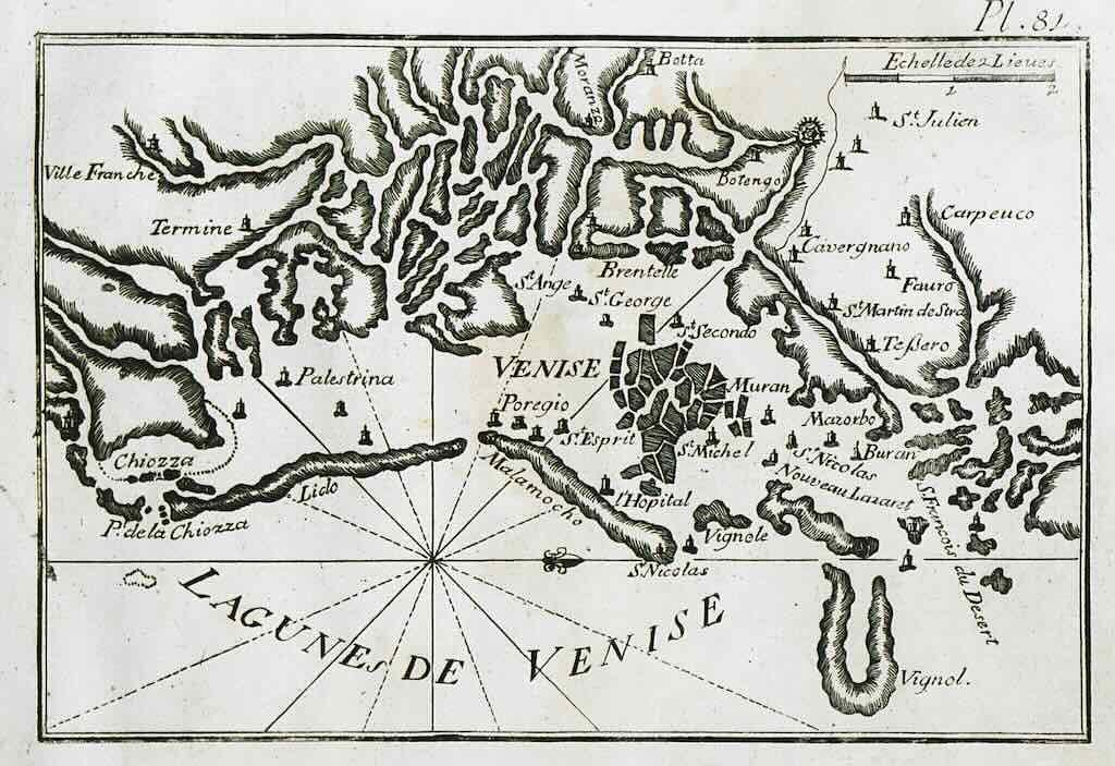
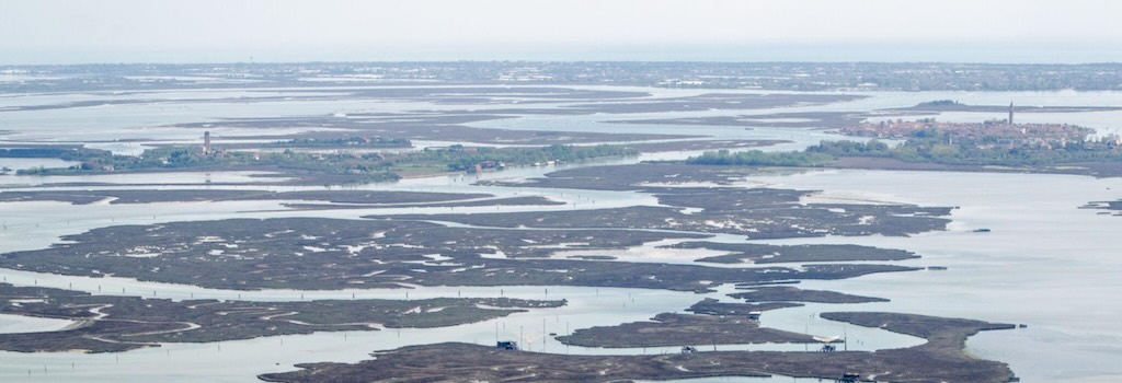
The Venetian lagoon lies at the northern end of the Adriatic Sea, between the mainland of northeastern Italy and a chain of sandy coastal barriers (one 11-km long is called the Lido). It extends roughly 50 kilometres from north to south and covers approximately 550 square kilometres, depending on the boundaries and measurement used. The larger UNESCO World Heritage property covers 701.8 square kilometres, including areas beyond the lagoon itself. It’s worth remembering that the islands are only 5% of the lagoon, the rest is water.
The Venetian Lagoon covers almost as much as the entire city of Madrid (604 square km).
It is not a lake, a river estuary or an ordinary stretch of coastline. It is a shallow coastal basin separated from the open Adriatic by long barrier islands, but connected to the sea through tidal inlets. Tides repeatedly move seawater into and out of the lagoon, creating channels and mudflats, salt marshes and low islands.
The distinction matters because much of what appears on a map as water is extremely shallow, e.g. bathymetry from 2002 put most of the lagoon less than 2m deep. Other areas emerge at low tide and disappear beneath the water at high tide. The navigable channels are considerably deeper, e.g. the inlets of Lido, Malamocco and Chioggia.
For a community dependent on boats, this was not necessarily a disadvantage. The same channels that permitted local fishermen and merchants to move between settlements were difficult for an invading army unfamiliar with the lagoon to negotiate.
The islands were not all alike. Some were sandy ridges near the Adriatic, others were patches of firmer ground within the lagoon. Still others were marshy formations that could support little permanent construction (about 10% of the lagoon). Their shapes and areas changed as sediments accumulated, channels shifted and storms eroded exposed land.
This is the first essential correction to the familiar picture, Venice was not built on a ready-made collection of 118 conveniently shaped islands. The figure of 118, used by UNESCO, describes the familiar historic urban archipelago, not the number of inhabited islands in Roman times, nor the total number of islands throughout the lagoon. There is no reliable historical count of how many separate islands existed, or how many were occupied, in the 5th century.
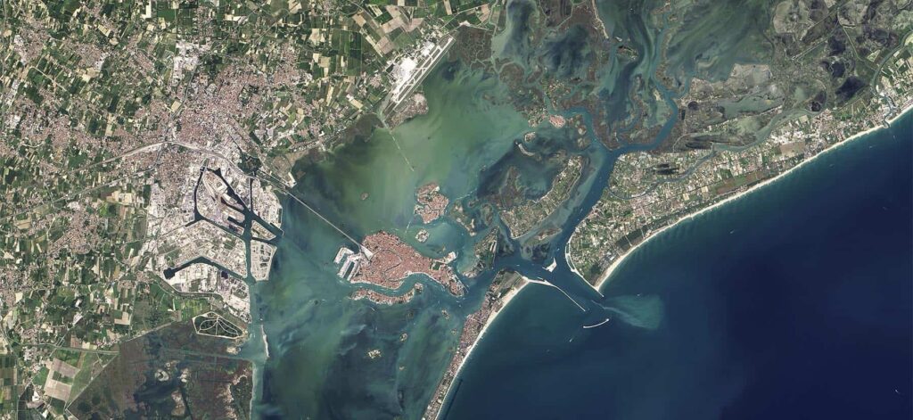
So there is good archaeological evidence for people living on some of the islands within the northern Lagoon beginning in the first few centuries AD. Dry land suitable for building purposes, as opposed to marsh islands prone to regular flooding, was at a premium and so right from the start there was a strong incentive to alter conditions to favour human needs. By raising the height of the land, through importing extra sediment to a site, it was possible to reduce the probability of flooding in periods of acqua alta. Sand from some of the barrier island dunes seems to have been used, or building rubble when it was available.
We always have to remember that at the time of full and new moons, the difference in water level between high and low tide on any given day would have been approximately 80–100 cm. Thus pavements and living floors in both early and later Venice were generally built at least 100 cm above the mean sea level current at the time of construction.
Additionally, the enclosure and infilling of areas of salt marsh near the small settled natural islands were used to expand the inhabited area. By building successive phases of wooden waterside structures, to minimise erosion and increase the usable margins of islands, it was possible to protect and maximise the land that already existed. Based on the archaeological evidence now available these methods were employed in the Lagoon at least from Roman times.
As time passed, the scale of habitation increased and the nature of settlements changed. Initially, the occupation of Venice was more akin to a broadly dispersed series of settlements than to an urban centre. Only later, in the 8–9th centuries AD, would it have taken on the character of a city.
Maps of the 11–13th centuries, and detailed parish records, suggest that even close to Piazza San Marco gardens, orchards and open places existed. By the end of the 13th century, Venice had become one of Europe’s largest and most prosperous cities, with a population commonly estimated at around 100,000 inhabitants, although medieval population figures remain uncertain. Comparable urban centres included Milan, Florence, Genoa, Naples and Paris, while London probably had approximately 60,000–100,000 inhabitants around 1300.
These comparisons illustrate the exceptional scale of Venice. In a Europe where most towns contained only a few thousand inhabitants, Venice had developed into a major urban centre whose commercial and maritime activities supported a population approaching or exceeding 100,000.
Venice expanded through the gradual consolidation and reclamation of the lagoon’s islands, mudbanks and shallow waters. Where necessary, builders drove closely spaced wooden piles into the soft, waterlogged sediment, creating foundations that could support substantial masonry structures. Timber beams or planking, together with stone foundation courses, distributed the weight of the buildings above. The piles generally did not reach bedrock, with their effectiveness depending on the properties of the surrounding sediment and the distribution of the load.
As the city developed, brick became a principal building material because it was relatively light, economical and suitable for construction on the lagoon’s compressible ground. Stone, particularly Istrian limestone, remained important for foundations, exposed surfaces and architectural details. Thus Venice’s distinctive construction combined timber foundations, stone and brick masonry, and the progressive reclamation of land from the lagoon.
On the extensive mainland behind the Lagoon, the region known today as the Veneto, there was a system of rivers that drained into the Lagoon. By the 14th century the area was used for agriculture, and the rivers Brenta, Sile and Zero used for transport. This produced a deterioration of the Lagoon, which began to silt up because of heavy sedimentary loads. Shoals interfered with navigation, which threatened the trade-centred economy of the city.
If allowed to continue, the sedimentation would have opened Venice up to direct military attack. Such a change would have been a disaster for the Venetians, and so a start was made on schemes to divert the rivers away from the Lagoon so that their sediment load would be discharged directly into the Adriatic. Thus the primary source of alluvium responsible for causing shoaling in the port of Venice would be eliminated, but the lagoonal salinity increased as less freshwater entered the Lagoon.
A map from 1709 shows how levees and dikes had totally diverted all the main rivers around the Lagoon. This illustrates how, in so many ways, historical Venice is the consequence of human environmental interventions that, from small beginnings, ultimately transformed the city and Lagoon from what existed 1,000 years ago.
Volume I — From the lagoon settlements to the 12th-century Republic
Setting the scene for Hazlitt’s first volume
The fundamental question is not simply how Venice became a maritime republic. It is why a community should have developed in a shallow, muddy, tidal lagoon when substantial Roman towns, established roads and productive agricultural land already existed a few kilometres away.
The principal Roman towns nearby were Altinum, Patavium (Padua), Aquileia, Iulia Concordia (Concordia Sagittaria) and Opitergium (Oderzo). Distances were 19, 36, 44, 45 and 85 km. They were not all immediately beside the lagoon, some stood on its margins, others inland, but all connected by Roman roads, rivers and navigable waterways.
So it’s important that the first Venetians were not leaving a remote, undeveloped countryside. They came from a region containing established Roman towns, commercial ports, cultivated estates and an extensive transport network. Altinum stood at the northern edge of the lagoon and was an established Roman trading town with canals, quays and connections to the mainland road network. Torcello (first settled in 452 AD) was only a few kilometres across the northern lagoon from the Altinum area, making the movement of people and goods between them more than plausible. Padua was a much larger inland centre, economically important for agriculture and manufacturing. Oderzo was another Romanised town of the Venetian plain, while Concordia occupied a strategic road junction. Aquileia, founded as a Roman colony in 181 BC, was a major commercial and military centre linking Italy with the northeastern provinces and the Adriatic.
Two roads help explain the geography, first, the Via Annia, connecting Padua, Altinum, Concordia and Aquileia, and second, the Via Postumia, linking the Po Valley with northeastern Italy. These were not isolated towns separated by empty countryside. So the future Venice arose not on the edge of civilisation, but immediately beside a prosperous and interconnected Roman landscape whose political security was progressively collapsing.
Who were these people? Were they impoverished refugees, fishermen, merchants, Roman citizens or soldiers? Why did they choose islands that could flood, where drinking water was scarce, building was difficult and almost everything had to arrive by boat? And how did such settlements eventually acquire the wealth and political independence to challenge established European powers?
The answer begins with geography, several centuries before there was a city called Venice. To understand better how Venice emerged it requires separating three things that Hazlitt’s 19th-century history views together, first the ancient inhabitants of Venetia, next the early communities of the lagoon, and then later the Republic of Venice (697–1797).
Who lived there first?
The people from whom Venice eventually emerged were predominantly inhabitants of Roman Venetia, a region of northeastern Italy that had been incorporated into the Roman world long before the 5th century.
Their ancestry cannot be reduced to a single tribe. The ancient Veneti were established in northeastern Italy before Roman conquest, and their territory was gradually integrated into Roman political, economic and cultural life. By late antiquity (AD 250-750), the relevant population was substantially Romanised.
The important point is that the first lagoon settlers were not a mysterious people arriving from an unknown country. Many belonged to the population already living in the surrounding region.
As mentioned, their principal mainland centres included:-
- Altinum (Altino), on the northern edge of the lagoon, connected to roads and waterways.
- Patavium (Padua), an important inland Roman city.
- Aquileia, a major commercial and administrative centre farther northeast.
- Concordia, Opitergium (Oderzo) and other towns of the northeastern Italian plain.
Altinum is particularly important. It was not an isolated settlement overlooking a wilderness. It was connected to the regional Roman road network and to navigable waterways leading towards the Adriatic. Its inhabitants were already accustomed to using boats, managing wetland resources and moving goods through the coastal environment.
The lagoon therefore formed part of an established economic landscape before Venice existed. In other words, the newcomers did not necessarily encounter an empty lagoon. They encountered a difficult environment that local people already knew how to exploit.
Why move into such an inhospitable place?
The conventional explanation is that people fled the barbarian invasions of the 5th and 6th centuries. That is partly true, but incomplete.
The Western Roman Empire was progressively disintegrating. In 401–402 and again in 408, northern Italy experienced the campaigns of the Visigoths under Alaric I. In 452, Attila’s Huns invaded northern Italy and attacked Aquileia. In 568–569, the Lombards, a Germanic people, entered Italy and established control over large parts of the Po Valley.
These events did not all produce the same consequences. A threatened population might temporarily take refuge on islands and return to the mainland when the danger passed. The Lombard conquest, however, helped establish a lasting political division between the mainland and the lagoon. Much of the mainland passed under Lombard control, while the maritime settlements remained within the sphere of the Eastern Roman, or Byzantine Empire.
That division was decisive because a person leaving Altinum or Oderzo for the lagoon was not necessarily abandoning Roman civilisation. They could be moving from an exposed part of the former Roman world to a more defensible part still associated with imperial authority.
The lagoon offered several advantages that compensated for its disadvantages.
First, it was difficult to attack. Armies organised around infantry, cavalry and land transport could not simply march across tidal mudflats and deep channels. An invader needed boats, pilots, knowledge of the tides and suitable landing places.
Second, it offered economic resources. Fishing, shellfish gathering, salt production and transport were already familiar activities. Salt was particularly valuable because it was essential for preserving food and could be exchanged for agricultural products that the islands could not produce.
Third, it was connected rather than isolated. Its waterways linked the northern Adriatic to mainland rivers, and the Adriatic itself connected northern Italy with Istria, Dalmatia, Ravenna and, ultimately, the eastern Mediterranean.
Fourth, its inhabitants possessed specialised skills. Boatbuilding, navigation, fishing, managing shallow water and maintaining embankments were valuable forms of knowledge.
The inhabitants did not choose the lagoon because it was a pleasant alternative to the mainland. They chose or remained in it because, under changing political circumstances, its disadvantages could be turned into advantages.
There is, however, a further correction to make. The archaeological record does not support the notion that all the early settlements were suddenly created by refugees fleeing Attila in 452. Occupation developed over a longer period, and existing commercial activities were important. The refugee story became central to Venice’s later account of its own origins.
What did these people actually live on?
One of the earliest contemporary descriptions is provided by that letter from Cassiodorus. Its immediate purpose concerned the transport of supplies, including wine and oil, from Istria to Ravenna. This is important evidence for two reasons.
First, it demonstrates that maritime communities in Venetia were sufficiently organised to receive official instructions and undertake transport duties. They were not invisible refugees forgotten by the outside world.
Second, the letter describes people whose lives depended on boats, salt and the waterborne environment. It presents a society with recognised local officials, not merely a collection of temporary shelters.
There were also considerable practical difficulties.
Fresh water was a persistent problem. Saltwater surrounded the settlements, but it could not be drunk. Rainwater collection and supplies from the mainland were essential. As the later city grew, Venetians developed sophisticated cisterns beneath squares and courtyards, using sand filtration and waterproof clay lining (pudding), so sand-filled rather than large empty chambers. The elaborate system visible in Venice today belongs largely to later centuries, but the underlying water problem was present from the beginning.
Building presented another difficulty. Firm ground was scarce, and the soil was often unstable. Archaeological investigations have identified techniques for retaining and extending land using timber posts, woven barriers and deposited material. These methods developed over time, and it would be misleading to imagine that every early dwelling already stood on the elaborate foundations associated with later Venetian palaces.
Where were the first important settlements?
Torcello became one of the most important settlements in the northern lagoon. Its archaeological evidence includes early medieval occupation, and it developed into a religious and commercial centre. The cathedral of Santa Maria Assunta, traditionally associated with the 7th century, is the most conspicuous surviving monument of that early importance. Its present fabric and decoration reflect subsequent rebuilding and alteration.
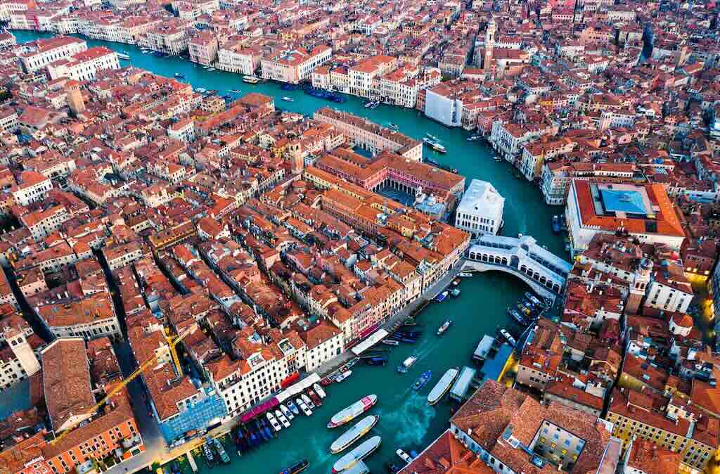
These were not simply five neighbourhoods of one existing city. They represented different communities and centres of power, whose relative importance changed over several centuries.
Other significant places included Murano, Mazzorbo, Burano, Ammiana, Jesolo, Caorle and Chioggia. Some became prosperous settlements, others declined or disappeared as channels silted up, environmental conditions changed and political and economic activity became concentrated elsewhere.
The development of Venice was therefore partly a process of competition within the lagoon itself.
How many islands, how much land, and how many inhabitants?
Here we encounter a serious limitation in the historical evidence. We can describe the geography and identify important settlements, but we cannot produce a reliable census of the 5th- or 6th-century lagoon.
The lagoon as a whole covers approximately 550 square kilometres, comprising open water, tidal flats, salt marshes, channels and islands. It was never a single continuous area of habitable land. The historic city of Venice is conventionally described as occupying 118 small islands. This is a description of the developed city, not a count of islands occupied by the first settlers.
Archaeological evidence identifies occupation at a number of sites, including Torcello, Olivolo, Murano, San Lorenzo di Ammiana and San Francesco del Deserto. But the number of inhabited islands changed over time, and no reliable comprehensive count survives.
There is no trustworthy population total for the lagoon in 450, 550, 650 or 750. Nor can we calculate the number of inhabitants by multiplying an assumed number of houses by an assumed household size. The archaeological sample is too incomplete.
It would therefore be false precision to write that Venice began with, say, 5,000 inhabitants on 20 islands. We can say that the lagoon contained multiple inhabited settlements by the early Middle Ages and that some acquired sufficient economic and institutional importance to support churches, bishops and administrative centres.
By the late 13th century, the situation was entirely different. Venice had developed into a major European city with an estimated population of around 100,000. That figure gives a sense of the eventual scale, but it must not be projected backwards onto the first settlements.
Nor should the communities be imagined as socially identical. Their inhabitants included people involved in fishing, salt production, transport and commerce, alongside landowners, religious authorities, soldiers and administrators. Political leadership increasingly emerged from families possessing wealth, connections and administrative influence.
We cannot establish that each island had a distinct ethnic population. The more useful distinction is between settlements with different economic activities, political allegiances and institutional roles, rather than separate peoples occupying separate islands.
Were they ignored by the great powers?
No. This is another misconception. The lagoon’s early history unfolded within the struggles between the Ostrogoths, the Eastern Roman Empire, the Lombards and, eventually, the Franks.
In 535, the Byzantine emperor Justinian began his campaign to reconquer Italy. Ravenna fell to Byzantine forces in 540, and the Gothic War continued until 554. Byzantine authority subsequently extended across parts of Italy, including the maritime Venetian region.
When the Lombards entered Italy in 568–569, the political landscape changed again. The lagoon became part of the remaining Byzantine-controlled coastal territories, while much of the mainland came under Lombard authority.
The communities were therefore strategically useful. They provided maritime transport, connections along the Adriatic and a defensible presence near contested mainland territories.
Their political structures developed within this environment. The term tribune appears in the 6th-century evidence. Later, a dux, the Latin word from which doge derives (and Duke), became the principal political officer.
Venetian tradition places the election of the first doge, Paolo Lucio Anafesto, in 697. That date and the historicity of the individual are disputed. The later Venetian state had reasons to portray its political institutions as both ancient and continuous. It is safer to describe the dogeship as emerging through the transformation of Byzantine provincial government and the growing influence of local elites.
An especially important turning point came in 751, when Ravenna fell to the Lombards. The loss of the principal Byzantine administrative centre in Italy altered the relationship between the lagoon communities and imperial authority.
Then came the Frankish challenge. Charlemagne’s son Pepin ((777-810) campaigned against the lagoon around 809–810. The conflict helped demonstrate the importance of the lagoon’s defensive geography and the political risks of maintaining the ducal centre at Malamocco.
Around 810–811, the ducal seat moved to Rialto. The agreement reached between the Frankish and Byzantine empires in the following years left the lagoon within the Byzantine sphere.
This was not yet complete Venetian independence. But it created conditions in which local rulers could exercise increasing autonomy while maintaining valuable commercial and diplomatic connections with Byzantium.
Why did Rialto become Venice, rather than Torcello or Malamocco?
For several centuries, the history of the lagoon was not the history of a single city. Torcello was important in the north, Heraclea and Malamocco were also political centres, whilst Olivolo possessed ecclesiastical importance. Rialto was just one location among several.
The eventual concentration of power at Rialto resulted from political decisions as well as geographical advantages. Rialto lay within the lagoon rather than on its exposed outer edge. It was accessible through navigable channels, including the waterway that became the Grand Canal. It offered connections to both the mainland and the Adriatic, while remaining difficult for a land army to attack.
Once the ducal administration settled there, its presence encouraged the concentration of officials, merchants, religious institutions, residences and commercial infrastructure.
That concentration became self-reinforcing. A political centre attracted commerce, and commerce attracted population and wealth. That wealth supported construction, and the resulting urban development strengthened Rialto’s position against rival lagoon settlements.
The arrival of the relics of Saint Mark from Alexandria in 828, according to the traditional account, added another dimension. The construction of a ducal chapel dedicated to the evangelist helped give the emerging political centre a prestigious religious identity.
The important distinction is that the church of Saint Mark was initially associated with ducal authority, while the bishopric of Olivolo retained a separate ecclesiastical position. The future basilica was not originally the cathedral of Venice.
This is how the scattered settlements began to become something different. Not just some people living on islands, but an urban centre capable of organising and governing a maritime territory.
What remains visible today?
A visitor looking for the beginnings of Venice should not start by assuming that Piazza San Marco is the oldest and most revealing part of the city.
The archaeological remains and museum at Altino provide a much better starting point for understanding Roman Venetia than the medieval monuments of central Venice. They show the mainland urban culture that existed before the Rialto settlement developed into a city.
The comparison changes the question. Instead of asking how ancient Venetian ships became gondolas, we should ask how the commercial networks and settlements of the northern Adriatic changed as Roman political authority declined and Byzantine power developed.
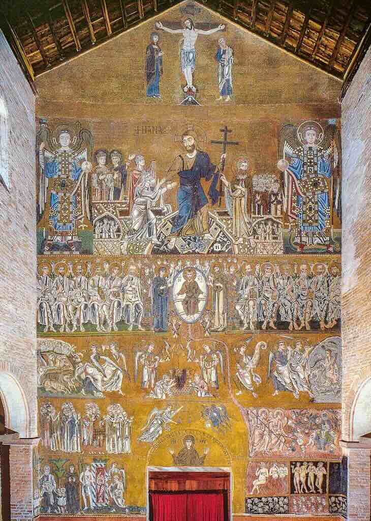
Torcello offers a better introduction to the earlier lagoon world. Its cathedral, Santa Maria Assunta, preserves a religious site associated with the 7th century, although the building has been substantially modified over the centuries.
When this was built Venice was not a densely built city with stone embankments, monumental bridges and palaces. The city would emerge from timber construction, small waterways, agricultural and fishing activities, religious foundations and gradually consolidated ground.
Above we have the full height gold-glass mosaic showing the Crucifixion, the Anastasis and the Last Judgement. The Cathedral in its present form was dedicated in 1008. There is no surviving documentation for the date of the mosaic, but stylistic and archaeological data suggest the last half of the 11th century.
Patrick Martin did his PhD on this mosaic, and I can do no better than to copy his analysis and description…
He argues that the iconography of the Last Judgement is Byzantine, as were the craftsmen who made it, and the materials used. The iconography is clearly based on the cluster of motifs that became the standard model for the Eastern Last Judgement around the beginning of the 11th century. It contrasts sharply with the Western model as seen in the near-contemporary west wall fresco at Sant’Angelo in Formis near Naples. The mosaic technique is Byzantine, and the same workshop may have worked, first at Daphni and then at Torcello. Analysis of the Torcello tesserae indicates that they were not produced locally, and the raw glass probably came from Syria.
The Monastery of Daphni is a Byzantine monastery approximately 11 km northwest of central Athens, on the ancient Sacred Way to Eleusis.
In the second half of the 11th century it was to Venice’s advantage to portray itself as an ally of the Byzantine emperors. It boosted trade and gave the city extra leverage against threats from the German empire, from other Italian states and from the Normans in the south. Part of the propaganda campaign was the redecoration of Torcello Cathedral, starting with the Apostles in the main apse, continuing with the Ravennate South Chapel, and culminating in the west wall.
Prestige demanded mosaic, but the native mosaic revival in Italy was not available until the 12th century, so the Venetians had to look East for craftsmen. At the level of the individual motif the craftsmen followed the standard Eastern iconography, making a clear statement of common interests between Venice and Constantinople.
The Venetian innovations came in the overall layout. The monumental Last Judgements in the Eastern Mediterranean up to the end of the 12th century were almost always found in narthexes and funerary chapels, and participants in the liturgy were literally depicted in the midst of the events. Flat images were confined to icons and painted panels, books and ivories.
For the Torcello west wall it was necessary to design a convincing flat composition to put across the desired religious messages. The second innovation is the unique combination of Crucifixion, Anastasis and Last Judgement. Anna Kartsonis sees the Anastasis as prompted by the presence of the baptistery just outside the west door, a traditional pairing of Baptism and Anastasis picked up later in the Baptistery of S. Marco.
Together these innovations allowed the Venetian patrons to achieve a new and complex image for both meditation and instruction. Reading from the Crucifixion downwards the viewer saw the cosmic drama of salvation, out of time and authenticating the timeless reality of Christ in the sacraments, in the church and in the resolution of history. Reading from the bottom upwards the viewer, as he left the church or watched the newly baptised enter, was confronted with the choice of virtue or vice, Paradise or punishment, with a message of hope in God’s mercy and of threat in God’s judgement.
Don’t forget to visit the main apse with its 11th-century mosaic of the standing Virgin Hodegetria, isolated against a huge gold background, above a register of standing saints.
The nearby church of Santa Fosca and the relatively open landscape help convey the difference between an early lagoon settlement and the densely built city that eventually developed at Rialto.
At San Pietro di Castello, the former cathedral site recalls the independent ecclesiastical importance of Olivolo. Its present buildings are much later, but the location is historically significant.
At Rialto, the present commercial district occupies the area that became the political and economic centre after the early 9th century. Almost nothing visible in the modern streets can simply be identified as an original 9th-century structure, but the central navigable channel remains fundamental to understanding why the site developed.
The wider lagoon also retains something that the central city largely conceals, the distinction between inhabitable islands, salt marshes, mudflats and channels. A journey by boat towards Torcello gives a far better impression of the physical conditions confronting early settlers than a walk between San Marco and the Rialto Bridge.
How this changes our reading of Hazlitt
Hazlitt’s first volume needs to be approached with two different questions. The first is what he believed about Venice’s origins. His historical framework belonged to the 19th century, when chronicles and traditional narratives of invasions, refugees, tribunes and early doges carried considerable authority.
The second is what we can now establish independently through archaeology, environmental history and critical examination of medieval sources.
The distinction is not a reason to dismiss Hazlitt. It is a reason to read him historically.
His treatment of the first doges, the migration of mainland populations and the development of political institutions tells us about early Venice, but it also tells us how a 19th-century historian understood the emergence of the Republic.
The modern archaeological picture is less orderly. There was no single foundation, no uniform migration, no immediate political unity and no inevitable rise of Rialto.
Instead, there was a succession of communities exploiting a difficult but commercially useful environment, responding to political upheavals, and gradually developing the institutions that allowed one settlement to become the centre of a state.
That is the scene which should precede an examination of Hazlitt’s first volume. The Republic did not arise simply because refugees found shelter in the lagoon. It emerged because the lagoon’s inhabitants converted geographical protection, maritime knowledge, commercial connections and changing imperial relationships into an increasingly independent political organisation.
Returning to Hazlitt's Volume I
In the opening chapters of Volume I of The Venetian Republic (1915), Hazlitt traces the origins of Venice to the ancient Roman province of Venetia, its prosperous mainland towns, and the communities that developed among the islands of the Adriatic lagoon.
He begins by describing the geography of the region, the formation of the lagoon, and the commercial importance of towns such as Aquileia, Concordia and Altinum. He also examines Grado, Torcello and Rialto, identifying their connections with the surrounding mainland and the wider maritime economy. In Hazlitt’s account, the lagoon was not an entirely unknown or uninhabited region before the migrations associated with the collapse of Roman authority.
Hazlitt places considerable importance on the invasions of the Goths, Huns and other peoples during the 5th century. He presents the movement of refugees from the mainland into the lagoon as the decisive event in the foundation of Venice, assigning the formative period to approximately AD 421–452. The relative security of the islands, protected by shallow waters and difficult channels, offered the displaced inhabitants a refuge from the dangers confronting the mainland towns.
The early communities were scattered among several settlements rather than concentrated in a single city. Hazlitt describes their gradual political organisation, initially under consular government and subsequently under the gastaldi, or tribunes. He also discusses the letters of Cassiodorus to the maritime tribunes, using them as evidence of the inhabitants’ occupations, their dependence on boats, and their participation in transport and commerce.
In Chapter II, Hazlitt describes the political disorders that eventually led to the replacement of government by tribunes with the office of Doge. He places the election of Pauluccio Anafesto of Heraclia in 697–698, attributing an important role to the Patriarch of Grado and the popular assembly. Anafesto’s election is presented as a significant step towards political unity and the establishment of a more effective central authority.
The following decades were marked by rivalries between the principal lagoon settlements, particularly Heraclia and Malamocco. Hazlitt recounts the struggles between successive doges, the influence of leading families, the changing relationship between secular and ecclesiastical authorities, and the continuing importance of the Byzantine Empire.
By the beginning of the 9th century, Venice was also drawn into the conflict between the Byzantine Empire and the expanding power of Charlemagne. In Chapter III, Hazlitt describes the divisions between Venetian factions favouring the Franks and those supporting closer relations with Byzantium. The intervention of Pepin, Charlemagne’s son and King of Italy, culminated in an attack on the lagoon in 809. Hazlitt attributes the successful Venetian resistance partly to the defensive advantages of the waterways, and to the measures taken to obstruct the invading forces.
Chapter III (787–810): When Venetian History and Venetian Legend Diverge
Chapter III in Volume I deserves separate attention, not because it is more important than every other chapter, but because it provides a particularly clear example of the difficulty of reading Hazlitt today. It describes events that genuinely shaped Venice’s political future, yet its interpretation depends heavily on a later Venetian tradition that presents the Republic’s emergence as a heroic struggle for independence. Here, the difference between 19th-century historical writing and modern source criticism is especially revealing.
A divided lagoon between two empires
At the end of the 8th century, Venice was still a Byzantine duchy, not an independent republic with an established constitution. Its doges depended on the support of powerful families and competing lagoon communities, particularly Heraclia, Malamocco, Torcello and Rialto.
The Galbaio family attempted to make the dogeship hereditary. Opposition intensified after the killing of Giovanni, Patriarch of Grado, traditionally attributed to Maurizio Galbaio, son of Doge Giovanni. The resulting struggle brought Obelerio, associated with Malamocco, to power around 804.
These were not simply disputes between patriots and foreign sympathisers. Venetian factions sought support from rival imperial powers, either Charlemagne’s Frankish Empire or Byzantium. The Royal Frankish Annals independently record the appearance of Venetian leaders at Charlemagne’s court in 805–806.
Pepin’s invasion: two incompatible accounts
The decisive confrontation came in 810, when Pepin, Charlemagne’s son and King of Italy, attacked the lagoon. Hazlitt dates the campaign to 809, reflecting chronological difficulties in the sources.
The contemporary Royal Frankish Annals describe a successful Frankish campaign and the submission of the Venetian dukes. John the Deacon’s Istoria Veneticorum, written approximately two centuries later, offers a contrasting account of Venetian resistance and Frankish failure.
Hazlitt largely follows the Venetian tradition. His account includes obstructed channels, sunken vessels, a withdrawal towards Rialto and the disastrous difficulties encountered by the invaders in the lagoon shallows.
The geographical obstacles were real. The detailed story of a crushing Venetian military victory, however, cannot be treated as established fact. The two narrative traditions differ, and neither supplies an entirely secure reconstruction of the campaign.
What actually changed
Whatever the immediate military outcome, the Franks failed to establish permanent control over the lagoon. The diplomatic settlement of 810–812 left Venice within the Byzantine sphere.
The crisis also contributed to the decline of Malamocco as the political centre. Under Agnello Participazio, the ducal government established itself at Rialto, the nucleus of the future city of Venice.
Hazlitt interprets these developments as evidence of an already recognisable Venetian nation defending its liberty. Modern scholarship suggests a more gradual process with competing lagoon elites, still operating within a Byzantine political framework, and using shifting imperial alliances to preserve and enlarge their autonomy.
The significance for assessing Hazlitt
Chapter III therefore exposes a central limitation of Hazlitt’s historical method. He is valuable for preserving and organising the traditional Venetian narrative, but less reliable when that narrative turns complicated political events into a continuous story of national independence.
The distinction matters throughout the four volumes. Venice’s later institutions and identity should not be projected backwards onto a society in which neither the mature Republic nor its constitutional independence yet existed.
Principal sources and further reading
Annales regni Francorum (Royal Frankish Annals), entries for 805–810; English translation by Bernhard Walter Scholz and Barbara Rogers, Carolingian Chronicles (University of Michigan Press, 1970).
John the Deacon, Istoria Veneticorum, edited by Luigi Andrea Berto (Bologna: Zanichelli, 1999).
Thomas F. Madden, Venice: A New History (Viking, 2012), chapters on Venice’s early political development.
Frederic C. Lane, Venice: A Maritime Republic (Johns Hopkins University Press, 1973), opening chapters.
John Julius Norwich, A History of Venice (Allen Lane, 1982), for a readable presentation of the traditional narrative, to be distinguished from the contemporary evidence.
The victory of Venice strengthened the position of a certain Angelo Badoer (more commonly identified today as Agnello Participazio (also Agnello Particiaco), who ruled approximately 811–827, whom Hazlitt presents as the founder of a new ducal dynasty. In Chapter IV, he describes Badoer’s efforts to restore settlements damaged by the conflict, encourage the inhabitants to rebuild their homes, and establish new religious foundations.
Chapter IV (810–864): Building a Capital Without Establishing a Dynasty
Chapter IV deserves a shorter examination than Chapter III, but it also raises an important question. How did Venice acquire a permanent political centre and a recognisable civic identity while repeatedly failing to establish a stable system of government?
Hazlitt presents the period as one of consolidation under the Badoer dynasty. Modern scholarship suggests a less orderly development, characterised by attempts to establish hereditary rule, factional conflict and the gradual construction of Venetian political identity.
The Particiaco dynasty and the limits of hereditary government
Hazlitt identifies Agnello Particiaco, whom he calls Angelo Badoer, with the later Badoer family. The relationship between the early Particiaci and the later patrician lineage is not securely established, and the dynastic continuity implied by Hazlitt requires qualification.
Agnello attempted to secure the succession through his sons Giovanni and Giustiniano, but their rivalry demonstrated the fragility of hereditary arrangements. Giustiniano succeeded in 827, followed by Giovanni in 829.
Giovanni’s eventual deposition in 836, after factional opposition and the earlier rebellion associated with Obelerio, shows that the dogeship remained dependent upon political support rather than an established right of inheritance.
St Mark and the construction of Venetian identity
The traditional arrival of St Mark’s relics from Alexandria in 828 was a decisive symbolic development. The evangelist became associated with the ducal government at Rialto, where a church was established beside the palace to house his remains.
The event gave Venice an apostolic patron of exceptional prestige. It also provided the emerging political centre with a religious identity distinct from those of its powerful neighbours.
The traditional account of the relics’ removal cannot be verified in every detail, but the subsequent development of St Mark’s cult is central to understanding the relationship between religion and political authority in Venice.
Pietro Tradonico and the persistence of political violence
Pietro Tradonico’s long government (836–864) demonstrated both the growing importance and the continuing insecurity of the dogeship.
Venice maintained diplomatic and commercial relations with the Carolingian world while facing military threats in the Adriatic and Mediterranean. Its maritime strength was developing, but was far from overwhelming.
Tradonico was assassinated in September 864, despite nearly three decades in power. His death exposed the continuing capacity of rival factions to challenge the ruling family.
The significance for assessing Hazlitt
The essential distinction is between the consolidation of Venice as a political centre and the consolidation of its governing institutions.
By 864, Rialto had become the seat of ducal government, St Mark had acquired a central place in Venetian civic identity, and the lagoon communities were developing more extensive diplomatic and commercial relationships.
Yet hereditary succession remained contested, and the removal or assassination of doges was still possible.
Hazlitt correctly recognises the formative importance of these decades. His weakness is to interpret them too readily through the later stability and constitutional identity of the Venetian Republic.
The emerging Venetian state was becoming more coherent, but its government remained remarkably insecure.
So the most important geographical change was the transfer of the seat of government from Malamocco to Rialto, which Hazlitt attributes to Badoer. Hazlitt describes the construction of a new ducal palace and the beginnings of a network of wooden bridges connecting the developing capital with neighbouring islands.
For Hazlitt, this transfer marked an important stage in the consolidation of the Venetian state. Heraclia and Malamocco had previously served as political centres, but Rialto now became the permanent focus of ducal authority and the nucleus of the city that would develop into the capital of the Republic.
The early history presented in these chapters is therefore one of successive transformations. From the prosperous Roman mainland to the refuge of the lagoon, from scattered communities to a government under tribunes, from the tribunes to the doges, and finally from competing island settlements to the establishment of Rialto as the political centre.
Hazlitt’s narrative is also concerned with the emergence of Venetian independence. He describes a state that maintained important relationships with Byzantium while increasingly asserting its own political authority, defending its territory and negotiating with neighbouring powers.
An Aside - Rialto from Mudbanks to a Living City
Before we venture into Hazlitt’s Volume II (in a separate part II) let’s take time out to understand how an unlikely place became habitable, and how everyday life changed as a settlement became the centre of Venice.
Standing today in the crowded streets around San Giacomo di Rialto, it is difficult to imagine that the solid land of Campo San Giacomo di Rialto was once part of an irregular collection of muddy islands, tidal channels and marshy banks. There were no continuous streets, no stone embankments, no great bridge and certainly none of the substantial buildings that now give Venice its apparently permanent appearance.
Yet the transformation was not accomplished in a single generation. It took centuries of practical decisions, made by people who needed somewhere to live, somewhere to keep their boats, somewhere to trade and, above all, somewhere that would remain above water (and we all know how successful that was).
The story of Rialto is therefore not simply the story of Venice acquiring a political centre. It is the story of how successive generations physically laid the ground on which their city would stand.
Before Rialto became Venice — Life among the tidal waters
The earliest useful written description comes not from a Venetian but from the Roman statesman Cassiodorus, writing in AD 537 to the maritime tribunes of Venetia.
In Variae, Book XII, Letter 24, he describes communities living among the waters of the northern Adriatic, their houses associated with the banks and waterways of the lagoon. Boats were essential to daily movement, and fishing and salt production formed important parts of the local economy.
Cassiodorus was not describing Rialto specifically, nor was he conducting a survey. His account was partly rhetorical, presenting a distinctive and apparently egalitarian society. Nevertheless, it establishes that the lagoon was already an inhabited and economically active environment long before Rialto emerged as the centre of Venice.
If I had lived there in the 6th century, I would have thought of the water less as an obstacle and just a fact of life. A boat would have been indispensable. The tide would have influenced where I could land, where I could work and which ground was suitable for building.
The lagoon was not an empty refuge waiting for fugitives from the mainland. It was already a working landscape, connected with the coastal traffic between the northern Adriatic and Ravenna.
Sources: Cassiodorus, Variae, XII.24 (AD 537); Monica Centanni, “Note to Cassiodorus, Variae XII, 24,” in Crossing the Water: The Venice Lagoon from Antiquity throughout the Centuries (2022); Sauro Gelichi, archaeological studies of early Venetian lagoon settlement.
The 8th and 9th centuries — Making a place to live
The most important fact about early Rialto is that the inhabitants did not discover a ready-made building site. So they had to create one.
The natural banks offered patches of relatively elevated ground, separated by shallow channels and areas periodically covered by tidal water. Building required the selection and consolidation of suitable sites. Timber could provide foundations and support, and earth, gravel and excavated sediment could raise or stabilise the surface.
The familiar description of Venice as a city built on wooden piles is broadly correct for many of its later buildings, but it should not lead us to imagine that every early dwelling stood on a dense forest of piles. Building methods varied with the ground, the size of the structure and the resources available.
I imagine the earliest work being done on a very modest scale. One family improves a landing place. Another strengthens the edge of its plot. A channel is cleared to allow a boat to reach a house. Mud removed from one place becomes useful material somewhere else.
Over time, such interventions would have changed the shape of the islands themselves. The original landscape was gradually replaced by an artificial one, although the process was uneven and much of its earliest chronology remains uncertain.
The inhabitants also faced the problem of drinking water. The surrounding lagoon was brackish or saline, and dependable freshwater had to be obtained through collection, storage or transport. The elaborate rainwater-filtering wells familiar from later Venice should not automatically be projected back into the 8th century.
At this stage, the settlement was not yet the tightly packed urban environment we recognise today. There was room for small open spaces, landing places and the practical activities of households whose livelihoods depended on the water.
Sources: Joanne M. Ferraro, Venice: History of the Floating City (Cambridge University Press, 2012), particularly “Engineering the Island Parishes”; Wladimiro Dorigo, Venezia romanica: La formazione della città medioevale fino all’età gotica (2003).
Around AD 810 — When the neighbourhood began to change
The traditional chronology places the transfer of the ducal seat from Malamocco to the Rialto islands in the early 9th century, generally around AD 810–811.
For the ordinary inhabitant, the significance was not necessarily the constitutional position of the doge. It was the arrival of people and activities. An administrative centre required new buildings, and more supplies, transport, craftsmen, religious institutions and people to service them. These needs would have encouraged settlement and construction beyond the immediate ducal precinct.
If I were a boatman living nearby, I might have noticed increasing traffic along the channels. If I owned a suitable landing place, its usefulness would have grown. If I supplied timber, transported stone or carried provisions, the developing settlement would have offered new opportunities.
These are reasonable consequences of urban growth, rather than individual experiences recorded in surviving 9th-century testimony.
The most important physical development was the emergence of two connected but distinct centres. The ducal and religious precinct at San Marco, and the commercial district at Rialto. Between them lay the Grand Canal, already an essential waterway through the developing settlement.
The transformation was not simply that more people arrived. It was that land began to acquire different functions and, consequently, different values. A waterside plot suitable for a dwelling might become more valuable as a landing place or shop. A narrow passage that had served a handful of households might become an important connection between neighbouring areas.
Sources: Giovanni Diacono, Istoria Veneticorum, written around AD 1000; Élisabeth Crouzet-Pavan, studies of the formation of Venetian urban space; Ferraro (2012).
The 10th and 11th centuries — Houses, churches and shops
By the 11th century, Rialto was no longer simply a collection of dwellings around useful waterways.
Documentary evidence begins to reveal a more organised commercial district.
Michela Agazzi‘s study of medieval Rialto identifies long, narrow buildings containing shops, while surviving property documents allow parts of the area to be reconstructed. A particularly important document dates from 1051, when members of the Gradenigo family divided property in the Rialto district. The land was arranged in long, narrow strips, reflecting a more structured pattern of occupation.
For an inhabitant, such changes would have been immediately visible. Where an earlier generation had known an open landing place or a relatively isolated building, there might now be a row of adjoining commercial premises. Access to the water remained important, but the relationship between the waterfront and the interior of the island was becoming more complicated.
A shop required customers, storage and deliveries. A house needed access, drainage and space for everyday domestic work. Neighbours increasingly had to share walls, passages, waterfronts and other facilities.
The growing number of churches also marked the transformation of scattered settlements into organised neighbourhoods. Religious buildings provided recognisable local centres around which houses and open spaces developed.
The settlement was becoming more permanent, more densely occupied and more dependent upon the management of common space.
Sources: Michela Agazzi, “The Medieval Rialto: The Transformation of an Area in the Developing City,” in Layers of Venice: Architecture, Arts and Antiquities at Rialto (2023); Ferraro (2012).
AD 1097 — When private space became public business
One of the most revealing documents in Rialto’s development dates from 1097.
Members of the Orio family transferred a row of market shops to public ownership, explicitly referring to the market of Rivoalto. This is an unusually concrete moment in the history of the district.
It tells us that commercial premises already existed in organised rows and that their ownership and administration were becoming matters of public concern.
From the perspective of someone living nearby, the change was potentially considerable. A market controlled by public authorities was not simply a place where neighbours exchanged goods. It was a place where premises could be allocated, rents collected, commercial activity regulated and access managed.
The significance of a shopfront was changing. It was no longer merely part of a privately owned property, it now belonged to a larger commercial system.
This also helps explain why Rialto increasingly developed a character different from that of the surrounding residential neighbourhoods. The market drew people towards it, but its success also created pressure upon the very space that made it possible.
Sources: Agazzi (2023), discussing the Orio donation of 1097 and the earlier property documents; Treccani, Storia di Venezia, “La conquista e l’organizzazione dello spazio urbano.”
The 12th and 13th centuries — A neighbourhood becomes a city centre
By the 12th century, the area around Rialto was already almost completely built up. This is perhaps the decisive stage in the physical story. The question was no longer primarily how to establish houses on the islands. It was how to accommodate increasing activity within an already occupied district.
The waterways remained essential for moving goods, particularly heavier cargoes. But land access became increasingly important as buildings multiplied and commercial premises occupied the available waterfront.
During the 13th century, one watercourse was filled in to create a principal street connected with the Ruga degli Oresi. Such interventions demonstrate how the original lagoon geography was progressively modified to meet urban needs.
Imagine having lived beside a small channel for years and then watching it disappear beneath a new thoroughfare. A route once travelled by boat could now be walked. A waterside property became a street frontage. Deliveries, movement, noise and the relationship between neighbouring buildings all changed.
The first permanent bridge across the Grand Canal at Rialto also belonged to this broad period of urban consolidation, although the precise chronology of the earliest crossing is not entirely secure. A bridge fundamentally altered the relationship between the two banks. It concentrated pedestrian movement at a particular point and made adjoining land especially valuable.
By now, the inhabitants were living in a district where the needs of commerce increasingly determined the arrangement of streets, buildings and public spaces.
Sources: Agazzi (2023); Wladimiro Dorigo (2003); studies of the medieval Rialto bridge and commercial district.
What remained of the original Rialto?
By the end of the 13th century, a resident of Rialto would have inhabited a place almost unrecognisable to someone who had lived there four centuries earlier.
The scattered banks had become an intensely occupied urban district. Channels had been altered or filled, land had been consolidated, and buildings had multiplied. Markets, workshops, churches, houses and public offices occupied space that had once been defined principally by the movement of water.
Yet the transformation had not erased the lagoon. The Grand Canal remained the principal artery of transport. Goods still arrived by boat. Buildings continued to depend upon the stability of artificially consolidated ground, and water remained a permanent practical consideration.
The streets of Venice were not laid out across an existing piece of dry land. They emerged through centuries of negotiation between people, buildings and water. Its inhabitants did not merely build a city beside the lagoon. They gradually converted part of the lagoon into a city, while remaining dependent upon the water that had originally made the settlement possible.
And when I walk today through the narrow streets behind San Giacomo di Rialto, I am walking not simply through a medieval neighbourhood, but across the accumulated results of hundreds of years of land reclamation, rebuilding and adaptation.
Chapter I (AD 409–654) — A twenty-first-century assessment
Hazlitt’s opening chapter presents the traditional story of Venice’s origins. The inhabitants of Roman Venetia, fleeing successive barbarian invasions, sought refuge among the islands of the lagoon and gradually created a new political community. He traces this development through the Gothic, Hunnic and Lombard invasions, the government of the tribunes, and the emergence of settlements such as Grado, Torcello and Rialto.
The central difficulty is that Hazlitt treats the foundation of Venice as a relatively coherent historical process, whereas modern research identifies a much longer, geographically uneven transformation. The lagoon was not empty before the refugees arrived, the settlement of its islands did not occur in a single episode, and the institutions of the later Venetian Republic cannot safely be projected backwards into the 5th century.
The first problem is the date of Venice’s foundation. Hazlitt reproduces the traditional chronology placing the beginnings of Venice in 421, followed by a period of consular government and the administration of tribunes. These dates belong primarily to the later Venetian historical tradition, not to securely documented 5th-century institutions.
The familiar date of 25 March 421 was eventually celebrated as the foundation of Venice. Some versions associate it with the establishment of a church near the Rialto and the arrival of representatives from Padua. Yet there is no contemporary document establishing that Venice was founded on that day, nor evidence for a unified Venetian government in 421.
The tradition emerged centuries after the supposed events. It offered Venice an ancient and respectable civic genealogy, presenting its inhabitants as descendants of Roman citizens who had preserved their freedom by escaping political disorder on the mainland.
Modern historians distinguish between this foundation narrative and the much less orderly process revealed by archaeology. Venice did not originate in a single ceremony, migration or political decision. Its development involved several settlements, different phases of occupation and changing relationships with the mainland.
Were the lagoon islands uninhabited before the invasions?
Hazlitt’s account gives particular importance to refugees escaping the Goths, Huns and Lombards. These movements undoubtedly affected the population and political geography of northeastern Italy, but they did not create settlement in an otherwise unknown lagoon.
The lagoon had long formed part of the economic landscape of Roman Venetia. Its waterways connected inland towns with the Adriatic, while fishing, salt production and maritime transport made use of its natural resources.
Archaeological evidence establishes activity on islands such as Torcello during the Roman period, although the extent of permanent settlement remains debated. Excavations at Torcello have identified a 2nd-century structure, 5th-century masonry remains and 6th-century timber houses.
The archaeological record also differs substantially from one part of the lagoon to another. The northern lagoon contains evidence of occupation earlier than that presently established for much of the future urban centre around Rialto and San Marco.
This geographical distinction is essential. The history of settlement in the Venetian Lagoon is not identical to the history of the city of Venice.
Attila and the destruction of the mainland cities
The invasion of Italy by Attila’s Huns in 452 was a genuine historical event. Aquileia suffered a major attack, and the upheavals of the 5th century contributed to changes in the region’s population and economy.
What cannot be demonstrated is the traditional sequence in which the inhabitants of Aquileia, Altinum and other Roman towns abandoned their homes in a single mass migration and immediately founded the principal settlements of Venice.
Altinum, for example, did not simply disappear in 452. Archaeological and historical evidence indicates continued activity during Late Antiquity (AD 250-750), even as the town’s functions and population changed.
The Lombard invasion beginning in 568 was another important development. It altered the political boundaries of northeastern Italy and strengthened the distinction between territories under Lombard rule and those retaining connections with the Eastern Roman Empire.
The movement of ecclesiastical authorities illustrates these changes. The patriarchal establishment associated with Aquileia relocated to Grado in the 6th century, although the precise sequence of events and the later division between the rival patriarchates remains unclear.
These migrations and institutional relocations were significant, but they occurred over generations rather than constituting one founding event.
Cassiodorus: what the earliest written evidence actually establishes
One of Hazlitt’s most valuable sources is the letter written in 537 by Cassiodorus, an official serving the Ostrogothic kingdom in Italy. Addressed to the maritime tribunes of Venetia, the letter concerns the transport of supplies, including wine and oil, from Istria to Ravenna.
Cassiodorus describes communities whose houses stood among the waters, where boats provided transport and salt production was an important economic activity. He also refers to the inhabitants’ ability to navigate sheltered inland waterways when conditions at sea were unfavourable.
This is unusually direct evidence of the economic organisation of the lagoon in the 6th century. But the letter does not establish the existence of the later Venetian Republic. Nor does it demonstrate that the tribunes constituted an independent Venetian government.
Indeed, the document originated within the administration of the Ostrogothic kingdom. The maritime communities were being instructed to perform services for that government.
Hazlitt is justified in recognising the letter’s historical importance. The mistake would be to interpret its references to maritime tribunes as proof of a political constitution already resembling that of medieval Venice.
The principal source is Cassiodorus, Variae, XII.24. Its value lies in what a contemporary administrator actually describes, rather than what later Venetian historians believed it demonstrated.
The tribunes and the supposed early constitution
Hazlitt describes an early period of consular government, followed by administration through tribunes or gastaldi. His chronology implies that a recognisable Venetian state existed well before the first doges.
Modern scholarship is much more cautious. The titles used for local officials in Late Antiquity and the early Middle Ages did not necessarily carry the institutional meanings later Venetian historians assigned to them.
A tribunus could exercise administrative or military responsibilities within a wider political system. Similarly, gastalduswas an official title used in several Italian contexts, but its appearance does not by itself establish a particular Venetian constitutional structure.
There is no secure contemporary documentary basis for Hazlitt’s precise sequence of a consular regime beginning in 421 and a replacement system of tribunes beginning in the 5th century. The better-supported interpretation is that different lagoon communities possessed local authorities whose relationships with Roman, Ostrogothic and subsequently Byzantine government changed over time.
Their gradual political consolidation belongs principally to the seventh and eighth centuries, and even then the evidence is incomplete.
The first doges: was Paoluccio Anafesto a historical figure?
Hazlitt treats the election of Paolo Luccio Anafesto in 697 as a decisive constitutional event, the replacement of competing local authorities by a single elected ruler.
The historical problem is that both the identity of this supposed first doge and the circumstances of his election are uncertain.
Roberto Cessi (1885–1969), whose work fundamentally revised the study of early Venetian history, questioned the traditional identification. He suggested that Anafesto might reflect confusion with the Byzantine exarch Paul. Other scholars have proposed different explanations, including a Lombard connection.
There is insufficient contemporary evidence to establish the election of an independent Venetian doge in 697.
The difficulty extends beyond one individual. Hazlitt presents a succession of early doges with relatively precise dates, reigns, political achievements and violent deaths. Much of this information comes from Venetian chronicles written long after the events.
The supposed government of five magistri militum between 737 and 742 illustrates the problem. Such an office fits the Byzantine military and administrative environment, but the precise succession recorded in the later chronicles cannot be independently established with confidence.
The fundamental distinction is between the origins of Venetian government and the later Venetian story about those origins. Hazlitt too readily treats the second as evidence for the first.
Byzantine Venice: autonomy was not independence
Hazlitt interprets the actions of the early doges as milestones in the creation of a sovereign republic.
Yet 7th- and 8th-century Venice remained within the Byzantine political and military system. The titles dux, tribunus and magister militum belonged to that administrative world.
Local autonomy developed, particularly as Byzantine authority in Italy weakened, but autonomy should not be confused with the existence of an independent Venetian republic.
The recovery of Ravenna from the Lombards in the 8th century, traditionally associated with Venetian naval assistance, is an important example. It demonstrates the lagoon communities’ continuing involvement in Byzantine affairs, not necessarily an independent Venetian foreign policy.
Modern historians also question whether the traditional chronology of this episode can be accepted without qualification.
Venice’s political identity emerged through a prolonged process involving Byzantine authority, Lombard pressure, ecclesiastical disputes, local rivalries and the growing importance of maritime commerce.
The Republic was not consciously constructing its later constitution in the 7th century.
Rialto and the creation of a political centre
The transfer of the ducal seat to Rialto in the early 9th century is traditionally associated with Agnello Partecipazio, elected around 811.
Unlike the supposed foundation in 421, the consolidation of ducal government at Rialto belongs to a period for which the historical framework is substantially more secure, although individual details remain disputed.
Hazlitt treats the transfer principally as an event in the political history of the doges. Modern historians place it within the wider reorganisation of the lagoon following conflict between Byzantine and Frankish interests.
The struggle involving Charlemagne’s son Pepin in 809–810 was especially important. The subsequent settlement between the Carolingian and Byzantine empires helped establish the political circumstances in which the Venetian duchy developed greater practical autonomy.
The precise terms and consequences of these agreements remain subjects of historical interpretation, but Venice’s emergence cannot be understood independently of the rivalry between the two empires.
Rialto’s sheltered position, navigable channels and developing commercial importance made it an increasingly suitable political centre.
The transfer of the relics of St Mark from Alexandria in 828 gave the city a powerful religious symbol. The account of their acquisition, however, comes through a tradition that served Venetian civic and ecclesiastical interests.
The patronage of St Mark helped distinguish the developing Venetian state from neighbouring religious authorities and contributed to the creation of a distinctive political identity.
The Orseolo dynasty: achievement and political instability
Hazlitt’s account becomes substantially more detailed and more securely historical during the 10th and 11th centuries.
Pietro II Orseolo (961−1009), doge from 991 to 1009, is one of the most important figures in Volume I. His reign marked a significant extension of Venetian influence in the Adriatic.
Hazlitt gives particular importance to the expedition of 1000, which established or reinforced Venetian authority along the Dalmatian coast.
Modern scholarship accepts the importance of the expedition but questions the extent to which it amounted to permanent territorial conquest. Dalmatian cities possessed their own institutions and political interests. Their relationships with Venice varied, and Croatian and Hungarian rulers continued to contest influence over the region.
The expedition therefore represented an important assertion of maritime leadership, not the creation of an uncontested Venetian province.
The subsequent history of the Orseolo family also exposes the limitations of Hazlitt’s progressive constitutional narrative. Pietro II‘s son Ottone (993-1032) succeeded him, but dynastic influence provoked opposition. Ottone was deposed in 1026, and the political struggles continued until the accession of Domenico Flabanico in 1032.
The traditional account associates the doge Domenico Flabanico with the prohibition of hereditary succession and the practice of associating a doge’s son with his father in government.
These developments were significant, but they did not produce a fully formed republican constitution. They reflected continuing competition among powerful families and opposition to the concentration of ducal authority.
The political system was evolving through conflict rather than through a carefully designed constitutional programme.
Venice and Byzantium: the commercial privileges of 1082
One of the most consequential developments in Volume I is Venice’s relationship with the Byzantine Empire during the reign of Alexios I Komnenos (1057-1118).
Faced with Norman attacks in the western Balkans, Alexios required naval assistance. Venice provided ships and military support, including participation in operations around Durazzo.
The Byzantine emperor rewarded the Venetians with extensive commercial privileges, traditionally dated to 1082, although the precise dating and transmission of the surviving documentation have been debated.
The chrysobull associated with Alexios granted Venetian merchants important exemptions and trading rights within Byzantine territories. Its significance was considerable. Venetian merchants gained advantages over many competitors, strengthening their position in Constantinople and other commercial centres.
Hazlitt recognises the importance of these concessions, but modern economic history gives them an even more central place in the explanation of Venetian expansion.
Venice’s prosperity was not simply the product of its independence, commercial genius or naval superiority. It also depended on privileges granted by an empire whose markets, institutions and infrastructure were essential to Venetian trade.
This relationship was mutually useful but increasingly unequal and contentious. The privileges benefited Venetian merchants while creating resentment among Byzantine commercial interests. They also exposed Venice to the political decisions of the imperial government.
The importance of the chrysobull is therefore double. It demonstrates both the extraordinary opportunities available to Venetian commerce and the Republic’s continuing dependence on Byzantine political structures.
The Crusades: religious warfare and commercial advantage
Hazlitt devotes considerable attention to Venetian participation in the Crusades, particularly the expeditions associated with the First Crusade (1096–1099) and the capture of Tyre in 1124.
The Venetian fleet that sailed east in 1099–1100 helped establish the Republic as an important participant in Mediterranean crusading operations.
The expedition of Doge Domenico Michiel (?-1130) in the 1120s further demonstrated the scale of Venetian naval capabilities.
The capture of Tyre in 1124 was accompanied by arrangements granting the Venetians substantial privileges in the Kingdom of Jerusalem.
The agreement commonly called the Pactum Warmundi provided for commercial rights, property and jurisdictional privileges in the Latin East.
Hazlitt describes the campaigns largely through military events, diplomatic negotiations and the achievements of individual doges.
Modern historians examine the relationship between religious commitment, commercial opportunity and the institutional development of the maritime republics.
There is no need to assume that Venetian participation was either entirely religious or merely a disguise for commercial ambition. Both motives could operate simultaneously.
What can be established is that crusading expeditions helped Venice obtain commercial advantages and develop the naval organisation required for long-distance operations.
The resulting trading establishments were not simply merchant warehouses. They could include property, churches, legal privileges and forms of communal administration.
They were important precedents for the more extensive Venetian possessions that emerged after 1204.
The Norman wars and the limits of Venetian naval power
Hazlitt’s narrative of the 11th and 12th centuries includes repeated conflicts involving the Normans, Byzantium and the Adriatic.
Venice’s naval forces played an important role in Byzantine attempts to resist Norman expansion, particularly around Durazzo and Corfu.
Yet the campaigns also demonstrate that Venetian naval superiority was neither absolute nor continuous.
The Republic could suffer defeats, lose ships and become entangled in wars whose objectives were determined partly by other powers.
Modern interpretation places these operations within the wider struggle for control of the Adriatic and the routes connecting Italy, the Balkans and the eastern Mediterranean.
Venice’s naval strength was increasingly impressive, but it remained dependent on finance, access to supplies, diplomatic alliances and the ability to mobilise maritime labour.
The history of Venetian expansion is consequently less a sequence of victories than a series of changing strategic calculations.
The crisis of 1171: a fundamental test of Venetian power
One of the most revealing episodes in Volume I is the breakdown of relations with Byzantium in 1171.
Emperor Manuel I Komnenos (1118-1180) ordered the arrest of Venetians throughout the empire and the seizure of their property.
The measure reflected deteriorating relations and mounting hostility towards Venetian commercial privileges.
Doge Vitale II Michiel (1110-1172) organised a major naval expedition in response. The campaign failed to achieve its principal objectives. Disease spread among the Venetian forces, and the fleet returned in disastrous circumstances. Michiel was assassinated in Venice in May 1172.
Hazlitt gives considerable attention to the doge’s fate and the political consequences of the expedition.
Modern historians regard the episode as evidence of the limitations of Venetian commercial and military power.
The Republic possessed substantial naval resources, but it could not compel the Byzantine emperor to restore its privileges.
Its merchants depended on access to foreign markets that could be withdrawn by political decision.
The crisis also revealed the connection between foreign-policy failure and internal political instability.
Venice’s constitutional changes after 1172 cannot be understood without this immediate background.
The constitutional reforms after 1172
The death of Vitale II Michiel was followed by changes traditionally associated with the establishment of the Great Council and the restriction of ducal authority.
Hazlitt presents these developments as major advances in the creation of a stable republican constitution. The reforms were undoubtedly significant, but modern historians are cautious about treating 1172 as the precise founding date of an institutional system that subsequently remained unchanged.
The emergence of the Great Council was part of a longer development. The composition, electoral procedures and responsibilities of Venice’s governing bodies evolved over time.
The central issue was the distribution of authority between the doge and the leading families. Restricting ducal power reduced the danger of personal or dynastic rule, but it did not create a democracy in the modern sense.
Political authority increasingly passed into institutions dominated by established families.
The distinction matters because Hazlitt tends to interpret the reforms as a progression towards constitutional liberty.
A modern assessment recognises their contribution to political stability while also identifying the consolidation of oligarchic government.
The Republic’s remarkable institutional durability was achieved partly through the concentration of political authority within a relatively narrow elite.
The later closure of membership in the Great Council belongs to a subsequent period, but its institutional foundations were developing during the twelfth century.
The Peace of Venice, 1177: an event and its legend
The meeting between Pope Alexander III (1100/1105-1181) and Emperor Frederick Barbarossa (1122-1190) at Venice in 1177 was a major diplomatic event.
Hazlitt describes Venice’s role in the reconciliation and the prestige gained by the Republic. The historical event is well established, but the surrounding Venetian traditions require critical examination.
Later accounts greatly embellished Venice’s contribution, sometimes presenting the Republic as the decisive power that humbled the emperor and restored peace to Christendom.
The famous story of the pope placing his foot upon the emperor’s neck belongs to this legendary tradition rather than to securely established contemporary history.
The reconciliation formed part of a much wider political settlement involving the papacy, the emperor, the Lombard cities and other Italian powers.
Venice provided an important setting and exercised diplomatic influence, but the agreement cannot be explained solely as a Venetian triumph.
This episode illustrates a recurring problem in Hazlitt’s interpretation. Genuine diplomatic achievements become surrounded by later traditions that magnify the Republic’s historical importance. The modern historian must distinguish the documented negotiations from the political mythology constructed around them.
Venice, commerce and the problem of social history
Hazlitt’s Volume I is overwhelmingly concerned with political leaders, diplomatic relations, military campaigns and constitutional institutions.
Modern scholarship has broadened the field considerably. Venice’s expansion depended on shipbuilders, sailors, craftsmen, merchants, financiers, transport workers and the communities that supplied the city with food, timber, metals and other materials.
Its economy was linked to northern Italy, the Adriatic, Byzantium and the eastern Mediterranean. Commercial agreements, maritime partnerships and credit arrangements enabled merchants to distribute risk and mobilise capital.
The lagoon environment also required continual management. Navigation channels, embankments, foundations and the supply of fresh water and food presented practical challenges.
The growth of Venice was therefore not simply a political achievement. It depended on technical expertise, organised labour, commercial institutions and the exploitation of a distinctive geographical position. Hazlitt’s emphasis on the doges and the patriciate tends to obscure these contributions.
A modern account must also consider the inequalities within Venetian society. The political authority exercised by leading families should not be mistaken for the participation of the population as a whole.
Enrico Dandolo and the agreement of 1201
Volume I ends with Venice approaching the most consequential episode in its medieval history.
Enrico Dandolo (1107-1205) became doge in 1192. Hazlitt describes his government and the negotiations leading to the agreement with the leaders of the Fourth Crusade in 1201. Volume I ends before those events. Its proper conclusion is therefore the extraordinary development of Venetian maritime capabilities and the risks inherent in the commitments undertaken.
Overall historical judgement
Hazlitt’s first volume is a substantial work of 19th-century historical scholarship. Its value lies in its extensive political narrative, its attention to documentary material, its treatment of Venetian institutions and its attempt to explain the Republic’s emergence as a major maritime power.
His preface makes clear that he wished to challenge earlier interpretations that he believed had treated Venice unfairly. He considered the Republic’s political institutions and civilisation among the greatest achievements of European history.
That perspective shaped his selection and interpretation of evidence.
The first major weakness is his reliance on later Venetian traditions for the earliest centuries. The foundation date of 421, the supposed consular government, the precise succession of tribunes and the election of Paoluccio Anafesto cannot be accepted as securely established historical facts.
The second is his treatment of independence as a defining characteristic of Venice from an early period. Modern scholarship places much greater emphasis on the lagoon’s continuing relationship with Byzantine authority and on the gradual development of local autonomy.
The third is his interpretation of maritime expansion as a progression towards Venetian greatness. The acquisition of influence in Dalmatia, the privileges granted by Byzantium and the commercial establishments obtained through crusading expeditions were important achievements, but they were often contested, conditional and expensive to maintain.
The fourth is his constitutional interpretation. The restriction of ducal power and the emergence of councils contributed to the durability of Venetian government, but they also strengthened the political position of a limited group of families. Stability and political exclusion developed together.
Finally, Hazlitt gives insufficient attention to the economic and social foundations of Venetian power. The Republic’s achievements depended not only on its doges and diplomats but also on maritime labour, technical knowledge, commerce, finance and the management of the lagoon environment.
The broad historical transformation described in Volume I remains unquestionable. Between Late Antiquity and 1201, the lagoon communities developed into a state with substantial commercial interests, a powerful navy, increasingly sophisticated institutions and an important position in Mediterranean politics.
What has changed is our understanding of how that transformation occurred.
It was neither the fulfilment of a political destiny established in 421 nor a continuous progression from refugee settlement to independent republic. It was a prolonged and often unstable process shaped by geography, migration, imperial authority, commerce, warfare, religious institutions and competition among local elites.
Hazlitt successfully identifies the emergence of Venetian power. Modern scholarship requires us to reject much of the orderly constitutional narrative through which he explains it.
By 1201, Venice had become capable of undertaking an extraordinary maritime enterprise. Whether that capability would produce further greatness or expose the Republic to unprecedented political and military risks was the question with which the next volume begins.
Supporting references
For the foundation legend: Lorenzo Calvelli and Giovannella Cresci Marrone, “Oltre la leggenda. Il 421 d.C. nella Venetia,” Ateneo Veneto, 209 (2022). This directly examines the supposed foundation of Venice in 421, the identities of its alleged founders and the chronological problems in the tradition.
For archaeology in central Venice: Albert J. Ammerman and colleagues, “Beneath the Basilica of San Marco: New Light on the Origins of Venice,” Antiquity (2017), together with the published archaeological response, “Archaeological Evidence of Early Settlement in Venice” (2018). These are especially useful because they expose the limits and disagreements within the archaeological evidence itself.
Bibliographical references
Sauro Gelichi, “The Future of Venice’s Past and the Archaeology of the North-Eastern Adriatic Emporia during the Early Middle Ages,” The Archaeology of Medieval Europe, and his later work on the origins of Venice. His research is central to understanding why the traditional refugee narrative is insufficient. See also his chapter on the origins of Venice in the Brill companion literature.
Dennis Romano, Venice: The Remarkable History of the Lagoon City. Oxford University Press, 2024. Particularly the opening chapters on the early lagoon and the transfer of power to Rialto.
Thomas F. Madden, Venice: A New History. Viking, 2012. Its opening chapters provide an accessible account of the geography, early settlements and traditional foundation narratives.
Monica Centanni, “Note to Cassiodorus, Variae XII, 24”, in Crossing the Water: The Venice Lagoon from Antiquity throughout the Centuries, 2022. Important for the interpretation of the maritime tribunes and their administrative role.
David Gentilcore, “The cistern-system of early modern Venice: technology, politics and culture in a hydraulic society”. Water History, 13 (2021), pp. 375–406. Valuable for understanding the city’s continuing freshwater problem.
UNESCO World Heritage Centre, Venice and its Lagoon. Useful for the physical setting and the relationship between the city and the wider lagoon, although its short historical account follows the traditional refugee narrative.
An aside - The symbol of Rialto, the bridge
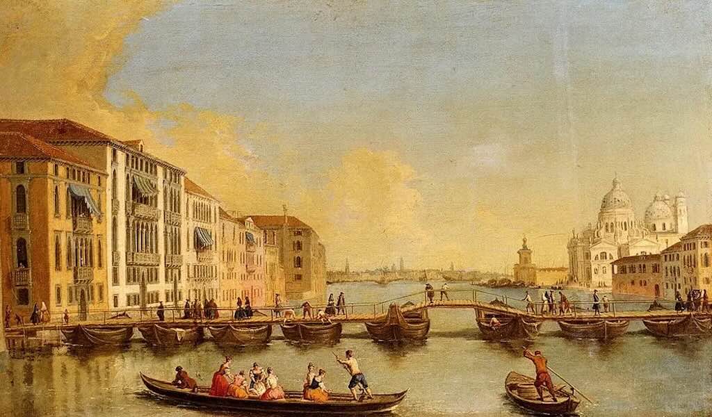
Painting of Johann Richter (1740)
The Ponte della Moneta, predecessor of the Rialto Bridge, is particularly interesting because it represents a fundamental change in everyday Venetian life. People who had previously depended on boats to cross the Grand Canal could now walk between its two banks.
But researching the original bridge reveals a problem with the conventional account. The date 1181, the attribution to Nicolò Barattieri, and even the precise construction of the first bridge, are less certain than many history books suggest.
What was the Ponte della Moneta?
The earliest crossing is generally described as a ponte di barche, a floating bridge consisting of boats secured together and covered by a timber walkway.
Imagine a series of substantial boats moored across the Grand Canal, with planks forming a continuous pedestrian passage. Such a structure would have been relatively quick to construct and would have avoided the difficulty of building permanent foundations in the canal bed.
It would also have presented practical problems. The boats had to remain secured against currents and tides, the walkway required maintenance, and the crossing could obstruct water traffic. Exactly how the earliest bridge accommodated passing vessels is not documented.
For the inhabitants of Rialto, however, the advantage was considerable. A merchant, labourer or resident could cross without finding a ferryman, waiting for a boat or paying for an individual ferry journey.
The two banks of Rialto and the first bridge
It is tempting to interpret the construction of the first bridge across the Grand Canal as an attempt to connect Venice’s two emerging centres of power. The Rialto, the commercial heart of the city, and San Marco, the seat of ducal government. However, this interpretation is geographically misleading and oversimplifies the way the city developed.
By the 11th century, Rialto was already becoming an important centre of trade. The market is traditionally dated to 1097, although commercial activity in the area was older. Its principal location was on the western bank of the Grand Canal, in what is now the sestiere (district) of San Polo, around the small church of San Giacomo di Rialto, commonly called San Giacometto. The opposite bank formed part of what is now the district of San Marco, although the Doge’s Palace and Piazza San Marco lay considerably further away.
The two banks were not inhabited by fundamentally different populations. Merchants, craftsmen, boatmen, labourers, shopkeepers and property owners were present on both sides. Nor was San Marco exclusively political, there were shops, workshops and commercial activities found throughout the district. The distinction was one of increasing concentration and specialisation rather than a separation between commercial and governmental communities.
What exactly were the Rialto markets?
Rialto was not a simple single market square. It developed into a collection of specialised trading spaces, serving both the daily requirements of Venice’s inhabitants and the much larger commercial activities of a maritime trading city.
The food markets occupied much of the San Polo bank. The Erberia was associated with vegetables and other garden produce, then there was the Fruttaria and Naranzeria with fruit, particularly citrus fruit, the Pescaria with fish, the Beccaria with meat; and the Casaria with cheese. Fish arrived from the lagoon and the Adriatic, while vegetables, fruit, grain, livestock and other provisions came from the lagoon islands and the mainland. Boats were essential to this system, bringing goods directly to the waterfront for unloading and distribution.
These names describe the market as it became organised over the later medieval and early modern periods. It would be incorrect to assume that every specialised market already existed in precisely this form when the first bridge was built.
Alongside the food markets developed a more extensive commercial world. The Ruga dei Oresi became associated with goldsmiths and jewellers, while the Ruga dei Spezieri was associated with spice merchants. Around San Giacomo di Rialto, merchants, money changers and eventually bankers, brokers, insurers and notaries conducted business. Rialto was therefore both a place where ordinary Venetians purchased food and a centre where merchants negotiated transactions involving goods arriving from distant Mediterranean and European markets.
The eastern bank also had commercial functions. Its waterfronts, shops and warehouses served the movement and storage of goods, while streets leading towards San Marco formed part of the city’s expanding commercial network. The two sides of the canal were economically interdependent, not competing settlements with entirely different occupations.
Why build a bridge, and why call it Ponte della Moneta?
Until the late 12th century, crossing the Grand Canal at Rialto depended on boats. This was entirely consistent with the way early Venice functioned, with canals as principal routes of transport, and goods were frequently moved more conveniently by water than through the narrow streets.
Nevertheless, as commercial activity increased, the absence of a fixed pedestrian crossing became increasingly inconvenient. Merchants, customers, workers and residents needed to move between the two banks without arranging a boat passage on every occasion.
The first bridge is traditionally dated to 1181 and attributed to Nicolò Barattieri. It was a floating structure, supported by boats or pontoons, rather than the permanent stone bridge familiar today.
There are in fact two explanations for the name Ponte della Moneta, either because there was a charge for crossing, or the proximity of an early mint (zecca) near its eastern approach.
The document is unusually valuable because it establishes an actual minting location in the neighbourhood, rather than relying entirely on later tradition. The State Archives also notes that Andrea Dandolo associated the name Pons de moneta with the wooden bridge built in 1264.
Was it really built in 1181 by Nicolò Barattieri?
This is where the sources disagree. The Venetian architectural historian Donatella Calabi, in her chapter “Rialto: The Medieval Bridge” (2009), examined the medieval chronicles.
She found that 15th-century chronicles attributed the first bridge to a Lombard craftsman named Barettieri, dating it to 1173, during the reign of Doge Sebastiano Ziani (?-1178).
However, the 14th-century chronicler Andrea Dandolo (1306-1354) places the construction of the wooden bridge much later, under Doge Renier Zeno (1253-1268), with 1264 commonly given as the date. Dandolo describes the city as previously divided by the canal and subsequently united by a wooden bridge.
This distinction is important since a temporary bridge of boats may have preceded the first fixed wooden bridge, and later accounts may have conflated the two.
Barattieri himself is an interesting but partly legendary figure. Elena Bassi, writing in the Dizionario Biografico degli Italiani (1964), describes him as a Lombard builder associated with raising the two columns in the Piazzetta San Marco and with replacing the earlier floating crossing by a bridge supported on piles.
Why was the bridge constructed at this particular point?
The Grand Canal was particularly narrow at Rialto. This reduced the length and complexity of a crossing, especially for an early floating bridge. The present bridge occupies one of the narrowest sections of the Grand Canal.
Agazzi associates the construction of the bridge and changes to the surrounding street network with the 13th century. The familiar date of 1181 for the first crossing comes from the traditional chronology, not an independently established construction record.
Did all Rialto bridges occupy the same location?
The present stone bridge was deliberately realigned in 1588
We have unusually good evidence for this. In The Church of San Giacomo di Rialto in the Sixteenth Century: Architecture and Founding Myth of the City, architectural historian Gianmario Guidarelli states explicitly that the Venetian Senate decided in 1588 to change the direction of the new stone bridge relative to the existing wooden bridge.
This is not a minor detail. The decision provoked debate over the placement of the bridge’s abutments on the Riva del Ferro, on the San Bartolomeo side of the canal.
It also required extensive demolition and reconstruction of the surrounding urban fabric. A survey of the perimeter of San Bartolomeo, probably undertaken by Antonio da Ponte in 1587–1588, survives in the Venetian State Archives.
Riva del Ferro together with the adjacent Riva del Carbon, both often crowded due to the vaporetto (water bus) stop, are the fondamenta (quayside walkways) that run along a stretch of the Grand Canal, starting from the Rialto Bridge. Notable palaces overlook this area, including Palazzo Dolfin-Manin (now the seat of the Bank of Italy), built to a design by Jacopo Sansovino (1536–73) and recognizable by the sottoportego (covered passageway) along the canal. There is also the 15th-century Palazzo Bembo, featuring splendid five-arched windows and once the residence of the celebrated Venetian man of letters Pietro Bembo (1470-1547) (now a venue for art exhibitions), and there is the 14th-century Gothic Palazzo Dandolo. Beyond the quayside, following Calle Bembo, one reaches Calle del Teatro, home to the Teatro Goldoni, which was rebuilt between 1969 and 1979.
We can therefore establish that the stone bridge did not simply replace the wooden bridge on precisely the same alignment.
This changes our understanding of the construction project. The engineers were not merely replacing an ageing structure, they were also redesigning how the crossing connected with the surrounding streets.
The Wooden Rialto Bridge — Mid-13th Century
By the middle of the 13th century, the development of Rialto as Venice’s principal commercial district required a more substantial crossing of the Grand Canal. The earlier floating bridge, traditionally known as the Ponte della Moneta, was replaced by a fixed timber structure incorporating a movable central section through which vessels could pass.
The chronology deserves some caution. The construction is variously dated to around 1250, 1255 or 1264. The Venetian chronicler (and doge) Andrea Dandolo, writing in the 14th century, associated the original wooden bridge with the reign of Doge Renier Zeno (1253–1268). Michela Agazzi, examining the medieval documentary evidence, concludes that the bridge existed before 1264. This is a more reasonable suggestion than assigning its construction to a particular year.
Structural design and foundations
The bridge was fundamentally a timber structure, supported by fixed foundations rather than the floating boats of its predecessor.
Its principal structural elements were two inclined ramps rising from the opposite banks towards a movable central opening. This arrangement permitted pedestrian traffic to cross the Grand Canal while preserving a passage for vessels whose masts or upper structures prevented them from passing beneath a fixed bridge.
The fixed portions of a medieval timber bridge of this kind would ordinarily have consisted of longitudinal beams supported by timber piles or trestles, with transverse members carrying the walking surface. Such construction is discussed in the Enciclopedia dell’Arte Medievale, under the entry “Ponte”, which also identifies the wooden Rialto Bridge as a notable example of a bridge combining fixed ramps with a central drawbridge.
The exact number, spacing, dimensions and species of the piles supporting the 13th-century Rialto Bridge have not been established from a surviving contemporary construction specification. Nor can we securely identify its precise load-bearing framework or the arrangement of its joints and braces.
It is therefore reasonable to describe the general structural principle, but no detailed engineering plans have been found.
The movable central section
The most distinctive feature was the opening at the centre. The Enciclopedia dell’Arte Medievale describes the Rialto structure as having two fixed lateral portions and a central drawbridge divided into two sections, raised in opposite directions.
In mechanical terms, this is a double-leaf bascule arrangement, where two hinged sections could be lifted to clear a navigable opening. When lowered, the leaves completed the pedestrian crossing; when raised, they permitted the passage of taller vessels.
This solution addressed a particular Venetian problem. The Grand Canal was not simply an obstacle to be crossed. It was a major navigable route carrying passengers, merchandise and supplies through the city. A permanently low bridge would have obstructed vessels with high masts. A fixed bridge providing sufficient clearance would have required a substantially higher crossing, longer approaches or a different structural solution.
The movable section avoided this difficulty, but the precise operating mechanism of the 13th-century bridge is less certain. Medieval drawbridges could employ chains, ropes, pulleys and counterweights, but the surviving evidence does not tell us what particular combination was used for the original Rialto structure.
Likewise, we cannot establish how many people were needed to operate it, how long an opening took, or whether it followed a regular timetable.
Dimensions and appearance
There are no reliable set of original measurements for the bridge’s total length, deck width, maximum height or the clear span of its central opening.
Later representations show a bridge with two prominent inclined approaches, a central movable section and substantial timber construction. The best-known image is Vittore Carpaccio‘s Miracle of the Relic of the True Cross at the Rialto Bridge, painted around 1494–1496.
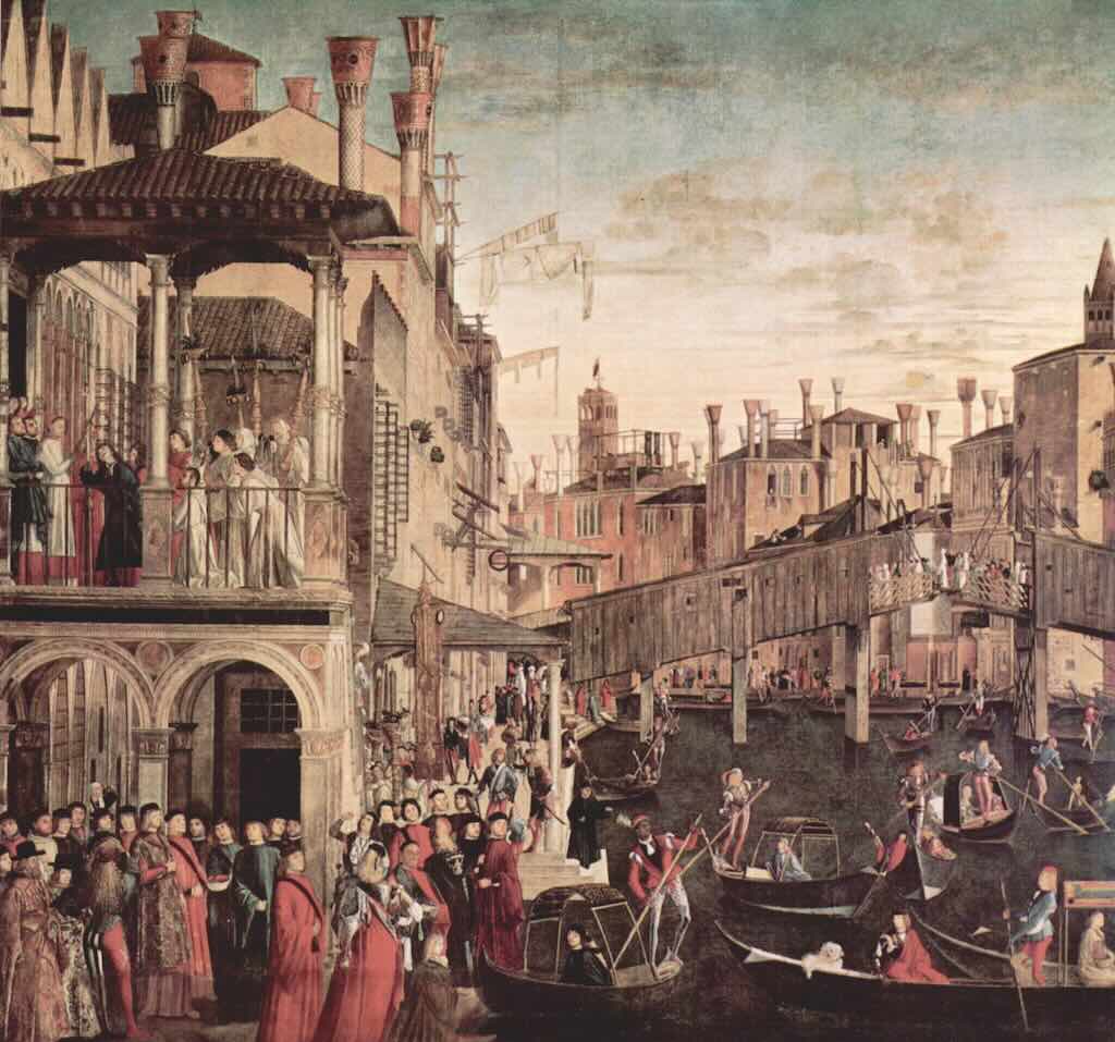
However, Carpaccio depicted a bridge that had undergone more than two centuries of repairs and reconstruction. His painting is valuable evidence for its late-15th-century appearance, not a measured record of the structure erected in the 13th century.
The distinction matters particularly because the commercial shops visible in later representations were additions to the bridge’s development, rather than features securely attributable to its first construction.
Agazzi associates the addition of wooden shops with the restoration of 1458, when the bridge was adapted to generate rental income. The 13th-century crossing should therefore be understood principally as a pedestrian and navigational structure, not automatically as the shop-lined bridge familiar from Renaissance paintings.
Construction and maintenance
Building a fixed timber bridge across the Grand Canal required a different engineering approach from maintaining a floating walkway. The builders needed stable supports capable of transferring the weight of the superstructure and pedestrians into the ground. They also had to construct the bridge without permanently interrupting the canal’s navigability.
Timber offered important advantages. It was relatively light, could be worked into substantial beams and replaced more readily than masonry. Its principal disadvantage was the need for continuing inspection, repair and eventual replacement, particularly where structural members were exposed to water, weathering and repeated loading.
The submerged foundation timbers and the exposed bridge superstructure would have experienced different environmental conditions. Waterlogged wood, especially where oxygen is limited, can survive for very long periods, whereas exposed timber is vulnerable to decay.
A modern scientific investigation of wooden material recovered from the foundations of the present Rialto Bridge identified predominantly alder wood. Radiocarbon analysis yielded samples corresponding approximately to AD 960 and AD 1570, although the earlier result cannot be assigned securely to the 13th-century bridge.
The research is valuable evidence for the history of timber construction at the crossing, but it does not provide a complete archaeological reconstruction of the medieval bridge.
The bridge in everyday operation
The new bridge changed how people and goods moved through Rialto. Pedestrians could cross the Grand Canal without arranging a ferry passage. The commercial district became directly accessible from the opposite bank, and movement between the market and the neighbourhood of San Bartolomeo became easier.
The construction also created a permanent concentration of pedestrian movement at a particular location. This would have influenced the importance of the approaches, adjoining properties and commercial premises.
Historical significance
The 13th-century wooden bridge was not simply an intermediate structure between the floating Ponte della Moneta and the present stone bridge. It established an engineering solution that remained fundamental to the crossing for centuries. It would have undergone major repairs and rebuilding, so its appearance in the 15th century should not be confused with the original design.
The Wooden Rialto Bridge, 1310–1444 — Rebuilding, Reconstruction and Collapse
Rialto Bridge, 1310 — What happened to the wooden bridge?
The fact is that the bridge was deliberately put out of use during the failed uprising of Bajamonte Tiepolo on 15 June 1310. This was not an accidental structural failure, it was an act by retreating insurgents to prevent government troops from pursuing them across the Grand Canal.
However, the sources disagree on precisely how the bridge was disabled. Some describe it as being cut or broken; others say it was set on fire. We should not turn these different descriptions into a single, confidently reconstructed engineering event.
The events of 15 June 1310
The revolt was led by members of the Tiepolo and Querini families against Doge Pietro Gradenigo (1251-1311). Their forces attempted to reach Piazza San Marco, approaching through the Mercerie and neighbouring streets.
The doge had been warned, and loyal troops confronted the insurgents before they could seize the ducal centre. Bajamonte Tiepolo’s men retreated towards Rialto, crossed the wooden bridge and damaged it behind them to block pursuit. The insurgents then regrouped on the Rialto side of the Grand Canal.
The bridge was therefore a strategically important point in the fighting, not the principal objective of the rebellion. The Enciclopedia Italiana entry on Bajamonte Tiepolo states explicitly that the bridge was set alight to hinder the pursuing troops. Other historical accounts describe the retreating insurgents as cutting the bridge.
The insurgents were defeated, but Bajamonte Tiepolo himself was not executed. After retreating across the Rialto Bridge, he negotiated a surrender and was sent into exile. The treatment of the other conspirators varied. Some were executed, others exiled, and property was confiscated. Marco Querini, one of the principal conspirators, had already been killed during the fighting.
The most interesting detail is that the surrender terms survive in an official decree of the Great Council dated 17 June 1310, just two days after the uprising.
The decree required Tiepolo to spend four years beyond Zara (modern Zadar), in the Slavonian/Dalmatian region, outside Venetian and enemy territory. Other nobles were also exiled, while lower-status participants who submitted could receive clemency.
The most lasting consequence was the creation of the Council of Ten (Consiglio dei Dieci) on 10 July 1310, initially a temporary security body charged with preventing further conspiracies. It eventually became one of Venice’s most powerful institutions.
What do we know about the actual damage?
We know the damage was intentional, but the extent is uncertain. Accounts range from partial burning to cutting or destroying the bridge. Unfortunately, the surviving accounts don’t appear to indicate which parts were destroyed. Modern accounts frequently state that the bridge was rebuilt after the revolt. The word rebuilt, however, is ambiguous. It might describe the replacement of damaged decking and supporting members, a substantial reconstruction of the superstructure, or an almost entirely new bridge.
Nobody appears to have discovered a contemporary construction contract, expenditure account or engineering description that would explain what repairs were made. It would appear that also we don’t know when it was opened again (or even if it was closed and for how long).
The early 15th century — A bridge increasingly difficult to maintain
By the beginning of the 15th century, the Rialto crossing was approaching two centuries of continuous use, although the physical structure had certainly undergone maintenance and may have been substantially renewed more than once.
The exposed timber members were subject to weathering, decay and mechanical wear. The foundations and supports had to resist vertical loading from pedestrians, lateral forces from the canal current and potentially accidental contact with passing boats.
The movable central section introduced additional maintenance requirements. Hinges, lifting arrangements and their supporting members had to remain serviceable, while the fixed approaches had to maintain a stable connection with the moving structure.
These are engineering considerations inherent in the type of bridge, rather than defects individually documented for Rialto in this period.
The bridge also had to accommodate increasing pedestrian traffic associated with the commercial activities of the Rialto market. It was the only bridge across the Grand Canal, and it offered an exceptional vantage point from which Venetians could watch processions and ceremonial barges along the waterway.
A bridge designed to carry people walking across it could therefore find itself supporting large numbers of stationary spectators, concentrated in particular areas for extended periods.
That distinction would become significant in 1444.
1431–1432 — A substantial reconstruction
A historical account reproduced by a certain Giovanni Malgarotto in Il Gazzettino gives unusually precise information about an early-15th-century reconstruction.
It reports that the old bridge was taken down on 8 September 1431 because of its age and was subsequently rebuilt at a cost of 2,323 gold ducats.
The wording is important. The account uses the Venetian expression gitado zoso perché vecchio per farlo da nuovo — taken down because it was old, in order to make it anew.
This suggests something considerably more substantial than the repair of a damaged plank or parapet. At least part of the existing structure was deliberately dismantled and replaced.
However, the account presents a chronological difficulty. In the reproduced text, the completion date appears as 13 August 1342, which is impossible if the work began in 1431 (a probable typographical error). A separate historical summary states that the Great Council decided in 1432 to reconstruct the bridge, at a cost of approximately 2,330 ducats. It attributes the underlying work to a Paolo Morachiello.
The convergence of these accounts supports the existence of a substantial reconstruction around 1431–1432, given the reported expenditure of 2,323 gold ducats. It certainly looks as if the bridge standing in 1444 had undergone major reconstruction only about twelve years earlier.
1444 — The collapse during the Ferrarese wedding procession
In 1444, part of the wooden Rialto Bridge collapsed while crowds were gathered to watch a ceremonial procession associated with the marriage of the Marquis of Ferrara. In May 1444, Leonello d’Este (1407-1450), the Marquis of Ferrara, married Maria of Aragon, the 19-year-old illegitimate daughter of King Alfonso V of Naples, The event is reported in numerous histories of Venice and in modern engineering accounts of the bridge.
The Grand Canal was one of Venice’s principal ceremonial spaces. Visiting dignitaries, foreign ambassadors and members of ruling families could be received with elaborate displays involving decorated boats, processions and large public gatherings.
The Rialto Bridge offered an especially desirable viewing platform. From its elevated walkway, spectators could look directly along the canal. And on this occasion, large numbers of people assembled on the wooden bridge to watch the passage of the bride of the Marquis of Ferrara.
The most detailed account states that part of the bridge gave way, causing approximately 200 people to fall into the water. It reports 36 deaths and numerous injuries. These figures derive from a later historical retelling of Venetian chronicle material.
The identity of the procession also deserves careful wording. Some modern accounts refer simply to the wedding of the Marquis of Ferrara. Others describe the procession of his bride or of the Marchioness of Ferrara. The precise identification of the participants, the date of the ceremony and the route of the procession have not yet been securely established from a contemporary source.
What actually failed?
The collapse is attributed to the weight of the spectators, which sounds plausible, but we don’t know where the failure began. There is no verified contemporary engineering report identifying a broken beam, failed joint, displaced support, defective foundation or failure of the movable span.
Nor do we know whether the bridge had been overloaded beyond its intended capacity, whether construction defects contributed to the collapse, or whether deterioration had weakened particular members. The fact that the bridge had apparently undergone substantial reconstruction around 1431–1432 makes these questions particularly interesting.
The aftermath — Another wooden bridge
The collapse of 1444 did not immediately produce the stone bridge that stands today. The crossing was restored in timber, an understandable and practical decision. Rialto remained the principal commercial district of Venice, and the Grand Canal crossing was essential to daily movement. Reconstructing a familiar timber structure offered a more immediate solution than embarking upon an entirely new masonry design.
The subsequent history also demonstrates that the Venetian authorities did not regard the collapse as sufficient reason to abandon wooden construction. In 1458, the Great Council authorised another substantial rebuilding. This phase is particularly important because the bridge was provided with shops, creating a source of rental income that could help finance its maintenance.
The bridge thus acquired an additional economic function. It was no longer simply a crossing and a place from which to watch the canal. It became commercial property in its own right. The wooden bridge represented in Vittore Carpaccio’s painting of the 1490s belongs to this later phase, not to the structure that collapsed in 1444.
1458 — Rebuilding the Rialto Bridge as a Commercial Structure
Following the collapse of part of the Rialto Bridge in 1444, the crossing was restored in timber. A further substantial intervention took place in 1458, when shops were installed along the sides of the bridge, transforming it from a pedestrian crossing into a commercial thoroughfare.
Michela Agazzi, in The Medieval Rialto: The Transformation of an Area in the Developing City (2023), explicitly associates the shops with the restoration of 1458. Before this intervention, the bridge had offered an open view of the Grand Canal. Afterwards, pedestrians crossed between two rows of timber commercial premises.
The precise structural extent of the 1458 works remains uncertain. The surviving accounts do not establish whether the principal supporting framework was entirely replaced or whether the shops were incorporated into an existing bridge that had already been reconstructed after 1444.
Nevertheless, the intervention created the basic architectural arrangement depicted by Vittore Carpaccio in the 1490s.
The construction and arrangement of the shops
Later historical descriptions suggest that the wooden bridge accommodated somewhat more than twenty shops, arranged along its two sides. However, an original inventory establishing their exact number in 1458 has not been identified.
The distinction matters because the present stone Rialto Bridge contains 24 shops, arranged in two groups of twelve. That number cannot simply be transferred to its wooden predecessor.
We do not possess verified measurements of their individual floor areas, frontages or internal heights. However a useful comparison is provided by Marin Sanudo‘s early-16th-century description of retail premises in the Rialto district. He records shops measuring less than two by two Venetian paces. Using a Venetian pace of approximately 1.74 metres, this represents a floor area of less than approximately 12 square metres.
In Venetian measurements, a passo was a formal unit of length, not the distance covered by a single step. The Venetian passo was commonly defined as five Venetian feet (piedi veneti), each approximately 34.8 cm. So that makes 1 Venetian passo 1.74 m.
Sanudo’s measurements concern the market district generally, not specifically the shops on the bridge. The shops would have also added considerable permanent weight to the timber crossing. In addition to the decking and supporting beams, the bridge now carried shop walls, roofs, fittings, stored merchandise and the people working there.
Ownership, rents and the Venetian treasury
The shops were public revenue-producing property. Their rents were paid to the Venetian authorities and helped finance the maintenance of the bridge.
The bridge was an essential piece of public infrastructure, but its construction and maintenance required continuing expenditure. The shops exploited the exceptional commercial value of the crossing to generate revenue towards these costs. The location was particularly attractive because the bridge was the only fixed pedestrian crossing of the Grand Canal. Traders could expect a concentration of customers moving between the commercial district and the streets leading towards San Marco.
Sanudo provides a striking illustration of the value of retail space in Rialto. In his Laus urbis Venetae, preserved in the Biblioteca del Museo Correr, he describes certain very small shops in the Rialto district commanding rents reported at approximately 100 ducats per month. We don’t know that a shopkeeper on the wooden bridge paid that rent. Nor do we know the annual rental income from the bridge as a whole, the length of the leases or whether tenants paid additional charges.
How were the shopkeepers selected?
The Venetian authorities had a long-established practice of letting publicly controlled commercial premises in the Rialto district. The market contained shops, stalls and specialised commercial areas, some of which had been under public control since the 11th century.
Documentary evidence also shows that auctions and public sales formed part of commercial life in Rialto. Agazzi notes that announcements, auctions and judicial proclamations were made from external stairways and galleries associated with the market buildings.
This does not, however, prove that the shops on the wooden bridge were originally allocated by competitive auction in 1458. Nor do we know how the first tenants were selected, e.g. auction, negotiated leases, preferential rights or the transfer of existing businesses. Nor do we have a verified list of the original tenants.
What did the shops sell?
The commercial activities of the wider Rialto district were highly specialised. By the 14th century, the surrounding streets already accommodated jewellers, textile sellers, weavers and other traders. The names of several Venetian streets still preserve the memory of these occupations.
For the original tenants of the bridge in 1458, we do not have a securely established breakdown by trade. By 1524, however, the diarist Marin Sanudo provides specific evidence of the businesses occupying at least part of the bridge. His Diarii records damage involving two cartoleri, sellers of stationery or paper goods, and two dealers in printed books.
Venice had become a major European centre of printing following the establishment of printing there in 1469. By the early 16th century, printed books were an important part of its commercial economy.
The movable bridge and the commercial premises
We do not know how frequently the bridge was opened, how long the operation took, or whether shopkeepers were subject to particular restrictions during the passage of vessels.
Around 1496 — Carpaccio’s Record of the Wooden Bridge
The best surviving visual evidence for the late-15th-century bridge is Vittore Carpaccio‘s Miracle of the Relic of the True Cross at the Rialto Bridge, generally dated to 1496 and now in the Gallerie dell’Accademia in Venice.
The painting was commissioned for the Scuola Grande di San Giovanni Evangelista as part of a cycle illustrating miracles associated with its relic of the True Cross.
Although the religious miracle is the nominal subject, Carpaccio devoted much of the composition to the surrounding city. The wooden bridge rises above the Grand Canal, with inclined approaches, commercial premises and the central opening. Boats occupy the water below, while the neighbouring waterfront is densely built.
The painting is especially valuable because it records the bridge as part of an active urban environment rather than as an isolated architectural monument. It shows how the shops formed a continuous commercial frontage along the crossing and how the bridge connected with the surrounding streets and waterfront buildings.
The picture also records the old Fondaco dei Tedeschi, subsequently destroyed by fire in 1505 and replaced by the present building.
A second important source is Jacopo de’ Barbari‘s monumental woodcut view of Venice, dated 1500 (see the level of detail below). It records the Rialto district before the destructive fire of 1514 and provides additional evidence for the relationship between the bridge, surrounding streets and market buildings.
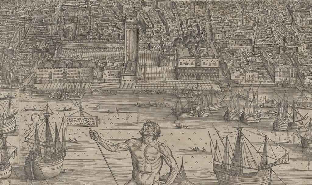
1524 — The Structural Failure and Its Commercial Consequences
In 1524, part of the wooden Rialto Bridge suffered another serious structural failure. The incident occurred approximately eighty years after the collapse of 1444 and sixty-six years after the works associated with the addition of shops in 1458.
Historical accounts describe another collapse of the wooden bridge, but the references suggest a failure affecting a section of the bridge. The actual cause is unknown, and there are no verified contemporary engineering report identifying a failed beam, broken joint, displaced foundation or defect in the movable central section.
However, Marin Sanudo’s Diarii recorded the consequences of the collapse. The affected premises included two stationers and two sellers of printed books.
This provides a rare glimpse of the actual businesses operating on the wooden bridge. Sanudo’s testimony establishes that the bridge was an active retail location for printed material by the early 16th century. It does not, by itself, establish the total number of shops damaged, the value of merchandise lost or the full cost of repairs.
Why was the bridge not immediately replaced in stone?
The collapse of 1524 did not bring the history of the wooden bridge to an immediate end.
Proposals for a stone replacement had already been discussed in 1503, more than twenty years before the failure. The devastating Rialto fire of 1514 had also prompted major reconstruction and reorganisation of the commercial district.
The problem was therefore considerably larger than the replacement of a damaged bridge. A new stone structure had to preserve navigation along the Grand Canal, maintain the essential pedestrian connection, accommodate commercial premises and connect with an already densely developed urban environment.
The authorities also had to consider the costs of construction, the interruption of traffic and the interests of the shopkeepers occupying the existing crossing.
The wooden bridge continued to be repaired while these issues were debated. In 1551, the Senate established a special magistracy concerned with the proposed new bridge. Architectural proposals and administrative discussions continued for decades.
Only in 1588 did construction begin on Antonio da Ponte‘s stone bridge, completed in 1591.
The bridge’s commercial success also complicated its eventual replacement. The authorities could not simply demolish an obsolete crossing without considering the movement of people, the passage of vessels and the businesses occupying it.
The final wooden Rialto Bridge was therefore more than an engineering structure. It was a piece of urban infrastructure, a commercial property and an important part of Venice’s everyday economic life. Its history explains why replacing it with stone became such a prolonged and difficult undertaking.
The Stone Rialto Bridge, 1503–1591 — Nearly a Century of Debate
The definitive decision was taken in January 1588. Construction began that year, and the bridge was completed in 1591, during the dogeship of Pasquale Cicogna (?-1595), the 88th Doge of Venice.
The most important sources are the detailed archival study by Donatella Calabi and Paolo Morachiello (1988), and Mauro Petrecca’s biography of Antonio da Ponte in the Dizionario Biografico degli Italiani (1986). Together, they describe the decision-making process in considerably greater detail than the familiar story of an architectural competition won by an obscure Venetian builder.
1503–1587 — Why did Venice take so long?
The idea of replacing the wooden Rialto Bridge with a permanent stone structure was being discussed by 1503. Yet the Republic continued to repair its timber version for another eighty-five years.
The delay was not simply indecision. A stone bridge across the Grand Canal presented three difficult problems simultaneously.
First, it had to cross one of Venice’s principal navigable waterways without obstructing the passage of commercial vessels. Second, it had to carry large numbers of pedestrians and accommodate revenue-producing shops. Third, its foundations had to support a heavy masonry structure in the waterlogged ground of a densely built city.
There was also the problem of money. Rebuilding the bridge would interrupt an essential route through the commercial heart of Venice, affect the shopkeepers occupying the wooden structure and require considerable public expenditure.
The fire of 1514, which devastated much of the Rialto market district, led the Senate to appoint officials responsible for surveying the damaged area and planning the reconstruction of public buildings, offices, shops and warehouses. The bridge was consequently considered within a much larger programme of urban redevelopment.
In 1551 the Senate established a special magistracy, the Provveditori sopra la Fabbrica del Ponte di Rialto, charged with gathering opinions, drawings and models for a stone replacement.
This was a significant administrative step, but it did not produce immediate construction. The authorities continued to maintain the wooden bridge while alternative designs were examined.
Calabi and Morachiello describe this prolonged process as characteristic of Venetian public works, and that technical decisions were inseparable from financial oversight, commercial interests and the procedures of republican government.
1587–1588 — The decision: one arch or three?
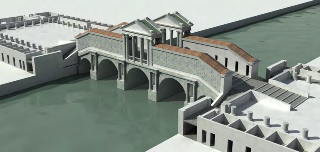
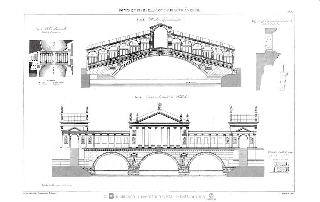
The final debate was much more specific than a simple choice between rival architects. It concerned the number of arches, the location of the bridge, its cost and the practical consequences for navigation and commerce.
In December 1587, the Senate appointed three provveditori to supervise the project. Between 20-23 December, several technical experts submitted proposals for bridges of timber or stone, including stone designs with one or three arches.
The 75-year old Antonio da Ponte initially proposed a three-arched stone bridge, with two rows of shops and three pedestrian passages. This is a particularly important correction to the popular account. He did not enter the final discussion with an unchanging single-arch design.
After the officials circulated a questionnaire addressing nine technical questions, Da Ponte submitted a revised opinion on 2 January 1588, favouring a single arch.
The decisions then followed in rapid succession:
7 January 1588: The authorities fixed the bridge’s position and required a stone structure with two rows of shops and three open pedestrian passages. The number of arches remained undecided.
16 January: Da Ponte submitted estimates and models for both alternatives, arguing for the economic advantages of a single arch.
20 January: The Senate formally selected the single-arch solution.
1 February: Da Ponte was assigned responsibility for assisting with the execution of the works.
These dates come from Mauro Petrecca’s biographical study, which cites the documentary collection of Roberto Cessi and Alberto Alberti, Rialto: l’isola, il ponte, il mercato (1934).
Why a single arch?
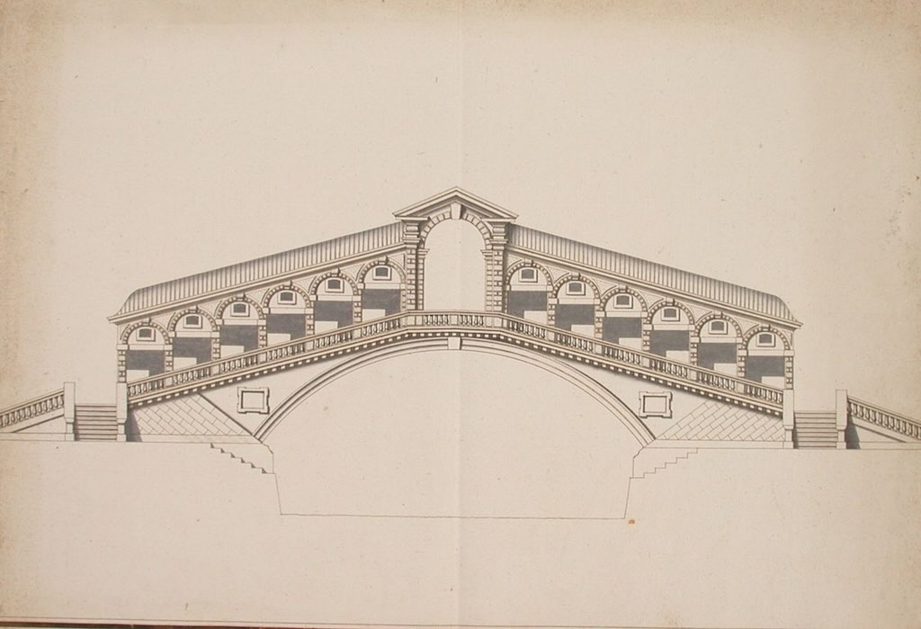
The principal engineering advantage was the absence of intermediate piers in the Grand Canal. A three-arch bridge would have required supports within the waterway. Those supports would have reduced the available navigable width and introduced obstacles into a busy commercial channel.
A single arch preserved an uninterrupted passage beneath the bridge, eliminating the need for the movable central section of its wooden predecessor.
But there was a trade-off. A masonry arch develops substantial outward thrust, requiring exceptionally strong abutments and foundations. In Venice, those foundations had to be constructed in soft, waterlogged ground immediately beside existing buildings.
The final choice was therefore not simply an aesthetic preference. It was a decision about navigation, structural engineering, cost and urban space.
Antonio da Ponte — A practical engineer rather than a celebrated theorist
Antonio da Ponte was born in 1512 and had spent much of his career supervising public construction and repair works. A document of 1554 describes him as a marangon, a carpenter or joiner. By 1563 he had become proto al Sal, a senior technical official responsible for works financed through the Venetian salt administration.
His experience included hydraulic engineering, the Arsenal, the reconstruction of damaged portions of the Doge’s Palace and other major public buildings.
He had also been consulted on the reconstruction of a bridge across the Piave at Belluno in 1568.
This practical background is important. Da Ponte’s reputation rested less on architectural theory than on his knowledge of materials, construction methods, estimates and the organisation of large building projects.
The choice of Da Ponte was not unanimous. Alvise Zorzi, one of the three bridge commissioners, supported him, while Marco Antonio Barbaro favoured Vincenzo Scamozzi.
The disagreement would continue after construction began.
1588 — Foundations in the Venetian lagoon
The most demanding aspect of the project was the construction of foundations capable of supporting a large masonry arch.
Venetian builders had centuries of experience with timber foundations. Rather than placing heavy buildings directly upon the soft lagoon deposits, they drove closely spaced wooden piles into the ground and constructed timber platforms above them.
The Rialto Bridge required a particularly substantial arrangement because the arch concentrated large vertical and horizontal forces at its two ends.
Modern descriptions frequently state that approximately 12,000 wooden piles were used beneath the bridge’s foundations. This figure is widely repeated, including in the Italian national tourism authority’s description, although it’s difficult to find an independent verification from 16th-century construction accounts.
Da Ponte’s unusual foundation design
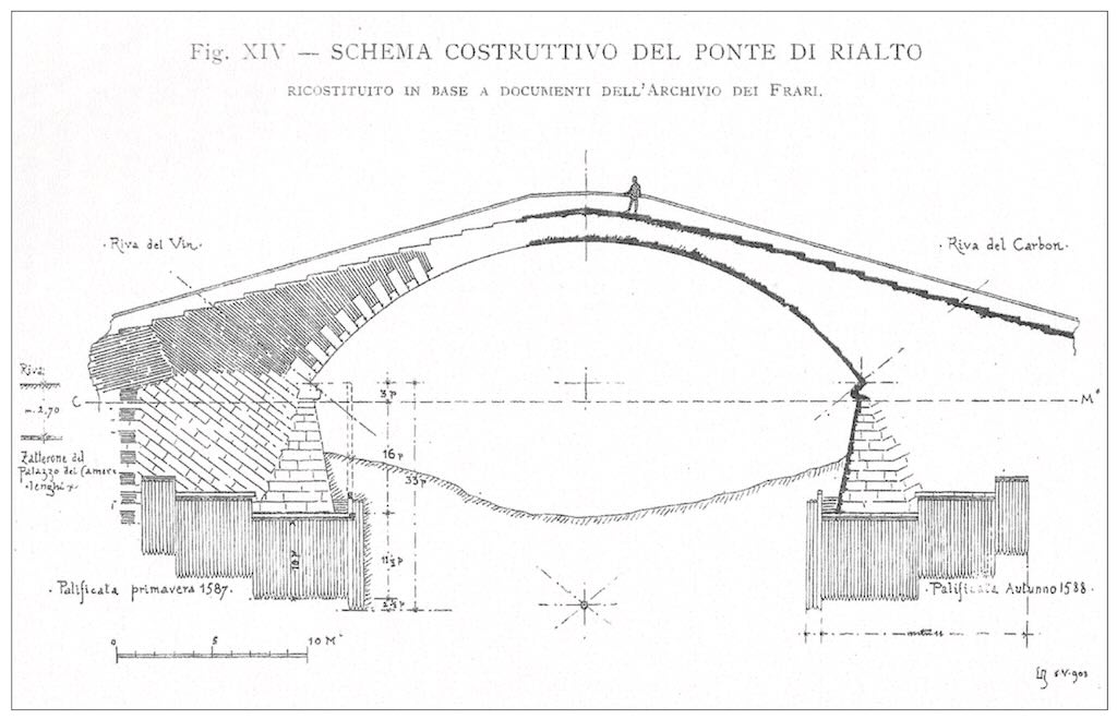
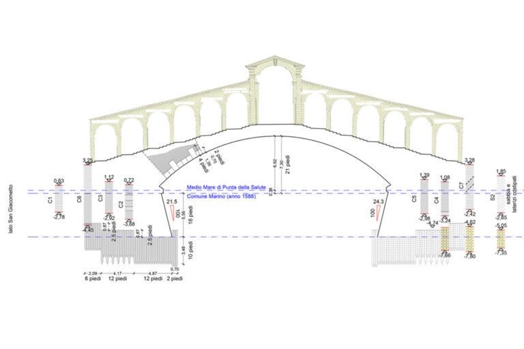
Petrecca describes an important technical innovation documented in the historical sources. Instead of terminating the piles at a single horizontal level, Da Ponte arranged their heads in three stepped groups, descending towards the centre of the Grand Canal (we can just see this in the above diagram).
The piles were of equal length but were driven to different depths. This produced a stepped foundation surface suitable for supporting the inclined masonry construction while reducing the danger of disturbing adjacent buildings.
The precise arrangement mattered because the foundations had to receive the outward thrust of the arch as well as its weight. The work also required careful control of the ground immediately beside valuable waterfront properties.
The first construction dispute
On 12 February 1588, Da Ponte attended the auction for the pile-driving work on the Rialto side. The contractors subsequently executed part of the work unsatisfactorily. According to the documentary history summarised by Petrecca, Da Ponte offered to remedy the defects without personal remuneration.
By the end of July, the Rialto-side foundations were complete and work was beginning on the San Bartolomeo side. At precisely this stage, the engineering design became the subject of a serious political dispute.
Vincenzo Scamozzi prepared a critical memorandum arguing that the foundation system could cause the bridge to collapse. The Senate responded by appointing a commission of experts to examine the work.
Da Ponte explained his design in detail on 26 August 1588. Further criticism followed on 29 August, but on 5 September the Senate authorised construction to proceed substantially according to his proposals, requiring only minor modifications.
This episode is particularly revealing. The authorities did not simply accept the judgement of the appointed builder. They required technical scrutiny and formal political approval before allowing the project to continue.
From October 1588, Da Ponte received a salary of 60 ducats per month for his work on the bridge, approximately six times his ordinary remuneration as proto al Sal.
1589–1590 — Constructing the masonry arch
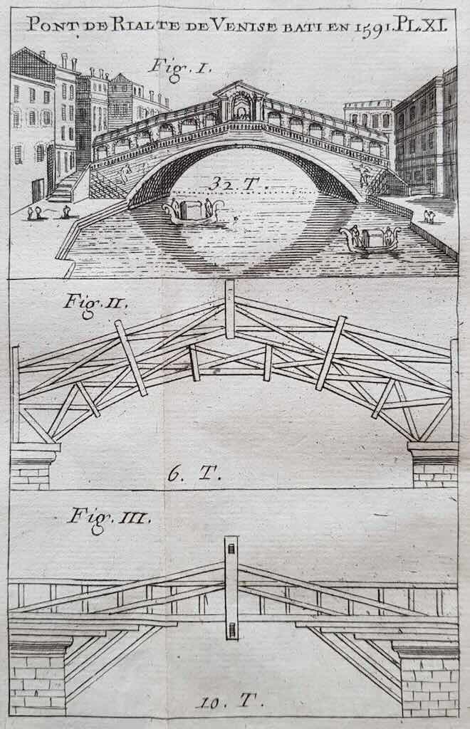
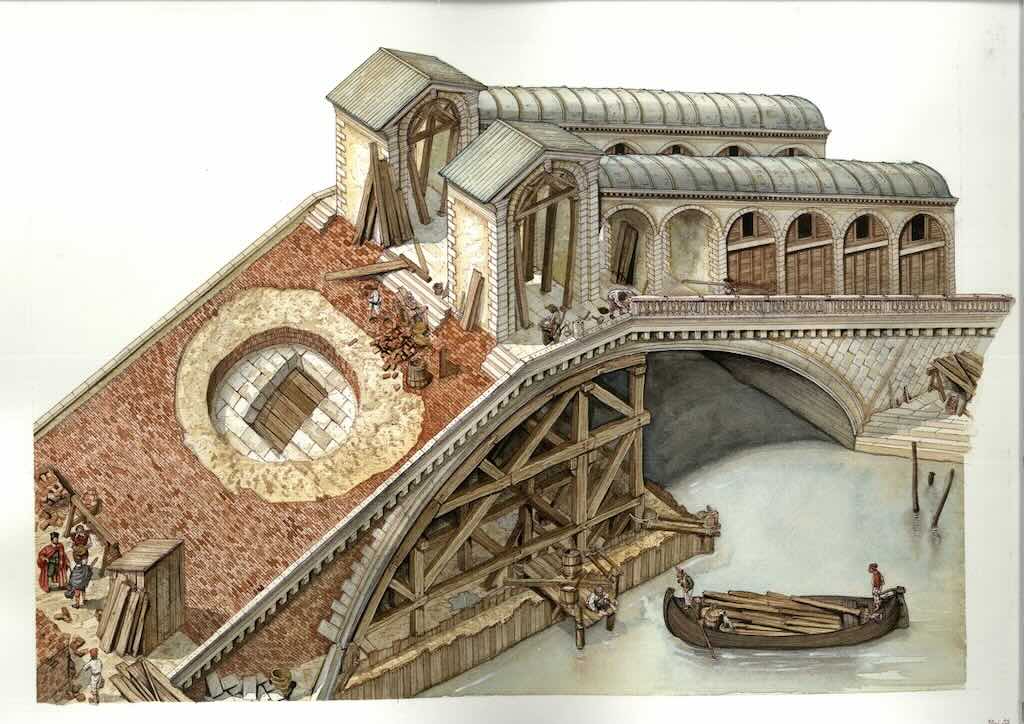
A masonry arch cannot be constructed in free space. Until the arch is closed and capable of carrying its own weight, its individual stones must be supported.
The builders therefore required a substantial temporary timber framework, known as centering, shaped to support the curve of the arch during construction. The framework had to be strong enough to carry the developing masonry while allowing the builders to place and adjust the stones. It also had to be removed in a controlled manner once the arch was complete.
This was one of the technically challenging stages of the project, particularly because the structure crossed a major navigable waterway.
The main arch was completed during 1590. Construction of the shops then began, following Da Ponte’s designs.
In October 1590, the Senate granted Da Ponte a twenty-year exclusive privilege to publish a perspective view of the bridge and its construction framework. That privilege is useful evidence of the importance attached to the technical achievement.
Materials and dimensions
The bridge is faced predominantly with pale Istrian limestone, a durable building stone widely used in Venetian architecture.
Published descriptions commonly give the following dimensions, overall length approximately 48 metres, overall width approximately 22 metres, clear arch span approximately 28 metres, and clearance above the water approximately 7–7.5 metres, depending on the measurement reference and water level.
These are conventional modern figures rather than a single set of measurements independently verified from the original construction drawings. Calabi and Morachiello gives a different figure of 23 metres for the arch.
The single arch was the bridge’s essential structural feature. Its stonework transmitted loads through compression towards the abutments, while the foundations resisted the resulting thrust.
The commercial bridge — Twenty-four shops and three passages
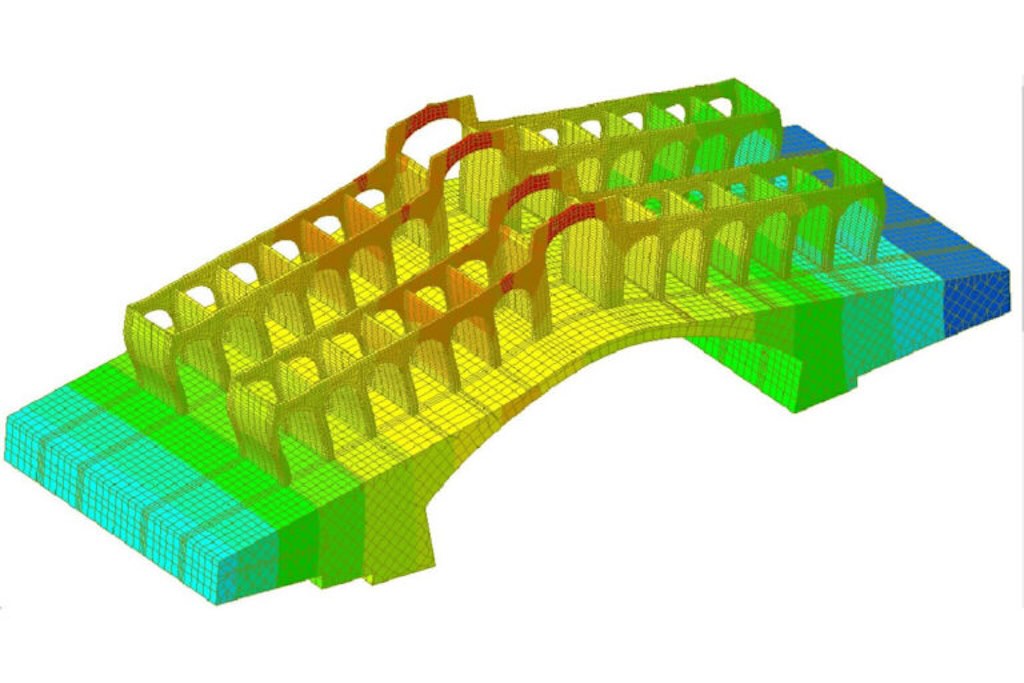
The stone bridge retained the commercial function established on its wooden predecessor. It was designed with 24 shops, arranged in two rows, each containing twelve premises. The shops divide the bridge into three pedestrian passages, a central passage between the rows and two exterior passages overlooking the Grand Canal.
The arrangement is particularly ingenious because it allows pedestrians to choose between a direct commercial route and two more open routes along the edges of the bridge.
The shops are arranged along the inclined approaches, with stairways rising towards the centre. Published modern descriptions give individual shop frontages of approximately three metres.
Who occupied the shops?
The Italian national tourism authority states that the premises initially accommodated predominantly goldsmiths, jewellers and craftsmen. This is consistent with the bridge’s position beside the established commercial quarter.
The shops remained an important source of revenue, continuing the principle already established on the wooden bridge. It’s not clear what the original rents were, and how places were allocated.
1591 — Completion and the bridge’s public meaning
The bridge was completed in 1591, under Doge Pasquale Cicogna, who had become doge in 1585.
The bridge’s appearance was deliberately restrained compared with some of the more elaborate Renaissance proposals. The architectural achievement lay primarily in the proportions of the arch, the organisation of circulation and the successful combination of engineering and commerce.
The bridge also changed the relationship between the two banks. The earlier wooden structure had required a movable opening for navigation; the new stone bridge established a continuous, permanent pedestrian connection while allowing boats to pass beneath it.
The Venetian historian of architecture Ennio Concina, writing in the Storia di Venezia published by Treccani, interprets the bridge as a decisive connection between the city’s commercial areas, not merely as a monument marking the decline of maritime traffic along the Grand Canal.
What happened to Antonio da Ponte?
The completion of the bridge brought Da Ponte considerable prestige, but not financial security. He continued to work on other Venetian public projects, including the new prisons and the Arsenal. His nephew Antonio Contin increasingly assisted him as his health deteriorated.
Da Ponte later petitioned the Senate for financial assistance, explaining that his dedication to public works had prevented him from attending adequately to his private affairs. In that petition, he recalled with pride the innovative method he had devised for constructing the Rialto arch.
He died in Venice on 20 March 1597 and was buried in the church of San Maurizio.
His career is a useful corrective to the conventional distinction between architect and engineer. The Rialto Bridge was the achievement of an experienced Venetian public works specialist whose authority derived from practical construction knowledge, technical judgement and long service to the Republic.
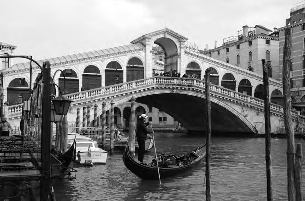
Has the wooden pontoon disappeared from Venice?
No.
There are two important Venetian religious processions associated with temporary floating bridges:
- Festa del Redentore (Feast of the Redeemer): Celebrated on the third Sunday of July, commemorating the plague of 1575–1577. Its temporary bridge connects the Zattere to the island of Giudecca.
- Festa della Madonna della Salute: Celebrated on 21 November, commemorating the plague of 1630–1631. Its floating bridge crosses the Grand Canal.
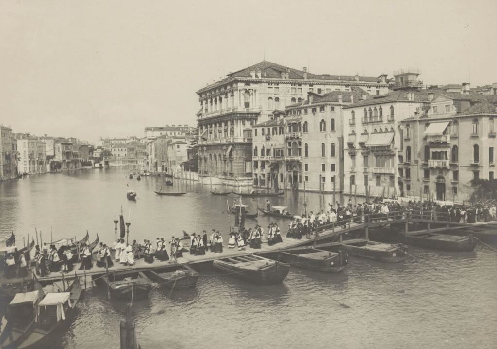
The Ponte Votivo della Madonna della Salute
Every November, Venice temporarily acquires a fifth pedestrian crossing of the Grand Canal. Unlike the four permanent bridges, this one exists for only a few days. It is assembled from floating structures to connect the San Marco bank with Dorsoduro, allowing Venetians to make their traditional pilgrimage to the Basilica di Santa Maria della Salute on 21 November.
Known as the Ponte Votivo della Salute, it is one of Venice’s most distinctive surviving civic and religious traditions. Its origins lie in the plague of 1630–1631, but the bridge itself is also an interesting example of temporary engineering in a city where water transport and pedestrian movement have always had to coexist.
The modern bridge is approximately 80 metres long, 3.6m usable width, but today only uses three floating modules. And there is a 10 metre central navigation opening.
It crosses the Grand Canal between Riva Santa Maria del Giglio, on the San Marco side, and Riva San Gregorio, on the Dorsoduro side, a short distance from the church.
The origin: Venice and the plague of 1630–1631
The plague that struck Venice in 1630 was part of a wider epidemic affecting northern Italy. It followed the military movements associated with the War of the Mantuan Succession and devastated a city whose economy depended on maritime trade, dense urban settlement and constant movement of people and goods.
The epidemic killed approximately 46,000–47,000 people in Venice itself, although historical estimates vary according to the geographical area and population counted.
On 22 October 1630, the Venetian Senate resolved to make a solemn vow to the Virgin Mary. If the city were delivered from the epidemic, the Republic would construct a church in her honour and organise an annual pilgrimage of thanksgiving.
Doge Nicolò Contarini (1553-1631) was in office when the vow was made. The epidemic eventually subsided during 1631, although Contarini himself died in April of that year.
The Senate selected a prominent site at the entrance to the Grand Canal, close to the Punta della Dogana. The resulting church, designed by Baldassare Longhena (1598-1682), became one of the most recognisable buildings in Venice.
Construction began in 1631. The basilica was consecrated on 9 November 1687, after Longhena’s death.
The choice of site had considerable symbolic importance. Anyone entering the Grand Canal from the Bacino di San Marco would see the new church, making the Republic’s thanksgiving a permanent feature of the city’s maritime landscape.
The annual pilgrimage on 21 November commemorated the vow, and the temporary bridge made it possible for participants to approach the church directly from the San Marco side of the canal.
The vow and annual pilgrimage date from the 17th century, but the modern modular floating bridge is a contemporary engineering solution maintaining a much older tradition.
The crossing and its location
The temporary bridge occupies the stretch of the Grand Canal traditionally served by the traghetto between Santa Maria del Giglio and San Gregorio.
This is not the shortest possible crossing of the canal, but it is particularly convenient for the ceremonial approach to the basilica.
The San Marco landing lies near Campo Santa Maria del Giglio, while the Dorsoduro landing is close to Calle del Traghetto San Gregorio. From there, pilgrims continue towards the Basilica della Salute.
The crossing also demonstrates an important characteristic of Venetian urban life. For most of the city’s history, movement between the two banks of the Grand Canal depended heavily on boats rather than fixed bridges. The annual installation temporarily transforms a traditional ferry crossing into a pedestrian route.
Engineering: how the modern floating bridge is constructed
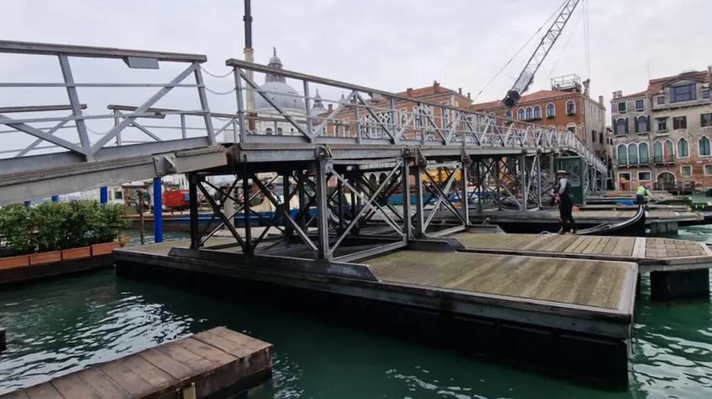
Each standard module consists of a steel-framed pedestrian deck supported by two floating units placed transversely beneath it.
The municipality’s 2016 description identifies the flotation units as having a core of expanded polystyrene, and outer shell of polyethylene, and a wooden covering.
This is why the municipality describes them as inaffondabili, or unsinkable.
So the design is quite different from a conventional pontoon bridge supported by ordinary boats.
The 2026 project specifies large galvanised-steel guide piles, approximately 350 mm in diameter, driven into the canal bed. These restrain the floating modules horizontally while permitting the vertical movement required by changing water levels.
Four additional oak piles, approximately 40 cm in diameter and 16 metres long, are specified to protect the central supports against accidental collisions with passing boats.
How boats can continue to navigate the Grand Canal
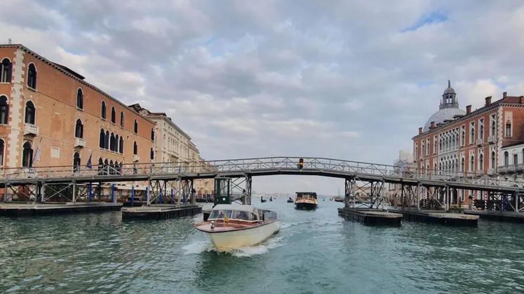
One of the most interesting features is the raised central section approximately 10 metres wide, with a maximum overhead clearance of 4.2 metres.
Lighting and the evening appearance
Municipal descriptions specify 26 lamps installed beneath the handrails, together with navigation warning lights at the opening.
The bridge is part of a larger reusable system
The same modular engineering principle is used for the considerably longer Ponte Votivo del Redentore, which crosses the Canale della Giudecca in July, and for temporary pedestrian connections associated with the Venice Marathon.
The historical bridge: from boats to modern pontoons
The modern celebration combines the temporary pedestrian bridge from the Zattere to Giudecca, the solemn religious observances, and the popular Saturday-night festivities with decorated boats, communal meals and fireworks over the Bacino di San Marco.
The religious ceremony and popular tradition
The bridge is not principally a tourist attraction. Its purpose remains the annual pilgrimage to the basilica. Venetians traditionally cross carrying candles, which they offer at the church while praying for health and protection for themselves and their families. The opening of the bridge is itself a civic and religious occasion. Municipal officials and representatives of the Patriarchate participate in the ceremony, and the bridge receives a blessing before being opened to pedestrians.
The celebration is also associated with stalls selling candles, sweets and other traditional goods around the church.
Principal sources and bibliography
Comune di Venezia, 18 November 2016, Festa della Madonna della Salute, inaugurato oggi il ponte votivo. Particularly valuable for the materials, dimensions, modular construction, flotation system and lighting. Municipal technical description
Comune di Venezia, 2026, C.I. 15462 — Gittamento ponti votivi, project documentation, section NP 03, Ponte della Madonna della Salute. The most detailed source located for the current engineering arrangement, including weights, dimensions, anchoring and protective piles. 2026 municipal project documentation (PDF)
Comune di Venezia, 23 March 2026, Ponti votivi, approvata installazione e gestione delle strutture galleggianti. Confirms the 2026 programme of installation, maintenance and dismantling. Municipal approval, 2026
Comune di Venezia, 18 November 2025, Madonna della Salute: apre il ponte votivo. Records the 2025 installation, opening arrangements and associated religious programme. Municipal announcement, 2025
Patriarcato di Venezia, Festa della Madonna della Salute: informazioni, appuntamenti e celebrazioni in programma. An ecclesiastical source for the contemporary pilgrimage and liturgical observances. Patriarchate of Venice
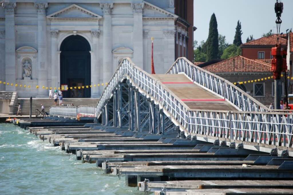
The Feast of the Redeemer celebrated on the third Sunday of July, is one of Venice’s oldest and most important festivals. It commemorates the end of the plague of 1575–1577, which killed approximately 50,000 people, more than a quarter of the city’s population. The celebration combines a religious pilgrimage, a temporary floating bridge, a night of festivities on the water and a major fireworks display.
Origins: the plague of 1575–1577
On 4 September 1576, with the epidemic still raging, the Venetian Senate, under Doge Alvise I Mocenigo (1507-1577), vowed to build a church dedicated to Christ the Redeemer if the city were delivered from the plague.
The architect Andrea Palladio (1508-1580) was chosen, and the foundation stone was laid in May 1577, during the reign of Doge Sebastiano Venier (1496-1578), who had commanded the Venetian fleet at the Battle of Lepanto in 1571.
On 13 July 1577, the plague was officially declared over. The first thanksgiving procession took place on 20 July, crossing the Canale della Giudecca on a temporary bridge of boats to reach the site of the unfinished church. The annual tradition has continued ever since.
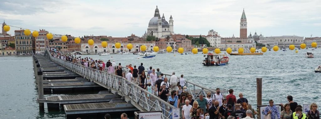
The floating bridge
The 2026 municipal engineering specifications are length 333 metres, usable width 3.60 metres, 16 floating modules and two hinged access ramps (weight approximately 22 tonnes per module). The navigation passage is 10 metres wide, with a maximum overhead clearance of 4.20 metres. The whole bridge is anchored with steel guide piles driven into the canal bed, allowing the pontoons to rise and fall with the tide. Five central modules form a raised section so that public transport and emergency boats can continue passing beneath the bridge.
How the bridge has changed
The original crossing was supported by boats using 80 galleys. Later versions used other vessels and floating platforms. After the Second World War, the Italian Army’s 2nd Bridge Engineer Regiment assembled a military-style Bailey bridge each year, using the exercise for training. This continued for approximately fifty years, and it was replaced with a modern modular structure in the early 2000s.
The Church of the Redentore
Palladio designed the church in 1576, but died in 1580 before its completion. Antonio da Ponte, later responsible for the present Rialto Bridge, oversaw its completion. It was consecrated in 1592.
The church is among Palladio’s finest religious buildings. Its white stone façade combines classical temple forms, while the interior uses a long, bright nave, side chapels and a dome. The decoration includes works by Paolo Veronese and his workshop, Jacopo Tintoretto and Francesco Bassano.
One less obvious detail concerns the Capuchin friars, for whom the church was built. Their rules favoured simplicity, so much of the interior’s apparently expensive marble decoration is actually brick covered with stucco.
The celebrations today
The festival begins with the opening and blessing of the floating bridge, normally on the Friday before the third Sunday of July.
Saturday evening is the popular highlight. Venetians decorate boats, terraces and waterside buildings with lights and lanterns. Families and friends gather for traditional meals, often aboard boats moored in the Bacino di San Marco. At approximately 23:30, a large fireworks display illuminates the lagoon.
Sunday retains the religious character of the original vow, with masses at the Redentore and a solemn celebration attended by the Patriarch of Venice and civic authorities.
An interesting Venetian distinction
The Redentore is both a religious festival and a major public celebration. The bridge was originally built to carry a thanksgiving procession, but today it also attracts thousands of residents and visitors who simply want to experience walking across the Giudecca Canal.
It also provides an unusual view of Venice, with the Zattere on one side, Palladio’s church on the other, and the normally busy shipping channel directly beneath one’s feet.
Bibliography
Donatella Calabi and Paolo Morachiello, “Le pont du Rialto: un chantier public à Venise à la fin du XVIe siècle,” Annales. Économies, Sociétés, Civilisations, vol. 43, no. 2 (1988), pp. 453–476. DOI: 10.3406/ahess.1988.283499. The principal scholarly source for the public works administration, financial organisation, craftsmen and construction records. The article draws on thousands of administrative orders. Read the article.
Mauro Petrecca, “Da Ponte, Antonio,” Dizionario Biografico degli Italiani, vol. 32 (Rome: Istituto della Enciclopedia Italiana, 1986). Particularly valuable for the documented sequence of decisions between December 1587 and September 1588, Da Ponte’s professional background, the foundation dispute and his subsequent career. Full biography and bibliography.
Roberto Cessi and Alberto Alberti, Rialto: l’isola, il ponte, il mercato (Bologna, 1934). A foundational documentary study repeatedly cited by Petrecca, particularly pp. 368–408 for the final design decisions and foundation controversy. I have not independently examined the original volume; the specific details above are supported through Petrecca’s documented references.
Donatella Calabi and Paolo Morachiello, Rialto: le fabbriche e il ponte, 1514–1591 (Turin: Einaudi, 1987). A major monograph on the redevelopment of the Rialto district and the bridge. It remains essential for a fuller examination of expenditure, commercial premises and the organisation of the building site, but I have not directly consulted the complete book.
Ennio Concina, “Ampliar la città: spazio urbano, res publica e architettura,” in Storia di Venezia, published by the Istituto della Enciclopedia Italiana. Useful for interpreting the bridge within the Republic’s larger programme of urban development. Full study.
M. Bernabei and colleagues, “The Wooden Foundations of Rialto Bridge (Ponte di Rialto) in Venice: Technological Characterisation and Dating,” Journal of Cultural Heritage, vol. 36 (2019). Provides modern scientific evidence concerning timber foundations and Venetian foundation technology. Journal article.
Matters that still require primary-source verification
For a genuinely exhaustive history, several details remain open: the audited total cost of the bridge, the exact original number and species of foundation piles, the complete inventory and rental terms of the 24 shops, and the precise dates on which the completed bridge was first opened to pedestrians and the shops began trading.
The relevant records should be sought principally in the Archivio di Stato di Venezia, particularly the papers of the Provveditori sopra la Fabbrica del Ponte di Rialto and the Senate’s deliberations.
Those uncertainties do not undermine the principal chronology or the engineering account, but they should not be disguised with attractive, unsupported figures.
The central historical point is that the stone Rialto Bridge was not the sudden triumph of one architect’s design. It was the result of decades of institutional debate, technical investigation and public investment. The structure completed in 1591 finally resolved the problem that had shaped every earlier crossing: how to connect the two banks permanently without sacrificing the Grand Canal’s navigability or Rialto’s commercial activity.
Draawings of the Rialto Bridge
Here are some references to the original or historical architectural drawings, foundation sections, shop-floor plans and diagrams of the temporary timber centering used to construct the arch. Some drawings show the bridge actually built, others show rejected proposals by Palladio or Scamozzi.
1. Construction and structural drawings of the bridge actually built
1. Detailed structural section — foundations, arch and water levels
This is one of the best technical drawings I found. It shows the arch, foundation piles, masonry geometry, measurements and historic water-level references. It comes from an engineering study rather than a tourist publication.
2. Sixteenth-century foundation schemes and their reconstruction
A specialist study in Archivio Veneto examines Da Ponte’s stepped pile foundations and reproduces early drawings, including a sheet possibly attributable to Francesco Zamberlan. It discusses the arrangement of piles, foundation levels and the objections raised in 1588.
Full scholarly article, including diagrams. Particularly useful around pp. 80–90.
Venezia Storia
3. Historical elevation of the completed bridge, c. 1750–1760
A carefully drawn elevation attributed to the workshop of Antonio Visentini. Held by the Canadian Centre for Architecture, Montréal.
Catalogue DR1985:0611. Original sheet: 41.9 × 61.9 cm.
Canadian Centre for Architecture
4. Historical floor plan of the completed bridge, c. 1750–1760
Companion drawing to the preceding elevation. Especially relevant to your questions about the shops, passages, stairs and overall arrangement.
Catalogue DR1985:0612. Original sheet: 41.9 × 60.9 cm.
Canadian Centre for Architecture
5. Nineteenth-century architectural plan
Reproduced from Leopoldo Cicognara’s Le fabbriche e i monumenti cospicui di Venezia (1858), p. 91. Texas Tech University has catalogued this as a public-domain architectural plan.
Texas Tech University Libraries
2. Historical construction drawings and alternative proposals
6. Antoine Rondelet — Essai historique sur le pont de Rialto (1837)
This is an especially promising discovery: an entire nineteenth-century architectural study with 12 engraved plates, including plans and sections. The digitised French edition contains 122 PDF pages, including the plates.
Wikimedia Commons+1
7. Antonio Rondelet — Italian edition, 1841
Saggio storico sul ponte di Rialto in Venezia, Mantua: Negretti, 1841. The edition contains multiple architectural plates, including comparisons between proposed designs. A scholarly article reproduces one comparative plate.
iris.unipa.it
8. French engineering engraving — elevation, plan and parapet detail
A nineteenth-century engineering plate titled Pont de Rialto à Venise includes the executed bridge and a comparative design attributed to Palladio. Particularly useful for understanding the relationship between elevation and plan.
9. Historical diagrams of bridge centering and scaffolding
A plate titled Pont de Rialte de Venise bâti en 1591, reproduced in a scholarly publication hosted by TU Delft, compares the completed bridge with timber support arrangements. Particularly relevant to how masonry arches could be supported during construction.
The precise relationship of each illustrated support arrangement to the actual 1588–1591 construction needs checking.
TU Delft Research Portal
10. Antonio da Ponte’s surviving design drawing
A scholarly study, Architectural Politics in Renaissance Venice, reproduces a remarkable original drawing combining plan, elevation and section on one sheet. It is particularly valuable because it records Da Ponte’s own method of communicating his construction design.
Scholarly study — see Figure 8.
The British Academy
3. Rejected Renaissance proposals
11. Andrea Palladio — plan and elevation, 1570
Published in I quattro libri dell’architettura, book III. A major three-arch alternative.
12. Vincenzo Scamozzi — alternative design, 1587–1588
A competing proposal showing how the commercial superstructure could be supported on multiple arches.
13. Palladio’s earlier proposal, c. 1553–1554
A scholarly reconstruction based on two drawings in the Museo Civico, Vicenza: a partial elevation and a complete plan. The study identifies two rows of seven shops in this unbuilt design.
Academic paper and reconstructions.
ecaade.org
14. Modern analytical reconstruction of Scamozzi’s proposal
A 2011 university study reconstructs the three-arch scheme in three dimensions and compares it with the later single-arch alternative.
University research record. The complete paper is access-restricted.
ricerca.unich.it
4. Further architectural diagrams
15. Cicognara — separate elevation plate, 1858
Companion to the Texas Tech plan, from page 92 of Le fabbriche e i monumenti cospicui di Venezia.
Texas Tech University Libraries
16. Urban plan and architectural elevations
A composite drawing showing the bridge in relation to the surrounding streets, market and waterfront buildings. Useful for explaining why the bridge was positioned where it was.
17. Historical cross-section through the bridge abutment
An older engineering illustration showing the relationship between the stone arch, the supporting masonry and the foundation. Useful as a simplified technical explanation, though not an original sixteenth-century working drawing.
18. Reconstruction of the construction site, 1588–1591
Giorgio Albertini’s modern illustration depicts the temporary timber supports, masonry work and transportation of materials by boat. It is a reconstruction, not contemporary documentary evidence.
Where I would concentrate your research
For your historical account, I would prioritise five collections, in this order:
Rondelet’s 1837 book — the richest immediately accessible set of historical architectural plates, especially for comparing designs.
The 2018 Archivio Veneto foundation study — the most technically informative scholarly source I found on the original pile foundations.
The British Academy study — because it reproduces Da Ponte’s own design drawing.
The Canadian Centre for Architecture’s paired elevation and plan — particularly valuable for the arrangement of shops and pedestrian passages.
The Marascalchi engineering project — modern structural information with measured foundation and arch sections.
A further bibliographic caution: the drawings attributed to Palladio and Scamozzi are designs for a bridge that was never built. They should be captioned as proposals, not illustrations of how Antonio da Ponte constructed the surviving bridge.
The most valuable single discovery is probably Antoine Rondelet’s Essai historique sur le pont de Rialto (1837). It offers a substantial collection of technical drawings in one digitised volume, rather than the isolated, frequently miscaptioned images found on general websites.
Bibliographic References about the Rialto Bridge
Michela Agazzi, “The Medieval Rialto: The Transformation of an Area in the Developing City,” in Layers of Venice: Architecture, Arts and Antiquities at Rialto (Venice: Edizioni Ca’ Foscari, 2023), pp. 3–16. This is the strongest directly checked source for the 1458 intervention. Agazzi specifically states that wooden shops were added during the restoration to produce rental income, and that the earlier bridge had afforded open views of the canal. Full chapter. University repository and full-text access. Study.
Donatella Calabi and Paolo Morachiello, Rialto: le fabbriche e il ponte, 1514–1591 (Turin: Einaudi, 1987). The principal specialist study of the commercial district and bridge reconstruction. Agazzi cites its discussion of the medieval bridge on pp. 173–185. They also in “Le pont du Rialto: un chantier public à Venise à la fin du XVIe siècle”. Annales. Économies, Sociétés, Civilisations, 43, no. 2, pp. 453–476 (1988), mentions the administrative and technical processes behind the stone replacement. It confirms that the wooden bridge continued to be repaired while a new bridge was being debated. Full article.
Marin Sanudo, Laus urbis Venetae, Biblioteca del Museo Correr, MS Cicogna 969, fol. 14r. A primary source for the small size and high value of certain Rialto commercial premises (not on the bridge itself). His I diarii, vol. XXXVI, p. 526. cited two cartoleri, sellers of stationery or paper goods, and two dealers in printed books affected by the 1524 incident. Sanudo provided an extensive record of Venetian public and commercial life. He reported that certain small shops in Rialto commanded rents of approximately 100 ducats per month. The modern historian Donatella Calabi cites the passage in The Market and the City, referencing Sanudo’s Laus urbis Venetae, manuscript Cicogna 969, folio 14r, in the Biblioteca del Museo Correr. Also Sanudo wrote in his Laus urbis Venetae that certain shops in Rialto measured less than two by two Venetian paces, yet commanded exceptionally high rents. Digitised original volume.
Gianmario Guidarelli, “The Church of San Giacomo di Rialto in the Sixteenth Century: Architecture and Founding Myth of the City,” in Layers of Venice (2023). Important for the transition to the stone bridge and the relationship between the crossing and its urban surroundings. Useful for the chronology of the stone-bridge proposals: 1503, the fire of 1514, the collapse of 1524 and the commission of 1551. Full chapter. Publisher’s open-access volume.
Archivio di Stato di Venezia, Rialto, busta 1, “Registro vendite case botteghe in Rialto. Istrumenti 1577–89”, which concerns property transactions during the transition to the stone bridge. This is not evidence of the original 1458 leases, but could help establish how later tenants were accommodated.
Horatio F. Brown, Studies in the History of Venice, vol. I (London: John Murray, 1907). Particularly useful because Brown examines the conspiracy with references to Venetian documentary sources, including Andrea Dandolo’s chronicle and records of the Maggior Consiglio. Digitised volume.
Vittorio Lazzarini, “Aneddoti della congiura Querini-Tiepolo,” Nuovo Archivio Veneto, vol. X (1895), pp. 81–90. An important specialist study cited in the Enciclopedia Italiana.
“Ponte” in Enciclopedia dell’Arte Medievale (Rome: Istituto della Enciclopedia Italiana, 1997). Provides the most useful technical explanation here of medieval timber bridge types and specifically describes Rialto’s two opposing movable leaves. Read the entry.
Elena Bassi, “Barattiero, Nicolò,” Dizionario Biografico degli Italiani, vol. 6 (1964); Archivio di Stato di Venezia, deed of September 1112 concerning the former mint at San Bartolomeo.
Richard J. Goy, Venice: The City and Its Architecture (Phaidon, 1997), which discusses the development of Venetian bridges and the Rialto crossing.
Wladimiro Dorigo (2003); studies of the medieval Rialto bridge and commercial district.
Donatella Calabi, “Rialto: The Medieval Bridge,” in The Materiality of Res Publica: How to Do Things with Publics, edited by Dominique Colas and Oleg Kharkhordin (Cambridge Scholars Publishing, 2009)
A 2019 scientific examination of timber recovered from the foundations of the present bridge identified samples dating to approximately AD 960 ± 59 years and AD 1570 ± 85 years. The researchers proposed that the older timber might belong to an early bridge foundation. That is a hypothesis, not proof of a tenth-century bridge, nor does it establish the precise alignment of the earliest crossing.
2023 Michela Agazzi, The Medieval Rialto. Probably the most immediately useful scholarly study for reconstructing the actual district. Ca’ Foscari publication.
Michela Agazzi, “The Medieval Rialto: The Transformation of an Area in the Developing City,” in Layers of Venice: Architecture, Arts and Antiquities at Rialto (2023); Ferraro (2012).
Michela Agazzi, The Medieval Rialto (2023), full chapter, pp. 3–16. Particularly valuable for the 1051 and 1097 documents and the changing streets.
The State Archives also notes that Andrea Dandolo associated the name Pons de moneta with the wooden bridge built in 1264.
Calabi is the strongest reference here: The Materiality of Res Publica — publisher’s PDF, including the chapter on the medieval bridge
In The Church of San Giacomo di Rialto in the Sixteenth Century: Architecture and Founding Myth of the City, architectural historian Gianmario Guidarelli states explicitly that the Venetian Senate decided in 1588 to change the direction of the new stone bridge relative to the existing wooden bridge.
A survey of the perimeter of San Bartolomeo, probably undertaken by Antonio da Ponte in 1587–1588, survives in the Venetian State Archives.
Archivio di Stato di Venezia, Provveditori sopra la fabbrica del Ponte di Rialto, busta 3, disegno 10.
Calabi also reproduces reconstructions showing the connection between the bridge and San Bartolomeo. Read Calabi’s illustrated chapter — pp. 11–50
Another valuable source is the entry on Antonio da Ponte in the Dizionario Biografico degli Italiani. It records that 7 January 1588 was the date on which the exact position of the proposed stone bridge was determined.
Antonio da Ponte — Treccani biography
The Venetian chronicler Andrea Dandolo, writing in the fourteenth century, associated the bridge with the reign of Doge Renier Zeno (1253–1268). Michela Agazzi, examining the medieval documentary evidence, concludes that the bridge existed before 1264.
Such construction is discussed in the Enciclopedia dell’Arte Medievale, under the entry “Ponte”, which also identifies the wooden Rialto Bridge as a notable example of a bridge combining fixed ramps with a central drawbridge
The Enciclopedia dell’Arte Medievale describes the Rialto structure as having two fixed lateral portions and a central drawbridge divided into two sections, raised in opposite directions.
The Enciclopedia Italiana entry on Bajamonte Tiepolo states explicitly that the bridge was set alight to hinder the pursuing troops.
This general construction is supported by the engineering history published by M. Bernabei and colleagues in the Journal of Cultural Heritage (2019).
A historical account reproduced by Giovanni Malgarotto in Il Gazzettino gives unusually precise information about an early-fifteenth-century reconstruction