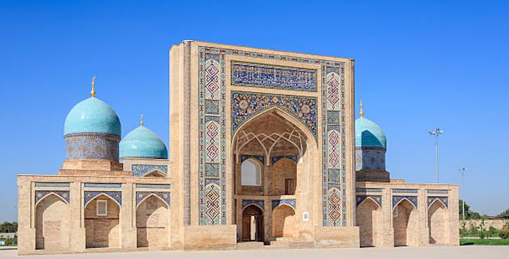
The trip was entitled “Astronomy and Culture through Silk Road Cities“, and was organised by New Scientist Discovery Tours with Intrepid. It was a trip to Uzbekistan from the 11-24 September 2026.
I had initially planned a different trip and had linked it with a visit to Canada, so when that fell through, I was lucky to find another interesting trip with similar dates.
It’s true that I had already looked at this trip, and had actually heard positive comments from two people who had made this same trip in the past. So it seemed the perfect solution.
Planning ahead
This is the guidance I received from the tour operator, customised and expanded to meet my needs.
Passports, visas and entry requirements
As a Luxembourg passport holder I didn’t need a visa. But I did renew my passport so that it had more than the required minimum of 6 months validity.
The travel agent recommended to carry a copy of the photo page of my passport while travelling, and leaving a copy at home with family or friends.
Luxembourg citizens have visa-free entry for up to 30 days, counted from the moment I cross the Uzbek border. This was confirmed by the Uzbek government, which specifically lists the Grand Duchy of Luxembourg among the 30-day visa-exempt countries.
Flying I would transit through Istanbul, and Luxembourg ordinary passport holders are visa-exempt for stays of up to 90 days in Turkey. And remaining airside in international transit at Istanbul, Türkiye also stated that no transit visa was required.
However, all visitors to Uzbekistan must register with the local department of the Ministry of Internal Affairs within 3 working days after arrival. When staying at the hotel, I would be registered automatically. However, it is important to keep any registration documents issued by the hotel until I left the country.
Medical and health information
The travel company explicitly noted that people must be in good physical health in order to participate fully on this trip. About 8-weeks before the trip I hurt my right knee, but I quickly visited a specialist to assess the risks. After an injection, he thought it would take about 2-3 weeks to get back to normal. He was right. But just to be sure I took a knee support, a folding walking stick, and some pain killers (Omep and Motifen).
The travel company stressed that part of this trip will visit extremely remote locations with limited access to medical help. If they decide that you can’t complete the itinerary, they reserve the right to exclude you from all or part of a trip without refund.
They clearly recommend that people carry a first aid kit as well as any personal medical requirements in their original packaging as they may not easily be obtained while travelling. You also have to remember that some medications available over the counter or by prescription in Europe, such as sleeping tablets, may be illegal or restricted in some Central Asian countries. You should have a copy of any prescriptions as well as a letter from a doctor and be prepared to declare any prescription medication at customs.
Travel in forested areas brings the risk of exposure to tick-borne diseases. Ticks are very common in country areas and are most active from spring to autumn. Take precautions against insect bites, including the use of insect repellent.
Crimean-Congo haemorrhagic fever (CCHF) as a tick-borne risk in Uzbekistan (generally the majority of cases have occurred in people involved in the livestock industry).
The best advice I saw was to use the insect repellent DEET 30–50% (this is N,N-diethyl-m-toluamide). It protects against mosquitoes, ticks, and other biting insects.
The minimum recommendation is at least 20% DEET for protection against both ticks and mosquitoes. 20–30% is very effective, while higher concentrations mainly provide longer-lasting protection rather than making the repellent intrinsically stronger.
Even better is 0.5% permethrin spray for clothing. Treat trousers, socks and walking shoes, but never put permethrin directly on skin. The recommended combination is repellent on exposed skin plus permethrin-treated clothing/gear.
A good routine for ticks, is:-
- Walking with long trousers, preferably light coloured, closed shoes, trousers tucked into socks when going through vegetation.
- DEET on exposed skin, particularly ankles/lower legs.
- Avoid brushing through long grass and scrub when there’s an easy path.
- Later shower and do a complete tick check. Pay particular attention behind knees, groin, waist, armpits, around/behind ears and scalp.
- Carry a small pair of fine-pointed tweezers in a day bag.
Medical facilities are limited in Central Asia, with doctors and clinics often requiring payment in cash prior to providing services, even for emergency care. Standards in remote areas will be very basic.
The diet and hygiene standards may be very different, so always wash hands before meals, etc., and bring some medication/re-hydration salts for stomach problems. Giardia intestinalis, a parasite that can cause diarrhoea, is reported from time to time in the water supply. NEVER drink unboiled tap water.

Personal medical / first-aid kit (customised for Uzbekistan)
| Item | Amount | Purpose |
|---|---|---|
| Motifene 75 mg (diclofenac) | As prescribed | Knee/joint pain and inflammation |
| Omep 20 (omeprazole 20 mg) | As prescribed | Stomach protection/acid suppression |
| Paracetamol | 1 packet | Pain/headache/fever |
| Loperamide (Imodium-type) | 1 small packet | Diarrhoea |
Oral rehydration salts | 6–8 sachets | Diarrhoea, dehydration |
| Cetirizine (antihistamine) | 1 small packet | Insect bites/allergic reactions |
| Antacid | Small quantity | Occasional indigestion |
| DEET icaridin/picaridin repellent | 50–100 ml | Mosquito/tick/insect protection |
| After-bite treatment | 1 small tube | Itching/insect bites |
| Hydrocortisone 1% cream | 1 small tube, | Itchy bites/rashes |
| Antiseptic | Small spray or wipes | Minor cuts/grazes |
| Ordinary plasters | ~10 assorted | Cuts |
| Compeed blister plasters | 6–8 | Walking blisters |
| Sterile dressings | 2–3 | Larger cuts/grazes |
| Medical tape | 1 small roll | Dressings |
| Elasticated knee support | 1 | For knee |
| Small elastic bandage | 1 | Minor sprain/support |
| Tick remover/fine tweezers | 1 | Tick/splinter removal |
| Hand sanitiser | 50–100 ml | Before eating, etc. |
| Wet wipes | 1 travel pack | Particularly Maidanak/yurt |
| Tissues | Several | General use |
Lets look into the above:-
Why oral rehydration salts (ORS)? Needed after significant diarrhoea, vomiting or heavy sweating because water alone replaces fluid but not the sodium and other electrolytes lost. Remember dehydration becomes more common with age. The sensation of thirst tends to become less sensitive, the kidneys become less efficient at conserving water and sodium, and older adults may therefore become dehydrated before feeling particularly thirsty. Dissolve one sachet in water (200 mL, 500 mL or 1 L) as stated and sip it gradually.
What does it mean “take plasters”? A small travel first-aid kit, should include 8–10 standard strips (the most useful size for cuts and small abrasions), 4 small strips (for fingers and small cuts), and 2–3 larger dressings (for a larger graze).
For acute diarrhoea I found SmectaGo, a ready-to-drink diosmectite suspension in small sachets. No water is needed to take it, but it can interfere with absorption of other medicines, so other oral medicines should generally be taken separately. This helps reduce watery stools, but it does not rehydrate. So I also have ORS Probiotical for diarrhoea/vomiting and consequent dehydration. So it replaces both lost water and electrolytes, and contains added probiotics and zinc.
Loperamide, mentioned in the list slows intestinal movement, usually giving stronger and faster symptomatic control which is particularly useful when travelling and you need to stop frequent urgent stools. However the chemists advised SmectaGo (diosmectite) does not slow the bowel, but acts locally in the intestine and reduces watery diarrhoea. Whereas ORS Probiotical does neither, but it replaces the lost water and electrolytes.
The tour document specifically warns that ticks are common in country areas and active from spring to autumn, so insect repellent is worth having.
The tour document also specifically mentions gastrointestinal problems and Giardia in water supplies, and recommended not to drink unboiled tap water. So loperamide with rehydration salts could be useful. The rehydration salts are more important than carrying lots of different stomach medicines.
Remember, if diarrhoea is accompanied by blood, high fever, severe abdominal pain or significant dehydration, tell the tour leader and seek medical advice.
I kept Motifene and Omep in their original pharmacy boxes, together with the prescription.
Food and dietary requirements
The Central Asian diet relies heavily on meat based dishes. There are options available for vegetarians, however these may at times be limited to plain noodles, bread, fruit, nuts, yoghurt, cheese, eggs etc.
Money matters
The official currency of Uzbekistan is the Som (UZS). The approximate value is 13,000-14,000 som for 1€ (use 14,000 som ≈ 1€ to calculate), or 12,000 som ≈ $1.
A bottle of water 5,000–10,000 som ($0.40–0.85), tea 10,000–20,000 som ($0.85–1.70), coffee 20,000–40,000 som ($1.70–3.30), Cappuccino 40,000–55,000 som ($3.30–4.60), Shashlik, one skewer 15,000–40,000 som ($1.25–3.30).
A simple local meal 40,000–70,000 som ($3.30–5.80), but for a good sit-down Uzbek meal 80,000–150,000 som ($6.70–12.50). In a tourist/upmarket restaurant 150,000–250,000+ som ($12.50–21+), and in an international luxury hotel 250,000+ som ($21+).
You can only obtain UZS inside Uzbekistan, so it’s best to bring $ or € to exchange, and cards for ATM withdrawals (better to use $). Important to have clean, crisp noted, because Uzbek banks and exchange offices can be quite particular about the physical condition of foreign banknotes, especially US dollars.
ATMs are common in major cities like Tashkent and Samarkand. Visa cards have the most reliable results. Credit cards and payments in foreign currencies aren’t widely accepted.
All UZS must be exchanged before leaving the country, as it’s difficult to exchange UZS outside Uzbekistan.
Keep at least US$100 for emergencies (e.g. severe weather, natural disasters, civil unrest) or other events that result in unavoidable changes to the itinerary (e.g. transport strikes or cancellations, airport closures). Sometimes these things necessitate last-minute changes to a trip, and as a result, there may be some extra costs involved.
Travel insurance
Travel insurance is compulsory on all our trips for those travelling internationally. Intrepid requires that, at a minimum, all people are covered for medical expenses including emergency repatriation.
They strongly recommend all travellers have a policy that also covers personal liability, cancellation, curtailment and loss of luggage or personal effects.
Intrepid explicitly state for international trips, participants will not be permitted to join the group until evidence of travel insurance and the insurance company’s 24-hour emergency contact number has been sighted by your group leader or local representative.
With credit card insurance, the group leader or local representative will require details of the participating insurer/underwriter, the level of coverage, policy number, and emergency contact number rather than the bank’s name and credit card details.
For travellers who reside within the European Union, Switzerland or USA the requirement to purchase travel insurance cannot be compulsory. However the purchase of travel insurance is still highly recommended, and travellers from these regions who decline travel insurance when travelling outside of their home region must sign a Travel Insurance Waiver Form at the Group Meeting, recognising personal responsibility for emergency medical and repatriation costs should they arise.
I have a 365-day personal travel insurance with europ-assistance, which covers me for medical costs, repatriation costs, etc. I had a specific statement that it covered me for the visit to Uzbekistan,
Personal Safety
Its best to have a secure method of carrying passport, phone, credit cards and cash while travelling (e.g. money belt). Leave all other high value items, including jewellery, at home.
Use safety deposit boxes at hotels to store valuables when available and ensure luggage is lockable.
Be aware of the risk of pick-pocketing and petty theft.
Exercise caution when walking at night, don’t walk alone and stick to well-lit streets wherever possible.
Be vigilant on public transport and look out for your fellow travellers.
Take precautions such as carrying bags in front of you, and never leaving personal items unattended.
Uzbekistan is generally a very safe place to travel. Petty crime targeting foreigners and tourists can occur. A regulation has been introduced allowing only licensed taxis (with certain colour and signs and card payment equipment) to operate in Uzbekistan. However, unlicensed taxis continue to operate. Use official taxis where possible.
There have been reports of robberies by individuals posing as police officers.
Avoid obvious displays of wealth, particularly in rural areas. Crime levels are higher at night. Avoid walking alone.
It is illegal to photograph government and military buildings. This may result in confiscation of equipment or detention. Check before taking photographs of government or security infrastructure.
There is a ban on the sale of alcohol and tobacco to those under 20.
Homosexuality is illegal under Uzbek law and is still very much frowned upon socially. Take care over public displays of affection.
Local Dress
Dress respectfully at all stages of the trip especially when in and around religious sites.
In Central Asia both men and women generally dress very conservatively by covering their legs and shoulders. Women are advised to cover their heads when entering functioning Orthodox churches and mosques, while men should remove their hats.
Community guidelines
Intrepid has issued some community guidelines.
No violence, harassment (whether physical, verbal or sexual), or disrespect toward fellow travellers, the teams or local communities.
Decisions made by the group leader are final.
If something concerns you during your travels, please speak to your group leader immediately. Alternatively, contact Intrepid on the emergency contact number detailed in the Problems and Emergency Contact Information.
Travelling in a group means being understanding of the various needs and preferences of the group. Be patience, be punctual.
Packing
The major constraints are:-
- Heat and strong sun – much of the trip can be around 28–33°C, especially Bukhara, Khiva and the desert. Lightweight, breathable clothing dominates the packing.
- Large day–night temperature swing – Samarkand, Nurata and especially the Kyzylkum can lose 12–15°C after sunset. Layers are much better than taking a genuinely heavy jacket.
- Maidanak – the cold-weather minimum of roughly 7–12°C during the observing night, potentially colder. Heavier shirt, warm jacket, light gloves and warm socks would be sensible.
- Main concern is Sun rather than insects – a lightweight long-sleeved shirt gives useful UV protection while remaining cooler than repeatedly applying sunscreen to your arms.
- Dry, dusty conditions – particularly around Aydarkul, Nurata and the Kyzylkum. Closed comfortable shoes are more useful than elaborate hiking boots unless your itinerary contains substantial hiking.
- A lot of walking – Samarkand, Bukhara and especially Khiva involve considerable walking over stone, paving and uneven historic surfaces.
- Religious/historic sites – Lightweight trousers and shirts that give reasonable coverage are ideal, no need to have separate “mosque wardrobe”.
- Astronomy – Keep things simple, avoid complicated equipment.
- Moving frequently – the ultimate constraint, so keep it to a minimum.
One simple rule – Pack primarily for 30°C, layer sufficiently for 8°C.
| Place | Daytime | Night | What it means |
|---|---|---|---|
| Tashkent | 28–32°C | 15–18°C | Warm/hot days, pleasant evenings |
| Samarkand | 27–30°C | 12–15°C | Noticeably cooler after sunset |
| Shahrisabz | 28–31°C | 13–16°C | Warm daytime, comfortable evening |
| Maidanak Observatory | 18–23°C | 7–12°C | The one place where your warmer layer matters |
| Nurata | 27–31°C | 13–17°C | Hot sun but large day/night difference |
| Aydarkul / Kyzylkum | 28–32°C | 12–17°C | Desert, so very warm afternoon, rapidly cooler after sunset |
| Gijduvan | 29–33°C | 15–18°C | Hot and dry |
| Bukhara | 30–33°C | 16–19°C | Probably among the hottest stops |
| Khiva / Itchan Kala | 28–32°C | 14–17°C | Hot afternoon, pleasant-to-cool late evening |
Tour guidance recommends to have max. 20kg (15kg would be ideal). A lockable wheelie is ideal. A smallish backpack (45-50 litres) is also a good option. And a very light, simple day pack/bag to carry water, camera, jacket, etc. during the day would also be a good idea.
Documents, money & essentials
- Passport — validity checked
- Visa/entry documentation (not needed)
- Travel insurance certificate (policy number + 24-hour number)
- Flight/e-ticket details
- Intrepid/New Scientist tour document
- Paper photocopy of passport and credit cards
- Copies of insurance and important travel documents
- Copies stored on phone/cloud
- Emergency contact details
- Intrepid Uzbekistan emergency number: +998 91 520 68 33
- $/€ cash for exchange into Uzbek som
- Visa card (back-up card, stored separately)
- Wallet/small secure pouch for passport and money
- Keep all hotel registration slips until leaving Uzbekistan — hotels normally perform the required registration automatically.
Medication & small medical kit
The tour document specifically recommends bringing personal medicines because obtaining them can be difficult in remote areas, and warns that some medicines, including some sleeping tablets, may be restricted.
- Prescription medication
- Medication in original labelled packaging
- Copy of prescription(s), where appropriate
- Doctor’s letter for any potentially controlled/restricted medication
- Mild painkiller/anti-inflammatory
- Anti-diarrhoea tablets (e.g. loperamide)
- Oral rehydration/electrolyte sachets
- Indigestion/antacid treatment
- Antihistamine
- Plasters/Band-Aids
- Blister plasters (Compeed type)
- Small antiseptic wipes
- Small tube antiseptic cream
- Any usual cold/throat medication
- Insect-bite treatment
- Insect repellent
The rehydration and stomach medication aren’t excessive precautions. The document specifically recommends them and advises against drinking unboiled tap water because Giardia is occasionally reported.
Hygiene & toiletries
- Toothbrush/toothpaste
- Deodorant
- Shampoo/shower gel as required
- Shaving equipment
- Comb
- Wet wipes/travel wipes
- Hand sanitiser
- Tissues
- Toilet wipes
- Lip balm
- Nail clippers
- Small travel towel
- Laundry bag dirty clothing
- A few small zip-lock bags
Clothes
- 5–6 lightweight short- and long-sleeved shirts
- 3 lightweight trousers/chinos
- Underwear
- Lightweight everyday socks
- Sleepwear
- Belt
- One slightly smarter shirt/outfit for dinners
- One lightweight jumper/fleece
- Light windproof/waterproof jacket
I wear shorts, but the itinerary included numerous mosques and mausoleums and the tour asks for shoulders and knees to be covered at religious sites.
For the Maidanak & desert stargazing the jumper/fleece and windproof jacket may be valuable, along with a slightly warmer pair of socks.
Remember the Maidanak night-time temperature could be around 10°C.
Footwear
- Well broken-in, closed walking shoes
- Second pair of comfortable shoes/trainers (optional)
- Flip-flops
Sun & heat
- Sun hat
- Sunglasses
- SPF 30–50 sunscreen
- Reusable water bottle
- Lip balm
- Small packet of electrolyte sachets in daypack
Electronics
- Phone, with charger and cable(s)
- Spare memory card(s)
- Headphones/earbuds
Before leaving
- Download offline maps of Uzbekistan/Tashkent/Samarkand/Bukhara/Khiva
- Download offline translation
- Download airline tickets
- Download insurance documents
- Photograph passport and important documents
- Store Intrepid emergency number in phone
Daypack
- Water
- Sunscreen
- Hat
- Sunglasses
- Phone
- Tissues
- Wet wipes
- Hand sanitiser
- A couple of plasters/blister plasters
- One electrolyte sachet
- Any essential medication
- Light jacket/jumper (option)
- mall amount of cash
- Passport/copy as appropriate
Hand luggage on the flight
- Passport/documents
- Money/cards
- All essential medication
- Phone/charger
- Camera/valuable electronics
- Glasses (spare)
Things I would NOT take
No cold-weather clothing, heavy boots, elaborate first-aid kit, excessive formal clothing or large quantities of toiletries.
When arriving in each new hotel
Upon arrive in a new hotel room, immediately check the air-conditioning, shower/hot water, toilet, electrical sockets and room safe. If something isn’t working, tell the tour leader while everyone is still checking in. It’s far easier to change a room at 17:00 than discover the problem when you return at 23:00.
Day 0: 10th September 2026
10:25 Luxembourg (LUX) – 14:45 Istanbul Airport (IST)
TK1354 – Boeing B737-800 – narrow-body – Seat 02A
Day 1: 11th September 2026
I had booked an early arrival on the 10th, so I had my room and a day free.
The group was programmed to arrive with a London flight TK0368 at 07:55.
The local contact was +998 91 520 68 33.
For those arriving on the 11th, an early check-in was not guaranteed.
At 18:00, meet other travellers, the Tour Leader and Colin Stuart, the New Scientist Discovery Tours Expert.
The Tour Leader gave an introductory brief on the tour planning. Afterwards, there was a welcome dinner.
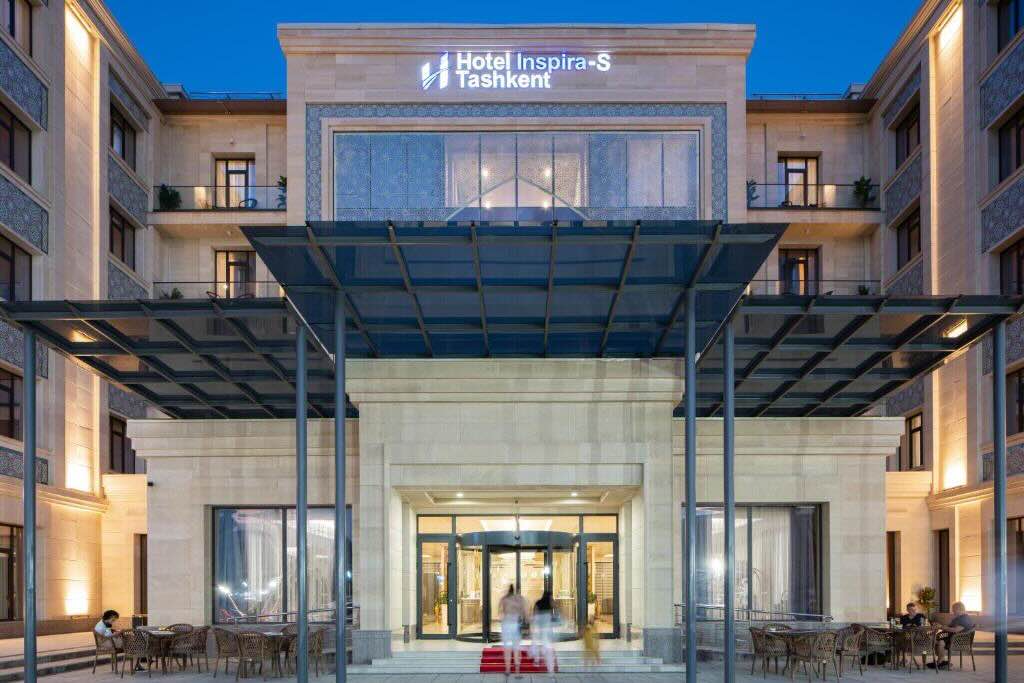
The hotel in Tashkent was the Inspira-S Hotel, in A. Kadiriy street 6A, Tashkent, operated by Japan’s H.I.S. Hotel Holdings.
At the time Booking reviews gave it around 9.0–9.1, with particularly good scores for cleanliness, comfort, facilities and staff. Rooms are generally described as large, and it has an indoor pool, spa, sauna and gym.
First morning: walk from the hotel
Your Inspira-S is actually in quite an interesting part of old Tashkent. Abdulla Qodiriy memorial muzeyi is very close to the hotel—the hotel itself is on Abdulla Qodiriy Street. This is potentially much more interesting than it sounds.
Abdulla Qodiriy (1894–1938) was one of the foundational figures of modern Uzbek literature, author of O‘tkan kunlar(Bygone Days), and an important figure in the Jadid intellectual movement. He was arrested during Stalin’s Great Terror and executed in 1938. The museum is small and very much not one of the standard international-tourist sights; current information gives weekday opening as 09:00–17:00. That makes it exactly the sort of thing I’d use your independent day for.
There’s also Abdulla Qodiriy Park immediately nearby. The hotel is only about 200–250 m from it.
From there I’d walk towards the Shaykhantaur/Sheikh Hovendi Tahur complex. One particularly interesting survivor is the 15th-century Kaldyrgach-biy/Töle-bi mausoleum, with an unusual pyramidal dome on a twelve-sided drum—quite different from the great Timurid monuments you’re going to see later.
That would give you a gentle first morning after the flight: hotel → Qodiriy museum/park → Shaykhantaur, without duplicating the organised tour.
I would not continue the short distance to Chorsu Bozor or Khast Imom, tempting though that is: they’re both on your Day 2 programme. Chorsu is only about 800 m from the hotel, which shows how centrally you’re positioned.
But for the afternoon I’d take a taxi somewhere special
My choice would be the Museum/Complex of the Victims of Political Repression.
Museum of Victims of Political Repression
It occupies a historically significant site associated with detention and executions during the Soviet repression. The museum deals particularly with the repression of Uzbek intellectuals in the 1920s–40s—the very history into which Qodiriy fits. The surrounding Shahidlar Xotirasi memorial park covers about 17 hectares.
That creates a surprisingly coherent independent day:
Qodiriy himself in the morning → the wider story of Soviet repression in Uzbekistan in the afternoon.
And it’s something your New Scientist itinerary doesn’t cover at all.
However: the current local-business listing marks the Museum of Victims of Political Repression as temporarily closed, while the official Visit Tashkent pages still describe the museum and give opening information. So I would not build the day around it until we verify its status immediately before you travel. The memorial park itself is nevertheless worth knowing about.
If that museum remains closed
Then I’d choose State Museum of the History of Uzbekistan.
That makes considerable sense before your tour rather than afterwards. It gives you the chronological framework—ancient Central Asia, Silk Road cultures, successive states and empires—before you start encountering the actual monuments in Samarkand, Bukhara and Khiva.
Alternatively, State Museum of the Temurids concentrates specifically on Amir Timur and the Timurid period. That’s highly relevant to what you’re about to see in Samarkand, although I’d personally favour the broader History Museum because the organised tour is going to give you an enormous amount of Timurid material anyway.
So my provisional 10 September would be:
Morning: leisurely breakfast → Abdulla Qodiriy museum and park → Shaykhantaur complex → lunch.
Afternoon: taxi to the Museum of Victims of Political Repression and memorial complex if confirmed open; otherwise the State Museum of the History of Uzbekistan.
Then back to Inspira-S without trying to cram in anything else. You have thirteen days of intensive sightseeing ahead of you.
And I rather like the Qodiriy/repression option because it’s precisely what you asked for: not another “must-see Tashkent” checklist, but something historically substantial that the organised tour is unlikely to show you.
Day 2 - 12th September 2026
Depart after breakfast for a visit of Tashkent. Starting with the Astronomy Museum, to learn about the history of astronomy in Uzbekistan, including contributions from prominent astronomers such as Ulugh Beg.
He was a Timurid ruler, mathematician and astronomer who turned Samarkand into one of the world’s leading centres of astronomy in the early 15th century.
His great achievement was the Samarkand Observatory, built in the 1420s. Its principal instrument was an enormous meridian instrument with a radius of about 40 metres, allowing extremely precise measurements of the positions of stars without a telescope.
With his astronomers, he produced the Zij-i Jadid-i Guragani, completed around 1437. It contained a catalogue of about 1,000 stars, with positions measured to remarkable accuracy. It was the most important new star catalogue produced between Ptolemy in the 2nd century and Tycho Brahe in the late 16th century.
Ulugh Beg also determined the length of the year as approximately 365 days, 6 hours, 10 minutes and 8 seconds—only about a minute different from the modern value for the sidereal year.
What makes him particularly important is that this was observational science: he built a major scientific institution, employed skilled astronomers and mathematicians, constructed exceptionally large precision instruments, made systematic measurements, and published the results. In that sense, Samarkand in the 1420s–30s was one of the great astronomical observatories of the pre-telescopic world.
There is not much official information on the museum, but from what I could understand it is not the Tashkent Planetarium, but has some exhibits worth seeing:-
Look out for the displays on the Institute’s observing stations at Kitab and Maidanak.
The James Short reflecting telescope — 18th century. This is probably the object I would look at most carefully. James Short (1710–1768) was one of the outstanding makers of Gregorian reflecting telescopes. The museum describes its example as a telescope used by Short.
This is not merely an old telescope, it represents the period when the reflecting telescope was becoming a genuinely precise astronomical instrument after Newton’s original reflector.
The Hadley octant. Another particularly good object for you because it is an actual precision measuring instrument rather than a decorative astronomical exhibit. John Hadley’s reflecting octant dates from the early 18th century and was the ancestor of the sextant. The museum explicitly associates its instrument with Hadley’s implementation of Newton’s reflecting-instrument idea.
The Dollond reflector / telescope. The museum has an instrument attributed to the celebrated English optical firm Dollond. John Dollond is especially important because of his development of the achromatic objective in the 1750s, which dramatically reduced chromatic aberration in refracting telescopes.
The Muhammad Sharif Bukhari celestial globe. This is perhaps the object I would pay most attention to from the Central Asian side of the collection. It gives you the link between the Islamic/Central Asian astronomical tradition and the later European instrumentation displayed alongside it.
The Ulugh Beg meridian instrument model. This is a model rather than the original — the surviving original instrument is, of course, at Samarkand. But it is worth studying before or after your visit there because it shows how Ulugh Beg’s enormous ~40 m radius meridian quadrant/sextant worked.
The model/display of Ulugh Beg’s Zij-i Jadid-i Guragani. This is arguably more scientifically important than any individual antique telescope. Ulugh Beg’s catalogue gave positions for 1,018 stars, produced from observations made at Samarkand without telescopes.
The Tashkent master clock/chronometer. This one could easily be overlooked, but I think you should seek it out. The museum has the clock that served as the Tashkent time standard from 1873 to 1931, made by the Amsterdam firm identified by the museum source as “Hovyu.” It connects directly to the foundation of the Tashkent Observatory in 1873 and to the fundamental astronomical problem of accurate timekeeping.
The historic Tashkent astrograph and photographic work. This may actually be the most important thing for understanding Tashkent astronomy, rather than astronomy in general. A normal astrograph was installed at the observatory in 1895. Observations continued into the 1980s, producing a photographic-plate archive that the Institute describes as one of the richest in the world.
Stefan Kozik material. Kozik was a Tashkent astronomer who discovered two comets, in 1936 and 1939. His medals from the Astronomical Society of the Pacific and the Uzbek Academy of Sciences are displayed. It’s a small exhibit, but it tells you something important: Tashkent was doing real observational astronomy, not simply preserving the legacy of Ulugh Beg.
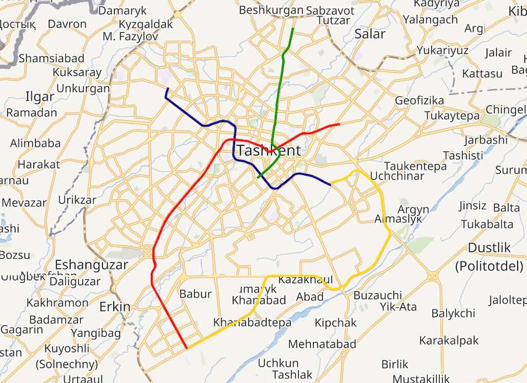
Tour of the Tashkent metro, which was inaugurated in 1977, making it the first metro system in Central Asia. The metro is adorned with various pieces of art, including mosaics that depict scenes from Uzbek history, folklore and nature, contributing to a cultural experience while commuting.
But it is much more interesting as architecture and public art than as transport. Its early stations were conceived almost as a sequence of underground ceremonial rooms: each was given its own subject, materials, lighting and artists. Uzbek history, poetry, astronomy, cotton, national ornament and Soviet technological achievement were translated into marble, ceramics, glass, metalwork, mosaics and elaborate lighting.
The important cultural point is that this is not simply a provincial copy of the Moscow Metro. Tashkent’s architects combined the Soviet idea of the metro as monumental civic architecture with Central Asian forms: pointed arches, domes, geometric ornament, turquoise and blue ceramics and references to Timurid and Islamic architecture.
That mixture became particularly important after the devastating Tashkent earthquake of 1966. The rebuilding of the city became one of the USSR’s major architectural projects, and the metro eventually formed part of that new image of Tashkent. The result is an unusual hybrid of Soviet modernism and Uzbek architectural tradition.
A good example is Alisher Navoi, opened in 1984. Its domed, arched spaces deliberately recall medieval Central Asian architecture rather than conventional underground railway architecture; decorative panels refer to the works of the great 15th-century poet Alisher Navoi.
The less obvious story: engineering shaped the architecture
There is a particularly interesting fact behind all this decoration. Tashkent is in a serious earthquake zone.
When the specialist Tashkent Metro design institute was established in 1972, seismic engineering became a fundamental part of the project. Engineers developed earthquake-resistant tunnel linings, reinforced-concrete waterproof structures and special station forms. The institute subsequently contributed its expertise to metro projects elsewhere in the USSR.
The 1966 earthquake also appears to have influenced the decision to keep much of the system comparatively shallow, rather than constructing the extremely deep stations characteristic of Moscow and Kyiv. Contemporary accounts describe tunnelling only several metres below parts of the city.
So what appears to be extravagant decoration is actually sitting inside a rather carefully engineered seismic structure.
Another unusual feature: climate
There was another problem Moscow did not have: Tashkent’s extremely hot, dry summers.
Metro engineers developed an evaporative cooling ventilation system, later improved with rotary evaporative equipment, to control the underground microclimate economically. This was sufficiently successful to be regarded by the design institute as one of its important technical innovations.
Thus the metro is interesting simultaneously as architecture, art, earthquake engineering and climatic engineering.
Kosmonavtlar — look more carefully than most visitors do
The station I think will particularly interest you is Kosmonavtlar, opened in 1984 and designed by Sergo Sutyagin and Sergei Sokolov.
Most people notice the portraits of cosmonauts. The architecture itself is cleverer.
The walls gradually change from white through increasingly dark blue to ultramarine, intentionally creating the sensation of disappearing into infinite space. The columns were made unusually slender and clad in dark reflective glass so that visually they almost disappear. Most remarkably, the architects increased the normal station height by about 60 cm specifically to strengthen this feeling of weightlessness and spatial infinity.
The long ceiling lighting represents the Milky Way. And the sequence of medallions isn’t simply Soviet propaganda: it constructs a history of humanity’s relationship with the heavens, beginning with Icarus and Ulugh Beg, moving through Tsiolkovsky and Korolev, and eventually Gagarin, Tereshkova, Leonov and Dzhanibekov.
That makes Kosmonavtlar particularly interesting in the context of your astronomy trip: Ulugh Beg is deliberately placed in the same historical narrative as modern space exploration.
One final oddity
For decades almost nobody outside Uzbekistan saw good photographs of these interiors.
The metro was treated as a strategic civil-defence installation, capable of functioning as a shelter, and photography underground was prohibited. The restriction was finally removed only in 2018. Consequently, an architectural complex dating from the 1970s and 1980s effectively remained visually hidden from much of the outside world for about forty years.
That is partly why the Tashkent Metro suddenly seems to have been “discovered” internationally quite recently.
For your visit, I would concentrate on about six stations rather than trying to see everything. Kosmonavtlar and Alisher Navoi are essential, but I can give you a 60–90 minute art-and-architecture route, with exactly what unusual detail to look for at each station.
The Tashkent earthquake struck at 05:23 local time on 26 April 1966. Its epicentre was extraordinarily close to the city—about 8–9 km NNW of central Tashkent—and it was shallow, around 10 km deep. Modern USGS reassessment gives it a magnitude of about Mw 5.2–5.3.
What is striking is that it wasn’t a particularly large earthquake. The destruction was severe because the shaking occurred virtually beneath Tashkent and much of the old city consisted of vulnerable one-storey adobe/mud-brick buildings. Thousands were destroyed or badly damaged. A contemporary USGS account records 10 deaths, about 1,000 injured and roughly 100,000 people made homeless; hundreds of aftershocks caused further damage.
The earthquake became a turning point in Tashkent’s physical history. Large areas of the traditional low-rise city were subsequently cleared or rebuilt, and Soviet republics sent construction teams to Tashkent. The reconstruction produced the broad avenues, apartment blocks, public buildings and monumental modern architecture that still define much of central Tashkent.
So when you walk around Tashkent, 1966 is one of the most useful dates to keep in mind: a surprising amount of what appears to be a deliberately planned Soviet city is actually the product of the post-earthquake reconstruction.
Visit Chorsu Bazaar, Amir Timur Square and the Khast Imom complex.
Before dinner we had the first talk from Colin Stuart.
Dinner at a local restaurant.
Chorsu Bazaar Tashkent is much older as a place of trade than the building you see today. It occupies part of Tashkent’s historic commercial centre; chorsu is Persian, essentially meaning “four ways/crossroads.” The present complex, however, is predominantly late Soviet, designed in the 1980s by Vladimir Azimov and Sabir Adylov and built mainly in 1985–90.
The enormous turquoise dome is nearly 90 m in diameter. Because this is earthquake-prone Tashkent, that span presented a serious structural problem: the architects used an unusually large steel structure combined with reinforced concrete at the lower level. The blue tiled surface deliberately makes a thoroughly modern engineering structure resemble the great tiled domes of Central Asian architecture.
The little-known part is underneath it. The picturesque bazaar sits on a huge functional podium with a two-storey basement large enough for trucks to circulate, supplying the stalls and removing waste without putting all that servicing through the public market above. The market therefore works rather like a modern logistics building disguised as a traditional Central Asian bazaar.
Another detail worth looking for is the large central skylight. As the sun moves, the pool of light moves across the concentric trading floors beneath the dome—an intentional architectural effect, not simply illumination.
And there is an uncomfortable historical irony: although the complex was designed to evoke old Tashkent, part of the historic Chorsu mahalla—the traditional residential fabric—was actually demolished to construct it. The architects were simultaneously destroying part of the old city and recreating an architectural image of it.
That tension—ancient market function + Soviet engineering + deliberately Uzbek appearance—is what makes Chorsu architecturally much more interesting than simply “the famous blue bazaar.”
Amir Temur Square is best understood not simply as a park but as Tashkent’s political and symbolic centre. It was created by the Russian administration in the late 19th century, at the intersection of two important avenues in the newly built Russian city, separate from old Tashkent. The site was laid out around 1882 as Konstantinovsky Square.
So the same urban space has successively represented Russian imperial conquest → Soviet communism → independent Uzbek national identity. That makes the square almost a physical timeline of who controlled the historical narrative of Uzbekistan.
The less-known detail
The square wasn’t placed randomly. The two major Russian avenues crossing here largely followed much older routes: one towards Kashgar and China, the other towards Kokand and the Fergana Valley. The Russians therefore imposed their new administrative centre onto an already important geographical crossroads.
There is another detail worth noticing when you are standing there. The monuments erected in the square have traditionally faced west, towards the surviving 19th-century gymnasium buildings. Those buildings are among the remnants of the original Russian colonial city surrounding the square.
And one rather striking modern change: in 2009, during another redesign of the square, many of its mature trees were removed, opening long sight-lines towards the surrounding monumental buildings. In other words, even the vegetation has been manipulated to change how the state’s symbolic centre is perceived.
What I would look at: don’t concentrate only on Temur. Stand back and look at the whole ensemble—19th-century Russian buildings, Soviet-era Hotel Uzbekistan, post-independence Temurid imagery and new monumental architecture all facing the same piece of ground. Few places in Tashkent show its
Khast Imam — more formally Hazrati Imam — is the religious heart of old Tashkent. Unlike Registan in Samarkand, however, it is not one ensemble constructed at one time. It grew over centuries around the tomb of Abu Bakr Kaffal al-Shashi (903–976), an important Islamic scholar born in Tashkent—then known as Shash
The historically important buildings are principally the 16th-century Kaffal al-Shashi Mausoleum and Barak Khan Madrasa, together with the later Tillya Sheikh Mosque and Muyi Muborak Madrasa. This is significant because this part of the old city survived the destructive 1966 earthquake considerably better than many areas of Tashkent.
The easily missed fact
What you see today is much less ancient than it initially appears. The enormous Hazrati Imam Mosque with its two 53-metre minarets was built only in 2007, by order of President Islam Karimov. Architect Abdukakhor Turdiyevdeliberately designed it in a historic Central Asian vocabulary; craftsmen from Samarkand and Khorezm were employed, and the interiors of the domes were decorated with gold leaf.
So when looking across the beautiful square, distinguish between genuine surviving 16th-century Tashkent and a 21st-century recreation/continuation of that architectural language. That distinction makes the complex considerably more interesting.
The famous Qur’an — with an important qualification
The Muyi Muborak collection contains the celebrated Uthman Qur’an, an enormous early Qur’anic manuscript of 353 parchment leaves. Tradition associates it with Caliph Uthman, the third caliph, who died in 656.
The qualification often omitted in tourist descriptions is important: the manuscript’s association with Uthman personally is traditional, not securely established historically. Scholarly dating places the manuscript among the very early Qur’anic manuscripts, but claims that Uthman himself read from this particular volume—and that stains on it are his blood—should be treated as tradition rather than proven history.
Its later history is almost as interesting: after centuries in Central Asia, it was taken to St Petersburg following the Russian conquest, transferred after the Revolution, and eventually returned to Tashkent in 1924.
What I would particularly notice
Look at the Barak Khan Madrasa rather than concentrating entirely on the grand mosque. Its portal, glazed tilework and domes belong to the older architectural history of Tashkent. Then turn around and compare them with the enormous 2007 mosque.
You are effectively seeing two different ideas of Uzbek Islamic architecture facing one another: the surviving historical architecture and the modern Uzbek state’s carefully constructed continuation of it. That is probably the most interesting way to read Khast Imam.
Day 3 - 13th September 2026
Early morning high-speed train to Samarkand aboard Uzbekistan’s Afrosiyob train system, which offers one of the most modern rail travel networks in the world. The train will reach speeds of up to 300 kilometres per hour and the journey will take just over 2 hours.
The high-speed train is called Afrosiyob, after Afrasiyab, the ancient settlement immediately north of modern Samarkand. Service began on 8 October 2011, making Uzbekistan the first country in Central Asia to operate high-speed trains. The Tashkent–Samarkand railway distance is about 344 km, covered in roughly 2¼ hours, depending on the service.
The train itself is Spanish, a Talgo 250 specially adapted to Uzbekistan’s 1,520-mm Russian railway gauge. It has a power car at each end and lightweight articulated passenger coaches between them. The trains are designed for 250 km/h; current commercial operation reaches about 230 km/h.
The less obvious engineering story
What is particularly interesting is that Uzbekistan didn’t build an entirely new Japanese- or French-style high-speed railway. Much of the existing Soviet-era Tashkent–Samarkand route was substantially upgraded instead—track, signalling and 25 kV AC electrification, together with fencing, level-crossing work and special high-speed points.
That helps explain the choice of Talgo. Its coaches use natural tilting, allowing them to negotiate existing curves faster—Talgo says by as much as 25% faster through curves—without rebuilding the whole alignment.
So don’t expect to travel continuously at 230–250 km/h. One technical study of the route shows permitted/actual speeds varying considerably: some sections around 220 km/h, others around 140–170 km/h. The average over the complete journey is therefore much lower than the headline maximum.
Something to notice from the window
The journey is also a rather good geographical introduction to Uzbekistan. Leaving Tashkent, you cross the Syr Darya, then run across the broad, intensively irrigated plains towards Gulistan and Jizzakh. Around Jizzakh the landscape changes as the railway approaches the foothills separating the Tashkent/Syr Darya region from the Zeravshan basin and Samarkand.
And there is a nice cultural detail in the name. You are travelling on Afrosiyob towards Afrasiyab: the modern high-speed train has deliberately been named after the ancient predecessor of the city to which it originally ran.
Perhaps the most surprising fact is the speed with which it was done: the first train arrived in Tashkent on 22 July 2011, made its first Tashkent–Samarkand run on 26 August, and entered regular service on 8 October.
For the journey itself, I would regard it as part of the visit rather than dead travelling time—particularly the change in landscape approaching Jizzakh and Samarkand.
On arrival, tour of the city with a visit to Registan Square, which is a masterpiece of Islamic architecture.
It served as the heart of ancient Samarkand, symbolising the cultural and intellectual prominence of the Timurid Empire.
The Registan was the civic heart of medieval Samarkand. Its name comes from Persian registan, essentially “sandy place.” It was originally an open public square used for commerce, proclamations and ceremonies—not a purpose-built architectural courtyard. The extraordinary enclosure by three monumental madrasas developed gradually over more than two centuries.
The three buildings aren’t contemporary
This is the first thing worth remembering when standing there.
Ulugh Beg Madrasa — 1417–1420. Built by Ulugh Beg, Timur’s grandson, ruler, mathematician and astronomer. It was a serious centre of higher learning, with lecture rooms and accommodation for students. Ulugh Beg himself taught there. Notice the stars and geometric patterns on the great entrance portal: particularly appropriate for the man who subsequently created Samarkand’s great astronomical observatory.
The other two sides appeared about 200 years later, under the ruler Yalangtush Bahadur: Sher-Dor, 1619–1636, opposite Ulugh Beg, and Tilla-Kari, 1646–1660, closing the northern side. Sher-Dor deliberately echoes Ulugh Beg’s façade, creating the apparent symmetry we see today.
Look above the Sher-Dor entrance
This is one of the strangest details in Islamic Central Asian architecture.
Above the enormous portal are two great feline predators pursuing deer, with rising suns bearing human faces on their backs. Figurative representations of animals and human faces on such a monumental Islamic building are highly unusual.
So the Registan isn’t simply endless abstract Islamic geometry. One of its most conspicuous façades actually breaks what we tend to assume are the rules of Islamic religious architecture.
Tilla-Kari contains a wonderful architectural trick
Tilla-Kari means approximately “covered with gold.” Go inside its mosque and you’ll understand the name.
The interior is extraordinarily heavily gilded. More interestingly, the spectacular dome you perceive above the prayer hall is largely an illusion created by painted and gilded decoration: perspective and concentric ornament visually transform the comparatively shallow interior surface into something resembling a soaring dome.
It is worth standing directly underneath and deliberately trying to make your brain see the real surface rather than the apparent dome.
The little-known story: much of what you’re seeing is restoration
This substantially changes how I would look at the Registan.
By the late 19th and early 20th centuries, the ensemble was in very poor condition. Domes and portals had collapsed, minarets were leaning dangerously and some façades had lost large quantities of their ceramic covering. Early photographs show parts of Ulugh Beg’s madrasa essentially as rubble.
One Ulugh Beg minaret had collapsed in 1870. Another began leaning alarmingly by 1918.
Then came a remarkable piece of Soviet structural engineering. After years of preparation, engineer Vladimir Shukhov and his team straightened the enormous north-east minaret in 1932 rather than dismantling and rebuilding it. Another was straightened in 1965.
Even more importantly, the Ulugh Beg courtyard had to be extensively reconstructed, including portions of its inscriptions and decorative programme. UNESCO’s documentation explicitly notes that the Registan buildings have been partly rebuilt.
So the Registan you see is not an untouched 15th–17th-century survival. It is a combination of substantial original fabric, reconstruction and roughly a century of highly ambitious conservation.
One thing I’d particularly do
Stand in the centre and temporarily ignore the decoration.
Look at the architectural composition: Ulugh Beg on one side, its 17th-century imitation Sher-Dor opposite, and Tilla-Kari closing the end. What now appears to be a perfectly planned three-sided composition was actually created piecemeal across roughly 240 years.
Then go close. The original structures were fundamentally mud-brick buildings covered with extraordinarily sophisticated ceramic skins.
That contrast—very ordinary structural material transformed by an immensely elaborate surface—is one of the keys to understanding Timurid architecture.
Continue to Siab Bazar and the Shahi Zinda Complex.
Siab, or Siyob, Bazaar is Samarkand’s principal food market, immediately beside the Bibi-Khanym Mosque. The present market covers more than 7 hectares, with seven main covered pavilions. But the important point is that the market tradition here is much older than the present buildings.
The interesting historical point
The location makes much more sense if you remember 1220, when Genghis Khan’s forces devastated ancient Samarkand at Afrasiab, just to the north. As urban life subsequently shifted southwards, the area between Afrasiab and the Registan developed into a major zone of workshops, caravanserais, warehouses and markets. The present bazaar occupies part of that medieval commercial landscape.
By Timur’s period this was an extremely important urban axis. The great Bibi-Khanym Mosque, begun in 1399, stood beside the commercial quarter, and a covered bazaar route connected this area towards the Registan. So mosque, market and political centre were not isolated monuments: they formed parts of the functioning city.
The little-known detail
Don’t assume the buildings you’re walking through are ancient. The old bazaar structures have disappeared. What survives is principally the location and commercial function, while the architecture of today’s market is modern.
There is remarkable photographic evidence of this. Early-20th-century photographs show low, flat-roofed mud-brick bazaar buildings immediately in front of the ruined Bibi-Khanym complex. The contrast with today’s restored mosque and orderly market is enormous.
The name itself is also interesting: Siyob derives from the district and nearby Siyob watercourse; it is generally interpreted from Persian/Tajik as “black water.”
What to look for
Look particularly at the bread. Samarkand non is characteristically large, thick and heavy, stamped decoratively in the centre. It isn’t merely tourist merchandise—the bread stalls remain part of the everyday food economy of the city.
But architecturally, I’d do something else: walk out of the market and look directly at Bibi-Khanym. Imagine the mosque partly ruined and surrounded by low mud-brick shops rather than the monumental restored setting you see today. It gives a much better idea of what this part of Samarkand actually looked like before the enormous 20th-century restoration programme.
Shah-i-Zinda, “the Living King”, is not a single monument but a cemetery and pilgrimage complex built over many centuries, on the southern edge of ancient Afrasiab. The surviving ensemble contains mausoleums, mosques and associated buildings, with its greatest architectural flowering under the Timurids in the 14th and 15th centuries.
Why it is sacred
At its heart is the supposed burial place of Qutham (Kusam) ibn Abbas, a cousin of the Prophet Muhammad, traditionally credited with bringing Islam to this region in the 7th century. The name “Living King” derives from legends that he did not truly die—in one version he disappeared underground and continues to live there.
That shrine existed long before Timur. The extraordinary Timurid mausoleums were subsequently built along the narrow route leading towards it. So architecturally you are effectively walking through later royal architecture towards an older sacred nucleus.
What makes it exceptional
Unlike the Registan, Shah-i-Zinda was not designed as a unified architectural composition. Individual mausoleums were commissioned for members of the Timurid elite, including women associated with Timur’s family and court.
That produced something rather wonderful: the builders were effectively competing within a very confined space.
Look closely and almost every façade offers a different experiment in ceramic decoration—carved glazed terracotta, mosaic faience, majolica, moulded tiles and inscriptions. This concentration of techniques is one reason Timurid decoration at Shah-i-Zinda became influential far beyond Samarkand; UNESCO specifically identifies Timurid architecture as influential on later Persian, Mughal and Ottoman architecture.
A detail easily missed
The spectacular blue is not one uniform “Samarkand blue.” Get close to the façades and you will find turquoise, cobalt, white, black and other colours produced by different ceramic techniques.
More importantly, some decoration is three-dimensional. In places the craftsmen carved the terracotta first and then glazed it. The pattern therefore exists physically in relief rather than merely being painted onto a flat tile. The changing sunlight makes these surfaces behave almost like architectural sculpture.
And there is a major catch
As with the Registan, don’t assume everything that looks medieval is untouched medieval fabric.
Shah-i-Zinda was actually regarded as having retained unusually high authenticity when Samarkand’s World Heritage nomination was evaluated. But in 2004–05 a very rapid, large-scale restoration programme altered the complex.
UNESCO became so concerned that in 2005 it formally requested Uzbekistan to stop the work immediately, saying it appeared to be seriously affecting the site’s integrity and authenticity. An ICOMOS inspection subsequently found that genuine conservation had been necessary—some mausoleums were in critical condition—but that the work had been completed in less than two years, exposing earlier foundations and producing questionable reconstruction and finishing in places.
That is unusually useful information when visiting: the dazzling completeness you see today is partly the result of very recent intervention.
What I would particularly do
Don’t rush up the famous staircase looking straight ahead.
Stop halfway, turn around, and then examine one façade from perhaps 10 metres away and again from 50 cm away. At distance you see an astonishing blue architectural composition; close up you discover that it is actually an encyclopaedia of different ceramic technologies.
And unlike Registan, which impresses through monumental space, Shah-i-Zinda works through compression: a narrow street, irregular buildings, changing levels and mausoleums almost pressing against one another. That crowdedness isn’t a failure of planning—it is largely the consequence of centuries of prestigious burials accumulating around a sacred grave.
In the afternoon, drive to Konigil, and visit paper-making workshop, located near the “Meros” paper mill, founded by well-known masters, the Mukhtarov brothers. The local factory revived an ancient tradition based on old Samarkand technologies.
Koni Gil Meros, in Konigil village just outside Samarkand, is a reconstructed traditional paper mill. The present workshop is not an ancient surviving mill: traditional Samarkand papermaking had largely disappeared by the 19th century. Craftsman Zarif Mukhtarov and his family revived the technique around 2002, after studying historical methods.
Why Samarkand paper matters
Samarkand became one of the great papermaking centres of the medieval Islamic world. By the 9th–10th centuries its paper was an important commercial product, and papermaking subsequently spread westwards through the Islamic world. Paper was enormously cheaper and easier to produce in quantity than parchment, helping make possible the proliferation of manuscripts, administration, scholarship and libraries.
The little-known fact — the famous story is probably wrong
You will almost certainly be told that Chinese papermakers captured at the Battle of Talas in 751 revealed the secret of papermaking and established the industry in Samarkand.
It’s a wonderful story—but historians now regard it as probably legendary. The story does not appear until an 11th-century account, roughly 300 years after Talas, and archaeological/documentary evidence indicates that paper was already known in Central Asia before 751. The historian of Islamic paper Jonathan Bloom considers the captive-papermaker explanation unlikely.
That is something worth remembering when the guide tells the story.
What you actually see being made
At Konigil the characteristic paper is made from mulberry bark. The bark is stripped and cleaned, boiled for hours and then pounded into pulp. A waterwheel drives wooden pounding mechanisms—so the picturesque waterwheel actually has a mechanical purpose.
The pulp is suspended in water, lifted out on a screen, pressed into sheets and dried.
But the crucial final operation is burnishing. The dried sheet is rubbed against a smooth stone surface using stone, horn or similar hard material. This compresses and smooths the fibres, producing a surface on which a calligrapher can make an exceptionally clean line rather than having the ink simply feather into the fibres.
One important qualification
There is an interesting historical mismatch here. Today’s Konigil demonstration emphasises mulberry-bark paper, which connects visually and technically with East Asian papermaking. But much medieval Islamic paper—including that associated with Central Asia—was produced substantially from linen/hemp rag fibres, not simply mulberry bark.
So Konigil is best understood as a modern revival of traditional craft techniques, not an untouched production line preserved continuously since the 8th century.
And that actually makes it more interesting: when you watch the pulp being beaten and the individual sheet being lifted from the vat, you are seeing the basic technology that helped move written culture from the relatively expensive world of parchment into the age of paper.
Visit a ceramic workshop.
Konigil itself is principally famous for paper, but the wider Samarkand region is also important for ceramics because it sat at a major point of exchange between Chinese, Iranian and Central Asian technologies and aesthetics.
The particularly important development came in 9th–10th-century Samanid Samarkand. Potters produced sophisticated glazed earthenware, especially white-slipped bowls carrying extraordinarily bold Arabic inscriptions in dark pigment. The effect resembles expensive Chinese white ceramics, but the technique and decoration are distinctly Central Asian/Islamic. These are among the masterpieces of early Islamic ceramics.
There is an important technical point. Local potters generally couldn’t reproduce Chinese high-fired porcelain, because their clays and kiln technology were different. Instead they developed slip coatings and lead glazes that allowed ordinary earthenware to acquire a smooth, pale surface. In other words, an inability to copy Chinese porcelain directly stimulated a different ceramic technology.
Samarkand’s other great ceramic achievement is architectural. Under Timur and the Timurids in the 14th–15th centuries, enormous quantities of glazed architectural ceramics were required for buildings such as Shah-i-Zinda, Bibi-Khanym and later the Registan. Workshops developed exceptionally sophisticated glazed terracotta, mosaic faience and tilework, using cobalt blue, turquoise, white and other colours.
A less obvious connection with your visit is Afrasiab. Excavations of ancient Samarkand have produced huge quantities of ceramics, including imported Chinese wares and locally produced imitations. Archaeologists can therefore use pottery almost like a historical measuring instrument: changes in fabric, glaze and decoration reveal Samarkand’s changing trade connections along the Silk Roads.
So paper and ceramics illustrate essentially the same phenomenon: Samarkand did not merely receive technologies moving along the Silk Road; its craftsmen absorbed them, modified them and created distinctive Central Asian products of their own.
Continue to Gur-e-Amir Mausoleum and then finally visit the Ulugh Beg Observatory.
Gur-e-Amir means “Tomb of the Emir.” It is principally famous as the burial place of Timur (Tamerlane, 1336–1405), but it was not originally built for Timur. In 1403 he ordered the mausoleum for his favourite grandson and intended successor, Muhammad Sultan, who had died unexpectedly during a military campaign. When Timur himself died in 1405, he too was buried there.
What you are actually seeing
The great ribbed turquoise dome is the architectural masterpiece: about 15 m in diameter and 12.5 m high, carried on a tall cylindrical drum. The exaggerated vertical ribs make the dome appear taller and lighter than its actual geometry would suggest.
Inside is almost the opposite experience: intensely concentrated decoration—gilding, painted papier-mâché, carved plaster, inscriptions and deep blue and gold surfaces. Much of the interior decoration belongs to work undertaken under Ulugh Beg, Timur’s grandson.
A particularly important fact
The impressive tombstones you see inside do not contain the bodies immediately beneath them. They are cenotaphsmarking the positions of graves in a crypt below.
Timur’s is particularly conspicuous because it is made from a very dark green stone traditionally called jade—more accurately nephrite. Ulugh Beg is thought to have brought the stone to Samarkand following his campaign into the Mongol regions in 1425.
The actual grave of Timur lies in the crypt underneath, in approximately the corresponding position.
The 1941 opening of Timur’s grave
This produced one of the best stories surrounding the building—and one where fact and legend need separating.
A Soviet archaeological team led by Mikhail Gerasimov opened the tombs in June 1941. Examination of Timur’s skeleton supported historical descriptions: he was a powerfully built man and had physical abnormalities consistent with the lameness behind the European name Tamerlane, from Timur-i Lang, “Timur the Lame.”
Then, on 22 June 1941, only days after the tomb was opened, Nazi Germany invaded the Soviet Union.
The resulting legend says that Timur’s tomb carried a warning that whoever disturbed him would unleash an invader more terrible than himself. There is no reliable evidence that such a curse inscription was actually found. The coincidence, however, ensured the story survived.
The less obvious architectural importance
Gur-e-Amir became extraordinarily influential. Its combination of a high drum, monumental bulbous/ribbed dome, axial entrance and richly decorated dynastic tomb became part of the architectural vocabulary subsequently carried into Mughal India by Timur’s descendants.
That lineage eventually leads to the great Mughal mausoleums—and, most famously, the Taj Mahal. It would be too simple to say that the Taj Mahal is a copy of Gur-e-Amir, but Gur-e-Amir belongs directly to the Timurid architectural tradition inherited and transformed by the Mughals.
One thing to look for
Stand well back and look at the building without the decoration.
The extraordinary thing is the proportion: the dome is deliberately oversized relative to the building beneath it. It isn’t simply a roof; it is the monument’s principal visual object, designed to dominate Samarkand’s skyline.
And remember that the apparently complete ensemble is deceptive. Much of the original complex disappeared: Muhammad Sultan’s madrasa and khanqah survive largely as foundations and fragments, while the mausoleum itself underwent extensive restoration, particularly during the Soviet period.
So, as at the Registan, you are seeing a genuine Timurid monument whose pristine modern appearance owes a considerable amount to 20th-century reconstruction and restoration.
This observatory was founded in the 15th century by Ulugh Beg, a Timurid prince and renowned astronomer, and is considered one of the finest observatories of the medieval Islamic world. One of the most impressive instruments at the observatory was a giant sextant, which measured about 40 metres in radius. It was used to measure the angles between stars, allowing for precise astronomical observations.
Ulugh Beg Observatory was built around 1420–1429 by Ulugh Beg (1394–1449), Timur’s grandson, ruler of Samarkand and an unusually serious mathematician and astronomer. It was one of the most sophisticated astronomical observatories of the pre-telescopic world.
The extraordinary instrument
The most important thing to see is not the modern museum but the great curved trench.
This is the surviving underground portion of a monumental meridian instrument, usually described as a sextant, with a radius of about 40 m. Two parallel marble-faced arcs were built precisely on the north–south meridian.
Astronomers watched stars and the Sun cross the meridian and measured their altitude against the enormous graduated scale. Making the instrument physically enormous allowed angular divisions to be spread over a much greater distance and therefore read more accurately.
It was essentially precision engineering in masonry rather than metal.
How accurate was it?
Remarkably accurate.
Ulugh Beg’s astronomers determined the length of the sidereal year as approximately 365 days, 6 hours, 10 minutes and 8 seconds. The modern value is about 365 days, 6 hours, 9 minutes and 10 seconds—a difference of roughly 58 seconds.
Their great astronomical work, the Zij-i Jadid-i Kuragoni, completed around 1437, catalogued approximately 1,018 stars and provided highly accurate astronomical tables.
Importantly, most of these were new observations, not simply numbers copied from Ptolemy.
The less-known point: Ulugh Beg wasn’t working alone
The popular story tends to turn Ulugh Beg into a solitary genius. The observatory was actually a major scientific institution.
Among the mathematicians and astronomers associated with it were Qadi Zada al-Rumi, Jamshid al-Kashi and Ali Qushji. Al-Kashi was one of the outstanding mathematicians of the medieval world and wrote an important description of the observatory.
So what existed here was effectively a research group, supported financially by a ruler who was himself technically competent enough to participate.
And then it disappeared
After Ulugh Beg was murdered in 1449, the institution declined and was eventually destroyed. For centuries its precise location was forgotten.
The extraordinary part is that it was rediscovered only in 1908, by the Russian-Samarkand archaeologist Vasily Vyatkin. He used information in old property documents—a waqf deed—to identify where the observatory should have stood, excavated the site and uncovered the buried portion of the great instrument.
That underground construction is precisely why any substantial part of the instrument survives.
Something easily misunderstood when you visit
The circular building represented in models and reconstructions is largely hypothetical. Archaeology gives us the foundations and the extraordinary meridian instrument, while historical descriptions provide additional evidence, but we do not possess a complete 15th-century architectural record of the observatory.
So don’t look at a reconstruction and assume, “this is exactly what Ulugh Beg’s observatory looked like.”
What is unquestionably real—and far more interesting—is the 40-m-radius instrument cut down into the ground.
Why it matters historically
This was roughly 150 years before Tycho Brahe’s Uraniborg and nearly 200 years before Galileo’s telescopic observations.
Ulugh Beg achieved his precision entirely with naked-eye positional astronomy, geometry and exceptionally large instruments.
Given the astronomical purpose of your Uzbekistan trip, this is probably the site where I’d spend the most time looking at one apparently simple object: stand beside that surviving arc and imagine measuring a star’s position by watching it cross a precisely surveyed north–south line six centuries ago.
Second talk from Colin Stuart.
A traditional Uzbekistani meal with a local family.
Meridian Plaza
Samarkand — Meridian Plaza
13–14 and 15–16 September — 2 nights, separated by Maidanak
The itinerary uses the Meridian Plaza on both sides of your Maidanak excursion.
Meridian Plaza by Reikartz
This appears considerably better than one older review might suggest. Recent 2026 Booking reviews are exceptionally strong: 9.8 from 34 reviews, with 9.8 cleanliness/comfort and 9.9 staff. Guests describe large rooms, helpful staff and an outdoor pool.
There is, however, an interesting warning. A 2025 Tripadvisor reviewer complained very strongly about noisy and ineffective portable air conditioning, poor breakfast and a dispute with hotel management over a towel. That’s one person’s experience, so I wouldn’t extrapolate from it—particularly because the more recent 2026 reviews are overwhelmingly positive.
The practical issue is location. Some recent guests consider it convenient; others say it’s a little removed from the principal sights and report about a half-hour walk to some attractions. That’s largely irrelevant during the organised sightseeing, but worth remembering if you go back to Registan independently on your free evening.
Verdict: looks very good. If the air conditioning in your particular room is noisy or inadequate, say something immediately rather than putting up with it.
Day 4 - 14th September 2026
Destination: Maidanak
Today will involve a long travel day as the Maidanak Observatory is located in a remote region in the Gissar mountain range, about 100 kilometres south of Samarkand. Its remote location makes it ideal for stargazing, due to the absence of urban light pollution.
Begin by taking the 08:56 train from Samarkand to Karshi, which takes just over an hour. The train ride is comfortable and offers a smooth way to cover the distance between the cities. On arrival in Karshi you will be transferred to smaller cars for the drive to Maidanak, a journey of around 3 hours. The drive provides striking views of Uzbekistan’s countryside and mountains, however the roads can be bumpy and windy in places, with limited amenities along the way.
Check in to the guesthouse, where you will enjoy lunch. The guesthouse offers modest, no-frills accommodation, it is located in an very remote and high-altitude setting near the Maidanak Observatory and is the only accommodation in this area. The facilities are basic consisting of simple rooms with shared amenities and minimal infrastructure which are mainly used for suitable for small research astronomy teams. Due to the remote location and limited development in the area you should not expect hotel-level comfort. However, what the guesthouse lacks in luxury it makes up for in its location: the dark skies, high elevation, and low humidity make it an outstanding site for stargazing, offering some of the clearest and most stable viewing conditions in Central Asia.
Later in the afternoon, visit the Maidanak Observatory, which is home to several large telescopes. One of the key instruments is a 1.5-metre optical telescope, used for professional astronomical research. It also houses several smaller telescopes used for various observations and research, including those related to planetary science, asteroids and variable star observations.
Enjoy an evening of stargazing accompanied by Colin.
Included activities
• Maidanak Observatory
• Evening of stargazing
Accommodation
Guest house, Maidanak
L o c a t e d n e a r t h e M a i d a n a k O b s e rv a t o r y i n a r e m o t e m o u n t a i n s e t t i n g , t h i s g u e s t h o u s e o f f e r s s i m p l e , cl e a n a c c o m m o d a t i o n s w i t h a p e a c e f u l a t m o s p h e r e . I d e a l f o r a s t r o n o m y-f o c u s e d s t a y s , i t i n c l u d e s s h a r e d f a c i l i t i e s , h o m e-c o o k e d m e a l s , a n d b a s i c a m e n i t i e s . P l e a s e n o t e t h a t t h e g u e s t h o u s e o f f e r s m o d e s t , n o-f r i l l s a c c o m m o d a t i o n , i t i s l o c a t e d i n a n v e r y r e m o t e a n d h i g h-a l t i t u d e s e t t i n g n e a r t h e M a i d a n a k A s t r o n o m i c a l O b s e rv a t o r y . T h e f a c i l i t i e s a r e b a s i c c o n s i s t i n g o f s i m p l e r o o m s w i t h s h a r e d a m e n i t i e s a n d m i n i m a l i n f r a s t r u ct u r e w h i c h a r e m a i n l y u s e d f o r s u i t a b l e f o r s m a l l r e s e a r c h a s t r o n o m y t e a m s . D u e t o t h e r e m o t e l o c a t i o n a n d l i m i t e d d e v e l o p m e n t i n t h e a r e a , o p t i o n s f o r l a r g e r g r o u p s a r e e x t r e m e l y r e s t r i ct e d , a n d y o u s h o u l d n o t e x p e ct h o t e l-l e v e l c o m f o rt . H o w e v e r , w h a t t h e g u e s t h o u s e l a c k s i n l u x u r y i t m a k e s u p f o r i n i t s l o c a t i o n : t h e d a r k s k i e s , h i g h e l e v a t i o n , a n d l o w h u m i d i t y m a k e i t a n o u t s t a n d i n g s i t e f o r s t a r g a z i n g , o f f e r i n g s o m e o f t h e c l e a r e s t a n d m o s t s t a b l e v i e w i n g c o n d i t i o n s i n C e n t r a l A s i a .
The key at Maidanak Astronomical Observatory is not to treat it as a collection of telescopes. Look for evidence of why this particular mountain became an observatory and how astronomers exploit it.
What I would specifically look for
1. The site before the instruments.
When you arrive, look at the horizon, the isolation and the amount of open sky. Maidanak is about 2,600–2,650 m high, and site testing was already under way by the 1970s. Measurements in 1996–99 gave median atmospheric seeing of 0.69 arcsec, and remarkably, measurements in 2018–21 again gave 0.69 arcsec. That stability is scientifically important.
So ask someone there: “What is the seeing tonight?” If they quote 0.6″, 0.7″, 1.0″ etc., you will immediately know what they mean.
2. Find the AZT-22 — the 1.5-m telescope.
This is the instrument I would make certain you see. It is a LOMO-built 1.5-m Ritchey–Chrétien reflector, installed around the end of the Soviet period and achieving first light in 1991. Its principal f/8 configuration has a roughly 1.5° corrected field, and optical testing found the optics close to diffraction-limited.
Don’t just look through it. Look at it as machinery: find the 1.5-m primary mirror, secondary mirror, telescope tube, mounting and the point where the CCD/camera is attached.
3. Look underneath and around the telescope.
This is one of the things most visitors won’t notice. The AZT-22 dome has a “cold floor”, deliberately isolating the telescope from warmer laboratories and control rooms below. Its ventilation system can move up to 25,000 m³ of air per hour.
Ask them to show you the ventilation openings. The paradox is lovely: you travel to one of the world’s better atmospheric sites and then have to make sure your own building doesn’t spoil the atmosphere immediately around the telescope.
4. Look for the smaller Zeiss telescopes.
Don’t dismiss them because they aren’t huge. Maidanak has historically included a Zeiss-1000 (1 m) and 60-cm Zeiss instruments alongside the AZT-22.
Ask what each is observing now. That may produce a much more interesting conversation than asking what it “can” observe. Maidanak has been used for variable stars, quasars, gravitational lenses and other programmes requiring repeated photometric observations.
5. Find the DIMM.
This would be high on my list because it connects directly with the famous 0.69″ figure.
DIMM means Differential Image Motion Monitor. It is a relatively modest-looking instrument used to measure atmospheric seeing by measuring tiny relative movements of stellar images. The famous Maidanak seeing measurements were made with an ESO DIMM.
If one is operating, ask to see it. It may look far less impressive than the 1.5-m telescope, yet it tells the astronomers whether the atmosphere is good enough to exploit the big telescope properly.
6. Look for the remains of the Soviet space-tracking installation.
This is the part I would particularly pursue.
A neighbouring Maidanak summit housed a Soviet command-and-measurement complex, not simply another astronomical telescope. It included optical tracking and satellite laser ranging equipment.
If your guide has access or can point it out, ask:
“Which buildings belonged to the old Soviet satellite-tracking station?”
That distinction matters. Some of what you see on Maidanak belongs to astrophysics, while other infrastructure belongs to the history of the Soviet military/space tracking network.
7. Look for something that doesn’t move: the foundations.
Ask whether any unused domes, concrete bases, old equipment rooms or abandoned telescope structures date from the Soviet period. Maidanak developed through several institutions rather than as one perfectly planned observatory, so the physical site itself records that complicated history.
8. At sunset, watch the dome rather than the sky.
Notice when it opens. Astronomers want the telescope, mirror, dome and outside air approaching the same temperature. A large warm mirror or warm building produces rising turbulent air and worsens the image. Measurements with AZT-22 have actually detected the effect of the telescope/dome environment on seeing.
That transition from a closed daytime building to a thermally equilibrated nighttime instrument is something you rarely see explained on an ordinary observatory tour.
9. After dark, spend time without any optical instrument.
Don’t immediately reach for your binoculars. Give your eyes 20–30 minutes to dark-adapt and look at the Milky Way. Recent organised observing at Maidanak has included naked-eye/telescope viewing of the Milky Way and bright planets and stars.
Your binoculars will then become much more useful. But remember: the spectacular quality that astronomers value at Maidanak—0.69″ seeing—isn’t principally something your naked eye detects. What you will notice personally is the dark sky and transparency; the telescope benefits from the extraordinary atmospheric stability.
The one question I would ask an astronomer
Rather than “What can this telescope see?”, ask:
“What observation are you actually making tonight, and what measurement will you extract from it?”
That changes everything. They may not be trying to obtain a beautiful image at all. They may be measuring a star’s brightness repeatedly, the light curve of an exoplanet transit, a variable source or the changing brightness of a quasar.
And I’d ask one second question:
“Can you show me tonight’s seeing measurement?”
If you come away having seen the AZT-22, its mirror and detector, the dome ventilation/cold-floor arrangement, a DIMM measurement, the old Soviet tracking infrastructure, and the actual night’s observing programme, you will have understood Maidanak rather than simply visited it.
Maidanak — Observatory guesthouse
14–15 September — 1 night
This is not really a hotel, and the tour operator is making considerable efforts to ensure nobody expects one.
The document twice warns that it is a remote, high-altitude guesthouse with simple rooms, shared amenities, minimal infrastructure and no hotel-level comfort. It normally accommodates small research astronomy teams.
The journey itself is also worth remembering: train from Samarkand to Karshi, then about three hours in small cars, with bumpy, winding roads and limited amenities.
Potential problems: basic bathroom arrangements; possibly limited hot water/electrical facilities; little opportunity to buy anything you’ve forgotten; colder conditions after dark; and potentially a poor night’s sleep after a late observing session.
I’d put a tiny Maidanak kit in your daypack: toothbrush/paste, medication, wet wipes, small towel, clean underwear/socks, jumper, jacket, water and power bank. Then you aren’t dependent upon accessing a large suitcase or upon what the guesthouse supplies.
And this is where the red torch is particularly worthwhile.
Verdict: deliberately basic, but potentially one of the highlights of the entire tour. Think “astronomers’ field station”, not bad hotel.
There have since been explicit plans to develop accommodation and scientific tourism at Maidanak, including construction of a modern guesthouse near the observatory, and recent organised visits include evening programmes and telescope observing.
The observatory itself currently has a very good 4.6/5 Google-derived rating, although from only 12 reviews, so that isn’t enough to tell us much about sleeping facilities specifically. Maidanak Astronomical Observatory
For your visit, I would therefore go with the expectation of scientific-station accommodation rather than a mountain hotel. I wouldn’t be concerned about luxury; I would want to know four practical things before going: does your particular room have a private toilet, a proper hot shower, reliable electricity, and heating? At 2,600+ m, those matter considerably more than décor.
And in a way, if the guesthouse is still slightly primitive, I think it could actually add something to this particular visit: you are staying at an isolated working observatory, among the domes, rather than being driven back to a tourist hotel after sunset. That gives you the one thing a daytime visitor cannot really experience—Maidanak after everyone has switched to night-time observing.
Maidanak Observatory — what makes it exceptional
Maidanak Astronomical Observatory is quite different from Ulugh Beg’s observatory. Ulugh Beg is fundamentally a historical monument; Maidanak is a working astrophysical observatory, and a scientifically very good one.
It lies on the Maidanak plateau in the Qashqadaryo region, roughly 45 km from Shakhrisabz, on the western extensions of the Hissar/Hisor mountain system. The astronomical site is usually quoted at about 2,650–2,700 m above sea level. Today it is the principal observing station of the Mirzo Ulugbek Astronomical Institute of the Academy of Sciences of Uzbekistan.
Why put an observatory here?
The site wasn’t chosen merely because it was a high mountain.
Beginning in the 1960s, astronomers from the Astronomical Institute in Tashkent carried out a long search for a site with exceptionally stable air. V. S. Shevchenko played a major role in the programme. After roughly a decade of site testing, Maidanak emerged as one of the best locations.
The important measurement is seeing: the apparent blurring of an astronomical image caused by turbulence in Earth’s atmosphere. The smaller the number in arcseconds, the better.
Long-term measurements at Maidanak in 1996–99 found a median seeing of about 0.69 arcsec. Later measurements in 2018–22 again produced 0.69 arcsec. That remarkable agreement suggests that the site’s excellent optical conditions have remained quite stable.
For comparison, the original study obtained approximately:
- Maidanak: 0.69″
- La Palma: 0.69″
- Paranal, Chile: 0.66″
- La Silla, Chile: 0.87″
So Maidanak’s atmosphere genuinely competes with some of the world’s great astronomical sites. In the best 25% of measurements, seeing was 0.55″ or better, and November produced a monthly median of about 0.62″.
That is perhaps the single most important fact about Maidanak: the telescopes are not enormous by modern standards; the site itself is the exceptional instrument.
The clear sky
There are roughly 2,000 useful clear observing hours annually. July–September has historically been particularly good, with around 90% of the possible nighttime observing time clear in some studies.
Altitude helps, but so does the surrounding geography: relatively dry continental air, limited urban development nearby and favourable atmospheric turbulence.
Interestingly, a recent analysis found a long-term reduction in the amount of clear time—about 7 percentage points over 27 years—although the actual quality of the seeing has remained remarkably stable.
What you will actually see
Don’t expect something resembling a single enormous modern observatory such as the VLT.
Maidanak is a scattered mountain-top scientific settlement. Different telescope buildings and domes are distributed across the plateau. Historically there were around ten telescopes belonging to several Soviet institutions; the modern observatory operates several instruments, with apertures ranging from about 50 cm to 1.5 m.
The dominant instrument is the 1.5-m AZT-22.
The 1.5-m AZT-22
This is the telescope I’d pay particular attention to.
It is a 1.5-m Ritchey–Chrétien reflector, manufactured by LOMO in St Petersburg. It can operate in several optical configurations—originally f/8, f/17 and f/48. Tests found its optics to be extremely good, approaching the diffraction limit in its wide-field configuration.
The telescope’s history is also pure late-Soviet history.
Construction had been substantially completed when the USSR collapsed. In 1993, the telescope was nationalised by newly independent Uzbekistan. Rather than disappearing into a post-Soviet institutional dispute, it became the centrepiece of cooperation between Uzbek astronomers and the Sternberg Astronomical Institute in Moscow.
Look at the dome as well as the telescope
There is some clever engineering that most visitors probably won’t notice.
Putting an excellent telescope under a warm dome can destroy the very seeing quality that justified building it on the mountain: warm air rising from the building produces local turbulence.
The AZT-22 dome was therefore designed with a cold floor separating the telescope environment from warmer laboratory and control areas. Its ventilation system can exchange as much as 25,000 cubic metres of air per hour, allowing the telescope environment to approach the outside temperature before observations begin.
In other words, when looking at the dome, the ventilation is scientifically almost as important as the dome itself.
The history most visitors don’t know
There is a second Maidanak story, and it is one of the most interesting aspects of the place.
There were effectively two Maidanaks.
The astronomical institute occupied what is generally called the eastern summit, while Moscow State University and other Soviet scientific institutions established telescopes on a neighbouring western summit roughly 5 km away.
But the eastern summit was also taken over for something quite different.
Maidanak was part of the Soviet space-tracking system
During the 1970s–80s, the USSR established a Satellite Laser Ranging station on the mountain. A Soviet military space unit operated there; sources identify the installation as OKIK Maidanak, part of the Soviet command-and-measurement infrastructure for spacecraft.
This wasn’t astronomy in the conventional sense.
Satellite laser ranging works by firing extremely short laser pulses at satellites carrying retroreflectors. The pulse returns to Earth, and its round-trip travel time gives the satellite’s distance with extraordinary precision.
So Maidanak’s exceptional atmosphere was valuable for looking both outward into the universe and upward at artificial satellites.
The astronomers were nevertheless permitted to continue working nearby with two 60-cm telescopes and a 48-cm telescope.
That explains something you may otherwise find puzzling when you arrive: some of the infrastructure around Maidanak does not look like an ordinary civilian astronomical observatory because some of it wasn’t built as one.
A former military measuring complex still exists several kilometres from the main observatory; Uzbekistan has more recently been developing tourism infrastructure in that area.
What do astronomers actually do there?
Maidanak is principally an optical observatory, and its strength is repeated precision observations rather than spectacular Hubble-style pictures.
Research programmes have included:
Variable stars — measuring changes in stellar brightness.
Gravitationally lensed quasars — monitoring multiple images of the same distant quasar. Changes in brightness and their time delays can provide information about the lensing galaxy and cosmological distances.
Blazars and active galactic nuclei — monitoring rapidly varying objects powered by supermassive black holes.
Supernovae — following their changing brightness after discovery.
Gamma-ray bursts — rapidly attempting optical observations following high-energy alerts from satellites.
Exoplanets — measuring the very small reduction in a star’s brightness when a planet passes across it.
Asteroids and other minor bodies.
And, particularly interesting today, Maidanak has participated in searches for optical counterparts of gravitational-wave events through the GRANDMA international collaboration.
So although the equipment looks relatively traditional, it can participate in very modern multi-messenger astronomy: a gravitational-wave detector reports an event, observatories around the world rapidly search the relevant part of the sky for its visible-light counterpart.
Why don’t they simply build a 10-m telescope there?
This is an interesting question because Maidanak’s atmosphere could certainly justify larger instruments.
The limitation is largely historical and economic rather than optical. After the collapse of the Soviet Union, Uzbekistan inherited an excellent site and a collection of useful telescopes but not the enormous budgets required for modern 8–10-m-class observatories.
The result is actually scientifically useful. Maidanak’s 0.5–1.5-m telescopes can devote substantial amounts of observing time to monitoring objects night after night. A giant telescope such as the VLT is enormously more powerful, but observing time on it is extremely competitive.
For variable stars, gravitational lenses, exoplanet transits and transient follow-up, time on target can sometimes matter more than aperture.
Something else you may notice: the geology
The mountain is interesting even without the telescopes. Official Uzbek tourism information notes marine fossils in the area.
That tells you something immediately about the landscape beneath your feet: rocks now standing roughly 2.6 km above sea level contain evidence of environments that were once marine.
So there is a rather nice juxtaposition at Maidanak: you can be standing beside a telescope studying objects millions or billions of light-years away while the rock underneath records a completely different history of Earth’s geological past.
What the naked-eye sky should be like
This may actually be the most memorable part.
At 2,650 m, away from major urban lighting, with dry air and excellent atmospheric conditions, the sky can be exceptionally transparent. During an organised observing event in August 2025, visitors observed the Milky Way, Saturn, Jupiter, Vega, Altair and Deneb, together with Perseid meteors.
The important distinction is that seeing and transparency aren’t the same thing.
Good seeing means exceptionally stable air, producing sharp telescopic images.
Good transparency means little absorption and scattering, giving a dark, clear sky.
Maidanak benefits from both.
And the human eye doesn’t exploit 0.69″ seeing in the way a telescope does. What you are more likely to notice personally is the darkness, number of visible stars and structure of the Milky Way.
What I would pay attention to when you arrive
I would mentally divide the visit into three layers.
First, look at the geography. Before looking through anything, look at why an astronomer would choose this isolated summit.
Second, examine the 1.5-m AZT-22 as an engineered measuring instrument: mirror, mounting, dome opening, ventilation and control systems. A 1.5-m mirror doesn’t sound enormous today, but it gathers roughly 46,000 times as much light as a fully dark-adapted 7-mm human pupil.
Third, look for the Soviet archaeology of the site—older telescope buildings, infrastructure and anything associated with the former satellite-tracking installation. Maidanak is simultaneously an Uzbek astronomical observatory and a surviving fragment of the Soviet space programme.
And there is a lovely historical connection with what you will have seen in Samarkand. Ulugh Beg solved the problem of precision by making his instrument enormous: a meridian arc with a radius of about 40 m. Maidanak solves essentially the same problem by using precision optics, electronic detectors and an exceptionally stable atmosphere.
They are separated by six centuries, but both observatories ultimately depend upon exactly the same thing: measuring the position or light of an astronomical object more accurately than was previously possible.
Day 5: 15th September 2026
7Destination:Samarkand
Meals Included: Breakfast, Lunch
After a busy evening, you will have a more leisurely morning, before driving back to Samarkand. You will drive by private cars to Shahrisabz, which will take around 3 hours. Shahrisabz is the birthplace of Amir Timur, who is regarded as one of the greatest conquerors in Uzbekistan’s history. The city’s architecture reflects the Timurid style, characterised by large-scale constructions, intricate mosaics and blue-domed structures.
Shahrisabz is a historic city about 80 km south of Samarkand, on the route towards Maidanak. Its importance is disproportionate to its present size because it was the home city of Timur (Tamerlane).
The city was ancient long before Timur. Known historically as Kesh, it existed by at least the first millennium BC and became an important settlement of Sogdiana. Alexander the Great’s campaigns reached this region in the 4th century BC. Its present name, Shahrisabz, is Persian/Tajik and means approximately “Green City.”
Its great period came with Timur, who was born in 1336 at Kesh—or in its immediate vicinity. Although he made Samarkand his imperial capital, he transformed Shahrisabz into a dynastic and ceremonial city.
The extraordinary survival is the ruined Ak-Saray (“White Palace”), begun around 1380. Only the enormous entrance pylons remain, but those fragments tell you how gigantic it was: the surviving portal towers rise roughly 38 m, while the original entrance structure was probably considerably higher. An inscription famously associated with the palace reads, in effect, “If you doubt our power, look at our buildings.”
Shahrisabz also contains the Dorut Tilovat complex, including the great blue-domed Kok-Gumbaz Mosque, built in 1434–35 by Timur’s grandson Ulugh Beg, and Dor us-Siyodat, the dynastic burial complex.
There is a fascinating connection with Gur-e-Amir. Timur apparently intended to be buried at Shahrisabz. A crypt constructed for him survives at Dor us-Siyodat. But when Timur died at Otrar in Kazakhstan in February 1405, winter conditions made the journey across the mountain passes to Shahrisabz difficult. His body was therefore taken to Samarkand, where he was buried in Gur-e-Amir. The Shahrisabz crypt remained unused.
Something important when you visit
The historic centre is a UNESCO World Heritage Site, inscribed in 2000. But there is a serious modern controversy.
From 2014 onwards, large-scale redevelopment demolished extensive areas of traditional urban fabric around the monuments to create broad landscaped spaces and tourist infrastructure. UNESCO concluded that this caused such substantial damage to the historic urban landscape that in 2016 Shahrisabz was placed on the List of World Heritage in Danger.
So when you see the great Timurid monuments standing rather isolated in immaculate parks, don’t assume that was their historical setting. Until quite recently they were embedded in a much denser traditional town.
For your Maidanak journey, Shahrisabz is therefore much more than a convenient stop: Samarkand shows you Timur’s imperial capital; Shahrisabz shows you where he came from, where he built his enormous palace, and where he originally intended to be buried.
Timur — Amir Timur, known in Europe as Tamerlane — was born in 1336 near Kesh, today’s Shahrisabz, and died in 1405. He created an enormous Central Asian empire stretching at various times from northern India through Iran and Iraq into parts of Anatolia and the Caucasus.
Timur rather than “Emperor Timur”
An important detail: Timur was not descended from Genghis Khan, so under the political traditions of the region he could not legitimately claim the Mongol title Khan.
Hence Amir — commander or ruler.
He maintained a Chinggisid khan as nominal sovereign while exercising the real power himself. He strengthened his legitimacy by marriage into the family of Genghis Khan and used the title Gürägän/Kuragan — “son-in-law.”
That helps explain why you repeatedly encounter the word Kuragoni in Timurid history.
What did he actually do?
Timur was above all an extraordinarily successful—and extremely violent—military conqueror. From his power base at Samarkand he defeated the Golden Horde, conquered Persia and Mesopotamia, invaded India and sacked Delhi in 1398, and defeated the Ottoman Sultan Bayezid I at Ankara in 1402.
His campaigns involved massacres and deliberate terror on an enormous scale. The beautiful architecture of Samarkand should therefore not obscure what financed and created it: imperial conquest, taxation, booty and the forced movement of skilled craftsmen from conquered territories to his capital.
That last point is particularly important when you look at Samarkand.
Timur brought architects, tile-makers, metalworkers and other specialists from across his empire. Consequently, buildings such as Bibi-Khanym, Gur-e-Amir and the early Shah-i-Zinda monuments represent a remarkable concentration of technologies and artistic traditions drawn from a huge geographical area.
Timur and astronomy — don’t give him credit for Ulugh Beg’s science
This is the distinction worth remembering.
Timur was not the great astronomer. His grandson Ulugh Beg was.
Timur created the dynasty, accumulated enormous resources and made Samarkand an imperial intellectual and artistic centre. That provided the political and economic environment from which the extraordinary scientific culture of Ulugh Beg’s generation subsequently emerged.
But the famous observatory belongs to a later generation.
The sequence is:
Timur (1336–1405)
↓
his son Shah Rukh (1377–1447)
↓
Shah Rukh’s son Ulugh Beg (1394–1449)
↓
Samarkand Observatory, c. 1420s
↓
Zij-i Jadid-i Kuragoni, c. 1437
That approximately 30-year gap between Timur’s death and Ulugh Beg’s great star catalogue is worth keeping in your head.
Why Ulugh Beg is so unusual
Ulugh Beg was born during Timur’s lifetime and accompanied the imperial court as a child. After Timur’s death and the subsequent struggles over succession, Ulugh Beg eventually governed Samarkand.
But unlike his grandfather, his lasting importance lies substantially in mathematics and observational astronomy.
He assembled an exceptional group of scholars in Samarkand, including Jamshid al-Kashi, Qadi Zada al-Rumi and Ali Qushji.
This is why your visit to the Ulugh Beg Madrasa at Registan matters. The madrasa, built 1417–1420, wasn’t simply a beautiful building. Mathematics and astronomy were among the subjects associated with this intellectual environment.
Then came the observatory.
The astronomical leap
The observatory’s enormous meridian instrument had a radius of about 40 metres.
Why make it so absurdly large?
Because there were no telescopes. Precision depended on accurately measuring angles with the naked eye. If an angular scale is physically enormous, each fraction of a degree occupies more physical space and can therefore be subdivided and read more accurately.
A one-degree interval on a 40-m-radius circle is about:
70 cm.
One arcminute corresponds to about:
11.6 mm.
That gives you a feeling for the instrument. Ulugh Beg effectively turned part of a building into a precision angular measuring device.
And this produced serious science
The resulting Zij-i Jadid-i Kuragoni contained a catalogue of roughly 1,000 stars, based substantially upon new observations rather than simply reproducing Ptolemy’s ancient catalogue.
The Samarkand astronomers also obtained remarkably accurate values for astronomical quantities, including the obliquity of the ecliptic and the length of the year.
So there is a fascinating progression in what you are going to see:
Shahrisabz: Timur’s origins and political power.
Gur-e-Amir: Timur’s dynasty and death.
Registan: Ulugh Beg as patron of learning.
Ulugh Beg Observatory: the dynasty transformed into a centre of quantitative science.
Maidanak: Uzbekistan’s continuation of observational astronomy with modern optics and electronic detectors.
One connection I’d particularly keep in mind at Maidanak
There is a surprisingly direct intellectual link between Ulugh Beg and Maidanak, despite six centuries of technological change.
Ulugh Beg’s fundamental problem was:
Where exactly is that star?
His solution was an enormous fixed geometrical instrument and careful naked-eye observations.
At Maidanak the question may instead be:
Exactly how bright is that star, and how does its brightness change?
The solution is a precisely figured mirror, tracking mount, CCD detector, accurate timing and computer analysis—all placed beneath an atmosphere whose median seeing is around 0.7 arcsec.
So I would think of Timur as the beginning of the political story, not the astronomical hero. His empire made Samarkand extraordinarily rich and cosmopolitan. Ulugh Beg converted part of that inheritance into science.
And modern Uzbekistan’s decision to call its principal astronomical institution the Mirzo Ulugbek Astronomical Institute is therefore very deliberate: for an astronomy trip through Uzbekistan, Ulugh Beg is the historical figure you really want to follow.
Enjoy lunch at Koba.
Koba Restaurant is worth knowing about because the building is more interesting than an ordinary lunch stop. It occupies the historic Koba caravanserai, in the old commercial part of Shahrisabz. Sources date the structure broadly to the late 15th/early 16th century, when caravan traffic, markets and accommodation were closely connected here.
The basic architecture is that of a caravanserai arranged around a courtyard, with very thick masonry walls and a sequence of rooms/cells beneath small domes. Historically, travellers and merchants arriving for the nearby market could lodge here with their goods. The building was restored after Uzbek independence; don’t assume that every surface you see is 500 years old.
One detail I’d look at is the entrance door: a local historical account records it as being made from plane and walnut wood, selected for durability. It also says that much of the original surface decoration of the building has been lost.
What should you expect for lunch?
This is essentially traditional Uzbek food, rather than elaborate international fine dining. Current and past descriptions consistently mention plov, shashlik/kebabs, grilled meats, samsa, salads and fresh flatbread. An older local guide specifically recommends lamb leg and the Koba salad.
A visitor who ate there described a substantial meal of shashlik, lentil soup, chicken with vegetables, vegetable salad, bread and tea; another documented meal included beef kebabs, a beef-and-vegetable Koba salad, soup, dumplings and ribs. So I’d expect a fairly meat-heavy, generous Uzbek lunch, probably accompanied by non bread, salads and tea, rather than delicate small courses.
The bread is worth understanding. Uzbek non is normally put on the table as part of the meal and treated with considerable respect culturally; traditionally it isn’t placed upside down or casually discarded.
What I would notice
If your tour simply announces “lunch at Koba,” look at the room before looking at the menu. The heavy walls, arches, domed spaces and courtyard are remnants—or restored elements—of a building whose original purpose was precisely to deal with people travelling through Central Asia.
So there is a pleasing continuity to your day: you are travelling from Samarkand through Shahrisabz towards Maidanak and stopping for lunch in a building originally intended for travellers doing essentially the same thing—stopping, eating and resting before continuing their journey.
Afterwards, return to Samarkand, taking in the beautiful mountainous scenery and local villages you drive past.
There will be an optional evening walking tour to Registan Square or there is the option to rest at the hotel.
Optional activities
• Evening walking tour to Registan Square
Registan is essentially the old public centre of Samarkand. Registan is Persian for “sandy place” or “sandy ground.”It was not originally conceived as a beautiful architectural enclosure: it was the city’s open civic space, where roads converged, markets operated, announcements were made and public ceremonies took place.
What makes it extraordinary is that over about 240 years, three monumental madrasas — institutions of higher Islamic learning — were built around this pre-existing space.
Ulugh Beg Madrasa, 1417–1420, is on the west. This is the one particularly important for your astronomy theme. Ulugh Beg built it before constructing his observatory. Mathematics and astronomy formed part of the intellectual culture associated with his Samarkand. Notice the stars and complex geometry covering the enormous entrance portal.
Opposite it is Sher-Dor Madrasa, 1619–1636, deliberately built roughly two centuries later to balance Ulugh Beg’s building. Look above its entrance: you will see the extraordinary tiger/lion-like animals pursuing deer, with human-faced suns rising from their backs. Figurative imagery this prominent on an Islamic educational building is unusual.
Closing the north side is Tilla-Kari Madrasa, 1646–1660. Tilla-Kari means “gilded” or “decorated with gold.” It also provided the ensemble with a congregational mosque. Inside, the gold decoration creates an extraordinary optical trick: the apparently deep dome above you is substantially an illusion created by perspective painting and decoration on a much shallower surface.
What people often don’t realise
The square looks as though one architect designed a perfectly symmetrical ensemble. Nobody did.
When Ulugh Beg built his madrasa, the two buildings opposite it today didn’t exist. Sher-Dor and Tilla-Kari were added about 200 years later, under Yalangtush Bahadur. The apparent unity is therefore a remarkable piece of later urban composition.
Nor is what you see today untouched medieval Samarkand. By the beginning of the 20th century the Registan was in serious disrepair: masonry had collapsed, ceramic decoration was missing and minarets were leaning. Soviet engineers and conservators undertook an enormous restoration programme during the 20th century.
One particularly remarkable operation occurred in 1932. One of Ulugh Beg’s minarets was leaning dangerously. Rather than dismantling it, engineers separated the enormous masonry tower at its base and mechanically rotated it back towards vertical. It was an extraordinary piece of structural engineering.
What I would actually look at
First stand well back and see the three-building composition. Then forget the overall spectacle and examine each building separately.
At Ulugh Beg, look for astronomy and geometry.
At Sher-Dor, find the animals, deer and human-faced suns.
At Tilla-Kari, go inside, look upwards and try to work out where the real architectural surface ends and the painted illusion begins.
Finally get very close to the walls. What from 50 metres looks simply “blue” resolves into turquoise, cobalt, white, yellow and black glazed ceramics, calligraphy, geometric constructions and vegetal patterns.
And keep one thought in mind before going to Ulugh Beg’s observatory: Registan shows you Ulugh Beg creating an institution for learning; the observatory shows what happened when that intellectual culture was turned into experimental measurement. That makes the two sites much more interesting when seen together.
Accommodation
Meridian Plaza. (again)
Samarkand — Meridian Plaza
13–14 and 15–16 September — 2 nights, separated by Maidanak
The itinerary uses the Meridian Plaza on both sides of your Maidanak excursion.
Meridian Plaza by Reikartz
This appears considerably better than one older review might suggest. Recent 2026 Booking reviews are exceptionally strong: 9.8 from 34 reviews, with 9.8 cleanliness/comfort and 9.9 staff. Guests describe large rooms, helpful staff and an outdoor pool.
There is, however, an interesting warning. A 2025 Tripadvisor reviewer complained very strongly about noisy and ineffective portable air conditioning, poor breakfast and a dispute with hotel management over a towel. That’s one person’s experience, so I wouldn’t extrapolate from it—particularly because the more recent 2026 reviews are overwhelmingly positive.
The practical issue is location. Some recent guests consider it convenient; others say it’s a little removed from the principal sights and report about a half-hour walk to some attractions. That’s largely irrelevant during the organised sightseeing, but worth remembering if you go back to Registan independently on your free evening.
Verdict: looks very good. If the air conditioning in your particular room is noisy or inadequate, say something immediately rather than putting up with it.
Day 6: 16th September 2026
Destination:Kyzylkum Desert and Lake Aydarkul and evening stargazing
Meals Included: Breakfast, Lunch and Dinner
Depart Samarkand and drive through part of the Kyzylkum desert, which means “red sand” in the Turkic languages. It is one of the largest deserts in Central Asia, spanning about 298,000 square kilometres. It covers large parts of Uzbekistan and extends into Kazakhstan and Turkmenistan. The desert is located between two major rivers: the Amu Darya to the south and the Syr Darya to the north.
The Kyzylkum Desert is the great desert occupying much of central Uzbekistan, extending north into Kazakhstan and touching Turkmenistan. The name is Turkic: Qizilqum/Kyzylkum means “Red Sand.”
First: don’t expect the Sahara
This is probably the most useful thing to know before seeing it.
Although there are sand dunes and reddish sand, much of the Kyzylkum is not an immense landscape of Sahara-like dunes. You will see gravel and clay plains, low sandy ridges, dry channels, sparse scrub and isolated rocky hills. The landscape can look surprisingly flat and austere.
It covers roughly 300,000 km², making it one of the world’s larger deserts. It lies broadly between two of Central Asia’s great rivers: the Amu Darya to the southwest and Syr Darya to the northeast.
That geography is fundamental. You have an enormous arid region sitting between two major river systems whose waters ultimately supported the cities and agriculture of Central Asia.
Why is there a desert here?
The Kyzylkum is a continental desert. It is thousands of kilometres from a major ocean, while mountain systems to the south and east influence the movement of moisture into the region.
Rainfall is generally only around 100–200 mm per year, much of it falling in winter and spring. Summers are intensely hot: temperatures can exceed 45°C. But this isn’t a permanently hot desert. Winters can be well below freezing.
So think extreme continental climate, rather than simply heat.
Look at the vegetation
What initially appears almost barren actually contains vegetation highly adapted to drought.
The characteristic plant to look for is saxaul (Haloxylon). It can survive extremely dry and saline conditions and develops an extensive root system. Saxaul stabilises mobile sand and provides important habitat.
You may also encounter tamarisk, salt-tolerant shrubs and ephemeral spring vegetation.
The ecological point is that removing desert shrubs for fuel can destabilise the sand. Saxaul planting is consequently also used in attempts to stabilise exposed soils elsewhere in Uzbekistan, particularly around the former Aral Sea.
There is a surprising amount of life
The Kyzylkum supports goitered gazelle, wolves, foxes, jerboas, tortoises and numerous reptiles, as well as desert birds.
One particularly important animal is the Bukhara urial, a wild sheep associated with the desert’s isolated mountain ranges. Protected areas include the Kyzylkum State Nature Reserve and other conservation zones.
But the animals are generally well camouflaged and avoid people. On an ordinary crossing, vegetation and traces of animals may be much easier to see than the animals themselves.
The desert is not geologically monotonous
This is something I’d particularly watch for.
Out of the flat desert rise isolated remnants of much older mountain systems—the Bukantau, Tamdytau and other low ranges. These aren’t dunes; they are exposed bedrock.
And beneath this apparently empty landscape are enormous mineral resources.
The Kyzylkum contains major deposits of gold and uranium.
Near Zarafshan lies Muruntau, one of the largest open-pit gold mines in the world. The pit is several kilometres across and hundreds of metres deep. Uzbekistan is consequently a significant global gold producer.
The region also contains major sandstone-hosted uranium deposits, exploited substantially by in-situ recovery rather than conventional open-pit mining.
So parts of the Kyzylkum that look almost completely economically empty are actually among Uzbekistan’s most valuable landscapes.
The Silk Road connection
The desert also helps explain the geography of the cities you are visiting.
Crossing the Kyzylkum was difficult, so water determined routes. Wells, oases and caravanserais became critical points rather than optional stopping places.
This is one reason Bukhara became so important. It sits on an oasis on the western side of the Zeravshan system. The great Silk Road cities were not randomly distributed across Central Asia: their locations make much more sense once you start looking at where reliable water was available.
If you travel between Samarkand/Bukhara and Khiva, you are effectively experiencing this geography yourself: fertile irrigated zones abruptly give way to enormous arid spaces.
Something people often don’t realise: the rivers don’t behave naturally anymore
Historically, the Zeravshan River, which supplies Samarkand and the Bukhara oasis, continued towards the Amu Darya.
Today, intensive irrigation consumes so much of its water that the river normally dies out in the desert before reaching the Amu Darya.
That is an excellent example of something you will repeatedly encounter in Uzbekistan: the apparent contradiction between enormous deserts and remarkably fertile cities. The fertility depends upon moving and controlling water.
The extreme modern consequence is, of course, the Aral Sea disaster, caused primarily by the diversion of the Amu Darya and Syr Darya for irrigation, especially cotton cultivation.
There are dinosaurs here
One of the less expected facts about the Kyzylkum is its importance to palaeontology.
The desert contains exceptionally rich Late Cretaceous deposits, particularly the Bissekty Formation, about 90 million years old. Fossils recovered include dinosaurs, turtles, crocodilians, mammals and other vertebrates.
Among the dinosaurs discovered from the region are Timurlengia euotica, a tyrannosauroid named partly after Timur. It lived about 90 million years ago and is scientifically interesting because it helps document the evolutionary transition between relatively modest early tyrannosauroids and the enormous apex predators such as Tyrannosaurus rexthat appeared much later.
So beneath the desert surface is a record of an environment utterly unlike today’s Kyzylkum.
And for your astronomy trip…
The Kyzylkum illustrates exactly why Central Asia can be so good for astronomy.
Low population density, very little artificial illumination over enormous areas and dry continental air can produce exceptionally dark skies.
But don’t confuse this with Maidanak’s famous ~0.7 arcsecond seeing. Darkness and atmospheric seeing are different things. The Kyzylkum can provide an exceptionally dark sky because there is little light pollution; Maidanak was selected because, in addition, its high mountain atmosphere provides exceptionally stable air.
What I would actually observe
When you cross it, don’t just photograph “the desert.” Watch how it changes.
Notice where cultivation suddenly ends. Look for irrigation channels and then the abrupt transition into scrub. Look for saxaul. Distinguish sand from gravel plain and exposed rock. Look for isolated hills. And whenever you encounter a settlement, ask yourself the most important question in Central Asian geography:
Where is its water coming from?
Once you start doing that, the Kyzylkum stops looking like an empty space between Samarkand, Bukhara and Khiva. It becomes one of the principal reasons those cities developed where they did.
Enjoy a picnic lunch near Lake Aydarkul, which covers an area of more than 3000 square kilometres, making it one of the largest lakes in Uzbekistan. Aydarkul has become a unique ecosystem that supports various fish species, including carp and catfish, and serves as a habitat for migratory birds. The lake has gradually become an important stopover for bird species in the region.
Aydar Lake is a huge body of water on the northern edge of the Kyzylkum Desert. The first thing to know is that the landscape looks ancient and natural, but most of the lake you see today is essentially a 20th-century accident of Soviet water engineering.
How did a huge lake appear in the desert?
Historically there were saline depressions here, but no permanent lake remotely comparable with today’s Aydarkul.
The crucial change came with construction of the Shardara Dam on the Syr Darya, completed in the 1960s. Beside it lay the natural Arnasay depression.
In 1969, exceptionally high flows threatened the dam and authorities opened the floodgates, diverting an enormous quantity of Syr Darya water into the Arnasay depression. The water couldn’t readily escape.
A lake formed.
Further releases and drainage water subsequently enlarged it, eventually joining Aydarkul with the Arnasay and Tuzkan lakes. Collectively these are known as the Aydar-Arnasay lake system.
So when you stand on the shore, remember:
Much of that enormous body of water wasn’t there within living memory.
It is much larger than it looks
Aydarkul itself is roughly 250 km long in some descriptions, although its dimensions fluctuate considerably with water levels. The wider Aydar-Arnasay system has at times covered roughly 3,500–4,000 km².
That makes it comparable in area to a small European country or major inland lake.
But it is relatively shallow, and its shoreline moves substantially as water levels change.
Where does the water come from?
This is where Aydarkul becomes particularly interesting.
It has no natural outlet to the sea. Water enters principally from the Syr Darya system, drainage and irrigation return flows, and precipitation; it leaves predominantly by evaporation.
In the hot, dry Kyzylkum climate that means enormous evaporation losses.
Consequently, dissolved salts remain behind as the water evaporates, and salinity can increase as the lake level falls.
This makes Aydarkul a good example of how unstable an artificial desert lake can be.
The connection with the Aral Sea
There is a striking irony here.
The same Soviet-era transformation of Central Asian rivers that contributed to the catastrophic shrinking of the Aral Sea also helped create the Aydar-Arnasay lakes.
The Syr Darya was increasingly controlled by dams, reservoirs and irrigation networks. At one end of that altered hydrological system, the Aral Sea lost much of its inflow; elsewhere, diverted water created new wetlands and lakes where substantial permanent lakes had not previously existed.
Aydarkul therefore isn’t simply a scenic lake. It is part of the much larger story of humans reorganising the hydrology of Central Asia.
Nature adapted remarkably quickly
Once permanent water existed, an entirely new ecosystem developed.
Fish were introduced, commercial fishing became important, and the wetlands attracted enormous numbers of birds. The wider Aydar-Arnasay system supports pelicans, cormorants, herons, ducks, geese and numerous migratory waterbirds.
Parts of the system are internationally recognised under the Ramsar Convention on Wetlands. Ramsar information on the Aydar-Arnasay Lakes System
So you have the rather extraordinary spectacle of an important wetland ecosystem developing within the Kyzylkum because of a Soviet hydraulic intervention.
What people often don’t know: the lake is still changing
Don’t think of the shoreline on your map as permanent.
Aydarkul’s level depends heavily upon water-management decisions upstream. Changes in releases from the Syr Darya and Shardara reservoir, irrigation demand and evaporation have caused substantial fluctuations.
Recent decades have seen declining water levels and increasing concern over salinisation and ecological deterioration in the Aydar-Arnasay system.
This is therefore a landscape that is still evolving on a human timescale, not geological time.
What I would look for
The most striking thing is the boundary between water and desert. Stand back from the shore and look behind you: Kyzylkum. Look forward: an apparently immense blue lake. That juxtaposition is almost entirely the consequence of decisions made about a river hundreds of kilometres away.
Look also at the shoreline. Depending upon where you stop, don’t necessarily expect a conventional sandy beach. Water-level fluctuations can leave broad exposed margins, salt deposits and vegetation marking former levels.
Look for birds, particularly if you’re there early or late in the day.
And if you are staying nearby overnight, look upwards. The settlements around Aydarkul are sparse, so artificial light can be very limited. It won’t give you Maidanak’s carefully measured astronomical seeing, but it can give you something equally enjoyable with your binoculars: a genuinely dark desert sky.
One fact to remember
If you want a single sentence for your notes:
Aydarkul looks like a natural desert lake, but its modern existence largely dates from the 1969 emergency diversion of Syr Darya water into a desert depression.
That one fact changes the way you see the whole landscape.
From here, travel to your yurt camp, where you will spend the night. Each yurt accommodates four people, so you will be required to share with other guests and the single supplement will not be applicable.
In the evening, enjoy a dinner with a bonfire under the open skies. The dry climate and minimal light pollution allow for clear visibility of stars, constellations and even the Milky Way. Enjoy guided stargazing with Colin.
Included activities
• Evening of stargazing
Accommodation
Kizilkum Kemel Travel Yurt Camp
T h i s t r a d i t i o n a l y u rt c a m p p r o v i d e s a u n i q u e e x p e r i e n c e i n U z b e k i s t a n’ s s e m i-d e s e rt l a n d s c a p e . G u e s t s s t a y i n
a u t h e n t i c , c o m f o rt a b l e y u rt s w i t h s h a r e d f a c i l i t i e s , o f f e r i n g a r u s t i c y e t m e m o r a b l e g r o u p l o d g i n g e x p e r i e n c e . M e a l s
a r e t y p i c a l l y s e rv e d i n a c e n t r a l d i n i n g y u rt , e n h a n c i n g t h e c o m m u n a l a t m o s p h e r e .
Kyzylkum — Kizilkum Kemel Travel Yurt Camp
16–17 September — 1 night
Again, don’t judge this by hotel standards.
The important detail is that each yurt accommodates four people, so even if you’ve paid a single supplement, it doesn’t apply that night. Facilities are shared and meals are taken communally.
Potential problems: snoring/other people’s nocturnal habits, shared bathrooms, sand/dust, less convenient washing facilities and potentially cool temperatures late at night.
Hence earplugs + eye mask + travel towel + wipes + flip-flops/slippers really earn their place in the suitcase here. Again I’d take only what I needed overnight into the yurt rather than unpacking everything.
Verdict: rustic by design. One night, and the Milky Way is the compensation.
For the general standard of camps in this area, the pattern is fairly consistent: proper beds inside traditional-style yurts, shared rather than en-suite bathrooms, simple Uzbek meals, electricity of varying reliability, very little surrounding development, and an emphasis on sunset/night sky rather than accommodation luxury. September nights can feel surprisingly cool after the daytime desert heat.
One thing I would not worry about is the lack of hotel-level facilities. For your particular trip, the isolation is the attraction. A yurt camp beside the Kyzylkum followed by Maidanak gives you two very different dark-sky experiences: desert darkness at Aydarkul, then genuinely excellent astronomical seeing at 2,600+ m at Maidanak.
Day 7: 17th September 2026
Destination: Nurata, Gijduvan and onto Bukhara
Meals Included: Breakfast
After breakfast, drive to Nurata, a small, historic town located at the edge of the Nuratau mountains. The remains of an ancient fortress, reportedly built by Alexander the Great, are perched on a hill overlooking Nurata. Though much of the fortress has crumbled over time, it offers a panoramic view of the town, surrounding mountains and desert.
This fortress is a fascinating reminder of the region’s deep historical significance as a crossroads of cultures.
Nurata — much more interesting than a roadside stop
Kompleks Chashma lies where the Nuratau Mountains meet the Kyzylkum Desert. That location explains almost everything about the town: mountains provide water; beyond them begins an arid steppe/desert world. Archaeology indicates settlement here from at least the 1st millennium BC, and evidence of human occupation in the immediate area goes back much further.
Alexander the Great
Above the town are the remains of Nur Fortress, traditionally associated with Alexander the Great’s Central Asian campaigns of 329–327 BC. Uzbek archaeological and government sources date the fortress to this period. Its position makes military sense: it controlled a strategic point between the settled agricultural lands and the steppe/desert to the north.
Don’t expect an impressive standing Greek fortress. What survives is principally eroded earthwork and ruined walls on the hill. The value is the position. Climb high enough to look down over Nurata and you can immediately understand why somebody would fortify it.
There is also an important caution. Tourist accounts often say that Alexander himself founded Nurata and constructed its water system. The fortress’s Hellenistic association is credible; attributing every ancient hydraulic feature personally to Alexander is much less secure.
The real reason Nurata exists: water
At the foot of the fortress is the Chashma, literally the spring.
It produces water at a remarkably stable temperature of about 19.5–20°C. The water feeds pools and channels and historically helped support the settlement in this otherwise very dry region.
This is the feature I would concentrate on.
Nurata demonstrates something fundamental about Central Asia: water creates settlement. You have just been thinking about the Kyzylkum; here you can physically see why a town developed at this particular point rather than 20 km farther into the desert.
The sacred fish
The spring contains marinka, a Central Asian freshwater fish. They are regarded locally as sacred and are protected from capture and consumption.
There are several legends concerning the spring. One says that a luminous meteorite struck here and created it; another tradition connects the place with Islamic holy figures.
Treat those as religious and local traditions, not geology. The spring itself is real; a meteorite origin is not established scientifically.
Why it became a pilgrimage centre
By the medieval Islamic period, Nur was already regarded as sacred. The 10th-century historian Narshakhi, author of the History of Bukhara, records Nur as a pilgrimage destination. This means the religious importance of the place is at least a thousand years old, rather than something invented for modern tourism.
The present Chashma complex contains the Juma Mosque, Panjvakta Mosque, spring, well, bathhouse and cemetery/mazar. The Juma Mosque is particularly interesting structurally: its dome is about 16 m across, supported by a system incorporating 40 wooden columns.
So here you have an unusual layering:
natural spring → ancient settlement → Hellenistic fortress → Islamic pilgrimage centre → modern town.
Something particularly worth knowing: the underground water system
Nurata also has remnants of karez/qanat irrigation.
This is clever technology rather than spectacular architecture. A gently sloping underground tunnel intercepts groundwater near the mountains and carries it towards fields and settlements by gravity. Vertical shafts are sunk at intervals so workers can excavate and maintain the tunnel.
The great advantage in a desert climate is obvious: because much of the water travels underground, far less is lost through evaporation.
Research on Nurata’s qanats indicates that these hydraulic systems helped turn the oasis into productive agricultural land; parts have been restored and reactivated.
If somebody can actually show you a karez shaft, it is worth looking at. It tells you considerably more about how people survived here than another decorated monument would.
Something else people often don’t know — Nurata textiles
Nurata has also given its name to an important school of suzani embroidery.
Traditional Nurata suzanis are particularly associated with fine floral compositions spread relatively lightly over a pale ground, rather than completely covering the textile. Flowers, vines and occasionally stylised birds and animals occur in the designs. Historic Nurata examples are now held by major international museum collections.
If you encounter genuinely local embroidery, therefore, it isn’t simply generic “Uzbek handicraft.” Nurata is one of the recognised historical centres of the art.
What I would look at
Start at the Chashma and watch where the water actually emerges. Look at the fish and, more importantly, follow the water into the channels.
Then look upward towards Alexander’s fortress.
That gives you the whole town in one view: water below, defensive high ground above, fertile settlement around it and the Kyzylkum beyond.
If time permits, climb to the fortress. Don’t worry too much about identifying individual pieces of 2,300-year-old masonry. Turn around. The panorama explains the archaeology better than the ruins do.
And there is a useful connection with Lake Aydarkul. At Aydarkul, you see a huge desert water body created largely by modern hydraulic engineering. At Nurata, you see the opposite scale: a natural spring and ingenious small-scale water management that have allowed people to occupy this edge of the desert for millennia.
Continue to Gijduvan, where you will visit a local ceramic pottery workshop. Gijduvan is famous for its distinctive pottery style, characterised by bright colours, intricate designs and often geometric or floral patterns. The town is home to the Gijduvan Ceramics School, which has passed down pottery techniques for over six generations. The Narzullaev family, a well-known family of master potters, leads this school. Their style is recognised for its vibrant green, blue and yellow glazes, applied to both functional and decorative ceramics.
Gijduvan lies about 45 km northeast of Bukhara. For your journey, its real interest is that it remains one of Uzbekistan’s important living pottery centres. This isn’t principally archaeological pottery displayed in a museum: families are still throwing, decorating, glazing and firing ceramics here.
First, learn to recognise Gijduvan pottery
This is probably the most useful thing to know before you arrive.
Uzbek ceramics are strongly regional. UNESCO’s history of Central Asian ceramics places Gijduvan within the Bukhara–Samarkand school, which is visually quite different from the famous pottery of Rishtan in the Fergana Valley.
Rishtan: think cool cobalt, turquoise, pale blue and white.
Gijduvan: think warmer earth colours — ochre/yellow, brown and green, often under a glossy glaze.
That warm palette is one of the easiest ways of recognising Gijduvan work.
The Narzullaev family
Your visit is quite likely to involve the workshops associated with the Narzullaev family, who are central to the modern survival of the Gijduvan tradition.
Museum. Gijduvan Ceramics Centre
The family traces its ceramic tradition through seven generations, beginning around the end of the 18th century. In the 20th century the crucial figure was Ibodullo Narzullaev (1920s–1980s), whose sons Alisher and Abdullo Narzullaevcontinued the tradition and trained subsequent generations and apprentices. UNESCO documentation specifically identifies their workshops with the preservation of traditional Gijduvan ceramics.
This matters because the Soviet period was difficult for some traditional ceramic centres. By the mid-20th century several Uzbek pottery traditions had declined or disappeared. Gijduvan was one of the places where the tradition survived and was subsequently revitalised.
Watch the process, not just the finished plates
If they demonstrate production, there are several stages worth separating mentally.
First comes the local clay. UNESCO’s field survey records Gijduvan soil and a Qiziltepa clay mixture among the traditional raw materials.
The potter then throws the vessel on the wheel. Look at how little measurement is involved. Someone who has made thousands of bowls can reproduce remarkably consistent forms largely through touch and experience.
After drying, the surface can be prepared and painted by brush. This is important: the decoration isn’t normally a transfer applied to industrial pottery. Traditional Gijduvan decoration is substantially qalami—brush painting.
Then comes glazing and firing.
Look very closely at the decoration
At first the patterns can appear simply “Islamic” or geometric. They are more interesting than that.
Historic Gijduvan pottery uses plant, geometric and strongly stylised zoomorphic motifs. UNESCO’s survey makes the particularly interesting observation that many motifs have become so geometrically transformed that you would no longer recognise the animal simply by looking at it; its traditional name preserves its zoomorphic origin.
That’s something worth asking the potter:
“Which of these patterns represents an animal or plant?”
You may suddenly find that an apparently abstract pattern has a name and meaning inherited through generations.
The glaze determines much of what you see
Traditional Gijduvan ceramics have used lead glaze, with green, yellow and brown colouring. That chemistry contributes directly to the characteristic warm appearance of the pottery.
This is quite a nice example of something we have been seeing repeatedly in Uzbekistan: artistic style partly emerges from technology.
The colours aren’t simply what somebody decided looked attractive. Local clays, pigments, glaze chemistry and firing conditions constrain what colours can reliably be produced. Over generations those technological characteristics become an identifiable regional aesthetic.
Something people often miss: these weren’t originally “art objects”
The displays of enormous decorative plates can make Gijduvan ceramics look like something created for walls and tourists.
Historically, this was fundamentally household pottery.
There were lagan — large serving dishes; kosa — bowls; piyala — small drinking bowls; kuza — jugs; together with cooking, storage and other vessels. UNESCO notes that Central Asian potters even tended to specialise: some were principally bowl makers, others jug makers.
So when looking at an elaborately decorated lagan, imagine it covered with plov in the centre of a family meal, not hanging vertically in a gallery.
That restores the object to its original cultural context.
Why did Gijduvan become a pottery centre?
There is a straightforward geographical explanation.
Gijduvan sits on the old route connecting Bukhara with Samarkand and the Zeravshan Valley. It had access to suitable clay and a large regional market. For centuries Gijduvan potters supplied ceramics across the Bukhara region, and craftsmen from elsewhere came here to learn techniques.
That makes your stop rather appropriate: you are following essentially the same Samarkand–Bukhara corridor along which these objects, materials, craftsmen and ideas travelled.
One thing I would definitely do
Pick up a handmade bowl and turn it over.
The front is the art; the underside often tells you much more about how it was made.
Look at the foot-ring, irregularities in the throwing, where glaze ends, firing marks and small asymmetries. Put two supposedly identical bowls beside one another and you’ll usually see differences.
Then watch a potter at the wheel.
The interesting thing isn’t that someone can make a pot quickly. Watch the fingers. A lump of rotating clay becomes centred, opened, raised and given its final wall thickness through a remarkably economical sequence of movements.
And if you’re considering buying one, I would favour a functional bowl or lagan in the characteristic brown–yellow–green Gijduvan palette, rather than the most elaborate tourist piece. It represents much better what made Gijduvan pottery important in the first place.
There is also a pleasing connection with Konigil paper: in both places you aren’t primarily looking at a monument. You’re seeing knowledge transmitted through hands—material selection, movements, recipes and judgements that aren’t completely captured by writing them down. That is why the survival of the workshop tradition matters as much as the survival of old examples in museums.
Continue on to Bukhara, where you will have the evening at leisure after a long day of travelling.
Included activities
• Nurata town visit
• Gijduvan pottery workshop
Accommodation
Zumrad Hotel, Bukhara
Bukhara — Zumrad Hotel
17–20 September — 3 nights
This is actually your longest uninterrupted hotel stay. The itinerary puts you at the Zumrad for all three Bukhara nights, including the full city tour and walking-tour days.
Here I would be more cautious about saying anything beyond the tour document. I haven’t found sufficiently reliable current evidence that lets me confidently identify and assess the exact “Zumrad Hotel” Intrepid is using. There are similarly named properties, and I don’t want to attach reviews from the wrong one.
So the tour document establishes the hotel and three-night stay, but doesn’t give enough detail about its facilities or standard for me to identify particular problems.
Verdict: unknown rather than worrying. This is one I would ask Intrepid to confirm the exact address/web listing for if you want me to investigate it properly.
Yes — and unlike the Maidanak guesthouse, there is a good body of very recent guest feedback for Zumrad Boutique Hotel in Bukhara. The evidence is unusually consistent.
What recent visitors actually say
The hotel is quite new, rather than an old Bukharan house converted into a hotel. Several 2026 guests explicitly describe it as “brand new” or “relatively new”, but built and decorated in a traditional Uzbek/Bukharan style.
Its current scores are exceptionally high: 9.8/10 on Booking, with cleanliness 10.0, staff 9.9, location 9.9 and comfort 9.8. The local listing is similarly strong at 4.9/5 from 123 reviews.
More useful than the scores is what repeatedly appears in the comments:
- Rooms: described as unusually spacious, quiet, extremely clean and comfortable. Several guests specifically mention attractive traditional decoration while retaining modern facilities.
- Breakfast: this is probably the strongest recurring compliment. Recent guests call it exceptional, extensive, fresh and home-cooked in character. One Belgian visitor in May 2026 called it the best breakfast of his Uzbekistan trip.
- Staff: repeatedly singled out by name. Aziz and Malika in particular appear in recent reviews. Guests report staff arranging taxis, giving restaurant/shopping advice and dealing with unusual requests rather than simply operating reception.
- Location: particularly good for you. It sits between the Ark and the historic centre, rather than right amid the busiest tourist streets. Guests describe both as an easy short walk.
- Courtyard: worth knowing before arrival. It has an attractive internal courtyard, and visitors mention using it as a quiet place to sit. One February 2026 guest even reports that the owner gave them a plov cooking demonstration in the courtyard.
One May 2026 Canadian visitor who had travelled elsewhere in Uzbekistan called it the best hotel of their Uzbekistan stay, specifically citing the quiet spacious rooms, cleanliness, breakfast and service. Another March visitor praised the staff for preparing a packed breakfast for an early train.
Anything negative?
Interestingly, I struggled to find a recurring complaint. Many of the verified 2026 reviews literally put “nothing” in the negative field. That always makes me slightly cautious—it’s a relatively new hotel and therefore hasn’t accumulated years of reviews—but the consistency across guests of different nationalities is encouraging.
The important thing is that this isn’t merely a hotel with an inflated score from half a dozen reviews: Booking currently has well over 100 reviews, while the local listing has more than 100.
What I think you should expect
This looks like one of the more comfortable stops on your Uzbekistan itinerary: small-scale boutique atmosphere, modern bathrooms and air-conditioning, substantial rooms, traditional-looking decoration, courtyard, very good breakfast and unusually personal service.
And its position is excellent. You should be able to come back from sightseeing, rest, and then walk back into old Bukhara in the evening rather than needing transport.
One distinction worth remembering when you arrive: although the architecture and interiors are designed to give you the feeling of historic Bukhara, the hotel itself appears to be modern construction in a traditional vocabulary. That’s quite different from staying in one of Bukhara’s genuinely historic merchant houses.
Day 8: 18th September 2026
Destination: Bukhara city tour including Sitorai Mohi Hosa,Chashma and the Ark Fortress
Meals Included: Breakfast, Dinner
Enjoy a full-day tour of Bukhara, one of Uzbekistan’s oldest cities. It is a UNESCO World Heritage Site, with over 2000 years of history and a remarkable collection of Islamic architecture. Begin with a visit to Sitorai Mohi Hosa, also known as the Star and Moon Palace. This summer palace was built as a retreat for the last Emir of Bukhara and represents a unique blend of Russian, Central Asian and Persian architectural styles. Afterwards, visit Chashma Ayub Mausoleum, Ismail Samani Mausoleum, Bolo Khauz and the Ark Fortress.
Sitorai Mohi Hosa — the Emir’s Summer Palace
Sitorai Mohi Khosa Palace (Summer Palace), about 4 km north of old Bukhara, is important because it shows you a completely different Bukhara from the madrasas and mosques. This was the country residence of the last Emirs of Bukhara—part palace, part garden retreat and part demonstration of wealth.
The date is important
There had been earlier residences here, particularly one built by Emir Abd al-Ahad Khan in the late 19th century. But the principal palace you see today belongs to his son, Sayyid Alim Khan, the last Emir of Bukhara, and was constructed mainly 1912–1918.
That means this isn’t medieval Bukhara at all. It belongs to the extraordinary final years of the Emirate, just before the Bolsheviks took Bukhara in 1920 and Alim Khan fled.
Why it looks so strange
This is the key to the building.
The Emir wanted something simultaneously Bukharan and European. Bukharan craftsmen had been sent to St Petersburg and Yalta to study Russian architecture, and the new palace involved two Russian engineers, Margulis and Sakovich, working alongside some of Bukhara’s finest traditional craftsmen.
Consequently you’ll encounter European doors and windows, furniture, mirrors, chandeliers and tiled stoves alongside Bukharan carved plaster, painted decoration, woodwork and Islamic ornamental forms.
It isn’t entirely successful as a unified architectural style—and that is precisely what makes it interesting. You are seeing a ruling court deciding what “modern” should look like around 1915.
The White Hall — look carefully here
The outstanding interior is the White Hall, made in 1912–14 under the celebrated Bukharan craftsman Usto Shirin Murodov.
Its walls are covered with extraordinarily delicate white ganch—carved plaster—combined with mirrors.
The mirrors aren’t simply large European mirrors hung on walls. Shirin incorporated pieces of mirror into elaborate plaster ornament so that reflected light becomes part of the decorative pattern. The result is almost monochrome: rather than relying upon the intense blues of Timurid tilework, the room works through white relief, shadow, reflection and light.
Get close to it. What initially looks like elaborate moulding reveals itself as an enormous amount of hand-carved plasterwork.
Something people often don’t realise
Many of the apparently exotic objects were imports from industrial Europe and Russia.
The palace museum records mirrors, Dutch tiled stoves, crystal chandeliers and furniture brought from Russia. The collection also contains Russian objects alongside Chinese and Japanese porcelain and Bukharan jewellery and gold embroidery.
This tells you something important about late Emirate Bukhara. It wasn’t culturally sealed off from Europe. The court was actively importing European technology, luxury goods and architectural ideas while maintaining traditional Bukharan craftsmanship.
The garden was part of the palace
Originally the residence occupied a 6.7-hectare enclosed garden, containing flower gardens, vineyards, orchards and even a zoo. High packed-earth walls surrounded the estate, making the summer residence almost a private fortified world.
The location outside densely built Bukhara also provided something extremely valuable: space, greenery, water and a cooler summer environment.
The surviving pool therefore isn’t merely decorative. Water, vegetation and shade were fundamental components of Central Asian palace architecture and summer comfort.
Look for the harem
The women’s quarters were deliberately separated deeper within the garden, away from the principal reception rooms. The new palace retained this traditional division between male/public and female/private spaces despite adopting European architectural elements.
That is another example of the palace’s central contradiction: European appearance did not necessarily mean European social organisation.
And look at the peacocks
If they’re wandering around when you visit, they aren’t completely incongruous modern tourist decoration. The palace gardens historically included an animal collection/zoo.
What happened after 1920?
When Bolshevik forces captured Bukhara in September 1920, Alim Khan lost his emirate and eventually escaped to Afghanistan.
Remarkably, the palace became a museum in 1927. Its first displays included The Life of the Last Emirs, traditional urban crafts and the history of the Bukhara Revolution. In 1954, however, part of the palace became a Soviet trade-union rest house and the museum was reduced to nine principal rooms.
Today it is the Museum of Decorative and Applied Arts, which is actually an excellent use for it because the building itself is effectively an exhibition of early-20th-century Bukharan craftsmanship.
One thing I would keep in mind
You’ve been seeing Bukhara principally as a great Islamic city of brick, domes, minarets and madrasas.
Sitorai Mohi Hosa gives you something quite different: Bukhara encountering European modernity immediately before the old political order disappeared.
Look particularly for the contrasts: Russian chandelier against Bukharan ganch; European furniture inside an Oriental reception room; conventional windows beside traditional ornament; formal reception rooms followed by the secluded harem.
And remember the dates 1912–1918. Within only two years of the palace being substantially completed, the Emirate of Bukhara ceased to exist. That makes all its conspicuous luxury feel rather different once you know what was about to happen.
Chashma-Ayub — Bukhara’s “Spring of Job”
Chashma-Ayub is one of the more unusual monuments in Bukhara because its importance is really about water, pilgrimage and successive layers of architecture, rather than a ruler’s grand tomb. Chashma means spring and Ayub is Job, the biblical/Qur’anic prophet: literally, “Job’s Spring.”
First, the legend
Local tradition says that Bukhara was suffering from drought when Job struck the ground with his staff and water appeared. The spring became sacred, and its water acquired a reputation for healing.
That is religious tradition, not established history. There is no evidence that the historical Job came to Bukhara.
What is historically important is that a water source became a place of pilgrimage, and successive generations built around it. In an oasis city on the edge of an arid region, a reliable spring had practical as well as spiritual significance.
It isn’t really one building
This is the first thing I’d notice.
Chashma-Ayub looks slightly odd because it was constructed and altered over several centuries. UNESCO describes surviving fabric dating back to the Karakhanid period, with an inscription dating an early phase to 1208–09; later domed chambers were added from the 14th century onwards.
So don’t try to understand it as one architect’s composition.
Look at the roofline: the domes are different shapes and sizes because the building grew by accretion.
Look particularly at the pointed conical dome
This is the architectural curiosity.
Instead of the familiar rounded turquoise Bukharan dome, one chamber has an extraordinary tall, tent-like conical roof on a cylindrical drum.
It is generally associated with Khorezmian architectural traditions, and a Timurid inscription records construction under Amir Timur in the 1380s. The traditional explanation is that craftsmen brought from Khorezm worked here following Timur’s campaigns there.
That makes it useful after everything you’ve seen in Samarkand: Timur didn’t merely move treasure around his empire—he moved skilled people and their architectural traditions.
Something people often misunderstand: it may not be a mausoleum at all
This is particularly interesting.
Despite almost universally being called the Chashma-Ayub Mausoleum, the Bukhara State Museum says that no burial has been discovered inside the building.
There are traditions connecting graves and holy figures with the site, but archaeologically its essential function appears to have been as a sacred structure associated with the spring.
So “mausoleum” is a convenient conventional name, but don’t imagine that you’re simply visiting Job’s tomb.
Why water matters so much here
Today the building houses a museum concerned with Bukhara’s water supply. That sounds rather mundane, but actually it is very relevant.
Bukhara exists in an extremely dry environment. Historically, supplying the city meant managing wells, canals, reservoirs (hauz) and underground water. Water wasn’t merely infrastructure—it determined where people lived, where gardens could exist and how large the city could become.
That gives Chashma-Ayub an interesting connection with places you’ve just encountered:
Nurata: natural spring → settlement.
Aydarkul: Soviet hydraulic engineering → enormous new lake.
Bukhara: carefully managed water → major oasis civilisation.
Another little-known point
The monument stands close to the Samanid Mausoleum, and this area was historically a cemetery outside the densely built centre.
UNESCO considers Chashma-Ayub important partly because it preserves evidence from before the Mongol destruction of Bukhara in 1220. Much of the monumental Bukhara you’ll visit is 16th–17th century; Chashma-Ayub contains significantly earlier fabric.
That makes it much more historically significant than its relatively modest appearance suggests.
What I would actually look for
First, the silhouette. Compare that strange conical dome with the normal Bukharan domes you’ve already seen.
Then look at the brickwork and small turquoise glazed inserts around the older portal. This is much more restrained architecture than Registan or Shah-i-Zinda.
Inside, find the spring/well and remember that this—not a spectacular tomb—is why the site became sacred.
And finally look at how the rooms fit together. They don’t quite. That’s the point: you’re looking at perhaps four centuries of construction wrapped around a sacred water source.
If I had to give you one sentence to remember when you arrive:
Chashma-Ayub is less a mausoleum than an architectural shell that gradually accumulated around a sacred spring—and its mismatched domes preserve the different periods and craftsmen who built it.
Ismail Samani Mausoleum is small, but historically it is one of the most important buildings you will see in Uzbekistan. UNESCO calls it a masterpiece of 10th-century Muslim architecture; it is also among the earliest surviving monumental Islamic mausoleums anywhere.
Who was Ismail Samani?
Ismail ibn Ahmad, usually called Ismail Samani, ruled 892–907. The Samanids were a Persian dynasty which formally acknowledged the Abbasid caliph in Baghdad but in practice governed a large, effectively independent state across Central Asia and northeastern Iran.
Under Ismail, Bukhara became the Samanid capital and one of the great intellectual and cultural centres of the Islamic world. Persian language and culture flourished alongside Islamic scholarship.
This matters because the building belongs to a Bukhara five or six centuries earlier than many of the famous madrasas you will see elsewhere in the city.
Is Ismail actually buried there?
Probably—but the evidence is more complicated than the name suggests.
The building dates from the late 9th or early 10th century and was clearly a Samanid dynastic tomb. Three male burials were discovered during investigation in the 1930s. A wooden lintel carried the name of Nasr ibn Ahmad ibn Ismail, Ismail’s grandson.
Tradition associates the mausoleum with Ismail, possibly originally constructed for his father. But we cannot simply label the three bodies with certainty.
That uncertainty is worth knowing because tourist accounts often present the identification as completely settled.
The astonishing thing is the brick
There is virtually no coloured tilework.
Instead, the builders took ordinary fired brick and made the brick itself simultaneously structure and decoration.
Look closely. Bricks are laid flat, vertically, diagonally, on edge and in projecting courses. They form basket-weave, herringbone, circles, diamonds and interlocking geometric patterns. As sunlight moves across the building, projecting bricks cast tiny shadows and the entire façade changes texture.
This is architecture in which shadow effectively supplies the colour.
That’s very different from the Registan or Shah-i-Zinda, where much of the visual effect comes from a ceramic skin applied over the masonry.
Look at the shape before the decoration
Strip away all that brick pattern mentally and the building is remarkably simple:
a cube roughly 10 metres square + a hemisphere-like central dome.
There are four essentially equivalent façades, each with a central arched opening. At the corners are substantial engaged columns; above is a gallery of small arches and then the dome.
That combination of square chamber and dome became fundamental to later Islamic funerary architecture.
But how do you put a circular dome onto a square room?
This is perhaps the best architectural detail to find inside.
A dome cannot simply sit neatly on four straight walls. The builders inserted squinches across the four upper corners—arched structures that transform the square progressively into an octagonal form capable of supporting the dome.
Look upwards from a corner and you can actually read the structural transition:
square → squinches → octagon → circular dome.
The technique had important precedents in pre-Islamic Sasanian Persian architecture. So although this is an Islamic mausoleum, its builders were drawing upon architectural knowledge considerably older than Islam.
That’s one of the building’s deeper historical messages
The Samanids were Muslim, but they ruled a region possessing very old Iranian, Sogdian and other Central Asian architectural traditions.
The mausoleum therefore isn’t architecture arriving fully formed from Arabia after the Islamic conquest. It demonstrates local builders adapting older regional forms to a new Islamic cultural environment.
That makes it particularly valuable historically.
Something else unusual: building a monumental tomb was itself problematic
Early Islamic attitudes towards elaborate funerary monuments could be strongly restrictive. The development of great dynastic mausoleums was therefore not inevitable.
The Samanid Mausoleum belongs to the period in which the monumental Islamic tomb was beginning to emerge as an important architectural type. Leiden’s Iran-Turan project describes it as the oldest surviving domed mausoleum in the Islamic world.
Within a few centuries enormous royal mausoleums became commonplace—from Central Asia and Iran eventually through to Mughal India.
You could therefore regard this modest 10-metre brick cube as one of the ancestors of an architectural tradition that ultimately includes Gur-e-Amir and, much later, the Taj Mahal.
How did something this old survive?
Here I’d be careful with the popular story.
You’ll probably hear that when Genghis Khan destroyed Bukhara in 1220, the mausoleum survived because it had become buried under accumulated earth or sand and the Mongols simply didn’t see it.
That is a very attractive story and is endlessly repeated, but the documentary evidence for that precise explanation is weak.
What we do know is more remarkable: very little monumental architecture in Bukhara survives from before the Mongol invasion. UNESCO specifically identifies the Samanid Mausoleum as one of Bukhara’s exceptional early survivals.
So I would remember the fact—it survived the destruction that eliminated much of early Bukhara—without becoming too attached to the buried-building legend.
What I would do when you get there
Don’t immediately go inside.
Walk completely around it first. All four façades are essentially equal, so there isn’t quite the conventional “front” you may expect.
Then stand perhaps 10 metres away and look at the overall cube-and-dome geometry.
Then go right up to the wall.
At that distance the building changes completely: you discover that what looked like an ornamental surface from afar is made almost entirely from one basic manufactured unit—the rectangular fired brick—repeated and manipulated with extraordinary ingenuity.
Finally go inside and look diagonally upwards into a corner. Find the squinch and follow visually how the builders get from square room to circular dome.
For me, that is the thing to remember about this building:
Registan demonstrates what Central Asian architects could achieve with colour; the Ismail Samani Mausoleum demonstrates what they could achieve with almost nothing but brick, geometry, light and shadow.
Bolo Haouz Mosque sits immediately opposite the Ark, and that relationship is the key to understanding it. It was effectively the Friday mosque associated with the rulers of Bukhara, rather than simply another neighbourhood mosque.
First: the name
Hauz/khauz means a pond or reservoir. Bolo means upper/above, hence approximately “Upper Pool.”
The rectangular pool in front isn’t simply picturesque landscaping. Bukhara historically depended upon a network of hauz, canals and wells for its urban water supply. Many ponds disappeared during the Soviet period because stagnant communal water was associated with disease; this one survived and became part of the architectural ensemble.
It was the Emir’s mosque
The original mosque was built in 1712, traditionally associated with Sitt-i Banu, mother of the Ashtarkhanid ruler Abu’l-Fayz Khan. A monumental iwan—the open summer prayer hall you principally notice today—was added in the early 20th century, around 1914–17.
Its location opposite the Ark was deliberate. The Emir of Bukhara attended Friday prayers here, crossing from the citadel accompanied by his court.
That gives you a useful way of reading the space:
Ark = political authority
Bolo Khauz = public religious expression of that authority
Look at the wooden columns
These are the feature you should spend time on.
The iwan is supported by 20 extraordinarily slender wooden columns, approximately 12 m high, with elaborately carved and painted capitals.
But look down as well as up.
The columns stand on substantial stone bases, which isolate the timber from damp ground and standing water. Structurally that’s important: the elegant wooden column above survives partly because its vulnerable end isn’t simply buried in wet soil.
And look carefully from column to column. They aren’t industrial repetitions. The carving, proportions and painted details vary.
Why people call it the “forty-column mosque”
There are only 20 columns.
Stand across the pool when the water is calm and you get another twenty reflected below them.
Hence the popular description “the mosque of forty columns.”
It’s a charming explanation, although I would treat “forty-column mosque” as a later descriptive name rather than assume that the architects formally designed the building around precisely that optical conceit.
Look up — the ceiling is arguably better than the columns
The underside of the iwan is spectacular.
Instead of the blue ceramic surfaces you’ve become accustomed to in Samarkand, you’re looking at painted timber: intensely coloured geometric and vegetal ornament arranged into separate ceiling compartments.
This is a different Central Asian architectural technology:
Samarkand: masonry + glazed ceramic
Bolo Khauz: timber + carving + paint
The very deep iwan also has a practical climatic purpose. It provides a large shaded, ventilated prayer space during Bukhara’s extremely hot summers.
Something easily missed: the mosque has two personalities
From the front, Bolo Khauz appears extraordinarily light: tall thin columns, coloured ceiling, reflection and open air.
Behind that iwan, however, is the much more massive winter mosque, built in brick and enclosed against the cold.
That’s important in Bukhara’s continental climate. Summer temperatures can exceed 40°C, while winter temperatures fall below freezing. Religious architecture had to work in both climatic extremes.
The magnificent open iwan therefore isn’t merely theatrical architecture—it is effectively the mosque’s summer room.
The minaret is surprisingly recent
The small minaret beside the mosque looks as though it belongs naturally to old Bukhara, but it dates only from 1917, right at the end of the Emirate.
That puts it remarkably close in date to Sitorai Mohi Hosa, which you’ve just looked at.
So although Bolo Khauz feels ancient, the ensemble you see is actually a mixture:
1712 mosque + 19th/early-20th-century alterations + c.1914–17 iwan + 1917 minaret.
Within only a few years, in 1920, the Emirate itself disappeared.
Something I’d particularly notice
Stand on the Ark side of the pool, rather than immediately walking into the mosque.
You then have the composition as it was intended to work:
Ark → road/open space → water → columns → mosque.
The pond separates the religious building visually from the political fortress and doubles the architecture through reflection.
Then cross over and stand under the iwan.
From a distance those columns create a grand symmetrical façade. Up close, forget the symmetry and examine one column, one capital and one section of ceiling. You’ll see individual craftsmanship rather than monumental architecture.
And because you’re seeing Sitorai Mohi Hosa, Chashma Ayub, the Samanid Mausoleum and Bolo Khauz in close succession, Bolo Khauz gives you another useful piece of Bukhara’s story: the Samanid Mausoleum shows the extraordinary possibilities of brick around 900; Bolo Khauz shows what Bukharan craftsmen could do with wood, paint, shade and water a thousand years later.
The Ark — Bukhara’s fortress, palace and government
Ark of Bukhara is much more than a fortress. For well over a millennium it was the seat of Bukhara’s rulers: a fortified royal city containing the palace, government offices, treasury, mosque, reception halls, workshops, stores and accommodation.
The site itself is ancient. UNESCO’s archaeological assessment dates the citadel to at least the 1st–3rd centuries BC. It stands on an enormous artificial mound, 16–20 m above the surrounding city, and covers about 4.2 hectares.
First, understand what you are looking at
The huge curving walls aren’t enclosing a conventional castle with one palace in the middle.
Think instead of a city within the city.
Generations of rulers rebuilt on essentially the same elevated site. The Ark was destroyed and reconstructed repeatedly—through changes of dynasty and invasions, including the Mongol conquest—and much of the form visible today developed under the Shaybanids from the 16th century onward.
That also explains the enormous mound. It isn’t simply a convenient natural hill. Centuries of construction, destruction, rebuilding and accumulated material have raised the citadel above the surrounding city.
The entrance is deliberately theatrical
Approach from Registan Square and look at the western gateway before going in.
Two enormous rounded towers flank the entrance, joined above by a gallery. You then climb a long covered ramp into the citadel.
This does two things. Defensively, it controls access. Ceremonially, it makes anyone entering the ruler’s residence climb from the ordinary city into the elevated world of the Emir.
Notice the contrast with Bolo Khauz directly opposite. The two belonged to the same political landscape:
Ark — ruler and government
Bolo Khauz — royal Friday mosque
The Emir could emerge from his fortress and attend Friday prayers across the square.
Inside, find the throne room
One of the most important surviving spaces is the Kurinish Khana, the reception/throne courtyard.
This was where the Emir received ambassadors and officials and conducted ceremonial business. Rather than imagining a European throne room enclosed inside a palace, look at the arrangement of courtyard, raised reception space and surrounding architecture.
It tells you something about how political ceremony worked in Bukhara: architecture controlled who approached the ruler, how close they came and where they stood.
Look for the Friday mosque
There is also a Juma Mosque within the Ark.
That initially seems odd because Bolo Khauz stands immediately outside. But remember the scale of the community inside the citadel. This wasn’t merely the Emir’s house; substantial numbers of officials, servants, guards and others worked and lived here.
The Ark therefore needed many of the functions of an independent settlement.
Then came 1920
This is the date that completely changes how you should interpret what you see.
The last Emir, Alim Khan, ruled from here until the confrontation between the Emirate and the Bolshevik Red Army.
In September 1920, Red Army forces under Mikhail Frunze attacked Bukhara. Artillery and aerial bombing were used during the fighting. The Emir fled, and the Emirate of Bukhara came to an end.
The Ark suffered enormous damage.
UNESCO records that the eastern gate and substantial parts of the palace complex were destroyed in 1920. What remains accessible today is principally the western entrance and a group of surviving palace structures; a very large proportion of the interior is now essentially an archaeological landscape.
This is one of the most important things to know before going inside.
The empty interior is therefore something to look at
Most visitors naturally concentrate on the restored rooms and museum displays.
I would deliberately look beyond them.
Large areas inside the walls are surprisingly empty, ruined or archaeological. Those spaces represent buildings that once made the Ark a densely occupied royal and administrative complex.
A 2024 UNESCO/ICOMOS mission actually criticised the lack of interpretation of these remains, noting both the extensive archaeological area and the difficulty visitors have understanding what once stood there. It also emphasised that the complex underwent substantial 20th-century reconstruction.
So if you find yourself thinking, “There doesn’t seem to be very much inside for such enormous walls,” you’ve noticed something important.
There was much more.
Something people often don’t know: the Ark is partly an archaeological tell
This is perhaps the most interesting aspect of the place.
Because rulers occupied essentially the same spot for perhaps two thousand years, successive buildings accumulated on top of earlier buildings.
The Ark is therefore not merely architecture; beneath the surviving Emirate buildings are archaeological layers of earlier Bukhara.
That makes it somewhat analogous to the great settlement mounds or tells of the Middle East: the hill itself contains history.
Be cautious about the Avicenna story
You may hear that Avicenna worked in the Ark.
There is a historical core to this. Ibn Sina spent part of his youth in Bukhara and obtained access to the extraordinary Samanid royal library after successfully treating the ruler Nuh ibn Mansur.
But statements that a particular surviving Ark room was “Avicenna’s library” or that you are seeing the actual building in which he studied should be treated very cautiously. The present architecture is many centuries later.
The important fact is that Bukhara’s royal court possessed a major library around 1000, and the young Ibn Sina had access to it.
The drainage pipes are worth looking for
When you look at the massive exterior walls, notice the wooden projecting spouts.
They’re drainage channels.
That may seem trivial, but earthen and mud-brick construction has a fundamental enemy: water. Rainwater has to be thrown clear of the wall rather than allowed to run down and penetrate it.
UNESCO still identifies groundwater, salinity and deterioration of earthen structures as serious conservation problems throughout historic Bukhara.
So those simple pieces of timber are part of the technology that allows enormous earth-based structures to survive.
The walls aren’t as untouched as they appear
This is another thing worth knowing.
You are not looking at 2,000-year-old exposed walls.
The Ark has been destroyed, rebuilt, repaired and refaced repeatedly. Conservation continues today, and UNESCO has recently required detailed scrutiny of proposed reconstruction and conservation work on the fortifications, Juma Mosque and Throne Hall.
So distinguish:
the site — ancient
the accumulated mound — centuries of occupation
much of the visible architecture — considerably later
some surfaces and structures — modern restoration
That’s a much more accurate way to read it.
What I would actually do
Before entering, stand beside Bolo Khauz and look across the water towards the Ark. That gives you the political centre of the final Emirate.
Then approach the great western gate and notice how dramatically you rise above street level.
Inside, see the Juma Mosque and throne/reception court, but don’t spend all your attention on museum cases.
Find somewhere from which you can see across the ruined interior.
That is perhaps the most revealing view of all. Imagine replacing those empty archaeological areas with a dense mixture of palace rooms, government offices, servants’ quarters, workshops, stores and passages.
Then remember September 1920.
Sitorai Mohi Hosa showed you the last Emir’s elegant new summer palace, completed only shortly before his regime collapsed. The Ark shows you where that regime had actually governed—and the physical destruction that accompanied its end.
That makes the two buildings excellent bookends to the story of the last years of the Emirate of Bukhara.
In the evening, enjoy a local folklore performance in the madrasah.
A madrasah (madrasa, Arabic madrasa, مدرسة) is fundamentally a place of study. The word simply means “a place where one studies.” In the Central Asian context you are visiting, it usually means an Islamic institution of higher learning, often roughly comparable in function—not curriculum—to a residential college.
The typical madrasah you will see in Samarkand and Bukhara consists of a large entrance portal (pishtaq) leading into a central courtyard, surrounded by small rooms called hujras. These were principally accommodation and study rooms for students. Larger vaulted rooms served for teaching, and many madrasahs incorporated a mosque.
What was actually taught?
Religion was central: Qur’an, Hadith, Islamic law (fiqh), theology and Arabic grammar. But the curriculum could extend further, particularly in major intellectual centres, to subjects such as logic, mathematics, astronomy, medicine and literature, depending upon period and institution.
This matters particularly at the Ulugh Beg Madrasah at the Registan, founded in 1417–1420. Ulugh Beg deliberately gathered leading scholars around him, and mathematics and astronomy were prominent within his intellectual circle. The astronomer Qadi Zada al-Rumi taught in Samarkand, while mathematician Jamshid al-Kashi worked under Ulugh Beg’s patronage.
So don’t think “religious school = only theology.” Medieval Islamic higher education could encompass sophisticated mathematical and scientific scholarship, although individual madrasahs differed considerably.
Who paid for them?
This is an important part of how they worked.
A madrasah was commonly supported through a waqf—a charitable endowment. A ruler, wealthy merchant or other patron endowed income-producing property: shops, agricultural land, caravanserais, mills, etc. The revenue could pay the teachers, maintain the building and sometimes support students.
So when you see enormous madrasahs in Bukhara, you’re looking not merely at spectacular façades but at endowed institutions designed to continue operating after their founder died.
Why are there so many in Bukhara?
Because Bukhara became one of the great centres of Islamic scholarship in Central Asia. By the early modern period it contained large numbers of madrasahs attracting students from across the region.
This also explains why the monumental madrasah became a statement of prestige. Founding one demonstrated piety, wealth, learning and political legitimacy simultaneously.
One thing to look for
When you enter one, temporarily ignore the spectacular entrance façade.
Stand in the courtyard and look at the rows of small doors.
Those change your understanding of the building. Behind them were students living and studying. The magnificent portal facing the city was the institution’s public face; the repetitive little hujras around the courtyard reveal what the building actually did every day.
And in your particular journey there is a useful progression:
Ulugh Beg Madrasah → education and mathematical astronomy
Ulugh Beg Observatory → astronomical measurement
Maidanak → modern observational astrophysics
The first is therefore not merely another beautiful tiled building. It is part of the institutional background from which Ulugh Beg’s scientific programme emerged.
Included activities
• Full-day tour of Bukhara
• Local folklore performance
Accommodation
Zumrad Hotel, Bukhara
Bukhara — Zumrad Hotel
17–20 September — 3 nights
This is actually your longest uninterrupted hotel stay. The itinerary puts you at the Zumrad for all three Bukhara nights, including the full city tour and walking-tour days.
Here I would be more cautious about saying anything beyond the tour document. I haven’t found sufficiently reliable current evidence that lets me confidently identify and assess the exact “Zumrad Hotel” Intrepid is using. There are similarly named properties, and I don’t want to attach reviews from the wrong one.
So the tour document establishes the hotel and three-night stay, but doesn’t give enough detail about its facilities or standard for me to identify particular problems.
Verdict: unknown rather than worrying. This is one I would ask Intrepid to confirm the exact address/web listing for if you want me to investigate it properly.
ay 9: 19th September 2026
Destination:
Explore the Poikalon Complex in Bukhara
Meals Included: Breakfast
Today, you will set off on foot to explore Bukhara further. Visit the Poikalon Complex, which includes the Kalon Minaret and Mosque. It is one of Bukhara’s most iconic architectural ensembles and a Central Asian masterpiece of Islamic architecture. The name “Po-i-Kalyan” means “foot of the great”, referring to the minaret, which stands as the tallest structure and a symbol of endurance. Afterwards, visit the Trading Domes, Bazars Taki and the Lyabi Khauz Complex.
Po-i-Kalyan — Bukhara’s great religious ensemble
Po-i-Kalyan is probably the single architectural ensemble in Bukhara that I would make sure you understand before you arrive. The name means approximately “at the foot of the Great [Minaret]” (Kalyan/Kalon = great).
It consists principally of three things: the Kalyan Minaret, Kalyan Mosque, and Mir-i-Arab Madrasah. The clever part is that they are not the same age. The minaret is 12th century; the mosque and madrasah are principally 16th century.
Start with the minaret — 1127
This is the exceptional survivor.
The Kalyan Minaret was completed in 1127, under the Karakhanid ruler Arslan Khan, by an architect named Bako. It is about 46–48 m high, depending on how measured, with a strongly tapering cylindrical shaft.
But don’t just look at its height. Look at the brickwork.
There is almost no need for coloured decoration. The shaft is divided into bands in which ordinary fired bricks are arranged in different geometric patterns. As with the Ismail Samani Mausoleum, the builders make brick simultaneously structure and ornament.
The tower becomes progressively narrower as it rises, then suddenly expands into the lantern at the top. This gives it an extraordinarily elegant silhouette.
Something people don’t usually know: the first minaret fell down
Arslan Khan had already commissioned a great mosque and minaret here around 1121–22.
The minaret collapsed shortly after construction and destroyed about two-thirds of the mosque.
The surviving tower was therefore essentially attempt number two, completed in 1127.
That makes its survival for nearly 900 years rather more impressive.
And then came Genghis Khan
In 1220, Genghis Khan captured and devastated Bukhara. Much of the city was destroyed.
The Kalyan Minaret survived.
You will almost certainly hear the wonderful story that Genghis looked upward at it, his helmet fell from his head, and he remarked that although he bowed to no man, the tower had forced him to bow—and therefore ordered it spared. The story is repeated by Uzbekistan’s official tourism authority.
Treat that as legend rather than established history.
The important fact is simpler and more remarkable: the minaret really did survive the Mongol destruction, making it one of the relatively few major pre-Mongol monuments still standing in Bukhara. UNESCO specifically identifies it as an outstanding Karakhanid survival.
Why make a minaret that enormous?
Obviously the muezzin could call Muslims to prayer from it.
But at almost 50 metres high, it did much more architecturally. It announced the location of Bukhara’s principal congregational mosque and dominated the skyline.
ICOMOS makes an interesting point: the Kalyan Minaret represents the development of the minaret into something approaching a “triumphal tower”—not merely functional infrastructure for the call to prayer but a monumental symbol of the city and its ruler.
There are traditions of it being used for observation, public announcements and even executions—the origin of the rather dramatic name “Tower of Death.” The execution stories are widely repeated, but their details should be treated cautiously.
Kalyan Mosque — much younger than its minaret
This is an important distinction.
The mosque standing beside the 1127 minaret is not the mosque the Mongols encountered. The present great mosque is principally a 16th-century Shaybanid reconstruction, erected after Bukhara’s revival under Uzbek rule.
When you enter, the most important thing isn’t individual decoration but scale.
You move from Bukhara’s relatively tight streets into an enormous rectangular courtyard surrounded by arcaded galleries and multiple small domes. At the far end, the great iwan identifies the qibla, the direction of Mecca.
It was Bukhara’s Friday congregational mosque—the place where very large numbers of worshippers could assemble.
Look at the contrast with Samarkand
This is something I think you’ll notice immediately.
The Registan announces itself through colour and surface decoration.
The Kalyan Mosque is much more about:
brick + repetition + arches + courtyard + enormous open space.
The restrained earth-coloured architecture makes the limited turquoise and blue ceramic decoration considerably more effective.
Mir-i-Arab Madrasah — facing the mosque
Directly opposite the mosque is the Mir-i-Arab Madrasah, constructed in the 1530s, during the reign of the Shaybanid ruler Ubaydullah Khan.
Its name comes from Sheikh Abdullah of Yemen, known as Mir-i-Arab—“Prince of the Arabs”—a Sufi religious figure associated with Ubaydullah Khan.
The placement is magnificent.
Mosque ↔ open square ↔ madrasah
with the 12th-century minaret standing beside them.
So the ensemble physically combines worship, religious education and the public symbol of Islam.
Something particularly important about Mir-i-Arab
Unlike many historic madrasahs you will visit, it is not simply a museum.
It remains associated with Islamic religious education. This became especially significant during the Soviet period, when religious institutions were heavily restricted.
Mir-i-Arab was reopened in 1946 and became one of the extremely small number of officially functioning Islamic educational institutions in the Soviet Union.
That gives it an extraordinary continuity: a 16th-century madrasah that became an important centre for training Muslim clergy inside the officially atheist USSR.
Look at the two turquoise domes
From the square, you’ll see the two blue domes behind the façade of Mir-i-Arab.
They aren’t simply decorative symmetry.
One covers the mosque, while the other is associated with the mausoleum containing the tomb of Mir-i-Arab and Ubaydullah Khan.
So the madrasah combines education + worship + burial.
Something else to notice: the ensemble is deliberately asymmetrical
Don’t expect Registan-like symmetry.
The Kalyan Minaret isn’t centred between mosque and madrasah. It stands beside the mosque because it predates the other two buildings by roughly four centuries.
That apparent irregularity is actually historical evidence.
The 16th-century architects did not demolish the old tower and construct a perfectly symmetrical new square. Instead they incorporated the revered 1127 minaret into their new urban composition.
So you can literally read the chronology from the plan:
1127 — minaret
↓ about 400 years
16th century — mosque + Mir-i-Arab
The ensemble only became an ensemble gradually.
What I would actually do there
First, don’t immediately enter anything.
Stand in the open space between Mir-i-Arab and Kalyan Mosque.
Turn slowly through 360°.
You have a 12th-century tower, a 16th-century mosque and a 16th-century institution of higher Islamic learning occupying essentially the same religious centre that had contained a congregational mosque as early as the 8th century.
Then go very close to the minaret. Ignore its height and examine one band of brickwork. The sophistication achieved with essentially one material is remarkable.
Next enter the mosque and experience the change from the compressed urban streets to the enormous courtyard.
Finally look across from the mosque towards Mir-i-Arab. Unlike the Ismail Samani Mausoleum, which is a single extraordinary object, Po-i-Kalyan is really urban architecture: the buildings derive much of their power from their relationship to one another.
And there is one time I’d particularly return if you can: around sunset or just after dark. The brick changes from pale ochre to deep brown, the turquoise domes remain visible, and the illuminated minaret again performs something close to its original urban function—a vertical landmark identifying the centre of Bukhara from a considerable distance.
The remainder of the day will be at leisure.
Included Activities
• Walking tour of Bukhara
9• Poikalon Complex visit
Accommodation
Zumrad Hotel, Bukhara
Day 10: 20th September 2026
Destination: Bukhara to Khiva
Meals Included: Breakfast
Today, you will travel from Bukhara to Khiva by coach. The distance between the two cities is 450 kilometres and you will stop along the way for refreshment breaks.
On arrival in Khiva, you will have time to relax at your hotel and the remainder of day will be at leisure.
Accommodation
Erkin Palace, Khiva
Khiva — Erkin Palace
20–23 September — 3 nights
This one looks reassuring.
Гостиница “Erkin Palace”
Current Booking information puts it around 8.8–9.0, with particularly strong cleanliness and comfort scores. More importantly for your itinerary, its location is excellent for Itchan Kala: guests specifically mention being able to walk straight across to the old city.
That’s valuable because the itinerary gives you free time as well as the organised walking tours. You’re not dependent on transport to get back into the historic centre.
There aren’t enough recent reviews to identify a convincing recurring fault. Facilities score slightly below cleanliness/comfort, but still respectably.
Verdict: good, and probably the most useful location of the trip.
Day 11: 21st September 2026
Destination: Khiva walking tour of Itchan Kala
Meals Included: Breakfast, Dinner
Today, you will enjoy a walking tour of Khiva. The city is a UNESCO World Heritage Site and is divided into two main parts: the inner city, Itchan Kala, and the outer city, Dichan Kala.
Itchan Kala, the walled inner city of Khiva, is like an open-air museum, with some of the most remarkable examples of Central Asian architecture. Surrounded by thick, high walls made of clay, this area is filled with minarets, mosques, palaces and madrasahs. The walls of Itchan Kala are especially striking at sunset, when they take on a reddish hue, and the city’s streets, buildings and narrow lanes feel like stepping back in time.
Explore the architectural wonders of Itchan Kala, including the Muhammad Aminhon Madrasah, the striking Kalta Minor Minaret, the historic Kunya Ark fortress, the elegant Muhammad Rahimhon Madrasah and the serene Juma Mosque.
Itchan Kala — what you should see first
Itchan Kala is the walled inner city of Khiva, and I would approach it differently from Samarkand or Bukhara. Don’t think of it as a collection of monuments. The remarkable object is the entire town.
It is compact: roughly 650 × 400 m, enclosed by massive mud-brick walls reaching about 10 m high. Within this small area UNESCO records 51 monumental structures and around 250 traditional houses. It became Uzbekistan’s first World Heritage Site in 1990.
First understand why Khiva is here
Khiva belongs to Khorezm, the ancient civilisation of the lower Amu Darya. This is oasis country surrounded by formidable desert. Itchan Kala became the protected core of Khiva and, importantly, a last major stopping point for caravans before the desert crossing towards Persia.
Khiva became capital of the Khanate of Khiva in the 17th century, and much of what you see dates from the 18th and especially 19th centuries.
That’s an important distinction from Samarkand.
Samarkand: overwhelmingly associated with Timur and the Timurids, especially 14th–15th centuries.
Bukhara: a much longer succession of major periods.
Khiva: although ancient as a settlement, the extraordinarily complete architectural cityscape is substantially late—18th and 19th century.
So don’t be fooled by its almost Biblical appearance into thinking everything is medieval.
The walls themselves
Spend some time looking at the mud-brick fortifications.
Their bulbous towers and gently battered walls are quite unlike European stone fortifications. They’re built primarily from adobe/mud brick, a logical material in a region where earth was plentiful and timber and building stone much less so.
Look at the colour. Khiva’s architecture derives much of its unity from the fact that houses, walls, palaces and madrasahs emerge from essentially the same earth-coloured material. Against that brown background, turquoise glazed ceramics become extraordinarily conspicuous.
That brown-and-turquoise relationship is almost Khiva’s visual signature.
The six things I would make certain you see
1. Kalta Minor — the tower that went wrong
Kalta Minor Minaret is impossible to miss: the enormous, intensely tiled turquoise cylinder near the western entrance.
It was begun in 1852 by Muhammad Amin Khan. The intention was apparently to build an exceptionally tall minaret, perhaps 70–80 m high.
Construction stopped when Muhammad Amin Khan was killed in 1855.
What survives is only about 29 m high, but extraordinarily broad—roughly 14–15 m diameter at its base.
That explains its strange proportions. It isn’t a deliberately designed squat tower; you’re looking at the bottom portion of an unfinished tall one.
And because work stopped abruptly, its tiled decoration finishes with a remarkably clean horizontal termination. Look at it from close up rather than just photographing the blue.
2. Kuhna Ark — where the Khan actually ruled
Kuhna Ark was Khiva’s citadel and royal compound, established much earlier but substantially rebuilt over successive centuries.
Think of it as Khiva’s equivalent of the Ark in Bukhara—but considerably more compact.
Inside, look for the throne/reception courtyard, mosque and the kurinish khana, where the Khan received people.
The wonderful detail is the open iwan. Khivan royal architecture repeatedly uses a high, north-facing open reception space with carved wooden columns. It provides shade while admitting air—architecture responding very directly to the ferocious summer climate.
If access permits, get up onto the watchtower/viewing platform. This is one of the places where Itchan Kala suddenly becomes comprehensible as a city rather than a collection of façades.
3. Juma Mosque — probably the interior I would most want you to see
Juma Mosque is completely different from the monumental courtyard mosques you’ve seen elsewhere.
You enter an enormous, dim, almost flat-roofed hall approximately 55 × 46 m, supported by 212 wooden columnsaccording to UNESCO. Only two octagonal roof openings admit substantial overhead light.
The effect is extraordinary—a forest of timber disappearing into darkness.


The present mosque was largely reconstructed in 1788–89, but some columns are considerably older and were reused from earlier structures.
That’s what I would investigate.
Don’t simply count columns. Look for differences between them. Their carving, proportions, capitals and dates vary. Some preserve much earlier Khorezmian carving traditions.
And notice the architecture itself. Instead of creating one enormous masonry dome, the builders created a low timber roof carried by many relatively small supports. It is structurally simple, climatically effective and visually unlike almost anything else on your journey.
4. Pahlavon Mahmud Mausoleum
This is important culturally because Pahlavon Mahmud (c.1247–1326) wasn’t originally a khan. He was remembered as a poet, wrestler and craftsman who became Khiva’s patron saint.
His grave became a pilgrimage site.
Later Khans chose to be buried around him, transforming the shrine into something approaching a royal necropolis.
That reversal is interesting: rulers gained prestige by being buried beside the saint, rather than the saint gaining importance because rulers were buried there.
Inside, look particularly at the extraordinary blue-and-white tilework. Khiva’s interior ceramic decoration is different in character from the Timurid work you’ve seen in Samarkand.
5. Tash Hauli — the palace I’d examine most carefully
The Tash Hauli or Stone Palace, constructed mainly 1830–38 for Alla-Kuli Khan, gives you a much better idea of how the Khivan court actually lived.
It contains separate areas for public receptions, administration and the harem/private household.
Look especially at the tall iwans supported by carved wooden columns, the intensely patterned blue ceramic walls and the relationship between open courtyard and shaded interior.
And look at the column bases.
The slender wooden columns are often raised on carved stone bases. That keeps vulnerable timber away from moisture at ground level—exactly the sort of small practical detail that explains why timber architecture survives.
6. Islam Khoja — surprisingly modern
Islam Khoja Minaret looks completely at home among Khiva’s old monuments.
But it was completed only around 1908–10.
At roughly 56–57 m, it is Khiva’s tallest minaret. Its strongly tapering form, alternating bands of brick and turquoise ceramic, makes it appear even taller.
Islam Khoja was the reform-minded chief minister of Khan Asfandiyar. The complex belongs to the very last period of the Khanate, immediately before the political upheavals of the Russian Revolution and the overthrow of the Khanate in 1920.
So one of the most visually characteristic “ancient” objects on Khiva’s skyline is actually early 20th century.
But look at the houses
This is something I’d particularly encourage you to do.
UNESCO explicitly says that Itchan Kala’s importance derives not merely from individual monuments but from the survival of its urban composition and domestic architecture.
Between the madrasahs are ordinary houses.
Traditional Khivan houses turn inward around courtyards. Reception spaces frequently have iwans supported by beautifully carved wooden columns, while private family accommodation is separated behind them.
This tells you something that Registan cannot: what an actual Central Asian city looked and felt like around its monuments.
That is one reason Itchan Kala can initially feel almost too perfect. It was declared an architectural-historical reserve in 1967 and has functioned as a museum-reserve since 1969.
Yet people still live within the walls.
Something else to notice — almost everything is close together
Khiva’s monumental architecture is extraordinarily compressed.
Madrasahs face other madrasahs across narrow streets. Minarets appear unexpectedly above roofs. A palace wall becomes part of a street. A mausoleum sits almost against another building.
This isn’t the monumental spaciousness of modern restored Samarkand.
And that’s precisely why I wouldn’t rush between named monuments.
Walk down one of the side streets and then turn around repeatedly. The constantly changing relationship between dome, minaret, portal, mud wall and domestic roofline is what UNESCO considers one of Itchan Kala’s exceptional qualities.
One little-known problem worth looking for
The greatest enemies of these buildings aren’t dramatic earthquakes or invading armies today.
UNESCO specifically identifies soil salinity, moisture affecting foundations and termites attacking timber as continuing conservation threats.
That is worth remembering when you see damaged brick near ground level or restored wooden columns. Khiva is essentially an earth-and-timber city sitting in an irrigated oasis, so water and salt can be extraordinarily destructive.
And finally: see it twice
If possible, see Itchan Kala once during the day, when you can understand materials, construction and decoration, and again around sunset and early evening.
During daylight, examine the brick, carved timber and glazed ceramics.
At sunset, stop examining monuments and look at the city as a silhouette—walls, Kalta Minor, Islam Khoja, domes and flat domestic roofs.
That is where Khiva differs from almost everything you’ve already seen. Registan is an architectural composition; Itchan Kala is an entire surviving urban composition. That is the real object you have come to see.
Dichan Kala — the part of Khiva most visitors overlook
If Itchan Kala is Khiva’s inner walled city, Dichan Kala (Dishan Qala) is the much larger outer city that once surrounded it.
The distinction is useful:
Itchan Kala = inner fortified administrative, religious and commercial core
Dichan Kala = outer residential and working city
The walls are surprisingly recent
The great outer fortification was constructed in 1842, under Allah Quli Khan. According to the traditional account, an enormous labour force was mobilised and the approximately 6-km circuit was built in only about a month.
The walls were made primarily of pakhsa — compacted earth/mud construction, reinforced by towers. They enclosed an area vastly larger than Itchan Kala and originally had ten gates.
Most of those walls have disappeared. That is why today you don’t get the immediate sensation of entering another walled city.
Why build another wall?
Khiva had expanded beyond the older Itchan Kala. Craftsmen, traders, farmers and ordinary households increasingly occupied the surrounding area.
The outer wall therefore protected the population and economic life necessary to support the inner city.
This is important because Itchan Kala can give a slightly misleading impression of historical Khiva: khans, palaces, mosques, minarets and madrasahs.
Dichan Kala reminds you that thousands of ordinary people had to feed, clothe, build and service that monumental city.
Look for Kosh Darvoza
Kosh-Darvoza is probably the most interesting surviving outer-city gate.
Kosh means double, and darvoza means gate. It was built in the early 20th century and is unusual because it has two adjacent arched passages, framed by substantial towers.
Don’t mistake it for a surviving piece of the original 1842 wall: the present gate belongs to a later phase.
It is useful because it gives you some idea of how traffic was controlled as people, animals and goods moved between Khiva and the surrounding countryside.
Nurullaboy Palace is the major monument
Nurullaboy Palace is probably the building I would particularly see in Dichan Kala.
It was developed in the late 19th and early 20th centuries, particularly under Muhammad Rahim Khan II and his son Asfandiyar Khan.
And it is fascinating for the same reason that Sitorai Mohi Hosa was interesting in Bukhara.
Inside you encounter a collision between traditional Khorezmian architecture and European/Russian taste: elaborate European-style rooms, parquet floors, large mirrors, fireplaces and chandeliers alongside local decorative work.
This wasn’t accidental. Khiva had fallen under a Russian protectorate in 1873, and by the early 20th century its ruling elite was increasingly exposed to Russian and European material culture.
So:
Tash Hauli inside Itchan Kala = traditional 19th-century Khivan royal palace.
Nurullaboy outside = the Khivan court confronting European modernity.
Seeing both would give you an excellent comparison.
There was a very practical reason for building outside
By the late 19th century, the tightly packed Itchan Kala wasn’t necessarily the most desirable place for constructing large new residences.
Outside the inner walls there was more land for gardens, courtyards and larger palace complexes.
Dichan Kala therefore records Khiva’s expansion from a compact fortified city into a more dispersed modern settlement.
What people often don’t realise
The preservation of Itchan Kala has actually distorted our perception of Khiva.
Because the inner city survives so spectacularly, it is easy to imagine historical Khiva as a little 400 × 650 m museum city surrounded immediately by desert.
It wasn’t.
The inner city was embedded within a much larger urban, agricultural and irrigation landscape. Markets, workshops, houses, gardens and cultivated land surrounded the monumental core.
Dichan Kala is part of that missing context.
Look at the ordinary houses
Here I would deliberately spend less time looking for monuments.
Traditional Khorezm houses often have high blank exterior walls, with life organised around an internal courtyard. This gives streets a rather austere appearance while the domestic architecture inside can be considerably richer.
The reason is partly climatic and partly social: the courtyard provides privacy, shade and a controllable microclimate.
If you get an opportunity to enter an older house, notice the orientation of the iwans. Khorezmian houses developed quite sophisticated arrangements of high and low iwans to exploit shade and air movement through different seasons.
That is architecture produced by climate rather than monumental ambition.
Also look at irrigation
Khiva couldn’t exist here without water from the Amu Darya system.
As you move away from Itchan Kala, notice channels, trees, gardens and cultivated plots. They are easy to ignore after seeing spectacular minarets, but they explain why Khiva exists at all.
The city sits within the Khorezm oasis, surrounded farther out by the Karakum and Kyzylkum desert regions.
Historically, controlling water was therefore every bit as important as controlling city gates.
The difference I would keep in mind while walking
There is a very simple way to use the two areas.
In Itchan Kala, keep asking:
What was this building for?
Palace, mosque, madrasah, mausoleum, caravanserai, market.
In Dichan Kala, ask instead:
How did the city actually work?
Where did people live? Where were things made? Where did food come from? Where did the water run? How did goods enter the city?
That makes Dichan Kala much more interesting than regarding it as merely “the less historic bit outside the walls.”
In fact, for understanding Khiva rather than simply photographing it, Dichan Kala may tell you something that beautifully preserved Itchan Kala cannot: what the monumental inner city was embedded within when it was still a functioning capital rather than a heritage site.
In the evening, enjoy drinks on the roof of a private house that offers panoramic views of the sunset. You will then take part in a cooking class, where you can sample Khorezmian cuisine and enjoy dinner at a guest house with a local family.
Included activities
• Walking tour of Khiva
• Khorezmian cuisine cooking class
Khorezmian food — quite distinct from Samarkand and Bukhara
Khorezm has a recognisable regional cuisine because it developed in the lower Amu Darya oasis, geographically rather isolated from the rest of Uzbekistan by desert. Historically it had its own agriculture, rice, fish from the river and irrigation channels, and a strong tradition of dough-based foods.
The first thing I would notice in Khiva is that plov is not necessarily the most interesting thing on the menu. There are several dishes that are particularly associated with Khorezm and which you won’t encounter in quite the same form elsewhere.
Shivit oshi — the one I would definitely try
This is probably Khiva’s most immediately recognisable regional dish.
Shivit means dill. Fresh dill is crushed or infused into the dough, producing striking green noodles. The noodles are usually served with a stew or sauce containing meat—often beef or lamb—tomatoes, peppers, onions and potatoes, with suzma, a thick strained fermented-milk product, alongside.
The green isn’t food colouring: traditionally it comes from the dill incorporated into the dough.
The combination is unusual: cool, slightly acidic suzma against warm meat-and-vegetable sauce and herb-flavoured noodles.
This is one dish where I wouldn’t accept the generic tourist alternative. Have it in Khiva.
Tukhum barak — more interesting technically
Tukhum means egg and barak is related to the Central Asian family of filled dumplings.
But these aren’t simply ravioli containing cooked egg.
Small rectangular dough pockets are prepared and partially sealed. A liquid mixture of beaten raw egg, milk and usually oil/butter is poured into each pocket; it is quickly sealed and immediately dropped into boiling water.
That requires considerable skill because the filling is still liquid when the dumpling enters the pot.
Cooking sets the egg inside the sealed dough.
Traditionally they can be served with sour cream or fermented dairy products.
If you get a cooking demonstration, this is the dish I’d want to watch being made. The technique is far more interesting than the finished appearance suggests.
Khorezm plov is different
You’ll obviously encounter osh/plov throughout Uzbekistan, but Khorezm has its own method.
Khorezmian plov—often called Chalov—tends to be lighter in colour and somewhat less heavily fried than some versions elsewhere. Rice, meat, carrots and onions remain fundamental, but regional varieties and cooking methods differ.
An interesting traditional feature is yellow carrots, rather than assuming Uzbek plov must always contain orange carrots.
So by the end of your trip you may actually be able to distinguish:
Samarkand plov — ingredients often maintained in relatively distinct layers during cooking and presentation.
Bukhara traditions — their own approaches, including festive oshi-sofi traditions.
Khorezm plov — different rice, carrot treatment and cooking tradition.
“Uzbek plov” is really a family of regional dishes, not one national recipe.
Fish matters here more than you might expect
This makes geographical sense.
Khorezm is the civilisation of the lower Amu Darya, and historically fish from the river, canals and surrounding wetlands formed a more important part of the diet than you might imagine after eating your way through meat-heavy Samarkand and Bukhara.
A characteristic preparation is whole or large pieces of fried fish, often carp or other local freshwater species, cooked until the outside becomes very crisp.
If you see fish advertised as Amu Darya fish, it is worth asking exactly which species it is and whether it is genuinely local.
The importance of fish also connects Khorezmian food with the environmental history you’re seeing: changes to the Amu Darya, irrigation and the Aral Sea profoundly altered the region’s fisheries.
The bread can be different too
Khorezm has distinctive forms of non, including relatively thin, broad flatbreads baked against the wall of a tandyr/tandoor oven.
Watch the baking if you get the chance.
The baker stretches and decorates the dough, often stamps the centre with a chekich to prevent excessive rising, moistens one surface and slaps it directly onto the extremely hot internal wall of the clay oven.
There’s no baking tray.
The bread cooks from intense radiant heat plus direct contact with the hot wall.
Something particularly Khorezmian: gumma
Look out for gumma.
These are fried dough pastries containing a savoury filling, traditionally including minced meat and offal, onions and seasoning. They’re essentially street or market food rather than elaborate restaurant cuisine.
If you encounter freshly cooked gumma in a market or bakery, that is probably a more authentic taste of everyday Khorezm than another elaborate tourist restaurant meal.
Why the cuisine developed differently
Khorezm is almost an ecological island.
The lower Amu Darya created an intensely cultivated oasis surrounded by desert. Irrigation allowed rice, wheat, vegetables, melons and fruit to grow, while livestock provided lamb and beef and the river supplied fish.
But historically travelling from Khorezm towards Bukhara meant crossing a substantial expanse of desert.
That relative geographical separation helped produce a distinctive Khorezmian dialect, architecture, crafts—and cuisine.
There’s therefore a nice parallel with what you’ll see in Itchan Kala. The unusual wooden-column architecture isn’t simply a provincial version of Bukhara, and Khorezmian food isn’t simply a provincial version of Uzbek food. Both developed within a distinctive regional culture.
What I would actually try in Khiva
If you have several meals there, I would prioritise shivit oshi, tukhum barak, a genuinely Khorezmian plov/chalov, fresh local fish, and gumma if you encounter it freshly fried.
And ask for Khorezm bread rather than treating the bread basket as something incidental.
One final thing worth observing: watch how much of the cooking is based on extremely simple equipment—a kazan (large cast-metal cauldron), tandyr, knives, wooden boards and considerable manual skill. As with the pottery at Gijduvan, much of what distinguishes the regional tradition isn’t an exotic ingredient. It is technique transmitted from one cook to another over generations.
Accommodation
Erkin Palace, Khiva
Day 12: 22nd September 2026
Destination: Khiva
Meals Included: Breakfast, Dinner
Today, you will set off on foot once again to visit Tosh Houli Palace, Islom Hoja Minaret & Madrasah and the Museum of Mennoniten.
Tosh Houli Palace — concentrate on three things
Toshhovli Palace (Tash Hauli, “Stone Courtyard”) is the palace I would use to understand how the Khan of Khiva actually lived and ruled. It was built mainly 1830–1838 for Allah Quli Khan, inside Itchan Kala.
Since you’re tired, remember just three spaces:
1. The Harem — look at the five tall iwans.
This is the most memorable courtyard. Along one side are five high open iwans, one for the Khan and four associated with his wives and households. Look at the extraordinary carved wooden columns on stone bases, painted ceilings and blue-and-white ceramic walls. Behind the ceremonial beauty were much more practical living rooms and upper galleries.
2. The reception courtyard — look at the circular platform.
The palace was divided into separate functional zones, including the Ishrat Hauli for receptions and ceremonies and the Arz Hauli where the Khan dealt with official business and petitions. If you see a raised circular brick platform in a courtyard, don’t assume it is decorative: it was associated with erecting a yurt for ceremonial purposes. The nomadic tent therefore survived symbolically inside a permanent royal palace.
3. The tiles — get very close.
These are among the palace’s great treasures. The walls are covered with intensely blue, cobalt, turquoise and white Khorezmian majolica. They contain complex vegetal and geometric patterns rather than simply repeating one design. UNESCO specifically identifies Khorezmian builders’ distinctive contribution to Central Asian architecture.
One detail I think you’ll particularly enjoy
Look at the wooden columns.
They aren’t merely decoration. The deep iwans put the rooms into shade, while the open courtyard permits ventilation. The wooden columns carry the projecting roof, and their carved stone bases keep the timber away from damp ground.
So the architecture you are admiring is also environmental engineering:
high walls + courtyard + deep shade + open iwan + air movement.
In Khiva’s extremely hot, dry summer climate, that matters enormously.
Something easily missed
The palace wasn’t one enormous symmetrical European residence. It was a sequence of courtyards and controlled passages, separating different functions and different categories of people.
That tells you about court society. Access to the Khan was architectural: depending on who you were and why you had come, you were admitted into different parts of the palace.
And don’t assume every tile and painted ceiling is untouched from 1835. Tosh Houli has undergone substantial conservation, including work on its painted ceilings, carved doors and columns, majolica wall facings and ceramic floors.
The one comparison to remember
You’ve already seen the Ark in Bukhara.
The Ark is fundamentally a fortified governmental city.
Tosh Houli is much more intimate. Here you can actually understand the domestic and ceremonial mechanics of a royal household—where the Khan sat, where his family lived, how visitors were received, and how courtyards controlled privacy and climate.
So tomorrow, don’t try to remember fifty facts. At Tosh Houli just find:
five iwans → circular yurt platform → blue tiles → carved wooden columns.
Those four things will give you most of what makes the palace special.
Islom Hoja Minaret & Madrasah — Khiva at the very end of the Khanate
Islam Khoja Minaret and Islam Khoja Madrasah are particularly interesting because they look ancient but aren’t. They were built 1908–1910, only about a decade before the Khanate of Khiva disappeared in 1920.
First, who was Islom Hoja?
This makes the buildings much more interesting.
Islom Hoja was the chief vizier—effectively prime minister—of the Khanate, serving Muhammad Rahim Khan II and then his son Asfandiyar Khan. He was also Asfandiyar’s father-in-law.
But he was unusual among the ruling establishment because he was a moderniser.
He promoted or financed a hospital, pharmacy, post and telegraph office, cotton processing and secular schools, while simultaneously commissioning this very traditional-looking madrasah and minaret.
So don’t think of him simply as a westernising secular reformer. He apparently wanted Islamic tradition and modern institutions to coexist.
That tension eventually became dangerous for him.
The minaret — look at its extraordinary proportions
The minaret is about 56.6 m high, making it the tallest in Khiva. At the base it is about 9.5 m in diameter, but it tapers dramatically as it rises.
Compare it with Kalta Minor.
Kalta Minor is broad and abruptly unfinished.
Islom Hoja is almost its visual opposite: complete, extremely slender and strongly tapered.
That contrast is worth deliberately finding from somewhere where you can see both in the skyline.
The coloured bands are doing something clever
From a distance you see a predominantly ochre brick tower crossed by rings of turquoise, blue, green and white glazed ceramic.
Get closer.
The decoration isn’t covering the whole building in the manner of Kalta Minor. Instead, horizontal ceramic bands interrupt the exposed brick at intervals.
Because the cylinder becomes progressively narrower, those horizontal bands give your eye reference points that emphasise the taper.
The architects were deliberately looking backwards: the form recalls the great 11th–12th-century Central Asian minaret tradition.
So one of Khiva’s newest great monuments was consciously made to look as though it belonged to a much older architectural tradition.
The view from the top
If you decide to climb it, there are about 175 steps, and the viewing level is roughly 45 m above the ground.
This is probably the best place to understand Itchan Kala as an urban structure.
Don’t spend all your time photographing individual monuments. Look at:
the city walls → dense inner city → flat domestic roofs → madrasah courtyards → minarets → green oasis beyond → increasingly arid landscape farther away.
From street level, Khiva seems almost entirely monumental. From above, you can see how small the monumental buildings actually are within a city of houses, courtyards and narrow streets.
And then look down at the madrasah
This is one of the cleverest aspects of the ensemble.
The minaret is Khiva’s tallest.
The accompanying madrasah is among its smallest, containing only 42 hujras—student cells—around a compact courtyard.
That contrast is visually powerful:
very small horizontal building + extraordinarily tall vertical tower.
The minaret consequently appears even taller.
Inside the madrasah
Don’t expect anything remotely comparable in scale to Ulugh Beg’s madrasah at Registan.
That’s the point.
Look at the little courtyard and the doors leading into the hujras. You can understand immediately that this was a functioning educational institution rather than simply a monumental façade.
The mosque occupies the southeastern part of the complex. Its mihrab—the niche indicating the direction of Mecca—contains majolica and finely carved ganch plasterwork.
But the really interesting building is nearby
Because of Islom Hoja’s modernising programme, I’d also look for the former Russian-language/new-method schoolnearby.
UNESCO’s inventory of Itchan Kala actually lists both the Islam Khoja Madrasah and a Russian-language native school among the protected monuments.
That juxtaposition tells you far more about Islom Hoja than the minaret alone:
traditional madrasah + modern school
minaret + telegraph
Islamic education + secular education
Khiva around 1910 was not simply preserving the past. Parts of its elite were actively debating how a traditional Central Asian state could modernise without ceasing to be itself.
And Islom Hoja paid a price
His reforms created enemies among conservative political and religious interests.
He was assassinated in 1913. Accounts implicate opponents within the Khivan establishment, although the precise responsibility and the extent of Khan Asfandiyar’s knowledge are not completely secure historically.
So when you see this beautiful minaret, remember that its patron survived its completion by only about three years.
And seven years after his death, in 1920, the Khanate itself was overthrown.
Something most visitors probably don’t think about
The Islom Hoja Minaret may look like the culmination of an ancient architectural tradition.
Chronologically, however, it belongs to the world of telegraphs, railways, photography, electric lighting and motor cars.
When it was completed in 1910, Einstein had already published special relativity five years earlier; powered aeroplanes were flying in Europe; and Halley’s Comet appeared spectacularly that same year.
Yet in Khiva, architects could still build a 57-m brick minaret using an architectural vocabulary with roots nearly a thousand years old.
That isn’t evidence that Khiva was simply “behind.” Islom Hoja himself demonstrates the opposite: he was simultaneously commissioning a traditional minaret and modern civic infrastructure.
What I would look for
You now have a very good comparison inside Itchan Kala.
Look at Kalta Minor and remember 1852–55: enormous ambition, never finished.
Then look at Islom Hoja, 1908–10: slender, complete, technically confident.
Get close enough to distinguish the ordinary fired brick from the glazed ceramic bands.
Look at the tiny madrasah beside the enormous tower.
And, if the climb is comfortable for you, go up. At the top, forget the minaret itself for a few minutes and study Khiva below you.
That may actually be the most useful thing the Islom Hoja Minaret gives you: the best instrument in Khiva for understanding Itchan Kala as a complete city rather than as a series of monuments.
Museum of the Mennonites — one of Khiva’s unexpected stories
This is worth seeing precisely because Mennonites seem completely out of place in Khiva. Yet for about fifty years a German-speaking Christian community lived peacefully only 12–15 km from the city, at Ak Metchet (“White Mosque”), and had a surprisingly significant influence on late-19th- and early-20th-century Khiva. The museum exhibition opened in 2019 within the Itchan Kala museum system.
Why were German Mennonites in Khiva?
They were descendants of the Anabaptist/Mennonite tradition, named after the 16th-century Dutch religious leader Menno Simons. Many had migrated eastward through Prussia into the Russian Empire.
A central Mennonite principle was non-violence and refusal of military service.
When the Russian government introduced forms of compulsory service in the late 19th century, a group led by the extraordinary and controversial Claas Epp Jr. travelled eastwards looking for somewhere they could live according to their religious beliefs.
After a difficult migration through Central Asia, they reached the territory of Khiva. Muhammad Rahim Khan II invited them to settle under his protection, and in 1884 about 40 families established themselves at Ak Metchet.The Khan initially exempted them from obligations and provided land.
There was an extraordinary astronomical/religious element
This is something I think you’ll find particularly interesting.
Claas Epp wasn’t merely seeking religious freedom. He became convinced from his interpretation of biblical prophecy that Christ would return in Central Asia in 1889.
Some of the migration was therefore literally a journey to be present for the Second Coming.
It didn’t happen.
Epp revised the date to 1891. That didn’t happen either. His increasingly extreme claims eventually alienated much of the community, but remarkably, the settlement itself survived and prospered.
So there is a strange little connection with your astronomy journey—not scientific astronomy, obviously, but another example of humans looking to the heavens and interpreting celestial/time cycles very differently.
What did they bring to Khiva?
This is where the story becomes much more important than a religious curiosity.
The Mennonites were highly skilled carpenters, cabinetmakers, builders, farmers and craftsmen. Their furniture, doors, window frames and cabinets became desirable among prosperous Khorezmian families.
And you may already have seen their work without knowing it.
Remember Nurullaboy Palace?
Mennonite craftsmen were involved in the European-style interiors of Nurullaboy Palace.
They worked with imported Russian woods—including oak and maple—to produce doors, windows, cornices and elaborate parquet floors. They also contributed designs connected with the palace’s tiled stoves.
So when I told you that Nurullaboy represents the Khivan court encountering European modernity, there is an additional layer:
some of the people physically creating that European-looking modernity were Mennonites living just outside Khiva.
They were also involved in other modern buildings, including Khiva’s post office of 1910 and hospital built in 1911–13.
And photography — a lovely connection
The community also intersects with the remarkable story of Khudaibergen Devanov, generally regarded as the pioneer of Uzbek photography and cinematography.
Recent Mennonite historical visitors to the Khiva museum specifically noted material concerning Devanov and the Mennonite community’s role in the technological environment of late-Khanate Khiva.
This is part of the broader point: these weren’t simply isolated farmers practising an unusual religion. They became one of the small conduits through which European crafts, techniques and technologies entered Khorezm.
What is actually in the museum?
Don’t expect a huge museum. It is essentially a small specialist exhibition, housed in a former trading building dating from around 1905 rather than in the original Mennonite settlement itself.
Look for historic photographs, documents and everyday domestic objects, particularly woodworking and household material associated with Ak Metchet.
A particularly nice recent account comes from a Mennonite historical group that visited in 2024. One visitor, Eleanore, was photographed with a wooden chest donated to the museum by one of her relatives. They also visited the actual Ak Metchet settlement site.
That tells you that the collection isn’t simply a reconstruction assembled by Uzbek curators. Descendants of the original community have participated in recovering its history.
What happened to them?
This is the darker end of the story.
The Mennonites survived the overthrow of the Khanate in 1920 and initially managed to preserve a surprising degree of independence under Soviet rule.
But collectivisation eventually reached them.
In 1935, Soviet authorities demanded that Ak Metchet become part of the collective farming system. The Mennonites refused. Community leaders were arrested and the population was subsequently deported; the settlement was broken up.
The original Mennonite buildings largely disappeared. The cemetery itself no longer survives, although its location is remembered.
What I would particularly take from it
There is a bigger story here than “Germans unexpectedly lived in Uzbekistan.”
You have been looking at Islom Hoja and asking how Khiva began modernising around 1900–1913.
Now another piece drops into place.
Khiva’s modernisation didn’t arrive exclusively through Russian officials. There was a small German-speaking Christian community living nearby whose members possessed European woodworking, building, agricultural and technical skills, while simultaneously maintaining their own religion, language and communal life.
And the remarkable thing is that this happened under a Muslim Khan.
The present Uzbek interpretation deliberately emphasises this. One of the stated reasons for establishing the museum was to document the religious tolerance of Khorezm, and local historical accounts record a notably positive memory of the Ak Metchet Mennonites.
So I’d give this little museum 20–30 minutes rather than skip it. After dozens of mosques, madrasahs, minarets and palaces, it gives you something quite different: evidence that late-19th-century Khiva was considerably more culturally connected and complicated than its perfectly preserved mud-brick skyline suggests.
The rest of the day will be leisure.
Included activities
10• Tosh Houli Palace, Islom Hoja Minaret & Madrasah and the Museum of Mennoniten visits
Accommodation
Erkin Palace, Khiva
Day 13: 23rd September 2026
Destination: Tashkent
Meals Included: Breakfast, Dinner
After a slower morning and breakfast, you will be transfered to Urgench airport to take a flight to Tashkent, where
you will be met on arrival and transferred to your hotel.
In the evening, enjoy a farewell dinner with the group at a traditional restaurant to look back on and discuss the
wonderful time you have spent exploring Uzbekistan.
Included activities
• Flight to Tashkent (16:15 – 17:35)
• Farewell dinner
Accommodation
Inspira-S Hotel
A. Kadiriy street 6A
Tashkent, Uzbekistan
Tashkent — Inspira-S Hotel
11–13 September, then again 23–24 September — 3 nights total
The tour starts and finishes at Inspira-S, A. Kadiriy Street 6A. On arrival on the 11th, you reach Tashkent at 07:55 and early check-in has been requested but is not guaranteed; the hotel will store your luggage if the room isn’t ready.
This looks like the strongest conventional hotel on the trip. Current Booking reviews give it around 9.0–9.1, with particularly good scores for cleanliness, comfort, facilities and staff. Rooms are generally described as large; it has an indoor pool, spa, sauna and gym.
Hotel Inspira-S Tashkent
Things to know: I see no significant recurring problem. One recent guest reported a room without an opening window, and breakfast gets occasional minor criticism, but these are hardly alarming. There is reportedly an ATM/currency facility in the entrance where euros and dollars can be exchanged; importantly, recent travellers say cash notes need to be in good condition.
Verdict: very good. No concern.
Day 14: 24th September 2026
Destination: Tashkent
Meals Included: Breakfast
After an early breakfast, you will be transferred to the airport for your onward flight.
The group departure transfer is based on flight TK0367 departing from Tashkent International Airport at 15:15. Your
tour leader will make you aware of when you will need to meet the transfer.
10:25 Luxembourg (LUX) – 14:45 Istanbul Airport (IST)
TK1354 – Boeing B737-800 – narrow-body – Seat 02A