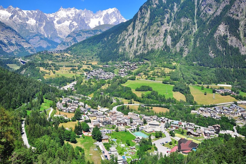
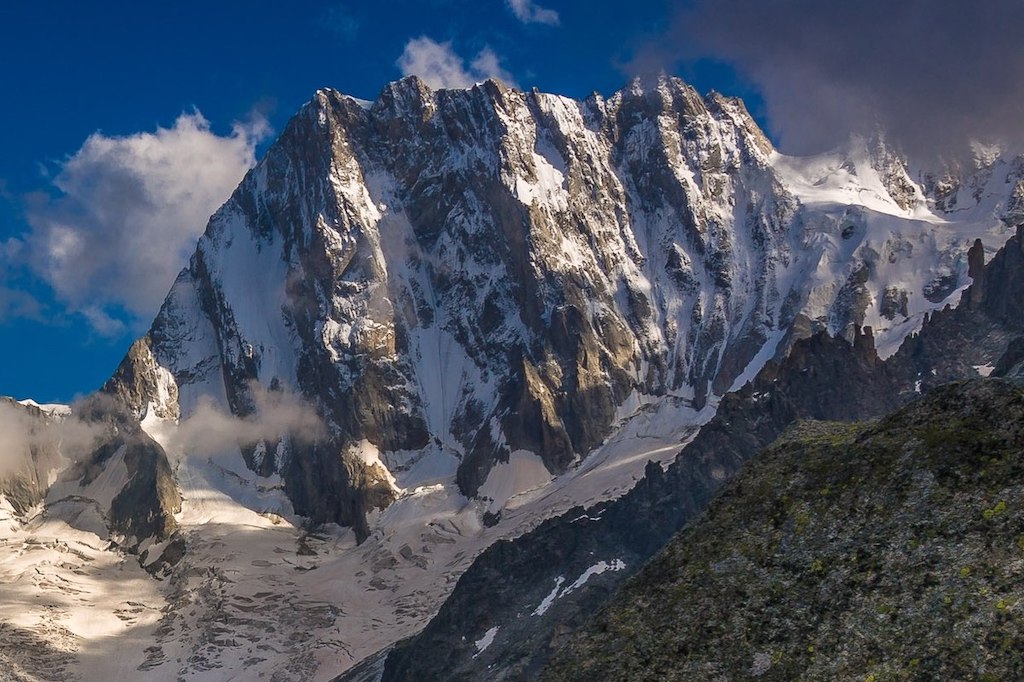
As we drive up the Aosta Valley towards the Mont Blanc, we first pass Pré-Saint-Didier with its thermal baths. But the full impact of Europe’s highest mountains can only be fully appreciated as we enter the Courmayeur basin (at 1,224 m) just before the Mont Blanc tunnel.
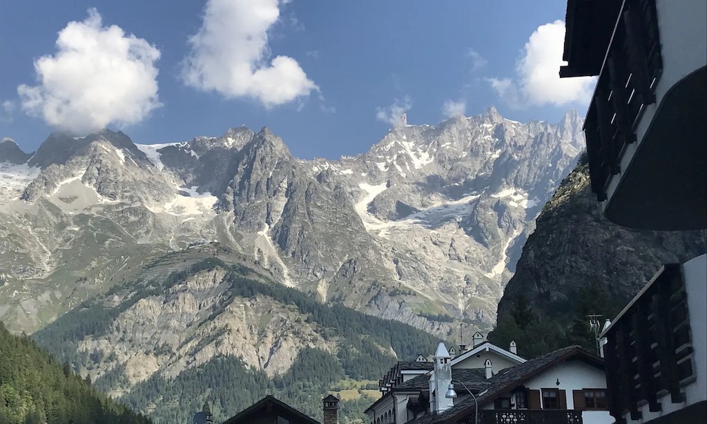
Driving beyond Courmayeur, and just before the tunnel, we can turn into the village La Palud and on to Val Ferret.
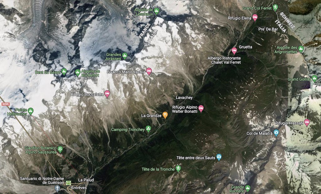
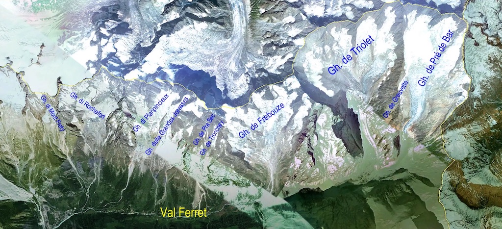
The name Val Ferret is shared by two valleys separated by the Col Ferret (2,543 m), a pass on the border between Italy and Switzerland. The valleys lie southeast of the Mont Blanc Massif. The Swiss valley drains northeast towards Orsières and on into the Rhône basin, whereas in the Italian valley, the Doire de Ferret, drains southwest towards Courmayeur and on into the Po basin.
The Tour du Mont Blanc
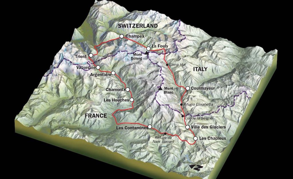
The two valleys are connected by a mountain footpath through Col Ferret (2,535 m) which forms part of the 170 kilometres circular Tour du Mont Blanc route (shown above and below).
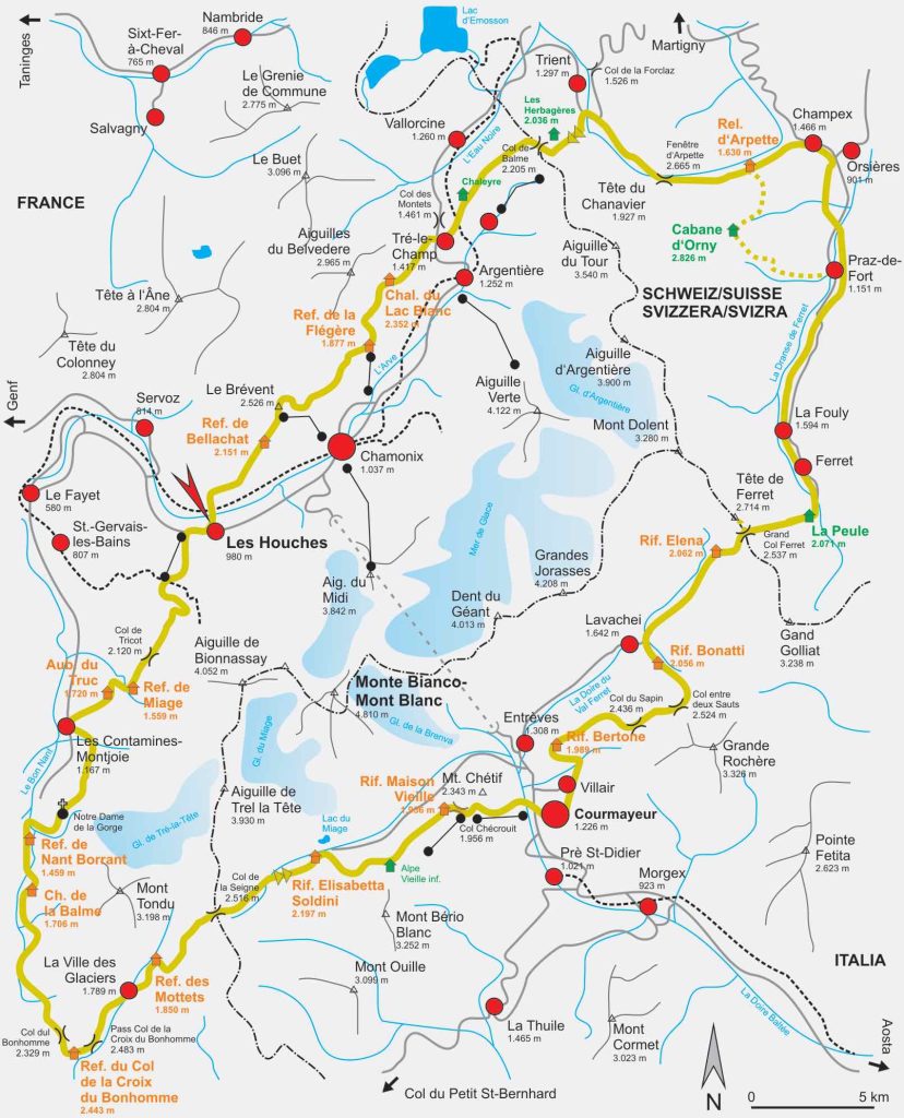
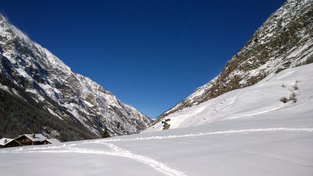
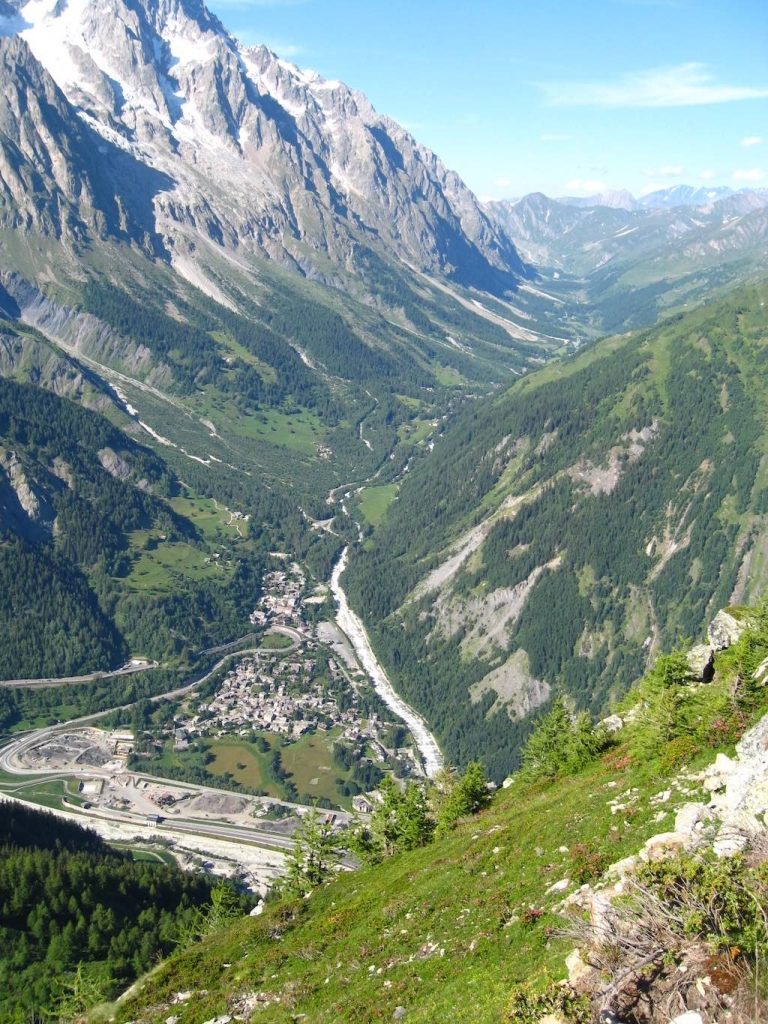
Below we have the view looking down the Italian portion of the valley toward the Mont Blanc.
We have driven up through the lower part of Val Ferret (up to Lavachey) many times. It is a very pleasant day out, and in the summer months you always see numerous family groups picnicking and quite a number of well-equipped walkers on the their way to the different refuges. However, the most impressive view, at least in the lower part of Val Ferret is that of the south face of the Grandes Jorasses (which at 4,208 m is “only” the 31st highest peak of the 82 Alpine peaks over 4,000 m).
Visiting the region in the summer it’s sometimes quite difficult to imagine it in the winter, and its important to remember that the average annual temperature in the Courmayeur basin (1,224 m) is -7.5°C, i.e. the average daily temperature only rises above 0°C in late April, and by November it has again dropped below zero.
Looking at the valley you can just about see that it progresses in a succession of steps from the village of La Palud to the Col Ferret, a distinctive trait of a glacial valley. Larch and pine forests cover both sides of Val Ferret up to an altitude of 1,750 m (on average). The right bank (in the above photo) has steep rocky sides that descend from the peaks of the Mont Blanc range to the valley floor at 1,400 m. This incredible drop of approximately 2,600 m is the perfect terrain for avalanches and debris flows. In fact, these natural hazards usually originate well above the timberline and are often associated with rockfalls and extreme precipitation events or, sometimes, to the partial collapses of glacier fronts (i.e. Grandes Jorasses and Planpincieux glaciers). These events flow over existing stream incisions, and their frequency effectively precludes the presence of forests in these areas.
The left bank, facing northwest, has more continuous forest cover, up to 2,000 m. On this side of the valley, the forest provides better protection from natural hazards, but despite the milder slopes, avalanche phenomena can still occur.
During the winter season, the Val Ferret road is open up to the village of Planpincieux, which is located at the entrance of the valley. From this little town, cross-country ski trails extend to the village of Lavachey, halfway up the valley. The end of Val Ferret is accessible only with ski mountaineering equipment. In all mountain areas, local avalanche risk management has always been of crucial importance, and along Val Ferret there are 80 different avalanche sites. By 2020 there were nearly 800 avalanche events recorded, fortunately less than 20 involved people.
In summer Val Ferret is entirely accessible. The municipal road is open up to the hamlet of Arp-Nouva, and side paths are available for mountain bikers and trekkers. Natural hazards that endanger the valley during summer are more rare, but are harder to forecast (i.e. debris flows) in comparison to the snow avalanches of the winter season.
Grandes Jorasses - North Face
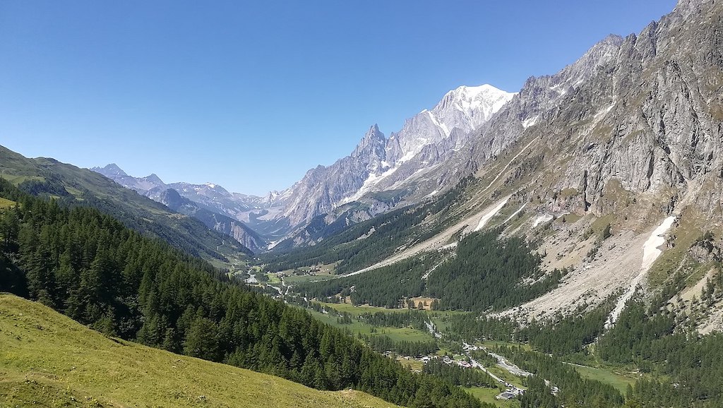
The north face, located on the French side of the mountain, is the most famous, being one of the three great north faces of the Alps, along with the north faces of the Eiger and the Matterhorn (known as “the Trilogy”).
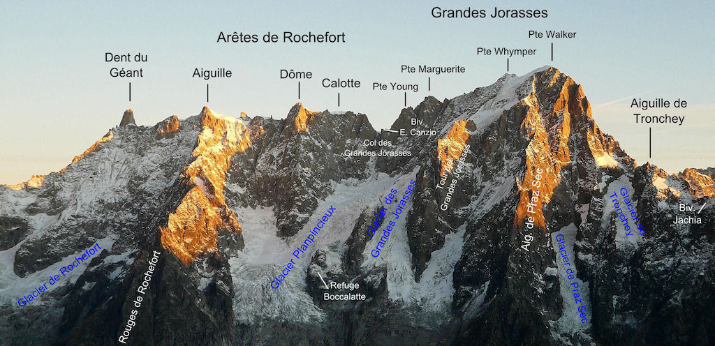
In fact what is called the Grandes Jorasses is actually a collection of summits, linked by a relatively regular ridge, 1 km long. Below we can see:-
- Pointe Walker (4208 m), named after Horace Walker, British Alpine Club’s president, who made the first ascension of this summit
- Pointe Whymper (4184 m), after Edward Whymper, the first climber and celebrated 19th century British mountaineer
- Pointe Croz (4110 m), after Michael Croz, the great Chamonix guide who accompanied Edward Whymper in many of its climb, and died in the Matterhorn tragedy of 1865
- Punta Elena/Hélene (4045m), after royal princess Elena of Savoia
- Punta Margherita (4066m), after the queen Margherita of Savoia, wife of then king of Italy Umberto I°
- Pointe Young (3996m) after Geoffrey Winthrop Young, a very strong British mountaineer of the early 20th century.
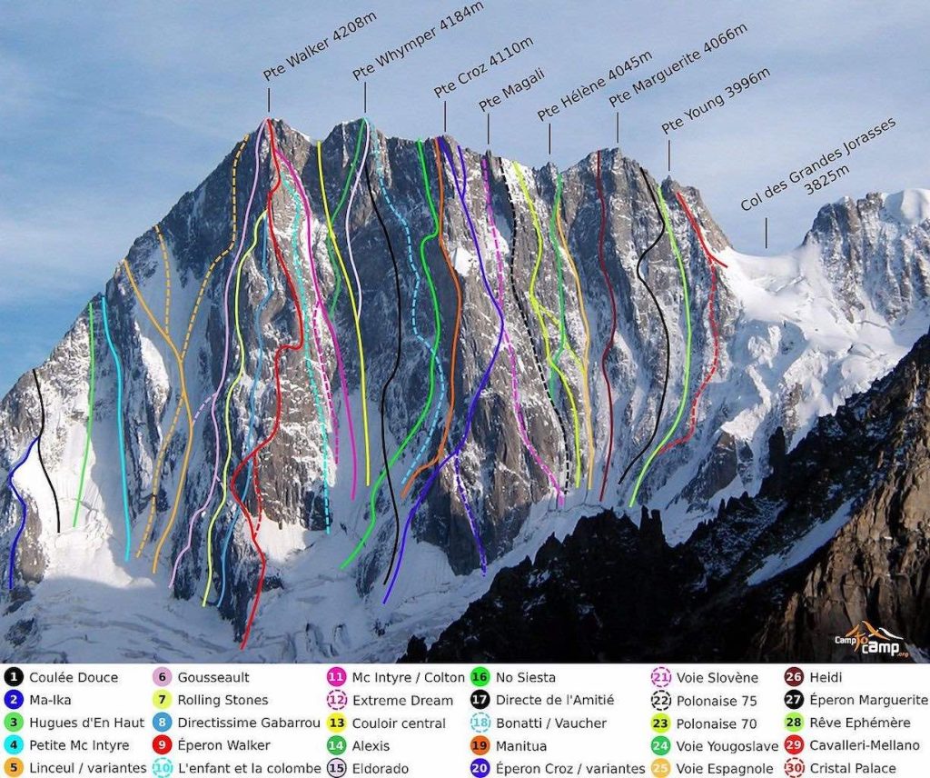
The north face of the Grandes Jorasses is one of the most famous walls in the Alps, towering 1200 m above the Leschaux Glacier, it stretches 1 km from end to end. The classic route on the face is the Walker Spur (N°9 Éperon Walker, Cassin/Esposito/Tizzoni, 1938, TD+/ED1, IV, 5c/6a, A1, 1200 m) which leads directly to the summit of Pointe Walker. The other major buttress on the mountain is the Croz Spur (N°20 Éperson Croz), which leads to the summit of Pointe Croz.
Above we see a route defined as “Cassin/Esposito/Tizzoni, 1938, TD+/ED1, IV, 5c/6a, A1, 1200 m”. According to Wikipedia climbing grades are as follows:-
Cassin/Esposito/Tizzoni – refers to Riccardo Cassin, Gino Esposito, and Ugo Tizzoni who completed the first ascent of the Walker Spur on August 6th 1938
TD+/ED1 – between very difficult and extremely difficult, with very steep to vertical snow and ice slopes
IV – major gullies with several difficult pitches and steep icefalls
5c/6a – a French numerical definition of difficulty (widely used in Europe) ranging from 1 (very easy) but open ended, and with subdivisions, a, b, and c, and an optional +
A1 – means specialist gear required but all placements are solid and easy.
Grandes Jorasses - South Face
On the Italian side of the Mont Blanc range, the south face of the Grandes Joresses can be accessed from the Boccalatte cabin, above the hamlet of Planpincieux. Below we can see the 32 different routes that have been opened on the south face.
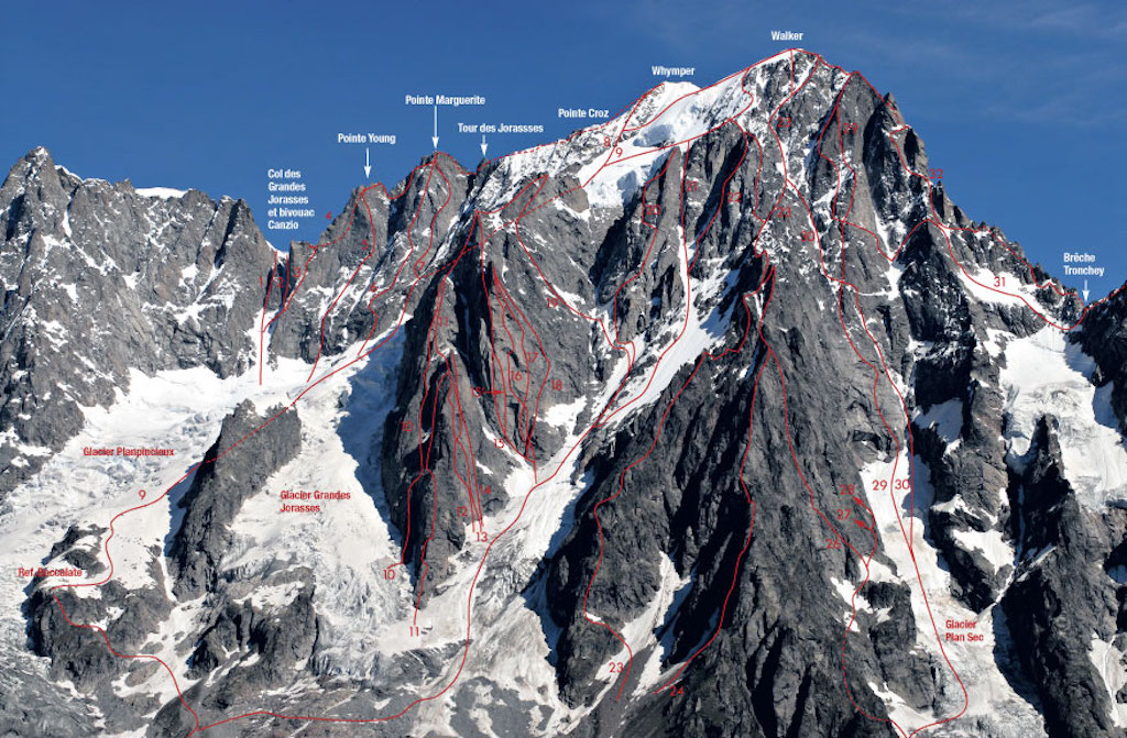
The south face of the Grandes Jorasses peak contains two steep glacial cirques, which form the accumulation zone of the Grandes Jorasses Glacier. The Whymper Serac, whose front is located at 3,800 m, forms the left cirque and is defined as an unbalanced cold hanging glacier.
When hanging glaciers are entirely located above equilibrium-line altitude, ice avalanching becomes the dominant form of glacial ablation. Morphological evidence and historical data indicate, in fact, that the Whymper Serac is progressively increasing in volume, reaching unstable geometries that are subject to recurrent breakoffs. The time between these collapse events ranges from a few years to more than a decade.
A collapse can also occur during the cold season, when it might easily trigger a large snow avalanche that could seriously threaten the buildings and the road located on the valley floor.
Four major collapse events have been well documented so far, namely August 1993, June 1998, September 2014 and November 2020. Unfortunately in the 1993 event, eight mountaineers that were climbing in the area are presumed to have lost their lives.
However avalanches can occur at almost any time, for example in December 1952, after an intensive snowfall, a huge avalanche was released below the Grandes Jorasses which destroyed a 200-year old forest and blocked the bottom of the Val Ferret over a distance of more than 1 km. The avalanche volume was estimated at more than 1 million cubic meters, but it is not clear what triggered the snow avalanche, possibly an ice avalanche from the Whymper glacier.
Recent work has been aimed at trying to predict avalanches. In this context, the Whymper glacier was known to have already broken off several times in the past, leading to major ice avalanches that occasionally reached the bottom of the valley. In autumn 2008, the glacier recovered its previous critical geometry from the year 1998 and again a critical crevasse appeared approximatively 100 m upstream from the frontal cliff. The glacier finally broke off causing no damage in autumn 2014, after more than 5 years of monitoring. The break-off event was successfully predicted 2 weeks in advance.
Below we can see the situation on 23 August 2014 (b), after the first breakoff on 23 September 2014 (c), and after the second breakoff on 30 September 2014. Total volume was estimated at 105,000 cubic meters.
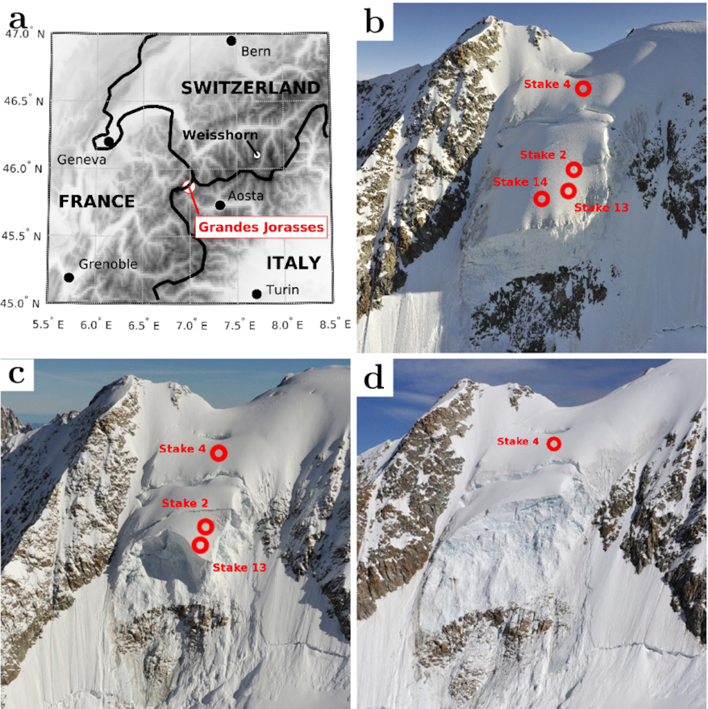
In 2020 15,000 cubic meters of ice and snow again detached from the Whymper Serac, but access to the region had been closed 24 hours before.
During our time living in Italy we were fortunate to know the Slesser family, with Malcolm Slesser claiming that he would try to climb all the peaks in the Alps that he had not already visited “before it was too late”. I remember him often disappearing into the Italian Alps to complete one or other climb on the Grandes Jorasses, Monte Bianco, Matterhorn, etc.
Golf de Courmayeur & Grandes Jurasses
There is also a golf club situated in Val Ferret under the Grandes Jurasses, and during our different visits to the valley we have often lunched there (and also played the occasional round of golf).
The golf course was born in 1935 from the project of Peter Gannon and Henry Cotton, and today is a nine-hole course with double tee locations (PAR 70, men 5,508 m, women 4,791 m).
Peter “Pedro” Gannon (1874-1940) was born in Buenos Aires of Irish parents, and became known as a Roman Catholic priest and golf course architect. In 1901 Peter Gannon was ordained a priest in London, and was appointed secretary to the bishop of Plymouth. In 1908 Gannon was runner-up at the South of Ireland championship at Lahinch, and the next year he was asked to redesign the Old Course at Karlovy Vary, Carlsbad, after winning the championship of Austria. In 1910 the left-handed Fr. Gannon won the French and the Italian amateur championships. He abandoned the religious life and in 1912-1913 settled in St. Moritz, Switzerland, and got married. Peter Gannon won the amateur championships of Switzerland in 1911 and 1923, and the amateur golf championship of Italy. He is remembered for designing some first-class golf courses in Europe, among them, Milano, San Remo, Villa d’Este, and Florence in Italy, Baden-Baden in Germany, as well as others in Switzerland and France. He moved to South Africa and died in or about 1940.
One list confirmed that Henry Cotton was also involved in the design of Courmayeur golf course, but it’s not clear if the two designers worked together. Another source quotes “The path was born in the thirties on a project by the Englishman Peter Gannon, and was revised in the forties by Henry Cotton, thanks to the far-sighted merit of the Gilberti family”. It was Lorenzo Bertolini who built a luxury hotel in Courmayeur, and later it was the Gilberti family from Milan who took over what is today called The Grand Hotel Royal and Golf.
Count Giovanni Battista Gilberti – (Titta for friends) was born in Milan on June 15, 1913. His family had been staying in Courmayeur since 1908. Passionate mountaineer and skier, pioneer of tourism and ski development in Courmayeur, his name is linked forever to this small Alpine town which under his leadership has become a modern winter resort. In 1957 the Count bought the shares of the Monte Bianco Company from Count Lora Totino, becoming the majority shareholder and President of the Company, owner of the cableways. From that moment the Gilberti family has become the main protagonist of the tourist development of Courmayeur.
A word of warning
As I mentioned above, Val Ferret makes for a very pleasant day out, but a word of warning.
The weather can change very quickly and the environment can become dangerous. On the afternoon of the August 6, 2018 the valley was full of tourists when a violent storm hit the area, causing landslides. One of the landslides broke off in Planpinceux (well before Camping Tronchey) and invaded the only road running though the valley. Unfortunately a man died in his car, when it was hit and dragged away by the mass of mud and debris. His wife was found the next morning under the car.
The lower part of the valley was evacuated using a convoy of cars escorted by the police, and about one hundred tourists in the upper part of the valley had to spend the night at the golf club. Along with those living or staying in the valley approximately 250 people had to be evacuated by helicopter the next day.
It took more than ten days to remove the approximately 25,000 cubic meters of debris that had collapsed downstream. In addition about 700 m of the valley river-bed needed to be cleaned up and repaired. In fact, this landslide was quite small, since it has been estimated that the whole wall could collapse with an estimated volume of anything between 400,000 and 8.3 million cubic meters.