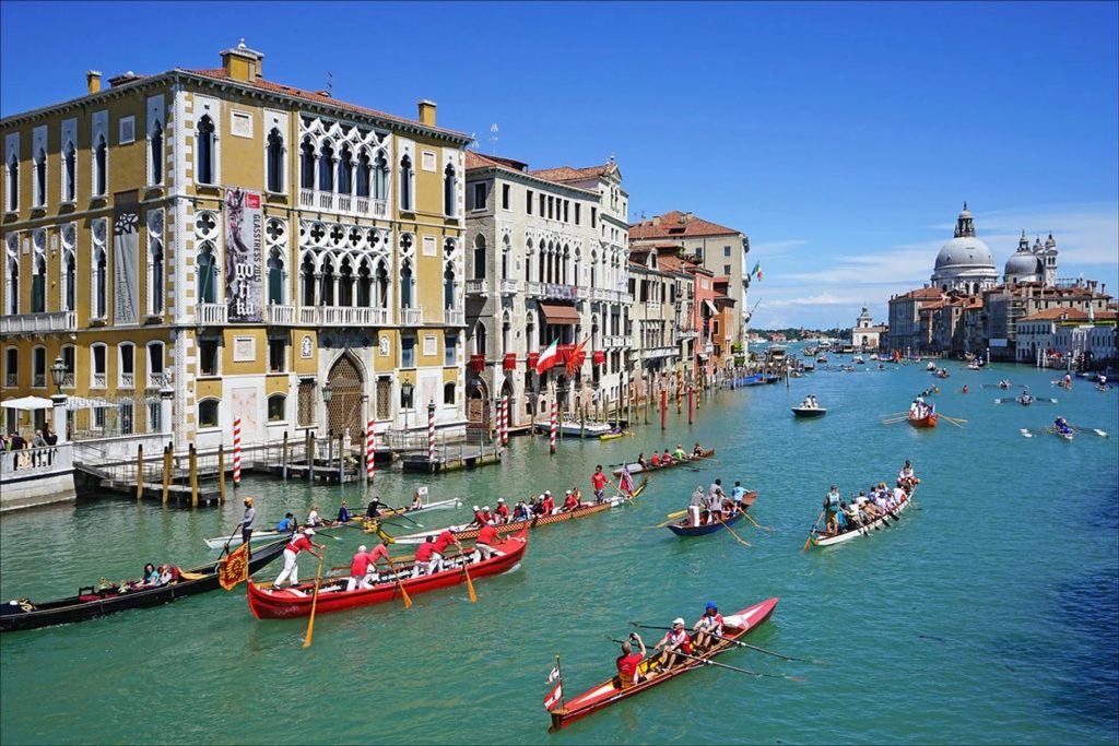
My collection on Cádiz includes Cádiz I, Cádiz – II, Cádiz – Today, Cádiz – Maps, Models and the Camera Obscura (this posting), Cádiz – El Centro, Cádiz – El Pópolo, Cádiz – El Mentidero, Cádiz – San Carlos, Cádiz – Nochebuena and Nochevieja, and Cádiz – Trafalgar.
On this page we start with a collection of maps of Cádiz from 1569 through to 1921. Then we visit a wonderful large-scale wooden model of the city. We then go to see a camera obscura in the Torre Tavira, which is a great place to see the whole city-scape.
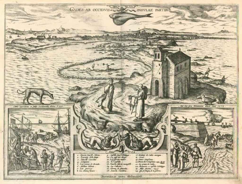
Gades ab Occiduis Insulae Partibus (a view of Cádiz seen from the western parts of the island) by Braun & Hogenberg, dated 1596 (and with two inset vignettes, dated 1564). On the back is written “Here can be seen in particular the skill of the inhabitants of Cádiz at catching fish. They wall off part of the sea with stones and rocks piled on top of each other, so that when the tide goes out they cannot escape and they can be caught very easily, even without a net, with the hands”.
The plate shows Cádiz seen across the narrow peninsula from the Atlantic. In the foreground stands the chapel of St Sebastian. A group of fishermen have been included in order to illustrate the fishing method described in the text. Also visible above the key is the figure of Hercules, the legendary founder of the city, subduing the Nemean Lion – in this instance there are even two lions. On the left, is a picture within a picture, showing crews being enrolled for service on the galleys by the method of casting lots, and subsequently being taken on board. A bastion is included on the right as a symbol of Cádiz’s military importance.
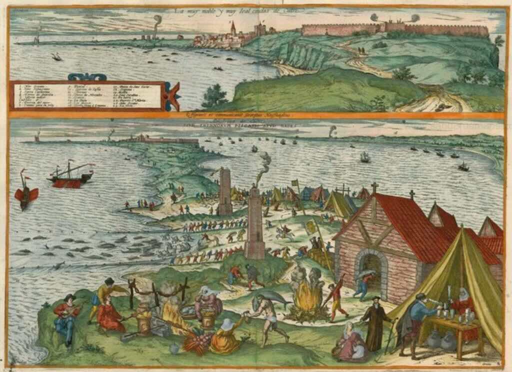
La muy noble y muy leal cividas de Cadiz, is another engraving from Braun & Hogenberg, dated 1598. This time taken from their Great Cities Atlas “Civitates Orbis Terrarum” (Part 5).
In the upper picture, Cádiz is shown from the southeast, with the chapel of St Sebastian on the far left and the city ramparts on the right (remember later Cádiz would build a Castillo de San Sebastián). The upper view is presented from a greater distance, so that the entire Bay of Cádiz is visible. In the lower view, the city itself forms merely the backdrop to the illustrations of Cádiz’s tuna-fishing industry. The artist records in detail how the fish are caught, cooked and packed and how the waste is incinerated. The watchtowers were primarily designed to protect the city from pirates (Cádiz was pillaged by pirates several times in the 16th century), but were also useful for observing the schools of fish.
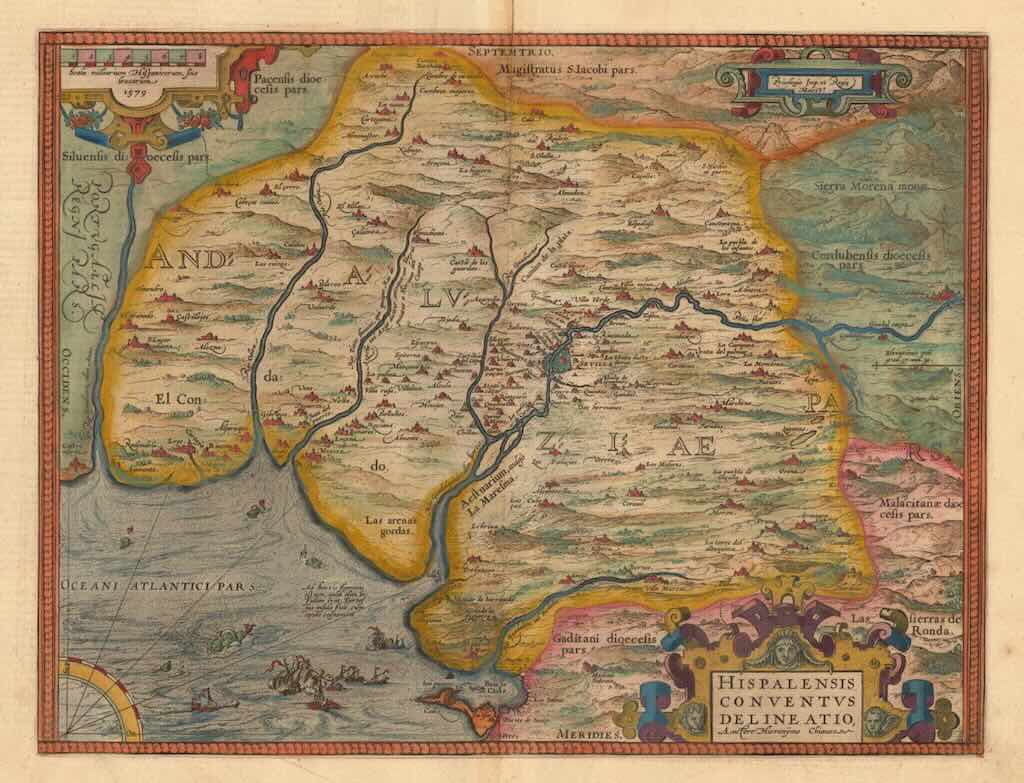
Hispalensis Conventus Delineatio, Auctore Hieronymo Chiaues (a map of Andalusia) by Abraham Ortelius, published in Antwerp in 1598. It was part of a French edition of the “Theatrum Orbis Terrarum”. Villages and towns are shown as miniature views, moreover the map is ornate with ships, sea monsters and animals, as well a compass rose in the sea.
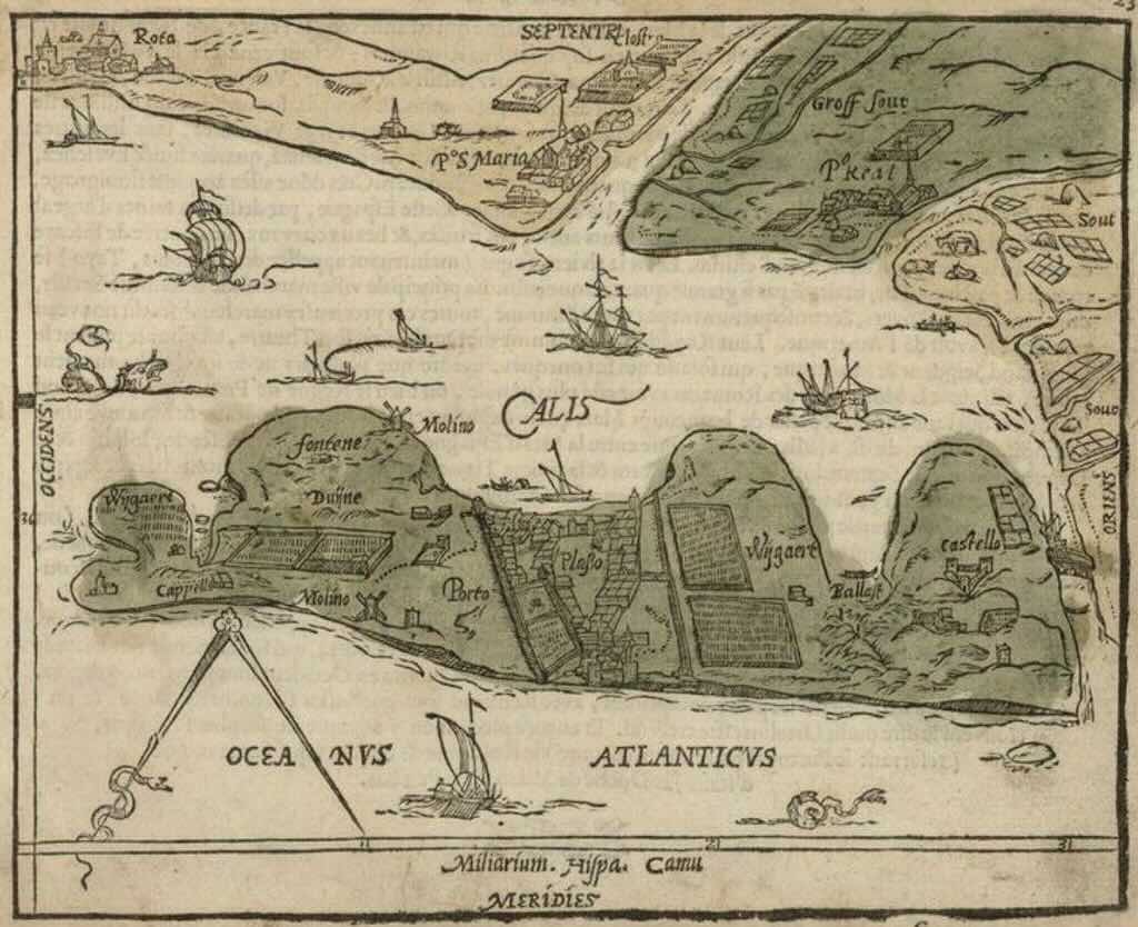
This is a rare 16th century map of the Cádiz, published by Zacharias Heyns in his Le Miroir du Monde, from Amsterdam in 1598.
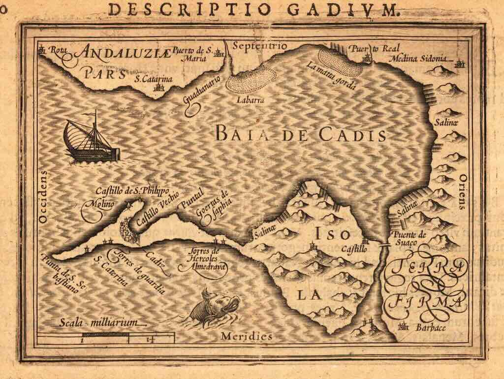
Descriptio Gadium, by Petrus Bertius and published in Amsterdam, 1630-44
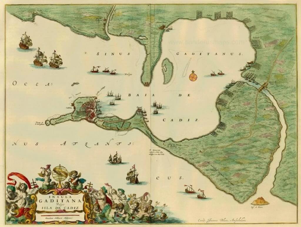
Insula Gaditana, Vulgo Isla de Cadiz, by Joan Blaeu and published in Amsterdam in 1664. Taken from the Grooten Atlas, oft Werelt-Beschryving.
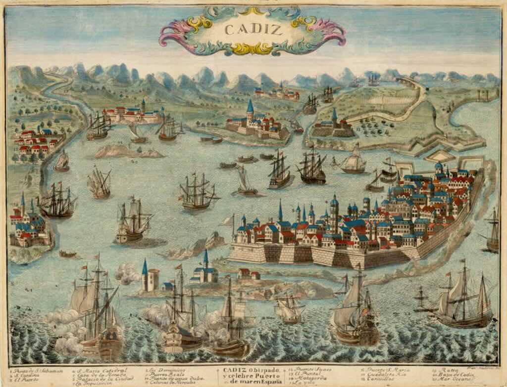
Cádiz by Francesco Ambrosi, and published in Vicenza around 1680. At the time Cádiz was the premier base of the Armada Real, the Spanish Navy. The heavily fortified city is shown to occupy a small island, and is surrounded by a harbour bustling with innumerable naval frigates and trading vessels. The key, located beneath the view identifies 21 points of interest.
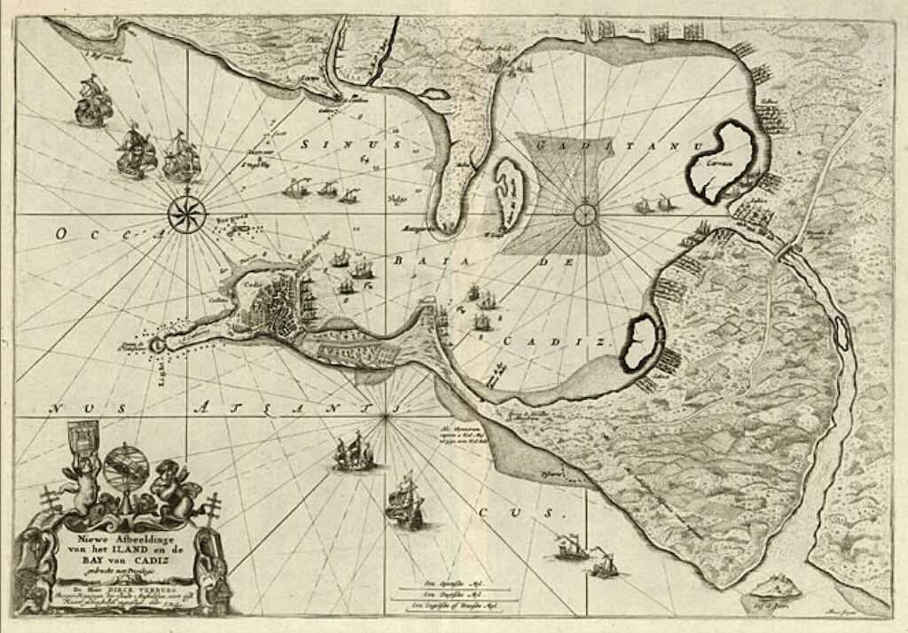
Nïewe Afbeeldinge van het Iland en de Bay van Cadiz, by Jacob Robyn and published in Amsterdam in 1683. Cádiz was at the time the primary Spanish sea port. The map includes many sailing ships, a compass rose, a plan of the city of Cádiz and soundings, rhumb lines and other details.
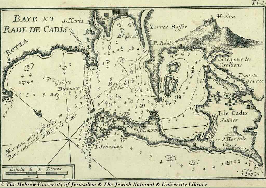
Baye et Rade de Cadis, by Joseph Roux and published in Marseille in 1764.
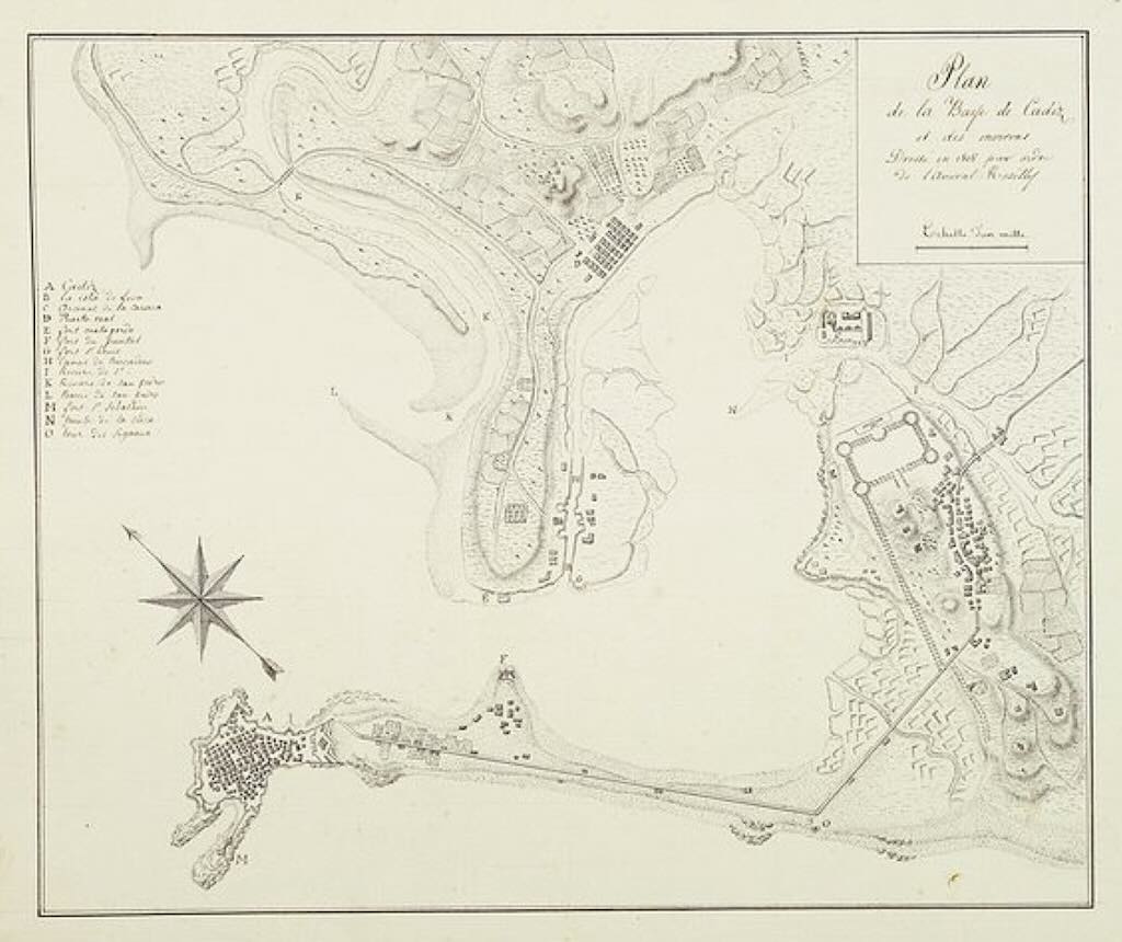
Plan de la baye de Cadiz et des environs, published anonymously in 1808. The capture of the Rosily Squadron took place on 14 June 1808, in Cádiz, Spain, nearly three years after the Battle of Trafalgar, when the Spanish had risen against the French invaders. Five French ships of the line and a frigate were also still in the port and had remained there since that British victory. Admiral Rosily, after an engagement with the Spanish lasting five days, surrendered his entire squadron with the four thousand seamen then on board.
Immediately after the surrender of the French fleet, the Spanish Supreme Junta requested the British give passage in one of their vessels for the purpose of negotiating with the Government of his Britannic Majesty for an alliance against Napoleon.

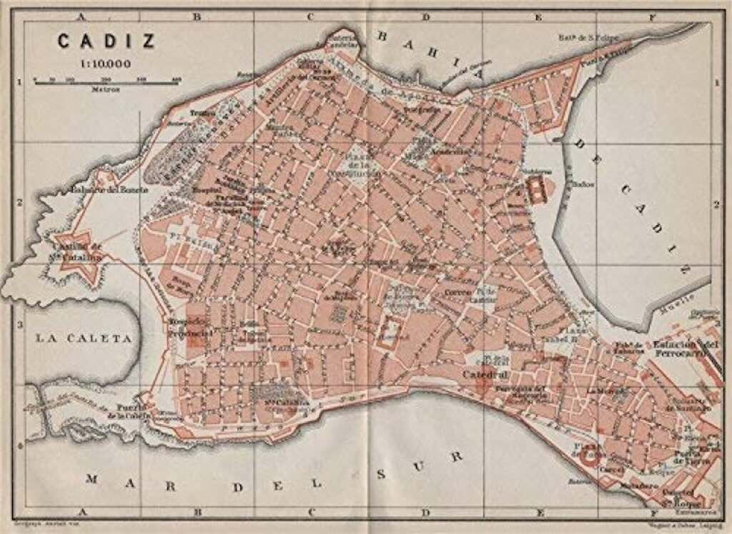
Cádix from “Les Guides Bleus” published by Librairie Hachette, Paris in 1921.
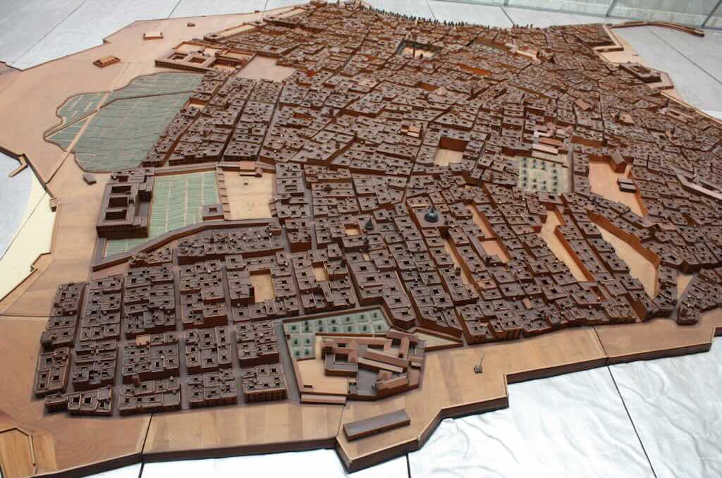
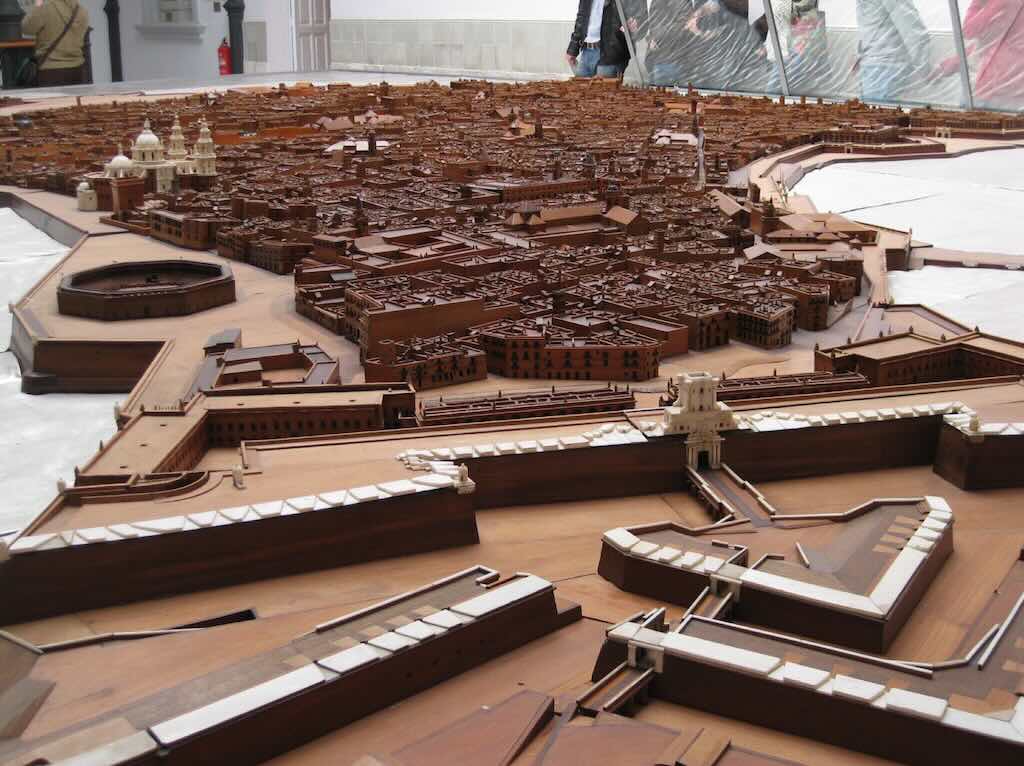
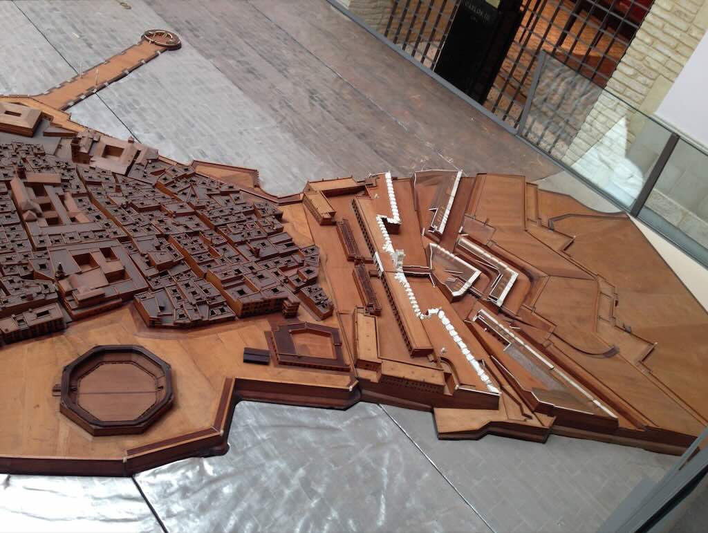
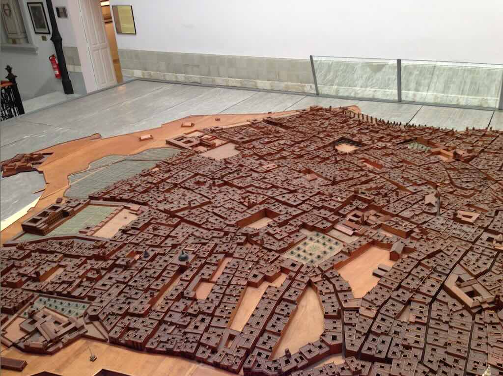
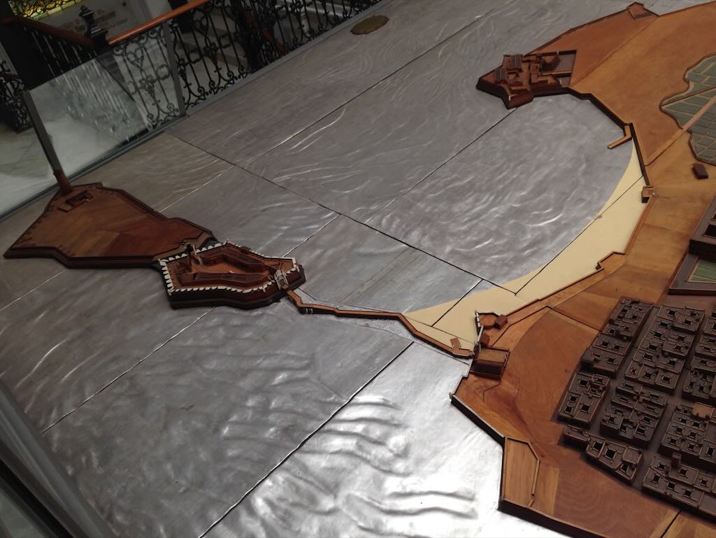
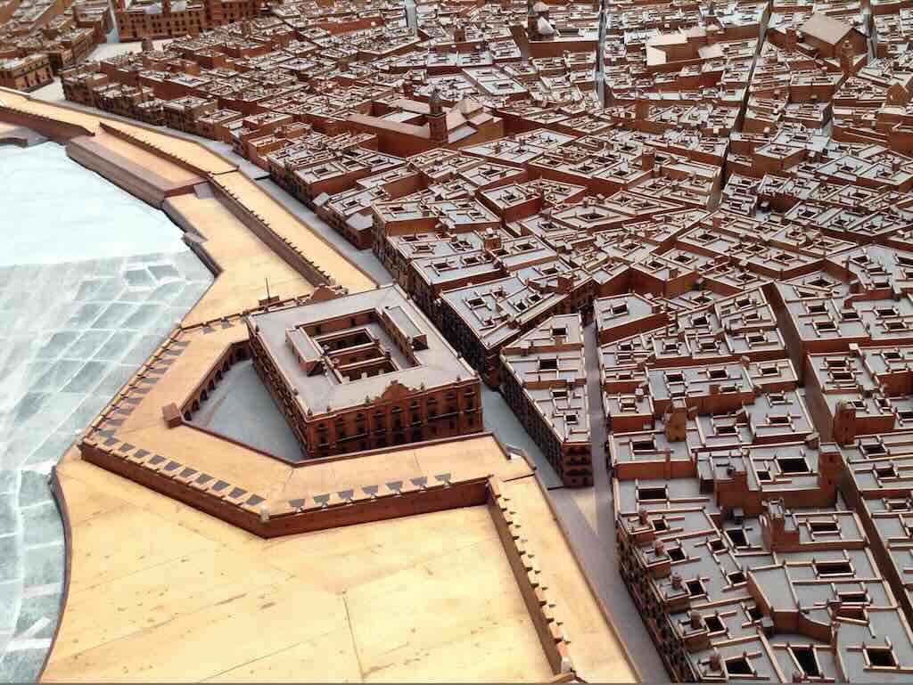
We are going to move from the maps of Cádiz to a wooden model of the city. In the centre of the city there is the Museo de las Cortes de Cádiz. And in that museum there is a very large wooden model of city made in 1777. We will now visit this model.
Below we can see the city from the south, with Playa de la Caleta to the west (on the left) and the Bay of Cádiz to the east (on the right).

Above we are looking at the city from the south-east towards the north-west. You see the massive defences with the Puerta de Tierra in the foreground, and the bull-ring and cathedral. Below we have a slightly different view with the barrio Santa María next to the entrance to the city.

Above we are looking at the city directly from the South. You can see the cathedral, at the heart of the barrio El Pópolo. And the barrio San Juan starts along the West wall of the cathedral.
Below we have on the South side the barrio San Juan and the barrio La Viña. To the West we can just see Playa de la Caleta and we can see the large building (the Hospicio) in front of the beach (this is still in the barrio La Viña). Next we have the barrio El Balón, and we can see the large area still left at that time as orchards and open land. We can also just see the Castillo de Santa Maria. Over on the North side we can just see some small trees marking the formal gardens of the Alameda Apodaca in the barrio El Mentidero.
Above we are looking over the West side of the city and the Playa de la Caleta. We can see clearly the Castillo de San Sebastián, and the long walkway (Paseo Fernando Quiñones).
Below we have the North side of the city. We can see in the distance the Ayuntamento with the empty Plaza San Juan de Dios in front of it. In front of us we can see the fortifications and the la Aduana (customs building) that was completed in 1784. Of course this whole coast line was modified to create Plaza de España, the gardens of the Paseo de Canalejas, and the new port.
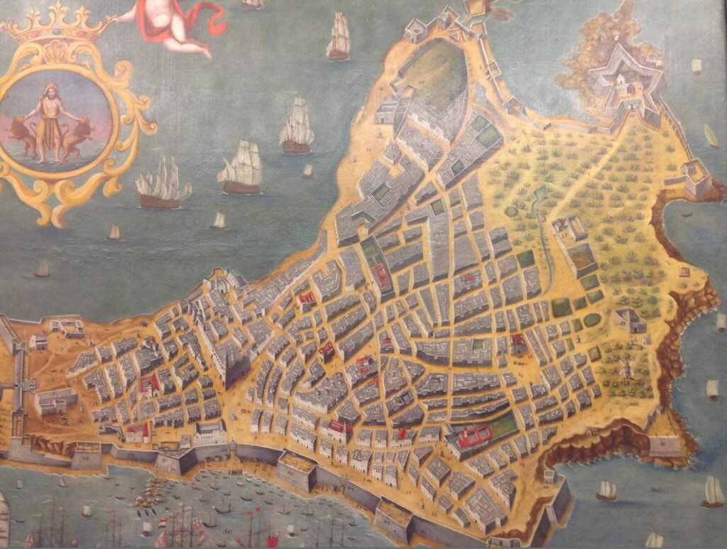
The idea to create this model (and the workmanship involved) was brilliant, since below we have an example of the alternative. It is painting of the city from 1647, and was actually used for planning purposes.
We are now going to move into the present day, even if we are going to use a very old technique to do so. In fact in the centre of the city there is an old house with a tower (Torre Tavira), in which they have installed a camera obscura. It is not possible to take photographs of the actual instrument, but the roof of the tower provides a great place to see the whole city.
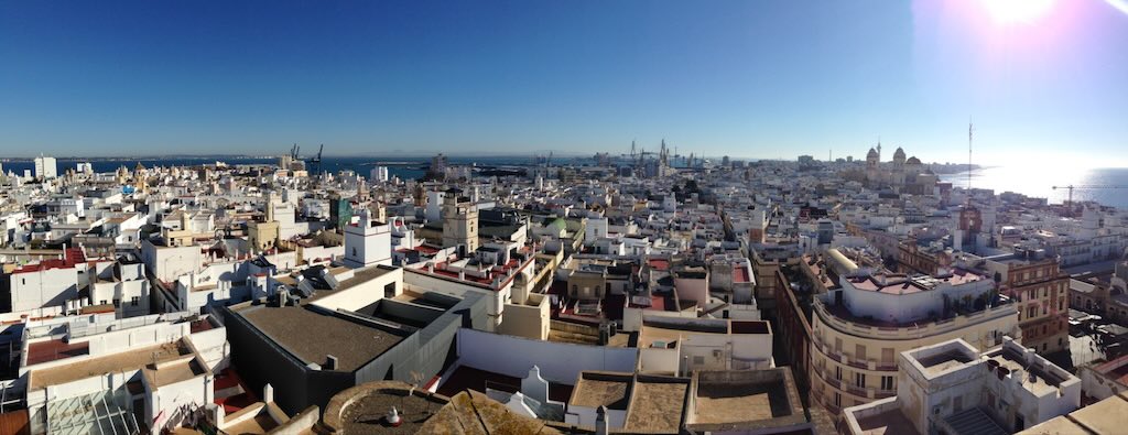
Above we are looking north-east, and we can see apartment blocks sitting near Plaza de España.
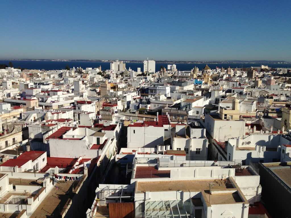
Below we are looking west and we can see some apartment blocks hiding the Castillo de Santa Catalina, and also we can see straight in front of us C/Sacramento leading to the Parador, Hotel Atlantico.
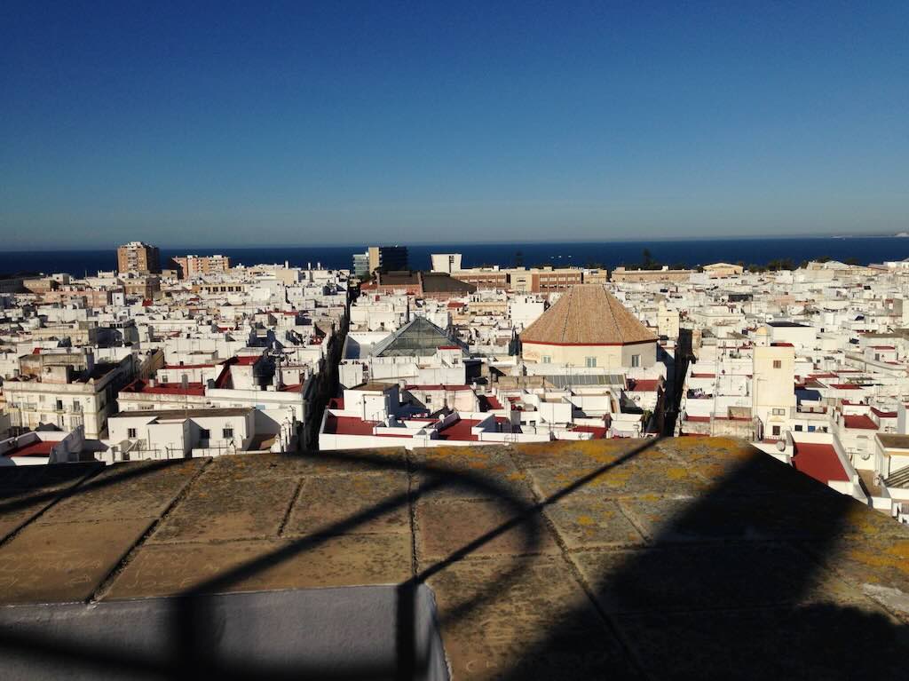
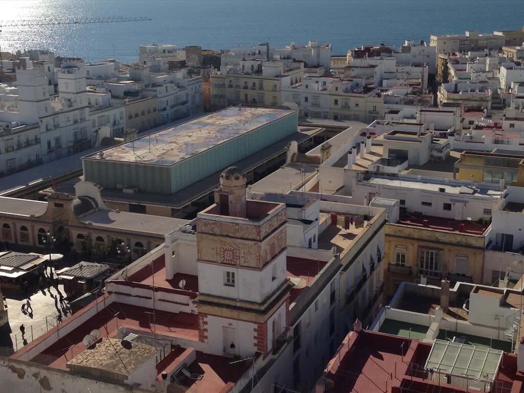
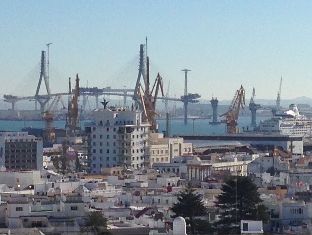
These last two photographs show (firstly) the roof of the Mercado Central, and then the new bridge being built. The so-called Puente de La Pepa (officially called Puente de la Constitution de 1821) crosses the Bay of Cádiz joining Cádiz with Puerto Real. The bridge was still in construction during our visit, and was only opened in September 2015.