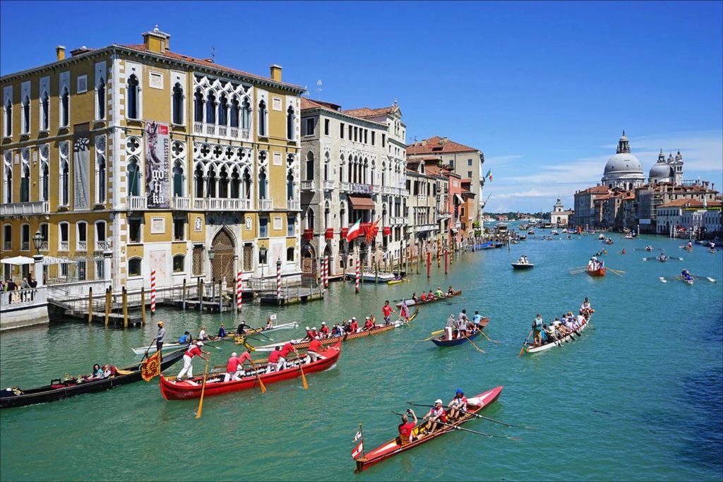
In this post I’m going to rapidly look at stamps from North Africa. I’m not a stamp collector, but I have accumulated quite a collection of stamps over the years, and recently I’ve started to arrangement them all in stock books for safe keeping (although I don’t have any valuable stamps).
My collection of North African stamps was recently enriched by a number of old albums purchased on eBay, each for a few euros (the postage often cost more than the album). I have made no targeted effort to buy or collect stamps from North Africa.
Countries of North Africa

I’ve adopted from Wikipedia the most common definition for the region, which includes Algeria, Egypt, Libya, Morocco, Tunisia, and Western Sahara (a territory disputed between Morocco and the partially recognised Sahrawi Arab Democratic Republic).
I don’t include the Spanish cities of Ceuta and Melilla, and the plazas de soberanía. Nor do I include Malta, Lampedusa and Lampione, the Azores and Madeira, and the Canary Islands.
Algeria, Libya, Morocco, Tunisia and the disputed territory of Western Sahara, are part of the Maghreb. Egypt (along with Sudan), is in the Mashriq, the eastern part of the Arab world.
North Africa has three main geographic features. The Atlas Mountains in the west, the Nile River and delta in the east, and the Sahara desert, which covers more than 75% of the region.
The largest and most numerous ethnic group in North Africa are the Arabs, and all the countries have Modern Standard Arabic as their official language. The region is predominantly Muslim, but is also home to Jewish and Copt minorities.
Algeria
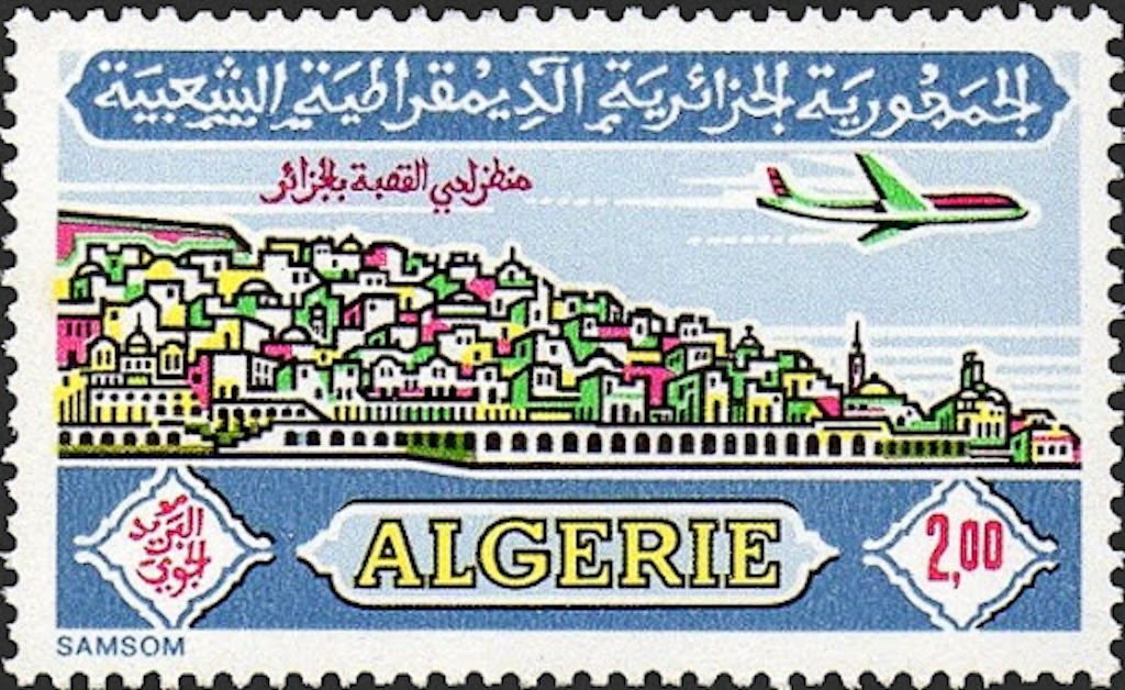
The People’s Democratic Republic of Algeria, is considered part of the Maghreb region of North Africa. It has a semi-arid climate, with most of the population living in the fertile north and the Sahara dominating the geography of the south. It is the world’s tenth largest nation by area, and the largest nation in Africa. However, with a population of 44 million, Algeria is only the tenth-most populous country in Africa. The capital and largest city is Algiers, located in the far north on the Mediterranean coast.
Algeria’s name derives from the city of Algiers which in turn derives from the Arabic al-Jazāʾir (“the islands”) in reference to four small islands off its coast.
The country was invaded by the French in 1830. The conquest and subsequent pacification of the country lasted until 1903 and led to Algeria becoming an integral part of France in 1848 and home to over a million European settlers. The Sétif and Guelma massacre in 1945 marked a turning point in Franco-Algerian relations and sparked the Algerian War which concluded with Algeria gaining its independence on 5 July 1962 and the proclamation of the People’s Democratic Republic on 25 September of that year.
The official languages of Algeria are Arabic and Tamazight. The majority of Algeria’s population is Arab, and almost everyone follows Sunni Islam of the Maliki school of jurisprudence. The native Algerian Arabic is the main spoken language. French also serves as an administrative and educational language in some contexts, but it has no official status.
Algeria is a semi-presidential republic, with local constituencies consisting of 58 provinces, known locally as wilayas, and 1,541 communes. Algeria has the world’s sixteenth-largest oil reserves and the ninth-largest reserves of natural gas.
The dinar is the monetary currency of Algeria and it is subdivided into 100 centimes (however, centimes are now obsolete due to their extremely low value).
Wikipedia has a webpage on “Postage stamps and postal history of Algeria“, where we learn that postage stamps were first issued in 1849. Beginning in 1924, French stamps were overprinted “ALGÉRIE”, but in 1926 they were superseded by the first stamps inscribed for Algeria.
I have more than 700 stamps from Algeria (with very few duplicates). My earliest stamp dates from 1924, and continues through to 2017.
Facts about Algeria
National colours – Green, white and red
National animal – Fennec fox (Vulpes zerda)
National bird – Barbary partridge (Alectoris Barbara) and/or Algerian nuthatch (Sitta ledanti)
National tree – Algerian oak (Quercus canariensis)
National flower – Blue Iris (Iris spuria maritima)
National food – couscous, rechta
National fruit – Dates (Phoenix dactylifera)
National dance – Chaabi
National sport – Football (most popular)
Football nickname – The Greens, The Fennec Foxes or The Desert Warriors
Highest mountain – Mount Tahat (2,908 m)
Algeria - French Committee of National Liberation
The French Committee of National Liberation was a provisional government of Free France formed by the French generals Henri Giraud and Charles de Gaulle to provide united leadership, organise and coordinate the campaign to liberate France from Nazi Germany during World War II. The committee was formed in June 1943 and both challenged the legitimacy of the Vichy regime and unified all the French forces that fought against the Nazis and collaborators. The committee also functioned as a provisional government for Algeria (then a part of metropolitan France) and the liberated parts of the colonial empire.
check https://www.stampdomain.com/country/algeria/
Egypt
The Arab Republic of Egypt, is a transcontinental country spanning the northeast corner of Africa and the Sinai Peninsula in the southwest corner of Asia. Cairo is the capital and largest city of Egypt, while Alexandria, the second-largest city, is an important industrial and tourist hub at the Mediterranean coast. At approximately 100 million inhabitants, Egypt is the 14th-most populated country in the world, and the third-most populated in Africa.
The country was occupied by the British Empire in 1867, and gained independence in 1922 as a monarchy. Following the 1952 revolution, Egypt declared itself a republic, and in 1958 it merged with Syria to form the United Arab Republic, which was dissolved in 1961. Egypt’s current government is a semi-presidential republic, with Islam as its official religion and Arabic its official language. Between 85-95% of the population are Sunni Muslim, with the next largest religious group being Coptic Orthodox Christians (5-15%).
“Miṣr” is the Classical Quranic Arabic and modern official name of Egypt, while “Maṣr” is the local pronunciation in Egyptian Arabic. The English name “Egypt” is derived from the Ancient Greek “Aígyptos” (“Αἴγυπτος“), via Middle French “Egypte” and Latin “Aegyptus“. The ancient Egyptian name of the country was 𓆎𓅓𓏏𓊖 (km.t), which meant black land, likely referring to the fertile black soils of the Nile flood plains, distinct from the deshret or “red land” of the desert.
The Egyptian pound (£, E£, £E, LE or EGP) is the official currency of Egypt. It is divided into 100 piastres, or qirsh (PT for “piastre tarif”), or 1,000 milliemes, but milliemes are no longer used.
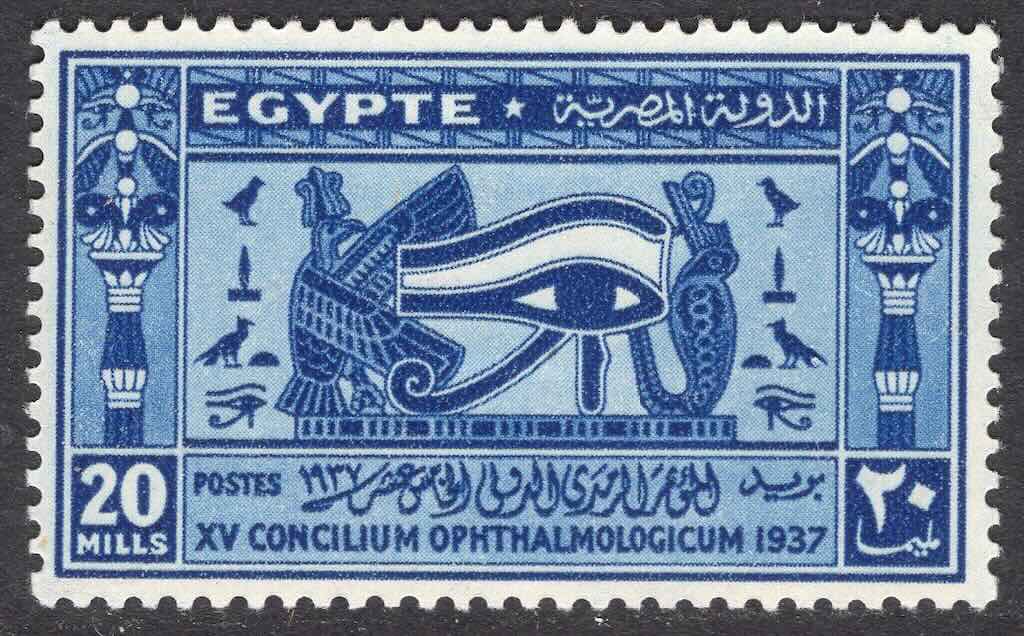
Wikipedia has a webpage on “Postage stamps and postal history of Egypt“, where we learn that postage stamps were first issued in 1866.
I have about XXX stamps from Egypt (more than half are duplicates), but almost no multicolour commemoratives. My earliest stamp dates from 18XX, and I have virtually no stamps after the early 60s.
Facts about Egypt
National colours – Red, white and black
National animal – Steppe eagle (national bird)
National bird – Steppe eagle (Aquila nipalensis)
National tree – Doum palm (Hyphaene thebaica)
National flower – Nymphaea lotus
National food – ful medames, kushari, molokhiya, taʿamiya
National drink – Black tea, Sugarcane juice
National fruit – Banana
National dance – Raqs sharqi and Raqs baladi
National sport – X (most popular)
Football nickname – The Pharaohs
Highest mountain – Mount Catherine (locally known as Gabal Katrîne is 2,629 m)
The French post offices in Egypt were a system of post offices maintained by France in Egypt during the 19th century and the early years of the 20th century. They were primarily intended to facilitate commercial and trading interests that needed to communicate between France and points east.
The post offices were located at Alexandria, Cairo, Suez and Port Said. However, the first postage stamps overprinted or inscribed “ALEXANDRIE” or “PORT-SAID” only appeared in 1899.
A British Army commander was appointed in the late 19th century after the Anglo-Egyptian War in 1882. The British Army remained in Egypt throughout the First World War and, after the War, remained there to protect the Suez Canal. Following Egypt’s independence in 1922, the United Kingdom and Egypt entered into a treaty in 1936 whereby British troops remained to protect the canal and to train the Egyptian Army.
United Arab Republic (UAR) - 1958-71
The United Arab Republic (UAR) was a sovereign state in the Middle East from 1958 until 1961. It was initially a political union between Egypt (including the occupied Gaza Strip) and Syria from 1958 until Syria seceded from the union following the 1961 Syrian coup d’état. Egypt continued to be known officially as the United Arab Republic until September 1971.
United Arab States (UAS) - 1958-61
The United Arab States (UAS) was a short-lived confederation of the United Arab Republic (Egypt and Syria) and the Mutawakkilite Kingdom of Yemen (North Yemen) from 1958 to 1961.
Federation of Arab Republics (FAR) - 1972-77
The Federation of Arab Republics (FAR) was an unsuccessful attempt to merge Libya, Egypt and Syria in order to create a unified Arab state. Although approved by a referendum in each country on 1 September 1971, the three countries disagreed on the specific terms of the merger. The federation lasted from 1 January 1972 to 19 November 1977.
Egyptian Occ. of Palestine (1949-59) and UAR Occ. (1958-71)
The 1949 Armistice Agreements, which ended the 1948 Arab–Israeli War by delineating the Green Line as the legal boundary between Israel and the Arab countries, left the Kingdom of Egypt in control of a small swath of territory that it had captured and occupied in the former British Mandate for Palestine (the Gaza Strip). The All-Palestine Protectorate was an Egyptian client state that lasted until 1959, a year after the Republic of Egypt and the Second Syrian Republic merged to form a single sovereign state known as the United Arab Republic. The Egyptian occupation of the Gaza Strip was briefly subsumed by Israel during the 1956 Suez Crisis and ended entirely during the 1967 Arab–Israeli War.
The following is taken from the article “Visualizing Palestine in Arab postage stamps: 1948-1967“. From 1948 to 1967, most Arab stamp depicted Palestine with the borders that existed during the British Mandate (1922-1948), from the Jordan River to the Mediterranean Sea. These borders conveyed Arab support for the Palestine cause, the right for Palestinians to return to what became Israel in 1948, and strengthen the Arab propaganda war against Israel by rejecting its right to exist. Occasionally Egypt, Jordan and Saudi Arabia deviate from these portrayals by delineating the Gaza Strip and excluding the West Bank from Palestine. Arab stamp depictions of the Palestine’s borders from 1948 to 1967 fluctuated because the territories became social constructs by the Arab regimes. Nasser’s Egypt depicted Gaza as part of the imagined ‘Arab nation’, Jordan recognised the West Bank as integral to the Hashemite Kingdom and a temporary deposit until the liberation of Palestine, and all Arab states recognised that Gaza and the West Bank had once comprised part of British Mandatory Palestine.
As far as I can see postage stamps were initially Egyptian stamps, then UAR stamps, over-printed with the word “Palestine”, and from 1960-61 until 1967 UAR postage stamps would have the word “Palestine” integrated into the stamp design.
Libya
The State of Libya is a country in the Maghreb region of North Africa, and is the fourth-largest country in Africa and the Arab world, and the 16th-largest in the world. The country’s official religion is Islam (96.6% Sunni Muslims). The majority of Libya’s population is Arab, and the official language is Arabic, with vernacular Libyan Arabic being spoken most widely. The largest city and capital, Tripoli, is located in northwestern Libya and contains over a million of Libya’s seven million people.
The origin of the name “Libya” first appeared in an inscription of Ramesses II. The name derives from a generalized identity given to a large confederacy of ancient east “Libyan” berbers, African people(s) and tribes who lived in the regions of Cyrenaica and Marmarica.
The dinar (LD) is the official currency of Libya, and is divided into 1,000 dirhams.
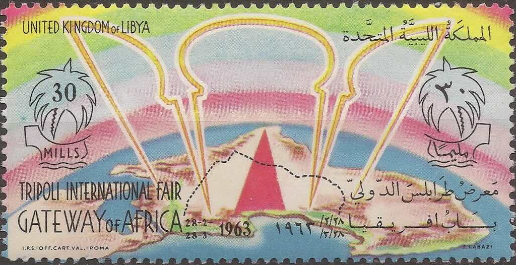
Wikipedia has a webpage on “Postage stamps and postal history of Libya“. We learn that stamps were issued in the country at the time of the Ottoman Empire, and then by Italian Libya until 1943, followed by the British from 1943 to 1948. The first stamp of the Kingdom of Libya was issued on the 24 December 1951, although the first stamps inscribed Kingdom of Libya were issued on 15 April 1952.
I have about xx stamps from Argentina, but almost no multicolour commemoratives. My earliest stamp dates from xxxx, and I have virtually no stamps after the early 60s.
Facts about Libya
National colours – Red, black, green and white
National animal – Lion (Panthera Leo)
National bird – Eagle (possibly)
National tree – Date Palm tree (Phoenix dactylifera)
National flower – Pomegranate Blossom (possibly)
National food – Couscous
National drink – Libyan tea, Arabic coffee
National fruit – Common Red Libyan Fig, Red-leaved fig fruit or Tin Arabian Redfruit (Ficus ingens)
National dance – ?
National sport – X (most popular)
Football nickname – The Mediterranean Knights
Highest mountain – Bikku Bitti, also known as Bette Peak (2,266 m)
Italian Cyrenaica,
During
British Military Adm. Tripolitania (1948-51)
During
Morocco
The Kingdom of Morocco, is a country in the Maghreb region of North Africa. It has a population of roughly 37 million, the official and predominant religion is Islam, and the official languages are Arabic and Berber, however French and the Moroccan dialect of Arabic are also widely spoken. Its capital is Rabat, while its largest city is Casablanca.
Morocco also claims the Spanish exclaves of Ceuta, Melilla and Peñón de Vélez de la Gomera, and several small Spanish-controlled islands off its coast.
The English Morocco is an anglicisation of the Spanish name for the country, Marruecos, derived from the name of the city of Marrakesh, which was the capital of the Almoravid dynasty, the Almohad Caliphate, and the Saadian dynasty. Morocco’s modern Arabic name is al-Maghrib, meaning land of the sunset or the west.
The Moroccan dirham (DH) is the official monetary currency of Morocco, and is subdivided into 100 santimat.
Wikipedia also has a webpage on “Postage stamps and postal history of Morocco“, where we learn that a French postal agency had sent mail from Tangier as early as 1854. The first Spanish post office in Morocco opened in 1867 and issued stamps in 1903. In 1955, the kingdom of Morocco regained independence and postal autonomy. From 1956 to 1957, stamps were issued in franc and Spanish peseta for the southern zone and northern zone, respectively. The franc was used throughout Morocco from 1958 and the first stamps for the entire country were the issue for the World Fair in Brussels.
I have about xxx stamps from Morocco, but almost no multicolour commemoratives. My earliest stamp dates from xxx, and I have virtually no stamps after the early 60s.
Facts about Morocco
National colours – Red and green
National animal – Lion (Panthera Leo)
National bird – Moussier’s redstart (Phoenicurus moussieri)
National tree – Argan (Sideroxylon spinosum)
National flower – Wild Rose
National food – couscous, tagine
National drink – Moroccan mint tea (atai), a green tea prepared with spearmint leaves and sugar
National fruit – Fuzzy kiwifruit (Actinidia deliciosa)
National dance – Gnawa and Reggada
National sport – Football (most popular)
Football nickname – The Atlas Lions
Highest mountain – Toubkal (4,167 m)
Tunisia
The Republic of Tunisia is the northernmost country in Africa, and is a part of the Maghreb region of North Africa. It is home to the archaeological sites of Carthage dating back to the 9th century BC, as well as the Great Mosque of Kairouan. Today it has a population of 12.1 million. Tunis is the capital and largest city of the country, which is itself named after Tunis. The official language of Tunisia is Modern Standard Arabic. The vast majority of Tunisia’s population is Arab and Muslim. Vernacular Tunisian Arabic is the most spoken, and French also serves as an administrative and educational language in some contexts, but it has no official status.
The dinar (DT) is the national currency of Tunisia, and is subdivided into 1000 milim or millimes.
Wikipedia also has a webpage on “Postage stamps and postal history of Tunisia“, where we learn that the first stamps were issued for the French protectorate of Tunisia on 1 July 1888, marked “Régence de Tunis“. Tunisia achieved independence from France on March 20, 1956 as the Kingdom of Tunisia. A year later, Tunisia was declared a republic. As a sovereign state, its first stamp was issued in 1956.
I have about xxx stamps from Tunisia, but almost no multicolour commemoratives. My earliest stamp dates from xxx, and I have virtually no stamps after the early 60s. There were however nearly forty different portrait stamps.
Facts about Tunisia
National colours – Red and white
National animal – Dromedary or Arabian Camel (Camelus dromedarius)
National bird – Courser (Cursorius cursor)
National tree – Olive
National flower – Jasmine
National food – couscous, brik/bric
National drink – Tea
National fruit – Pomegranate
National dance – Raks Al-Juzur (popular)
National sport – Football (most popular)
Football nickname – Eagles of Carthage
Highest mountain – Jebel ech Chambi (1,544 m)
Western Sahara
Western Sahara is a disputed territory on the northwest coast of Africa. About 20% of the territory is controlled by the Sahrawi Arab Democratic Republic (SADR), and the remaining 80% is occupied and administered by neighbouring Morocco. It is the second most sparsely populated country in the world and most sparsely in Africa, mainly consisting of desert flatlands. The population is estimated at about 500,000, of which nearly 40% live in Morocco-controlled Laayoune, the largest city in Western Sahara.
The Moroccan Dirham (MAD) is the primary medium of exchange in Western Sahara, but the Saharawi Arab Democratic Republic has issued Saharawi Peseta (EHP) coins for collectors.
I understand that in 1924 stamps for the Spanish Sahara were issued when La Güera was incorporated in to the Spanish colony of Rio de Oro. I also understand that the the Sahrawi Arab Democratic Republic has issued stamps, more in a publicity move. These are considered cinderella stamps.
I don’t have any stamps from the Western Sahara.